Ronald Reagan Washington National Airport station

Last updated

Ronald Reagan Washington
National Airport
WMATA Blue.svg WMATA Yellow.svg
Reagan National Metro Station.jpg
Ronald Reagan Washington National Airport station platform in January 2017
General information
Location2400 South Smith Boulevard
Arlington, Virginia
Coordinates 38°51′11″N77°02′38″W / 38.852985°N 77.0439°W / 38.852985; -77.0439
Owned by Washington Metropolitan Area Transit Authority
Platforms2 island platforms
Tracks3 (2 in regular service)
Construction
Structure typeElevated
ParkingPaid parking nearby
Bicycle facilities Capital Bikeshare, 8 racks
AccessibleYes
Other information
Station codeC10
History
OpenedJuly 1, 1977;46 years ago (July 1, 1977) [1]
Rebuilt2003–2004, 2020
Previous namesNational Airport (1977–2001)
Passengers
20234,500 daily [2]
Rank20 out of 98
Services
Preceding station WMATA Metro Logo small.svg Washington Metro Following station
Potomac Yard Blue Line Crystal City
Potomac Yard
toward Huntington
Yellow Line Crystal City
Location
Ronald Reagan Washington National Airport station

Ronald Reagan Washington National Airport station is a Washington Metro station in Arlington, Virginia on the Blue and Yellow Lines. The station platform is elevated and covered and is the last above-ground station on the Yellow Line in Virginia, heading into Washington, D.C. 
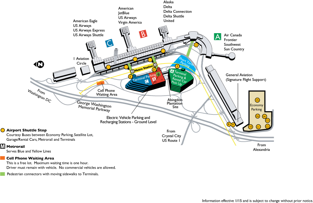
It is one of only two stations in the system to have three tracks (the other being West Falls Church). The station is located across Smith Boulevard from Terminal 2 at Ronald Reagan Washington National Airport; the mezzanine is directly connected to Level 2 of the terminal (security checkpoints/gates level) by two pedestrian bridges. Airport shuttle buses or a walkway connect the station and Terminal 1. The airport's Abingdon Plantation historical site is near the station.

Contents

History

North bound Yellow Line train at Ronald Reagan Washington National Airport in August 2018 Washington DC August 2018 01 (Ronald Reagan Washington National Airport).jpg
North bound Yellow Line train at Ronald Reagan Washington National Airport in August 2018

The station opened on July 1, 1977. [1] Its opening coincided with the completion of 11.8 miles (19.0 km) [3] of rail between National Airport and RFK Stadium and the opening of the Arlington Cemetery, Capitol South, Crystal City, Eastern Market, Farragut West, Federal Center SW, Federal Triangle, Foggy Bottom–GWU, L'Enfant Plaza, McPherson Square, Pentagon, Pentagon City, Potomac Avenue, Rosslyn, Smithsonian and Stadium–Armory stations. [4]

When service began on July 1, 1977, it was the southern terminus of the Blue Line. After the Yellow Line extension to Huntington opened on December 17, 1983, the station remained the southern terminus for the Blue Line [5] until the Van Dorn Street station opened in 1991.

During construction of a second canopy at the station, Metro began running trains through the center track even though it had not been constructed for standard operations, and on January 20, 2003, a Blue Line train derailed at the switch. No injuries resulted, but the accident delayed construction by a number of weeks. [6] The center track was originally intended for relaying trains. [1]

In 2014, a train was temporarily parked in the middle track while one of the elevators in the station was repaired, creating a "train bridge" to allow passengers to walk through the train to transfer between directions. [7]

In May 2018, Metro announced an extensive renovation of platforms at twenty stations across the system. The Ronald Reagan Washington National Airport station served as a temporary southern terminal for the Blue and Yellow Lines from May to September 2019, while the stations south of the National Airport station were closed. The platforms at the National Airport station itself were rebuilt from August to December 2020. [8] [9] [10]

Between May 25 and September 8, 2019, all trains terminated at this station due to the Platform improvement project which closed stations south of Ronald Reagan Airport. [8] [9] Between September 10 until November 5, 2022, all trains also terminated at Ronald Reagan airport due to the Potomac Yard station tie-in, closing all stations south of the station. [11]

Renaming controversy

The station retained its original name after the airport was renamed in 1998 from "Washington National Airport" to "Ronald Reagan Washington National Airport". In early 2001, a letter signed by 24 members of Congress requested WMATA rename the station to conform. However, according to a Metro policy adopted in 1987, groups seeking to rename a station were required to pay the cost of replacing signs and maps. The Arlington County government, which could have made the change, demurred—the price was estimated at $400,000—and WMATA subsequently declined to rename the station on April 19, 2001. [12] In response, Republican Congressman Bob Barr of Georgia threatened to withhold federal funding from the agency unless the station was renamed. [12] Congress ultimately voted to require the renaming on November 30, 2001. [13] According to then-General Manager Richard A. White, Metro paid to complete the renaming. [14]

Station layout

The station has two island platforms serving three tracks, with the southbound track not used for regular service.

P
Platform level
Southboundno service
Island platform
Center track WMATA Blue.svg toward Franconia–Springfield (Potomac Yard)
WMATA Yellow.svg toward Huntington (Potomac Yard)
Island platform
Northbound WMATA Blue.svg toward Downtown Largo (Crystal City)
WMATA Yellow.svg toward Mount Vernon Square (Crystal City)
GStreet levelExit/Entrance; fare control, ticket machines, station agent,
walkways to Terminal 2, shuttle bus and walkway to Terminal 1

Related Research Articles

<span class="mw-page-title-main">Washington Metro</span> Rapid transit system serving the Washington metropolitan area

The Washington Metro, often abbreviated as the Metro and formally the Metrorail, is a rapid transit system serving the Washington metropolitan area of the United States. It is administered by the Washington Metropolitan Area Transit Authority (WMATA), which also operates the Metrobus service under the Metro name. Opened in 1976, the network now includes six lines, 98 stations, and 129 miles (208 km) of route.

<span class="mw-page-title-main">Foggy Bottom–GWU station</span> Washington Metro station

Foggy Bottom–GWU station is an Washington Metro station in the Foggy Bottom neighborhood of Washington, D.C., United States. The island-platformed station was opened on July 1, 1977, and is operated by the Washington Metropolitan Area Transit Authority (WMATA). Providing service for the Blue, Orange, and Silver Lines, the station is located on I Street on the George Washington University (GWU) campus. It is the last westbound station in the District of Columbia on these lines before they dive under the Potomac River to Virginia.

<span class="mw-page-title-main">Blue Line (Washington Metro)</span> Washington Metro rapid transit line

The Blue Line is a rapid transit line of the Washington Metro system, consisting of 28 stations in Fairfax County, Alexandria and Arlington, Virginia; Washington, D.C.; and Prince George's County, Maryland, United States. The Blue Line runs from Franconia–Springfield to Downtown Largo. The line shares track with the Orange Line for 13 stations, the Silver Line for 18, and the Yellow Line for 7. Only 3 stations are exclusive to the Blue Line.

<span class="mw-page-title-main">Green Line (Washington Metro)</span> Washington Metro rapid transit line

The Green Line is a rapid transit line of the Washington Metro system, consisting of 21 stations in Washington, D.C., and Prince George's County, Maryland, United States. The Green Line runs from Branch Avenue to Greenbelt. It was the last line in the original Metrorail plan to be constructed, and is one of three north–south lines through the city of Washington. The Green Line shares track with the Yellow Line from L'Enfant Plaza to Mount Vernon Square.

<span class="mw-page-title-main">Yellow Line (Washington Metro)</span> Washington Metro rapid transit line

The Yellow Line is a rapid transit line of the Washington Metro system that runs between Huntington in Virginia and Mount Vernon Square in Washington, D.C. It consists of 13 stations in Fairfax County, the city of Alexandria, and Arlington County in Virginia, as well as Washington, D.C. It is the shortest line in the system, and since its truncation to Mount Vernon Square, it is the only line that does not enter Maryland.

<span class="mw-page-title-main">Ballston–MU station</span> Washington Metro station

Ballston–MU station is a side platformed Washington Metro station in Arlington County, Virginia. The station opened on December 1, 1979, and is operated by the Washington Metropolitan Area Transit Authority (WMATA). The station is part of the Orange and Silver Lines and serves the transit-oriented community of Ballston, Ballston Quarter, and Marymount University (MU).

<span class="mw-page-title-main">Rosslyn station</span> Washington Metro station

Rosslyn station is the westernmost station on the shared segment of the Blue, Orange, and Silver lines of the Washington Metro. It is located in the Rosslyn neighborhood of Arlington, Virginia, United States. Rosslyn is the first station in Virginia heading westward from the District on the Orange and Silver Lines and southward on the Blue Line. It is one of four interchange points on the Metrorail system west of the Potomac River and located in a growing business district.

<span class="mw-page-title-main">Farragut West station</span> Washington Metro station

Farragut West station is a Washington Metro station in downtown Washington, D.C., United States. The side-platformed station was opened on July 1, 1977, and is operated by the Washington Metropolitan Area Transit Authority (WMATA). Providing service for the Blue, Silver, and Orange Lines, the station is located just west of Farragut Square with two entrances on I Street at 17th and 18th Streets NW.

<span class="mw-page-title-main">Federal Triangle station</span> Washington Metro station

Federal Triangle station is a Washington Metro station in Washington, D.C., United States. The island-platformed station was opened on July 1, 1977, and is operated by the Washington Metropolitan Area Transit Authority (WMATA). Providing service for the Blue, Orange, and Silver Lines, the station's entrance is beneath the William Jefferson Clinton Federal Building.

<span class="mw-page-title-main">Franconia–Springfield station</span> Washington Metro station

Franconia–Springfield station is a Washington Metro rapid transit station and Virginia Railway Express commuter rail station located in Springfield, Virginia, United States. The station is the southwestern terminus of the Metro Blue Line and an intermediate station on the VRE Fredericksburg Line. It is also a major bus terminal for Fairfax Connector buses, plus other local and intercity bus routes. The station has one island-platform serving the two Metro tracks, plus two side platforms serving the RF&P Subdivision on which the Fredericksburg Line runs.

<span class="mw-page-title-main">King Street–Old Town station</span> Washington Metro station

King Street–Old Town station is a Washington Metro station in Alexandria, Virginia, United States. The station opened on December 17, 1983, and is operated by the Washington Metropolitan Area Transit Authority (WMATA). Providing service for both the Blue and Yellow Lines, this is the southernmost transfer station for the Blue and Yellow lines, as the two lines diverge just south of the station. During inclement weather, Crystal City is commonly used as an unofficial transfer point, being the southernmost underground station common to both lines. King Street was originally served only by the Yellow Line, until the Blue Line was extended from National Airport to Van Dorn Street in 1991.

<span class="mw-page-title-main">Eisenhower Avenue station</span> Washington Metro station

Eisenhower Avenue station is a rapid transit station on the Yellow Line of the Washington Metro in Alexandria, Virginia. It opened on December 17, 1983.

<span class="mw-page-title-main">Huntington station (Washington Metro)</span> Washington Metro station

Huntington station is an island-platformed Washington Metro station in the Huntington area of Fairfax County, Virginia, United States. The station was opened on December 17, 1983, and is operated by the Washington Metropolitan Area Transit Authority (WMATA). Serving as the southern terminus for the Yellow Line, the station is built into a hillside; the south mezzanine, along with escalator access, is accessible via an incline elevator.

<span class="mw-page-title-main">Braddock Road station</span> Washington Metro station

Braddock Road station is an island-platformed Washington Metro station in Alexandria, Virginia, United States. The station was opened on December 17, 1983, and is operated by the Washington Metropolitan Area Transit Authority (WMATA). Providing service for both the Blue and Yellow Lines, the station is located at Braddock Road and West Street.

<span class="mw-page-title-main">Pentagon station</span> Washington Metro station

Pentagon station is a split platform station on the Washington Metro located adjacent to The Pentagon in Arlington, Virginia. The station was opened on July 1, 1977, and is operated by the Washington Metropolitan Area Transit Authority. Providing service for both the Blue and Yellow Lines, the station is where the two lines diverge and thus acts as a transfer point. Northbound, both lines rise above ground, with the Blue Line serving the Arlington Cemetery station, and the Yellow Line crossing the Potomac River into the District of Columbia.

<span class="mw-page-title-main">Arlington Cemetery station</span> Washington Metro station

Arlington Cemetery station is a side platformed Washington Metro station in Arlington, Virginia, United States. The station was opened on July 1, 1977, and is operated by the Washington Metropolitan Area Transit Authority (WMATA). The station provides service for only the Blue Line, and is located at the entrance to Arlington National Cemetery, underneath Memorial Drive. There is no public parking near the station except at the cemetery, which is reserved for cemetery visitors. It is the only station that closes earlier than the rest of the system, closing at 7 PM from October to March, and 10 PM from April to September.

<span class="mw-page-title-main">Capitol South station</span> Washington Metro station

Capitol South station is a Washington Metro station in the Capitol Hill neighborhood of Washington, D.C., United States. The island-platformed station was opened on July 1, 1977, and is operated by the Washington Metropolitan Area Transit Authority (WMATA). The station currently provides service for the Blue, Orange, and Silver Lines.

<span class="mw-page-title-main">Eastern Market station</span> Washington Metro station

Eastern Market station is a Washington Metro station in the Capitol Hill neighborhood of Washington, D.C., United States. The island platformed station was opened on July 1, 1977, and is operated by the Washington Metropolitan Area Transit Authority (WMATA). The station currently provides service for the Blue, Orange, and Silver Lines. The station is located in Southeast D.C. at Pennsylvania Avenue and 7th Street. It is named after the nearby Eastern Market, a historic public marketplace.

<span class="mw-page-title-main">Southern Avenue station</span> Washington Metro station

Southern Avenue station is an island platformed Washington Metro station in Prince George's County, Maryland, United States. The station was opened on January 13, 2001, and is operated by the Washington Metropolitan Area Transit Authority (WMATA). Providing service for only the Green Line, the station is located on the southern side of Southern Avenue, putting it just outside the District of Columbia, opposite Valley Terrace straddling the D.C/Maryland border. Southern Avenue is the first station in Maryland going southeast on the Green Line.

<span class="mw-page-title-main">Van Dorn Street station</span> Washington Metro station

Van Dorn Street station is a Washington Metro station straddling the boundary between Fairfax County and the independent city of Alexandria in Virginia, United States. The station’s island platform lies in unincorporated Rose Hill in Fairfax County, while the station’s entrance and parking facilities are in Alexandria. The station was opened on June 15, 1991, and is operated by the Washington Metropolitan Area Transit Authority (WMATA). Providing service for the Blue Line, the station is located at South Van Dorn Street and Eisenhower Avenue, next to the Capital Beltway. From 1991 to 1997 it was the southwestern terminus of the Blue Line.

References

  1. 1 2 3 Feaver, Douglas B. (July 1, 1977). "Today, Metro could be U.S. model". The Washington Post. p. A1. Retrieved July 3, 2021.
  2. "Metrorail Ridership Summary". Washington Metropolitan Area Transit Authority. Retrieved February 8, 2024.
  3. "Sequence of Metrorail openings" (PDF). Washington Metropolitan Area Transit Authority. 2017. p. 3. Retrieved March 28, 2018.
  4. "Metro's newest stations: Where they are, what's nearby", The Washington Post, June 24, 1977
  5. Staff Reporters (December 17, 1983). "Gala opening set for Yellow Line extension". The Washington Post. p. C1.
  6. Layton, Lyndsey (February 27, 2003). "Metro track blamed in derailment – Section not made for regular use". The Washington Post. p. A1.
  7. Aratani, Lori (March 11, 2014). "See Metro's 'Train Bridge'". The Washington Post. Retrieved May 8, 2014.
  8. 1 2 "Metro wants to rebuild 20 station platforms over three years, creating SafeTrack-like disruptions". Washington Post. May 7, 2018. Retrieved February 19, 2019.
  9. 1 2 "Metro plans 'summer shutdown' on Blue, Yellow lines next year". WTOP. May 7, 2018. Retrieved February 19, 2019.
  10. "Platform reconstruction at Reagan National Airport Station to begin August 7 | WMATA". www.wmata.com. Retrieved August 29, 2020.
  11. "Metro announces travel alternatives for major Blue and Yellow Line construction this fall | WMATA". www.wmata.com. Retrieved June 15, 2022.
  12. 1 2 Layton, Lyndsey (April 21, 2001). "Riders rail at cost of 'Reagan' Metro stop". The Washington Post. p. B2.
  13. "H.R.2299 – Department of Transportation and Related Agencies Appropriations Act, 2002". Bill Sec. 345, Act of November 30, 2001 . Retrieved March 28, 2018.
  14. "LunchTalk Online transcript". June 17, 2005.