The Cree are a North American Indigenous people. They live primarily in Canada, where they form one of that country's largest First Nations.

The Assiniboine or Assiniboin people, also known as the Hohe and known by the endonym Nakota, are a First Nations/Native American people originally from the Northern Great Plains of North America.
Highway 16 is a provincial highway in the Canadian province of Saskatchewan. It is the Saskatchewan section of the Yellowhead Highway, and also the Trans-Canada Highway Yellowhead section. The main purpose of this highway is to connect Saskatchewan with Canadian cities such as Edmonton and Winnipeg. The highway runs from the Alberta boundary in Lloydminster to the Manitoba boundary near Marchwell. Major cities it passes through are Saskatoon, North Battleford in the central part of the province, Yorkton in the far east and Lloydminster to the far west.

Division No. 12 is one of the eighteen census divisions in the province of Saskatchewan, Canada, as defined by Statistics Canada. It is located in the west-central part of the province. The most populous community in this division is Battleford.
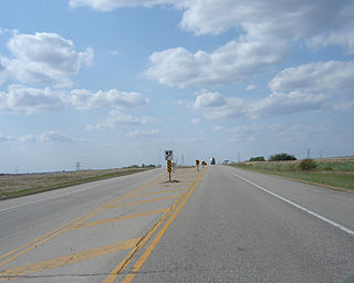
Highway 3 is a major provincial paved undivided highway in the Canadian province of Saskatchewan. It runs from the Alberta border, where it continues west as Alberta Highway 45, to the Manitoba border, and then continues east as Highway 77. Highway 3 is about 615 km (382 mi.) long. The CanAm Highway comprises Saskatchewan Highways 35, 39, 6, 3, as well as 2. 59.7 miles (96.1 km) of Saskatchewan Highway 3 contribute to the CanAm Highway between Melfort and Prince Albert.

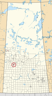
Mosquito, Grizzly Bear's Head, Lean Man First Nations is the name of an Assiniboine First Nation in Saskatchewan, Canada. It is home to a population of about 300.

Highway 9 is a paved, undivided provincial highway in the Canadian province of Saskatchewan. It runs from North Dakota Highway 8 at the US border near Port of Northgate until it transitions into Provincial Road 283 at the Manitoba provincial boundary.
The Saskota Flyway is known as the International Road to Adventure, because it takes you from Hudson Bay, Saskatchewan, all the way south to Bismarck, North Dakota.

Highway 13 is a highway in the Canadian province of Saskatchewan. It runs from the Alberta border until it transitions into Highway 2 at the Manitoba border near Antler. Highway 13 is about 676 km (420 mi.) long. Highway 13 passes through Shaunavon, Assiniboia, Weyburn, Redvers and Carlyle. It is also referred to as the Red Coat Trail, as much of its length follows the route of the original historic path. A majority of the route between Wauchope and Govenlock going through the Palliser's Triangle is also referred to as the Ghost Town Trail.

The Red Pheasant Cree Nation is a Plains Cree First Nations band government in the Canadian province of Saskatchewan. The band's sole reserve, Red Pheasant 108, is 33 km (21 mi) south of North Battleford.
Saskatchewan Highway 690 connects Saskatchewan Highway 23 near Arborfield to Saskatchewan Highway 789 in north-eastern Saskatchewan, Canada. The length of Highway 690 is 37.8 kilometres (23.5 mi).

Saskatchewan Highway 693 connects the Saskatchewan Highway 3/Saskatchewan Highway 55 concurrency near Shellbrook to Saskatchewan Highway 240 in the Prince Albert National Park. The length of Highway 693 in north central Saskatchewan, Canada is 44.2 kilometres (27.5 mi).
Red Pheasant 108 is an Indian reserve of the Red Pheasant Cree Nation in Saskatchewan. It is 33 kilometres south of North Battleford. In the 2016 Canadian Census, it recorded a population of 519 living in 136 of its 163 total private dwellings. In the same year, its Community Well-Being index was calculated at 46 of 100, compared to 58.4 for the average First Nations community and 77.5 for the average non-Indigenous community.

The Gold Eagle Reserve is an Indian reserve of the Mosquito, Grizzly Bear's Head, Lean Man First Nations in Saskatchewan. It is an urban reserve in the city of North Battleford.

Grizzly Bear's Head 110 & Lean Man's 111 is an Indian reserve of the Mosquito, Grizzly Bear's Head, Lean Man First Nations in Saskatchewan. It is 24 kilometres south of North Battleford. In the 2016 Canadian Census, it recorded a population of 67 living in 17 of its 19 total private dwellings. In the same year, its Community Well-Being index was calculated at 50 of 100, compared to 58.4 for the average First Nations community and 77.5 for the average non-Indigenous community.

Mosquito 109 is an Indian reserve of the Mosquito, Grizzly Bear's Head, Lean Man First Nations in Saskatchewan. It is 27 kilometres south of North Battleford. In the 2016 Canadian Census, it recorded a population of 478 living in 107 of its 113 total private dwellings. In the same year, its Community Well-Being index was calculated at 42 of 100, compared to 58.4 for the average First Nations community and 77.5 for the average non-Indigenous community.

Mosquito, Grizzly Bear's Head, Lean Man TLE 1 is an Indian reserve of the Mosquito, Grizzly Bear's Head, Lean Man First Nations in Saskatchewan.
Moose Mountain Upland, Moose Mountain Uplands, or commonly Moose Mountain, is a hilly plateau located in the south-east corner of the Canadian province of Saskatchewan, that covers an area of about 13,000 km2 (5,000 sq mi). The upland rises about 200 m (660 ft) above the broad, flat prairie which is about 600 m (2,000 ft) above sea level. The highest peak is "Moose Mountain" at 830 m (2,720 ft) above sea level. The area was named Moose Mountain because of the large number of moose that lived in the area. When it was originally used by fur traders, Métis, and the Indigenous peoples, the plateau was called Montagne a la Bosse, which is French for "The Mountain of The Bump or Knob."

Moose Mountain Creek is a river in the province of Saskatchewan, Canada. Its source is the Chapleau Lakes near Montmartre and it is a tributary of the Souris River, which, in turn, is a tributary of the Assiniboine River. The whole system is part of the Red River watershed, which is part of the Hudson Bay drainage basin and in a region called the Prairie Pothole Region of North America, which extends throughout three Canadian provinces and five U.S. states. It is also within Palliser's Triangle and the Great Plains ecoregion.
