Sherwood High School is a secondary school in Sandy Spring in unincorporated Montgomery County, Maryland, United States. Sherwood's program of interest is the international studies program, and it is also known for its music and athletic programs. Sherwood draws students from Farquhar and Rosa Parks Middle Schools.
Pukeashun Provincial Park is a provincial park in British Columbia, Canada, located north of the community of Scotch Creek, near the city of Salmon Arm. The park is named for Pukeashun Mountain which is within its boundaries and a major local landmark. It protects part of the Adams Plateau, the southeastern portion of the Shuswap Highland.
Steinhatchee is a Gulf coastal community in the southern part of Taylor County, Florida, United States. Steinhatchee is located at 29°40′16″N83°23′15″W, 33 miles (53 km). Steinhatchee is 38.09 miles south of the county seat of Perry. Just across the Steinhatchee River is Jena, which is in Dixie County. Steinhatchee is 19.27 miles north of the town of Cross City. The Stein in Steinhatchee is pronounced as if it were spelled Steen, rather than Stine. The name Steinhatchee was derived from the Native American "esteen hatchee" meaning river (hatchee) of man (esteen). Since the early 19th century, the village of Steinhatchee played an integral part in the foresting industry, particularly cedar used for making pencils, as well as fishing, crabbing and scalloping. The Steinhatchee River also flows by the community and into the Gulf of Mexico.
Wandoor is a town in Malappuram district of Kerala, India at 11°11′44″N76°14′09″E. It is located 12 km away from Nilambur

Lakelands Park is a City of Gaithersburg park in Montgomery County, Maryland. It is located in the Lakelands neighborhood. The park includes two baseball/softball fields, a playground, and a large grassy area usually used for soccer. This park is located next to Lakelands Park Middle School.
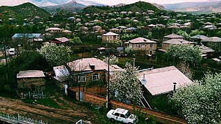
Malishka, is a village and rural municipal community at the south of Armenia, within the Vayots Dzor Province.
Huaccana District is one of the eight districts of the province Chincheros in Peru.
Sherwood Forest is an unincorporated community in Charles City County, Virginia, United States.
Perry State Forest is a state forest in Perry County, Ohio, United States.
Brooke is an unincorporated community in Stafford County, Virginia, United States.
Sherwood Forest is an unincorporated community in Montgomery County, Maryland, United States. It is roughly bounded by Randolph Road, Sherwood Forest Drive, Notley Road, the Intercounty Connector, and Northwest Branch Park.

Craig is a former settlement in Butte County, California. It was located 3 miles (4.8 km) east-southeast of Bidwell's Bar on the Feather River Railway, at an elevation of 981 feet. Craig still appeared on maps as of 1947.

Hurleton is an unincorporated community in Butte County, California. It is located 7.5 miles (12.1 km) north of Bangor. It lies at an elevation of 1598 feet.
Sherwood Forest is an area in Detroit, Michigan, United States. The district is bounded by Seven Mile Road, Livernois, Pembroke, and Parkside. The community, with about 435 houses, consists of two subdivisions: Sherwood Forest and Sherwood Forest Manor.
Avellaneda is a municipality of Spain in the province of Ávila, autonomous community of Castile and León. It is in the judicial district of Piedrahita.

Custer is a ghost town in Custer County, Idaho, United States. Established in 1877, it is at 44°23′15″N114°41′45″W, at an elevation of 6,470 feet (1,972 m). It lies along Yankee Fork Road southwest of the city of Challis, within the Challis National Forest.
Palliser Pass, 2,084 m (6,837 ft), is a mountain pass in the Canadian Rockies, located on the British Columbia / Alberta boundary at the south end of Banff National Park and at the north end of Height of the Rockies Provincial Park in British Columbia. The pass is located north of the headwaters of the Palliser River.
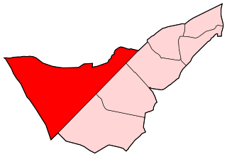
Campamento is a ward (barrio) of Madrid belonging to the district of Latina.

Barneston is an extinct town in King County, in the U.S. state of Washington. The GNIS classifies it as a populated place.
Palo Blanco is a census-designated place (CDP) in Starr County, Texas, United States. It is a new CDP formed from part of the Los Alvarez CDP prior to the 2010 census with a population of 204.