Bartonsville, Maryland

Last updated

Bartonsville, Maryland
USA Maryland location map.svg
Red pog.svg
Bartonsville
Location in Maryland
Usa edcp location map.svg
Red pog.svg
Bartonsville
Bartonsville (the United States)
Coordinates: 39°23′21″N77°21′45″W / 39.38917°N 77.36250°W / 39.38917; -77.36250
CountryFlag of the United States.svg United States
State Flag of Maryland.svg  Maryland
County 2023 flag of Frederick County, Maryland.svg Frederick
Area
[1]
  Total2.14 sq mi (5.55 km2)
  Land2.14 sq mi (5.53 km2)
  Water0.01 sq mi (0.02 km2)
Elevation
[2]
446 ft (136 m)
Population
 (2020)
  Total2,753
  Density1,288.86/sq mi (497.58/km2)
Time zone UTC−5 (Eastern (EST))
  Summer (DST) UTC−4 (EDT)
Area codes 301 and 240
FIPS code 24-04650
GNIS feature ID2583578 [2]

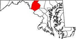
Bartonsville is an unincorporated community and census-designated place (CDP) in Frederick County, in the U.S. state of Maryland. As of the 2020 census it had a population of 2,753. [3] Prior to 2010, the area was part of the Linganore-Bartonsville CDP.

Contents

Geography

The community is in southeastern Frederick County, bordered to the north by Maryland Route 144 (Old National Pike), to the east by Ijamsville Road, and to the west by the Monocacy River. Via MD 144, the city of Frederick is 3.5 miles (5.6 km) to the west.

According to the U.S. Census Bureau, the Bartonsville CDP has a total area of 2.64 square miles (6.84 km2), of which 2.61 square miles (6.76 km2) is land and 0.03 square miles (0.08 km2), or 1.11%, is water. [3]

Demographics

Historical population
CensusPop.Note
2020 2,753
U.S. Decennial Census [4]

Notable person

Related Research Articles

<span class="mw-page-title-main">Lisbon, Florida</span> Census-designated place in Florida

Lisbon is an unincorporated community and census-designated place (CDP) in Lake County, Florida, United States. The population was 260 at the 2000 census. It is part of the Orlando–Kissimmee Metropolitan Statistical Area.

<span class="mw-page-title-main">Lake Shore, Maryland</span> Census-designated place in Maryland, United States

Lake Shore is a census-designated place and unincorporated community in Anne Arundel County, Maryland, United States, located east of Pasadena. The population of Lake Shore was 19,477 at the 2010 census.

<span class="mw-page-title-main">Pasadena, Maryland</span> Census-designated place in Maryland, United States

Pasadena is a census-designated place (CDP) in Anne Arundel County, Maryland, United States. The population was 24,287 at the 2010 census.

<span class="mw-page-title-main">Shady Side, Maryland</span> Census-designated place in Maryland, United States

Shady Side is a census-designated place (CDP) in Anne Arundel County, Maryland, United States. The population was 5,803 at the 2010 census.

<span class="mw-page-title-main">St. Leonard, Maryland</span> Census-designated place in Maryland

St. Leonard is a census-designated place (CDP) in Calvert County, Maryland, United States. The population was 742 at the 2010 census. Residents of the Calvert Beach and Long Beach communities also use the St. Leonard ZIP code designation.

<span class="mw-page-title-main">Ballenger Creek, Maryland</span> Census-designated place in Maryland

Ballenger Creek is an unincorporated community and census-designated place (CDP) in Frederick County, Maryland, United States. It is a part of the Frederick, Maryland urban area and is adjacent to Frederick's southern city limits. The CDP had a 2010 census population of 18,274.

<span class="mw-page-title-main">Green Valley, Maryland</span> Census-designated place in Frederick County, Maryland, United States

Green Valley is an unincorporated area and census-designated place (CDP) in southern Frederick County, Maryland, United States. The population was 12,643 at the 2020 census. The area was listed as a census-designated place in 2000 but not listed as part of any CDP at the 2010 census. It was re-designated a census-designated place for the 2020 census.

<span class="mw-page-title-main">Linganore-Bartonsville, Maryland</span> Former Census-designated place in Maryland

Linganore-Bartonsville was a census-designated place (CDP) in Frederick County, Maryland, United States, for the 2000 census, at which time its population was 12,529. For the 2010 census the area was split into three CDPs: Linganore, Bartonsville, and Spring Ridge.

<span class="mw-page-title-main">Fallston, Maryland</span> Census-designated place in Maryland, United States

Fallston is a census-designated place (CDP) in Harford County, Maryland, United States. The population was 8,958 at the 2010 census, up from 8,427 in 2000. Fallston is a semi-rural community consisting mostly of farms and suburban-like developments.

Linganore is a census-designated place (CDP) in Frederick County, in the U.S. state of Maryland. It consists of the area around Lake Linganore, a residential community governed by a homeowners association, located east of the city of Frederick. As of the 2020 census the CDP had a population of 12,351. Prior to 2010, the area was part of the Linganore-Bartonsville CDP. The mailing address for the area is Lake Linganore, with a ZIP code of 21774.
<span class="mw-page-title-main">Baltimore Highlands, Maryland</span> Census-designated place in Maryland, United States

Baltimore Highlands is a census-designated place (CDP) in Baltimore County, Maryland, United States, directly south of the city of Baltimore. The population was 7,019 at the 2010 census. At the 2000 census and earlier, the area was delineated as part of the Lansdowne-Baltimore Highlands CDP.

<span class="mw-page-title-main">Buckeystown, Maryland</span> Census-designated place in Maryland, United States

Buckeystown is an unincorporated community and census-designated place (CDP) in Frederick County, Maryland, United States. As of the 2010 census the population was 1,019. Buckeystown Historic District and Buckingham House and Industrial School Complex were listed on the National Register of Historic Places in 1982. Carrollton Manor was listed in 1997. Former Congressman Roscoe Bartlett lives on a farm in the town.

Worton is an unincorporated community and census-designated place (CDP) in Kent County, Maryland, United States. As of the 2010 census it had a population of 249.

<span class="mw-page-title-main">Libertytown, Maryland</span> Census-designated place in Maryland, United States

Libertytown is an unincorporated community and census-designated place (CDP) in Frederick County, in the U.S. state of Maryland. As of the 2010 census it had a population of 950. The Abraham Jones House was listed on the National Register of Historic Places in 1973.

Crellin is an unincorporated community and census-designated place (CDP) in Garrett County, Maryland, United States, with a population of 264 as of the 2010 census. Crellin Elementary School is located in the community, notable for winning the U.S. Green School Award of 2007.

Hutton is an unincorporated community and census-designated place (CDP) in Garrett County, Maryland, United States. Variant names for Hutton include Huttons Switch Station and Kindness.

Queensland is a census-designated place south of Upper Marlboro in Prince George's County, Maryland, United States. The population of the CDP was 2,191 at the 2020 census. It was formerly known as Queenland until 2014 when its name was changed to Queensland and a small portion of its geography was transferred to Upper Marlboro.

Spring Ridge is census-designated place (CDP) and suburban housing community in Frederick County, in the U.S. state of Maryland, just outside the city of Frederick. As of the 2020 census it had a population of 6,005. Before 2010, it was part of the Linganore-Bartonsville, Maryland census-designated place, which was split into three for the 2010 census.

Conesus Lake is a hamlet and census-designated place (CDP) in Livingston County, New York, United States. Its population was 2,584 as of the 2010 census. The community is located in the towns of Geneseo, Livonia, Groveland, and Conesus and covers Conesus Lake, the westernmost of New York's Finger Lakes, and nearly all of the lake's shoreline communities.

Georgetown is an unincorporated community and census-designated place in western Kent County, Maryland, United States. Per the 2020 census, the population was 117. It should not be confused with the community of the same name 22 miles (35 km) to the northeast on the Kent/Cecil County border.

References

  1. "2020 U.S. Gazetteer Files". United States Census Bureau. Retrieved April 26, 2022.
  2. 1 2 U.S. Geological Survey Geographic Names Information System: Bartonsville, Maryland
  3. 1 2 "Geographic Identifiers: 2010 Census Summary File 1 (G001), Bartonsville CDP, Maryland". American FactFinder. U.S. Census Bureau. Archived from the original on February 13, 2020. Retrieved June 1, 2016.
  4. "Census of Population and Housing". Census.gov. Retrieved June 4, 2016.