Tuscarora, Maryland

Last updated

Tuscarora, Maryland
MD Tuscarora.JPG
The Tuscarora post office in March 2004
USA Maryland location map.svg
Red pog.svg
Tuscarora
Location in Maryland
Usa edcp location map.svg
Red pog.svg
Tuscarora
Tuscarora (the United States)
Coordinates: 39°15′24″N77°28′13″W / 39.25667°N 77.47028°W / 39.25667; -77.47028
Country Flag of the United States.svg United States
State Flag of Maryland.svg  Maryland
County Flag of Frederick County, Maryland.svg Frederick
Elevation
[1]
89 m (292 ft)
GNIS feature ID591442 [1]

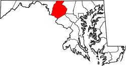
Tuscarora is a small unincorporated community in southern Frederick County, in the U.S. state of Maryland. Maryland Route 28 runs through the village. The community was named for Tuscarora Creek that runs in the area. There is an old, small post office that is in the area along Route 28. The area was formerly named "Licksville" after another creek in the area. It is bordered by Point of Rocks to the west and Adamstown to the north. The Nolands Ferry I Archeological Site was listed on the National Register of Historic Places in 1985. [2]

Related Research Articles

<span class="mw-page-title-main">Bethel, Delaware</span> Town in Delaware, United States

Bethel is a town in Sussex County, Delaware, United States. According to 2010 Census Bureau figures, the population of the town is 171. It is part of the Salisbury, Maryland-Delaware Metropolitan Statistical Area.

<span class="mw-page-title-main">Mercersburg, Pennsylvania</span> Borough in Pennsylvania, United States

Mercersburg is a borough in Franklin County, Pennsylvania, United States. The borough is 72 miles (116 km) southwest of Harrisburg, the state capital.

<span class="mw-page-title-main">Peters Township, Franklin County, Pennsylvania</span> Township in Pennsylvania, United States

Peters Township is a township in Franklin County, Pennsylvania, United States. The population was 4,462 at the 2020 census.

<span class="mw-page-title-main">Warren Township, Franklin County, Pennsylvania</span> Township in Pennsylvania, United States

Warren Township is a township that is located in Franklin County, Pennsylvania, United States. The population was 328 at the time of the 2020 census.

<span class="mw-page-title-main">Beale Township, Pennsylvania</span> Township in Pennsylvania, United States

Beale Township is a township in Juniata County, Pennsylvania, United States. The population was 769 at the 2020 census, a decline from the figure of 830 tabulated in 2010.

<span class="mw-page-title-main">Lewiston (village), New York</span> Village in New York, United States

Lewiston is a village in Niagara County, New York, United States. The population was 2,701 at the 2010 census. The village is named after Morgan Lewis, an early 19th-century governor of New York. It is part of the Buffalo–Niagara Falls Metropolitan Statistical Area.

<span class="mw-page-title-main">Cuba (village), New York</span> Village in New York, United States

Cuba is a village in Allegany County, New York, United States. The population was 1,575 at the 2010 census. The village is in the western part of the town of Cuba at the junction of Routes 305 and 446 on Oil Creek.

<span class="mw-page-title-main">Conococheague Creek</span> Stream in the U.S. states of Pennsylvania and Maryland

Conococheague Creek, a tributary of the Potomac River, is a free-flowing stream that originates in Pennsylvania and empties into the Potomac River near Williamsport, Maryland. It is 80 miles (129 km) in length, with 57 miles (92 km) in Pennsylvania and 23 miles (37 km) in Maryland. The watershed of Conococheague Creek has an area of approximately 566 square miles (1,470 km2), out of which only 65 square miles (170 km2) are in Maryland.

Nollville is an unincorporated community on Tuscarora Creek in Berkeley County, West Virginia, United States. It lies west of Martinsburg on the Tuscarora Pike.

<span class="mw-page-title-main">Shanghai, West Virginia</span> Unincorporated community in West Virginia, United States

Shanghai is an unincorporated community in Berkeley County, West Virginia, United States. The town is nestled in Back Creek Valley between Leading Ridge and North Mountain. Shanghai lies at the junction of West Virginia Secondary Route 7 and Secondary Route 18.

<span class="mw-page-title-main">Quantico, Maryland</span> Census-designated place in Maryland, United States

Quantico is an unincorporated community and census-designated place in Wicomico County, Maryland, United States, along the former stage route from Vienna to the port of Whitehaven on the Wicomico River. It consists of approximately 35 homes on the Quantico Creek. The community lies four miles (6 km) from Hebron along Maryland Route 347. There are two churches, a general store, and a post office in the community. It is part of the Salisbury, Maryland-Delaware Metropolitan Statistical Area.

<span class="mw-page-title-main">Maryland Route 28</span> State highway in Maryland, US

Maryland Route 28 is a state highway in the U.S. state of Maryland. The state highway runs 37.38 miles (60.16 km) from U.S. Route 15 in Point of Rocks east to MD 182 in Norwood. The western portion of MD 28 is a rural highway connecting several villages in southern Frederick County and western Montgomery County. By contrast, the eastern portion of the state highway is a major east–west commuter route, particularly within Gaithersburg and Rockville.

<span class="mw-page-title-main">Maryland Route 85</span> State highway in Frederick County, Maryland, US, known as Buckeystown Pike

Maryland Route 85 is a state highway in the U.S. state of Maryland. Known as Buckeystown Pike, the state highway runs 10.80 miles (17.38 km) from MD 28 in Tuscarora north to the Frederick city limit north of Interstate 70 (I-70), where the highway continues north as East Street. MD 85 connects Tuscarora and Buckeystown in southern Frederick County with the county seat of Frederick. The state highway also links the suburban area between Buckeystown and Frederick with I-70 and I-270. MD 85 is the old alignment of U.S. Route 15, which was originally constructed between Tuscarora and Frederick in the late 1910s and early 1920s. MD 85 was assigned to the highway in 1970 when US 15 was moved to a new highway heading north from its Potomac River crossing at Point of Rocks. The state highway was extended north to the city of Frederick as part of a project to overhaul MD 355's interchange with I-70 in the first decade of the 21st century.

<span class="mw-page-title-main">Calverton, Virginia</span> Census-designated place in Virginia, United States

Calverton is a census-designated place (CDP) in Fauquier County, Virginia, United States. The population as of the 2010 census was 239. The village runs along Virginia State Route 28 and its crossroad, Bristersburg Road. Calverton has a Southern States store, a small country store, and post office. Its ZIP code is 20138.

<span class="mw-page-title-main">Burnt Cabins, Pennsylvania</span> Unincorporated community in Pennsylvania, US

Burnt Cabins is a historic unincorporated community in Dublin Township, Fulton County, Pennsylvania, United States, at the foot of Tuscarora Mountain. It is approximately three miles west of the Tuscarora Mountain Tunnel on I-76 and the turnpike runs within 100 yards of the village. U.S. Route 522 also runs through the village.

Kingston is an unincorporated community in Somerset County, Maryland, United States. A small community at the head of navigation of the Big Annemessex River, it is located on Maryland Route 413 at the intersection of Kingston Lane. A very rural community far from any urban development, it is quite small in population, the land dominated by agricultural fields and tree farms.

<span class="mw-page-title-main">Libertytown, Maryland</span> Census-designated place in Maryland, United States

Libertytown is an unincorporated community and census-designated place (CDP) in Frederick County, in the U.S. state of Maryland. As of the 2010 census it had a population of 950. The Abraham Jones House was listed on the National Register of Historic Places in 1973.

<span class="mw-page-title-main">Glenwood, Howard County, Maryland</span> Unincorporated community in Maryland, U.S.

Glenwood is an unincorporated community in Howard County, Maryland, United States. It is located between Baltimore and Washington, D.C., therefore attracting commuters to those employment centers. The community features acres of open space and is districted to Bushy Park Elementary, Glenwood and Folly Quarter Middle, and Glenelg High schools. Union Chapel was listed on the National Register of Historic Places in 1975 and Round About Hills was added in 2008. The population in 2020 was approximately 3,416.

<span class="mw-page-title-main">Arkansas Highway 14</span> Highway in Arkansas

Highway 14 is an east–west state highway in Arkansas. The route of 227.35 miles (365.88 km) begins at Boat Dock Road near Table Rock Lake and runs east to Mississippi County Route W1020 (CR W1020) at Golden Lake. Segments of the highway are part of two Arkansas Scenic Byways: Sylamore Scenic Byway in the Ozark National Forest and the Crowley's Ridge Parkway atop Crowley's Ridge.

Stanton is an unincorporated community in New Castle County, Delaware, United States, near the confluence of the Red Clay and White Clay Creeks. It is located in the southern end of Mill Creek Hundred.

References

  1. 1 2 U.S. Geological Survey Geographic Names Information System: Tuscarora, Maryland
  2. "National Register Information System". National Register of Historic Places . National Park Service. April 15, 2008.