Libertytown, Maryland

Last updated

Libertytown, Maryland
Libertytown MD1.jpg
Central Libertytown in 2022
USA Maryland location map.svg
Red pog.svg
Libertytown
Location in Maryland
Usa edcp location map.svg
Red pog.svg
Libertytown
Libertytown (the United States)
Coordinates: 39°29′14″N77°15′20″W / 39.48722°N 77.25556°W / 39.48722; -77.25556
CountryFlag of the United States.svg United States
State Flag of Maryland.svg  Maryland
County 2023 flag of Frederick County, Maryland.svg Frederick
Area
[1]
  Total2.41 sq mi (6.25 km2)
  Land2.41 sq mi (6.24 km2)
  Water0.01 sq mi (0.01 km2)
Elevation
[2]
548 ft (167 m)
Population
 (2020)
  Total984
  Density408.64/sq mi (157.77/km2)
Time zone UTC−5 (Eastern (EST))
  Summer (DST) UTC−4 (EDT)
ZIP code
21762 Post Office, 21791 and 21701, RFD
Area code(s) 301 and 240, Walkersville and Frederick Exchanges, Telephone exchange names
FIPS code 24-46800
GNIS feature ID2583649 [2]

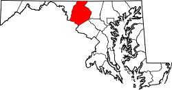
Libertytown is an unincorporated community and census-designated place (CDP) in Frederick County, in the U.S. state of Maryland. [3] As of the 2010 census it had a population of 950. [4] The Abraham Jones House was listed on the National Register of Historic Places in 1973. [5]

Contents

Geography

The community is in eastern Frederick County, along Maryland Route 26 (Liberty Road), which leads east 34 miles (55 km) to Baltimore and southwest 11 miles (18 km) to Frederick. Maryland Route 75 crosses MD 26 in the center of town, leading northeast 8 miles (13 km) to Union Bridge and south 7 miles (11 km) to New Market. Maryland Route 31 intersects MD 26 on the east edge of town and leads northeast 17 miles (27 km) to Westminster. Maryland Route 550 leaves MD 26 in the western part of town and leads northwest 5 miles (8 km) to Woodsboro.

According to the U.S. Census Bureau, the Libertytown CDP has a total area of 2.4 square miles (6.3 km2), of which 0.006 square miles (0.015 km2), or 0.23%, is water. [4]

Demographics

Historical population
CensusPop.Note
2010 950
2020 9843.6%
U.S. Decennial Census [6]

From 2010 to 2020, the population of Libertytown increased by 3.6%.

Education

Libertytown is the location of Liberty Elementary School. Liberty opened its doors in 1927, teaching grades 1 through 12. In 1945, Liberty graduated its final senior class and continued teaching junior high until 1962.

Notre Dame Academy is a Catholic elementary school in Libertytown.

Recreation

Libertytown Park contains picnic gazebos and a county maintained rain garden. This regional park also has two baseball fields: one for Little League and another regulation-sized baseball field. Additional facilities include a basketball court, three tennis courts, and a large field space for football or soccer. A very popular spot among locals is Dirty Dixon’s. It only is accessible from within the park, but also is accessible off Dollyhide Road with additional parking. The trails runs through a native bobwhite quail protection area maintained by Quail Forever.[ citation needed ]

Related Research Articles

<span class="mw-page-title-main">Pasadena, Maryland</span> Census-designated place in Maryland, United States

Pasadena is a census-designated place (CDP) in Anne Arundel County, Maryland, United States. The population was 24,287 at the 2010 census.

<span class="mw-page-title-main">Cockeysville, Maryland</span> Census-designated place in Maryland, United States

Cockeysville is a census-designated place (CDP) in Baltimore County, Maryland, United States. The population was 20,776 at the 2010 census.

<span class="mw-page-title-main">Owings, Maryland</span> Census-designated place in Maryland, United States

Owings is a town center and census-designated place (CDP) in northern Calvert County, Maryland, United States. The population was 2,149 at the 2010 census, up from 1,325 in 2000.

<span class="mw-page-title-main">Eldersburg, Maryland</span> Census-designated place in Maryland, United States

Eldersburg is an unincorporated community and census-designated place (CDP) in Carroll County, Maryland, United States. The population was 30,531 at the 2010 census.

<span class="mw-page-title-main">New Market, Maryland</span> Town in Maryland

New Market is a town in Frederick County, Maryland, United States. The population was 1,525 at the 2020 census. The town bills itself as the "Antiques capital of Maryland".

<span class="mw-page-title-main">Walkersville, Maryland</span> Town in Maryland

Walkersville is a town in Frederick County, Maryland, United States. The population was 5,800 at the 2010 census.

<span class="mw-page-title-main">Fallston, Maryland</span> Census-designated place in Maryland, United States

Fallston is a census-designated place (CDP) in Harford County, Maryland, United States. The population was 8,958 at the 2010 census, up from 8,427 in 2000. Fallston is a semi-rural community consisting mostly of farms and suburban-like developments.

<span class="mw-page-title-main">Rosaryville, Maryland</span> Census-designated place in Maryland, US

Rosaryville is an unincorporated area and census-designated place (CDP) in Prince George's County, Maryland, United States, located south of Cinton and Upper Marlboro beside U.S. Route 301. Per the 2020 census, the population was 11,548. including housing developments and rural open space. It was named for a local Roman Catholic church. Close to Rosaryville are the Marlton housing development, Maryland Veterans Cemetery, the Southern Maryland Farmers Market, and Rosaryville State Park.

Landover is an unincorporated community and census-designated place in Prince George's County, Maryland, United States. As of the 2020 census, it had a population of 25,998.

Bartonsville is an unincorporated community and census-designated place (CDP) in Frederick County, in the U.S. state of Maryland. As of the 2020 census it had a population of 2,753. Prior to 2010, the area was part of the Linganore-Bartonsville CDP.

<span class="mw-page-title-main">Jefferson, Maryland</span> Census-designated place in Maryland, United States

Jefferson is an unincorporated community and census-designated place (CDP) in Frederick County, Maryland, United States. As of the 2020 census the town had a population of 2,235. Jefferson was established in 1774 and incorporated as a town in 1831. However, a year later, in 1832, the citizens of the town decided that municipal government was unnecessary, and dis-incorporated the town, which has been unincorporated since then.

<span class="mw-page-title-main">Urbana, Maryland</span> Census-designated place in Maryland, United States

Urbana is a suburban census-designated place located in Frederick County, Maryland, United States. It lies at the I-270/MD 80 interchange, approximately 7.5 miles (12.1 km) south-east of Frederick and about 37 miles (60 km) north-west of Washington, D.C. Urbana started to develop circa 1999 and, as of the 2010 census, had a population of 9,175. It is part of the Washington metropolitan area.

<span class="mw-page-title-main">Buckeystown, Maryland</span> Census-designated place in Maryland, United States

Buckeystown is an unincorporated community and census-designated place (CDP) in Frederick County, Maryland, United States. As of the 2010 census the population was 1,019. Buckeystown Historic District and Buckingham House and Industrial School Complex were listed on the National Register of Historic Places in 1982. Carrollton Manor was listed in 1997. Former Congressman Roscoe Bartlett lives on a farm in the town.

Pylesville is an unincorporated community and census-designated place (CDP) in Harford County, Maryland, United States. The population was 693 at the 2010 census. It is part of the Baltimore metropolitan area.The town was named after Brandon Pyles. Until 1958, this community was served by the Maryland and Pennsylvania Railroad at milepost 40.3.

<span class="mw-page-title-main">Taylors Island, Maryland</span> Census-designated place in Maryland, United States

Taylors Island is an unincorporated community and census-designated place in Dorchester County, Maryland, United States, in the state's Eastern Shore region. The population was 173 at the 2010 census. It is known for hunting, crabbing and fishing. Ridgeton Farm was listed on the National Register of Historic Places in 1977. Bethlehem Methodist Episcopal Church and Grace Episcopal Church Complex were listed in 1979.

Worton is an unincorporated community and census-designated place (CDP) in Kent County, Maryland, United States. As of the 2010 census it had a population of 249.

<span class="mw-page-title-main">Kennedyville, Maryland</span> Census-designated place in Maryland, United States

Kennedyville is an unincorporated community and census-designated place in Kent County, Maryland, United States. As of the 2010 census it had a population of 199.

<span class="mw-page-title-main">Sabillasville, Maryland</span> Census-designated place in Maryland

Sabillasville is an unincorporated community and census-designated place in Frederick County, Maryland, United States. As of the 2010 census it had a population of 354.

Summerfield is a census-designated place near Landover in Prince George's County, Maryland. As of the 2020 census, the population was 14,758. It is a suburb of Washington, D.C.

Spring Ridge is census-designated place (CDP) and suburban housing community in Frederick County, in the U.S. state of Maryland, just outside the city of Frederick. As of the 2020 census it had a population of 6,005. Before 2010, it was part of the Linganore-Bartonsville, Maryland census-designated place, which was split into three for the 2010 census.

References

  1. "2020 U.S. Gazetteer Files". United States Census Bureau. Retrieved April 26, 2022.
  2. 1 2 U.S. Geological Survey Geographic Names Information System: Libertytown, Maryland
  3. "Geographic Names Information System". Libertytown (Populated Place). U.S. Geological Survey. January 29, 2009.
  4. 1 2 "Geographic Identifiers: 2010 Census Summary File 1 (G001), Libertytown CDP, Maryland". American FactFinder. U.S. Census Bureau. Archived from the original on February 13, 2020. Retrieved June 1, 2016.
  5. "National Register Information System". National Register of Historic Places . National Park Service. April 15, 2008.
  6. "Census of Population and Housing". Census.gov. Retrieved June 4, 2016.