Rocky Ridge, Maryland

Last updated
Rocky Ridge, Maryland
MonocacyBrethrenChurch001.jpg
The Monocacy Church of the Brethren in July 1996
USA Maryland location map.svg
Red pog.svg
Rocky
Ridge
Location in Maryland
Usa edcp location map.svg
Red pog.svg
Rocky
Ridge
Rocky
Ridge (the United States)
Coordinates: 39°36′18″N77°19′03″W / 39.60500°N 77.31750°W / 39.60500; -77.31750
Country Flag of the United States.svg  United States of America
State Flag of Maryland.svg  Maryland
County Flag of Frederick County, Maryland.svg Frederick

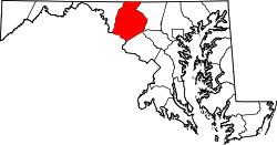
Rocky Ridge is an unincorporated community in Frederick County, Maryland, United States. [1] The name "Rocky Ridge" likely refers to a ridge of ironstone which runs through the area. [2]

Contents

History

The Rocky Ridge area was settled by several families by the mid-18th century, at which time it was known as Ogleton, after the Ogle family. [2] It has spent most of its life as a "crossroads village," being centered on the intersection of the roads that today are Maryland Route 76 and Maryland Route 77. It was a railroad depot in the latter half of the 19th century; the Western Maryland Railway reached Rocky Ridge in 1870, and the Emmitsburg Railroad connected with it there in 1875. [3] Highlighting the importance of the railroads in its existence, the Rocky Ridge stretch of Maryland Route 76 is known as Motters Station Road after Joshua Motter, president of the Emmitsburg Railroad. [4]

Rocky Ridge had two active church congregations by the mid-19th century, and got its own post office in 1870. [2]

Old Mill Road Bridge was listed on the National Register of Historic Places in 1979. [5] Loys Station Covered Bridge, located between Rocky Ridge and Thurmont, was listed in 1978. [6]

Tourism

The town is known for the "Big Slide," a forty-foot tall wooden slide, built by volunteers in 1950. [7] The slide is located in Mount Tabor Park, a park founded by Mount Tabor Church in the early 20th century and still administered by the church today. The park is said to have been used for religious revivals. [8]

Related Research Articles

<span class="mw-page-title-main">Leadville, Colorado</span> City in Colorado, United States

Leadville is a statutory city that is the county seat, the most populous community, and the only incorporated municipality in Lake County, Colorado, United States. The city population was 2,633 at the 2020 census. It is situated at an elevation of 10,158 feet (3,096 m). Leadville is the highest incorporated city in the United States and is surrounded by two of the tallest peaks in the state.

<span class="mw-page-title-main">Odenton, Maryland</span> Census-designated place in Maryland, U.S.

Odenton is a census-designated place (CDP) in Anne Arundel County, Maryland, United States, located approximately 10–20 minutes from the state capital, Annapolis. The population was 37,132 at the 2010 census, up from 20,534 at the 2000 census. The town's population growth rate of 80.8% between 2000 and 2010 was the greatest of any town in western Anne Arundel County. Odenton is located west of Annapolis, south of Baltimore, and northeast of Washington.

<span class="mw-page-title-main">Bowie, Maryland</span> City in Maryland, United States

Bowie is a city in Prince George's County, Maryland, United States. Per the 2020 census, the population was 58,329. Bowie has grown from a small railroad stop to the largest municipality in Prince George's County, and the fifth most populous city and third largest city by area in the U.S. state of Maryland. In 2014, CNN Money ranked Bowie 28th in its Best Places to Live list.

<span class="mw-page-title-main">Point of Rocks, Maryland</span> Census-designated place in Maryland, United States

Point of Rocks is an unincorporated community and census-designated place (CDP) in Frederick County, Maryland, United States. As of the 2010 census it had a population of 1,466. It is named for the striking rock formation on the adjacent Catoctin Mountain, which was formed by the Potomac River cutting through the ridge in a water gap, a typical formation in the Appalachian Mountains. The formation is not visible from the town and can only be seen from boats on the river, or from the southern bank of the river in Virginia.

<span class="mw-page-title-main">Savage, Maryland</span> Census-designated place in Maryland, United States

Savage is an unincorporated community and census-designated place located in Howard County, Maryland, United States, approximately 18 miles (29 km) south of Baltimore and 21 miles (34 km) north of Washington, D.C. It is situated close to the city of Laurel and to the planned community of Columbia. As of the 2020 census, it had a population of 7,542. The former mill town is a registered historic place, and has several original buildings preserved within and around the Savage Mill Historic District.

<span class="mw-page-title-main">George Washington Memorial Parkway</span> 7,142-acre parkway maintained by the National Park Service

The George Washington Memorial Parkway, colloquially the G.W. Parkway, is a 25-mile-long (40 km) parkway that runs along the south bank of the Potomac River from Mount Vernon, Virginia, northwest to McLean, Virginia, and is maintained by the National Park Service (NPS). It is located almost entirely within Virginia, except for a short portion of the parkway northwest of the Arlington Memorial Bridge that passes over Columbia Island within the District of Columbia.

<span class="mw-page-title-main">Blue Ridge Summit, Pennsylvania</span> Census-designated place in Pennsylvania, United States

Blue Ridge Summit is an unincorporated community and census-designated place in Franklin County, Pennsylvania, United States, southwest of Gettysburg in the central part of the state, adjoining Pennsylvania's southern border with Maryland. It is less than 3 miles (5 km) east of Pen Mar, Maryland. The population of Blue Ridge Summit was 887 at the 2020 census.

<span class="mw-page-title-main">United States National Register of Historic Places listings</span> Register for landmarks in the United States

The National Register of Historic Places in the United States is a register including buildings, sites, structures, districts, and objects. The Register automatically includes all National Historic Landmarks as well as all historic areas administered by the U.S. National Park Service. Since its introduction in 1966, more than 90,000 separate listings have been added to the register.

<span class="mw-page-title-main">Maryland Route 32</span> State highway in Maryland, US

Maryland Route 32 (MD 32) is a state highway in the U.S. state of Maryland. The road runs 51.79 miles (83.35 km) from Interstate 97 (I-97) and MD 3 in Millersville west and north to Washington Road in Westminster. The 30 mile four- to six-lane freeway portion of MD 32 is the Patuxent Freeway between I-97 and I-70 in West Friendship. The freeway passes through Odenton and Fort Meade, the site of Fort George G. Meade and the National Security Agency (NSA), in western Anne Arundel County and along the southern part of Columbia in Howard County. Via I-97, MD 32 connects those communities with U.S. Route 50 (US 50)/US 301 in Annapolis. MD 32 also intersects the four primary highways connecting Baltimore and Washington: the Baltimore–Washington Parkway, US 1, I-95, and US 29. MD 32's north–south section, Sykesville Road, connects West Friendship and Westminster by way of Sykesville and Eldersburg in southern Carroll County.

<span class="mw-page-title-main">Lutherville, Maryland</span> Census-designated place in Maryland, United States

Lutherville is a census-designated place (CDP) in Baltimore County, Maryland, United States. As of the 2010 census it had a population of 6,504. Prior to 2010 the area was part of the Lutherville-Timonium CDP. Within its borders lies the Lutherville Historic District.

<span class="mw-page-title-main">U.S. Route 15 in Maryland</span> Part of the U.S. Highway System in Maryland

U.S. Route 15 (US 15) is a part of the United States Numbered Highway System that runs from Walterboro, South Carolina, north to Painted Post, New York. In Maryland, the highway runs 37.85 miles (60.91 km) from the Virginia state line at the Potomac River in Point of Rocks north to the Pennsylvania state line near Emmitsburg. Known for most of its length as Catoctin Mountain Highway, US 15 is the primary north–south highway of Frederick County. The highway connects the county seat of Frederick with Point of Rocks, Leesburg, Virginia, and Charles Town, West Virginia, to the south and with Thurmont, Emmitsburg, and Gettysburg, Pennsylvania, to the north. US 15 is a four-lane divided highway throughout the state except for the portion between the Point of Rocks Bridge and the highway's junction with US 340 near Jefferson. The highway is a freeway along its concurrency with US 340 and through Frederick, where the highway meets US 40 and Interstate 70 (I-70). US 15 has a business route through Emmitsburg.

<span class="mw-page-title-main">Maryland Route 76</span> State highway in Frederick County, Maryland, US, known as Motters Station Rd

Maryland Route 76 is a state highway in the U.S. state of Maryland. Known as Motters Station Road, the state highway runs 5.69 miles (9.16 km) from MD 77 in Rocky Ridge north to U.S. Route 15 near Emmitsburg in northern Frederick County. MD 76 was constructed in two sections in the early 1920s and late 1930s.

<span class="mw-page-title-main">Maryland Route 77</span> State highway in Maryland, US

Maryland Route 77 is a state highway in the U.S. state of Maryland. The state highway runs 20.74 miles (33.38 km) from MD 64 in Smithsburg east to MD 194 in Keymar. MD 77 is the main east–west highway of northern Frederick County. The state highway connects Thurmont with eastern Washington County via Foxville, which lies between South Mountain and Catoctin Mountain near Catoctin Mountain Park and Cunningham Falls State Park. MD 77 links Thurmont with western Carroll County through the communities of Graceham, Rocky Ridge, and Detour in the Monocacy River valley. MD 77 was constructed from Thurmont east to Detour in the 1920s and early 1930s. A disjoint section of MD 77 was built between Cavetown and Foxville in the late 1930s. The portions of the modern highway between Foxville and Thurmont and from Detour to Keymar were county highways until they were designated part of MD 77 in 1956. MD 77's western terminus was moved east to MD 64 in Smithsburg in 1960.

<span class="mw-page-title-main">Emmitsburg Historic District</span> Historic district in Maryland, United States

The Emmitsburg Historic District is a national historic district in Emmitsburg, Frederick County, Maryland. The district is predominantly residential and includes most of the older area of the town extending along Main Street and Seton Avenue. Also included are several commercial buildings and churches interspersed among the dwellings. The buildings are primarily two-story sided log or brick, dating from the late 18th to the mid 19th centuries. Some later 19th century buildings in this area include some large Italianate-influenced buildings forming the northeast and southeast corners of the main square; an area destroyed by fire in 1863. Settlement began in the region during the 1730s, bringing Protestant Germans and Scotch-Irish from Pennsylvania, as well as English Catholics from Tidewater Maryland.

<span class="mw-page-title-main">Creagerstown, Maryland</span> Unincorporated community in Maryland, United States

Creagerstown is an unincorporated community in Frederick County, Maryland, United States. It is playfully known by its residents as "4 miles from everywhere" because of its situation at 4 miles (6.4 km) from Thurmont, Woodsboro, Rocky Ridge, and Lewistown.

<span class="mw-page-title-main">Sabillasville, Maryland</span> Census-designated place in Maryland

Sabillasville is an unincorporated community and census-designated place in Frederick County, Maryland, United States. As of the 2010 census it had a population of 354.

<span class="mw-page-title-main">Maryland Route 550</span>

Maryland Route 550 is a state highway in the U.S. state of Maryland. The state highway runs 24.43 miles (39.32 km) from MD 26 in Libertytown north to Pen Mar Road in Fort Ritchie. MD 550 runs southeast–northwest across central Frederick County, connecting Fort Ritchie in the northeastern corner of Washington County and Libertytown with the towns of Thurmont and Woodsboro and the smaller communities of Creagerstown and Sabillasville. South of the highway's junction with U.S. Route 15 in Thurmont, the state highway passes through the wide valley of the Monocacy River; to the north, the highway passes along the northern edge of Catoctin Mountain and crests South Mountain near Blue Ridge Summit, Pennsylvania.

Joseph S. Gitt was a self-taught civil engineer and politician from Pennsylvania. After an unsuccessful career as a newspaper publisher, Gitt went back into railroading, estimating that in his career, he had conducted 31 different railroad surveys for a total distance of over 300 miles in his career Gitt either surveyed or engineered most of the railroads constructed in Frederick and Carroll county, Maryland and Adams county, Pennsylvania in the 1855-1885 period with the exception of the civil war.

Pen Mar is an unincorporated community in Washington County, Maryland, and Franklin County, Pennsylvania, United States. It is one of the border towns in the United States with a portmanteau name. Pen Mar came to prominence as a resort in the 20th century after the construction of Pen Mar Park by the Western Maryland Railway. While the resort has long been dismantled, the area still has some significance in Maryland, since it is the northern starting point for the Maryland section of the Appalachian Trail.

References

  1. U.S. Geological Survey Geographic Names Information System: Rocky Ridge, Maryland
  2. 1 2 3 Rada, James Jr. "A History of Rocky Ridge". Emmitsburg Area Historical Society. Emmitsburg Area Historical Society. Retrieved 8 February 2016.
  3. Scharf, J. Thomas (1882). History of Western Maryland (vol. 1). Philadelphia: Louis H. Everts. pp.  581, 594. Retrieved 8 February 2016.
  4. Poor, Henry Varnum (1872). Manual of the Railroads of the United States for 1872-73. New York: H.V. & H.W. Poor. p. 527. Retrieved 8 February 2016.
  5. "National Register Information System". National Register of Historic Places . National Park Service. April 15, 2008.
  6. "Loys Station Covered Bridge". NPS Focus. National Register of Historic Places. Retrieved 8 February 2016.
  7. Redding, Lauren (19 July 2010). "Big Slide, big fun". Frederick News Post. Retrieved 8 February 2016.
  8. "National Register Eligibility Review Form - Rocky Ridge Survey District" (PDF). Maryland Inventory of History Properties. Maryland Historic Trust. Retrieved 8 February 2016.