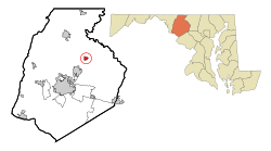
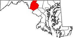
Woodsboro, Maryland | |
---|---|
Town of Woodsboro | |
Motto: "Small Town Life at its Best!" [1] | |
Coordinates: 39°31′58″N77°18′34″W / 39.53278°N 77.30944°W | |
Country | United States of America |
State | Maryland |
County | Frederick |
Founded | 1786 [2] |
Incorporated | 1836 [3] |
Government | |
• Burgess | Heath Barnes |
Area | |
• Total | 0.71 sq mi (1.84 km2) |
• Land | 0.71 sq mi (1.83 km2) |
• Water | 0.00 sq mi (0.01 km2) |
Elevation | 345 ft (105 m) |
Population (2020) | |
• Total | 1,092 |
• Density | 1,544.55/sq mi (595.97/km2) |
Time zone | UTC-5 (Eastern (EST)) |
• Summer (DST) | UTC-4 (EDT) |
ZIP code | 21798 |
Area code(s) | 301, 240 |
FIPS code | 24-86750 |
GNIS feature ID | 2391492 [5] |
Website | Woodsboro On-Line |
Woodsboro is a town in Frederick County, Maryland, United States that was granted to Joseph Wood in 1693. [6] The population was 1,092 at the 2020 census.
The town was named after Joseph Wood. [7] The LeGore Bridge was listed on the National Register of Historic Places in 1978 and Woods Mill Farm was listed in 2007. [8]
In 1895, Dr. George F. Smith founded Rosebud Perfume Company in Woodsboro. Smith had eight children, and served as mayor of the town for 19 years. [9] The business has remained in the family, and as of 2012, was still producing its famous "Smith's Rosebud Salve," a lip gloss and salve originally known as tholene. [10] [11] [12] The products are shipped from company headquarters in Woodsboro; however, "the salve is manufactured and filled at Case Mason in Joppa, Md., and the tins are made in Baltimore." [13]
The Woodsboro Savings Bank, and several buildings associated with the three limestone quarries near the town are among the structures which have been considered for historic preservation. [14]
Unlike most cities, the executive officer of Woodsboro, Maryland is called a burgess. The current Burgess of Woodsboro is Heath Barnes. [15]
According to the United States Census Bureau, the town has a total area of 0.71 square miles (1.84 km2), all land. [16]
The main means of transport to and from Woodsboro is by road, and two primary state highways serve the town. Maryland Route 194 traverses the area northeast to southwest, connecting the Frederick area to Taneytown. Maryland Route 550 follows a northwest-to-southeast alignment, providing connections to Thurmont and Libertytown. Both roads follow the same alignment for a short distance on the northeast side of Woodsboro.
Census | Pop. | Note | %± |
---|---|---|---|
1880 | 336 | — | |
1910 | 362 | — | |
1920 | 385 | 6.4% | |
1930 | 385 | 0.0% | |
1940 | 416 | 8.1% | |
1950 | 427 | 2.6% | |
1960 | 430 | 0.7% | |
1970 | 439 | 2.1% | |
1980 | 506 | 15.3% | |
1990 | 513 | 1.4% | |
2000 | 846 | 64.9% | |
2010 | 1,141 | 34.9% | |
2020 | 1,092 | −4.3% | |
U.S. Decennial Census [17] |
As of the census [18] of 2010, there were 1,141 people, 423 households, and 306 families living in the town. The population density was 1,607.0 inhabitants per square mile (620.5/km2). There were 443 housing units at an average density of 623.9 per square mile (240.9/km2). The racial makeup of the town was 91.9% White, 3.7% African American, 0.1% Native American, 1.3% Asian, 1.1% from other races, and 1.9% from two or more races. Hispanic or Latino of any race were 4.0% of the population.
There were 423 households, of which 38.1% had children under the age of 18 living with them, 60.5% were married couples living together, 7.8% had a female householder with no husband present, 4.0% had a male householder with no wife present, and 27.7% were non-families. 25.1% of all households were made up of individuals, and 12.5% had someone living alone who was 65 years of age or older. The average household size was 2.70 and the average family size was 3.23.
The median age in the town was 41.1 years. 27% of residents were under the age of 18; 8.3% were between the ages of 18 and 24; 19.9% were from 25 to 44; 32.7% were from 45 to 64; and 12.1% were 65 years of age or older. The gender makeup of the town was 46.6% male and 53.4% female.
As of the census [19] of 2000, there were 846 people, 273 households, and 229 families living in the town. The population density was 1,230.9 inhabitants per square mile (475.3/km2). There were 295 housing units at an average density of 429.2 per square mile (165.7/km2). The racial makeup of the town was 98.46% White, 0.24% African American, 0.59% Asian, 0.24% from other races, and 0.47% from two or more races. Hispanic or Latino of any race were 0.95% of the population.
There were 273 households, out of which 50.2% had children under the age of 18 living with them, 74.0% were married couples living together, 6.2% had a female householder with no husband present, and 16.1% were non-families. 13.6% of all households were made up of individuals, and 9.5% had someone living alone who was 65 years of age or older. The average household size was 3.10 and the average family size was 3.37.
In the town, the population was spread out, with 35.3% under the age of 18, 4.7% from 18 to 24, 33.3% from 25 to 44, 17.7% from 45 to 64, and 8.9% who were 65 years of age or older. The median age was 36 years. For every 100 females, there were 94.5 males. For every 100 females age 18 and over, there were 89.9 males.
The median income for a household in the town was $65,000, and the median income for a family was $62,500. Males had a median income of $45,250 versus $26,528 for females. The per capita income for the town was $21,434. About 0.9% of families and 2.0% of the population were below the poverty line, including 1.8% of those under age 18 and 5.7% of those age 65 or over.
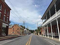
Midland is a town in Allegany County, Maryland, United States, along the Georges Creek Valley. It is part of the Cumberland, MD-WV Metropolitan Statistical Area. The population was 446 at the 2010 census. Midland was founded in 1850 as a coal-mining community, though today only some strip mining remains.
Westernport is a town in Allegany County, Maryland, United States, along the Georges Creek Valley. It is part of the Cumberland, MD-WV Metropolitan Statistical Area. The population was 1,888 at the 2010 census.
North Beach is a town in Calvert County, Maryland, United States. The population was 1,978 at the 2010 U.S. Census.
North East is a town in Cecil County, Maryland, United States. It is located between Philadelphia and Baltimore. The population was 3,572 at the 2010 census.
Hurlock is a town in Dorchester County, Maryland, United States. The population was 2,092 at the 2010 census.
Walkersville is a town in Frederick County, Maryland, United States. The population was 5,800 at the 2010 census.
Deer Park is a town in Garrett County, Maryland, United States. The population was 399 at the 2010 census. It is part of the Pittsburgh Media Market.
Friendsville is a town in Garrett County, Maryland, United States. The population was 438 at the 2020 census.
Kitzmiller is a town in Garrett County, Maryland, United States. The population was 321 at the 2010 census.
Galena is a town in Kent County, Maryland, United States. The population was 612 at the 2010 census.
Laytonsville is a town in Montgomery County, Maryland, United States. The population was 572 at the 2020 census, up from 353 in 2010. Laytonsville was incorporated in 1892.
Sudlersville is a town in the far northeastern corner of Queen Anne's County, Maryland, United States. The ZIP code is 21668 and the area code is 410. The population was 497 at the 2010 census. It is perhaps best known as the hometown of Baseball Hall Of Fame slugger Jimmie Foxx. Other famous residents include astronomer and mathematician Simon Newcomb.
Clear Spring is a town in Washington County, Maryland, United States. The population was 358 at the 2010 census.
Mission is a city on the Rosebud Indian Reservation in northern Todd County, South Dakota, United States. The population was 1,156 at the 2020 census.
St. Francis, also known as Sápauŋ thí is a town in the Rosebud Indian Reservation in Todd County, South Dakota, United States. The population was 469 at the 2020 census.
Carpendale is a town in Mineral County, West Virginia, United States, and part of the Cumberland, MD-WV Metropolitan Statistical Area'. The population was 861 at the 2020 census. Carpendale was incorporated on January 2, 1990, by the Circuit Court. The town is a combination of three subdivisions of which its name reflects: Carpenters Addition, Millerdale I, and Millerdale II. There are no stores in Carpendale and there is only one road in and out of the town.
Hampstead is a town in Carroll County in the U.S. state of Maryland. The population was 6,323 at the 2010 census.
Templeville is a town in Caroline and Queen Anne's counties, Maryland, United States. Templeville is located near the Maryland-Delaware line. The population was 138 at the 2010 census. It was known as Bullock Town until the name was changed in 1847. The name Templeville derives from the Temple family, whose most famous member was Governor William Temple of Delaware.
Queen Anne is a town in Queen Anne's and Talbot counties in the U.S. state of Maryland. The population was 222 at the 2010 census.
Chevy Chase —formally, the Town of Chevy Chase—is an incorporated town in Montgomery County, Maryland, United States. The population was 2,904 at the 2020 census.