
Sierra Vista is a city in Cochise County, Arizona, United States. As of the 2010 census the population of the city was 43,888. The city is part of the Sierra Vista-Douglas Metropolitan Area, with a 2010 population of 131,346. Fort Huachuca, a U.S. Army post, is located in the northwest part of the city.
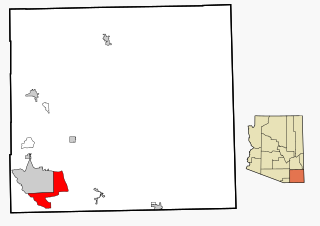
Sierra Vista Southeast, often referred to as Hereford or Nicksville, is a census-designated place (CDP) in Cochise County, Arizona, United States. The population was 14,797 at the 2010 census. It includes the CDP's Ramsey Canyon, and Sierra Vista Estates within its boundaries.

Lowell is a populated place situated in Cochise County, Arizona. It was incorporated into Bisbee in the early 1900s. Lowell has an estimated elevation of 5,075 feet (1,547 m) above sea level.
Hereford is a populated place in Cochise County along the San Pedro Riparian National Conservation Area in the southern part of the U.S. state of Arizona. It is southeast of Sierra Vista and is a part of the Sierra Vista-Douglas micropolitan area. The elevation is 4,193 feet at the location of the original townsite at the far eastern end of the unincorporated area; the residential area runs for another 8 miles west from this location, blending into the unincorporated area of Nicksville at an elevation of approximately 4800'. Hereford Station Post Office is located at the far western end of Nicksville, at the foot of the Huachuca Mountains.
KWCD is a radio station broadcasting a Country Western format. It is licensed to Bisbee, Arizona, United States. This station serves southern Cochise County, Arizona and a small piece of northern Sonora, Mexico. The station is currently owned by CCR-Sierra Vista IV, LLC.(Cherry Creek Media)

Apache Flats is a populated place situated with the city of Sierra Vista in Cochise County, Arizona. It has an estimated elevation of 4,951 feet (1,509 m) above sea level.
Bledsoe is a populated place situated in Cochise County, Arizona. It has an estimated elevation of 5,545 feet (1,690 m) above sea level.
Bradberry is a populated place situated in Cochise County, Arizona. It has an estimated elevation of 4,035 feet (1,230 m) above sea level.
Desert Vista Estates III is a populated place situated in Maricopa County, Arizona. It has an estimated elevation of 1,568 feet (478 m) above sea level.
Benson Junction is a populated place situated in Cochise County, Arizona. It has an estimated elevation of 3,862 feet (1,177 m) above sea level.
Fenner is a populated place situated in Cochise County, Arizona. It has an estimated elevation of 3,711 feet (1,131 m) above sea level.
Luzena, also known as Bowie Junction, is a populated place situated in Cochise County, Arizona. It has an estimated elevation of 4,019 feet (1,225 m) above sea level.
Ramsey is a populated place situated in Cochise County, Arizona, slightly north of the international boundary with Mexico. It has an estimated elevation of 5,659 feet (1,725 m) above sea level.
Rileys El Encinar is a populated place situated in Cochise County, Arizona. It has an estimated elevation of 5,036 feet (1,535 m) above sea level.
Stark is a populated place situated in Cochise County, Arizona, right along the international border with Mexico. It has an estimated elevation of 4,393 feet (1,339 m) above sea level.
Sunnyside is a populated place situated in the far west of Cochise County, Arizona, just north of the international border with Mexico. It has an estimated elevation of 5,814 feet (1,772 m) above sea level.
Taylor Place is a populated place situated in Cochise County, Arizona. It has an estimated elevation of 5,518 feet (1,682 m) above sea level.
Tully is a populated place in Cochise County, Arizona. It has an estimated elevation of 4,334 feet (1,321 m) above sea level.
Vanar is a populated place situated in Cochise County, Arizona, right against the border with New Mexico. It has an estimated elevation of 3,917 feet (1,194 m) above sea level.
Wheeler Place is a populated place situated in Cochise County, Arizona. It has an estimated elevation of 4,094 feet (1,248 m) above sea level.


