Lake Erie State Park is a 355-acre (1.44 km2) state park located in the Town of Portland in Chautauqua County, New York, United States, northeast of the village of Brocton. Its major attraction is its Lake Erie beach, in addition to its campsites and other recreational facilities.
Kring Point State Park is a 61-acre (0.25 km2) state park located on the St. Lawrence River in the Town of Alexandria in Jefferson County, New York. The park is north of Alexandria Bay near the St. Lawrence County line and is connected to NY 12 by Kring Point Road.
Cedar Island State Park is a 10-acre (4.0 ha) state park located in the Town of Hammond in St. Lawrence County, New York. The park comprises half of Cedar Island, located in Chippewa Bay in the St. Lawrence River, part of the Thousand Islands region. The remainder of the island is privately owned.

Wellesley Island State Park is a 2,636-acre (10.67 km2) state park located on Wellesley Island in the St. Lawrence River in the Town of Orleans in Jefferson County, New York. The park is divided into sections that are on different parts of the island. It has the largest camping complex in the Thousand Islands region, including wilderness campsites on the banks of the St. Lawrence accessible only by foot or boat. The park is open year-round.
Canoe-Picnic Point State Park is a 70-acre (0.28 km2) state park located on Grindstone Island in the St. Lawrence River. The park is within the bounds of the Town of Clayton in Jefferson County, New York.
Mary Island State Park is a 13-acre (5.3 ha) state park located in the St. Lawrence River in Jefferson County, New York. The park is situated in the Town of Alexandria on the east end of Wellesley Island, and is accessible only by boat.

Dewolf Point State Park is a 13-acre (0.053 km2) state park on Wellesley Island in the St. Lawrence River. The park is situated within the Town of Orleans in Jefferson County, New York. The park was established in 1898 as part of the St. Lawrence Reservation.
Burnham Point State Park is a 12-acre (0.049 km2) state park located on the St. Lawrence River in the Town of Cape Vincent in Jefferson County, New York, United States. The park is approximately 32 miles (51 km) north of Watertown.
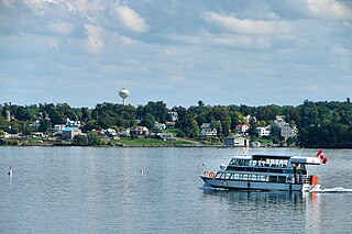
Keewaydin State Park is a 282-acre (1.14 km2) state park in the Town of Alexandria in Jefferson County, New York in the United States. The park is located along the St. Lawrence River, southwest of the Village of Alexandria Bay on New York State Route 12.
Cedar Point State Park is a 48-acre (0.19 km2) state park located on Cedar Point in the Town of Cape Vincent in Jefferson County, New York. The park is located on Route 12E on the St. Lawrence River.
The New York State Office of Parks, Recreation and Historic Preservation (NYS OPRHP) is a state agency within the New York State Executive Department charged with the operation of state parks and historic sites within the U.S. state of New York. As of 2014, the NYS OPRHP manages nearly 335,000 acres of public lands and facilities, including 180 state parks and 35 historic sites, that are visited by over 62 million visitors each year.
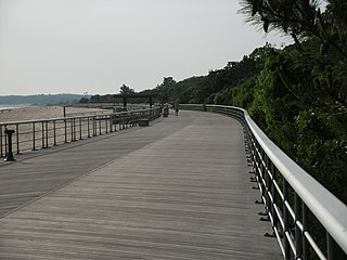
Sunken Meadow State Park, also known as Governor Alfred E. Smith State Park, is a 1,287-acre (5.21 km2) state park located in the Town of Smithtown in Suffolk County, New York on the north shore of Long Island. The park, accessible via the Sunken Meadow State Parkway, contains the 27-hole Sunken Meadow State Park Golf Course.

Oquaga Creek State Park is a 1,385-acre (5.60 km2) state park in Broome, Delaware, and Chenango counties, New York. The park is partially in the Town of Masonville and partly in the Town of Sanford. Broome County Road 241 passes through the park.
Chenango Valley State Park is a 1,137-acre (4.60 km2) state park located in Broome County, New York in the United States. The park is located adjacent to the Chenango River in western part of the Town of Fenton.

Pinnacle State Park and Golf Course is a 714-acre (2.89 km2) state park located in Steuben County, New York. The park is southwest of the City of Corning in the Town of Addison, east of Village of Addison.
Waterson Point State Park is a six-acre (2.4 ha) state park located on Wellesley Island in the St. Lawrence River in the Town of Orleans in Jefferson County, New York. It is near Wellesley Island State Park.
James Baird State Park is a 590-acre (2.4 km2) state park in Dutchess County, New York, United States. The park is located in the northern part of the Town of LaGrange, east of City of Poughkeepsie.
Bonavista State Park Golf Course is a 247-acre (1.00 km2) state park and golf course located in the Town of Ovid, just west of the Village of Ovid, New York, United States. The park is located between Sampson State Park and Seneca Lake State Park and overlooks Seneca Lake.
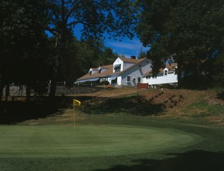
Mark Twain State Park and Soaring Eagles Golf Course is a 464-acre (1.88 km2) state park located in the Town of Horseheads in Chemung County, New York. The park was named for Mark Twain, who spent several summers in the area.