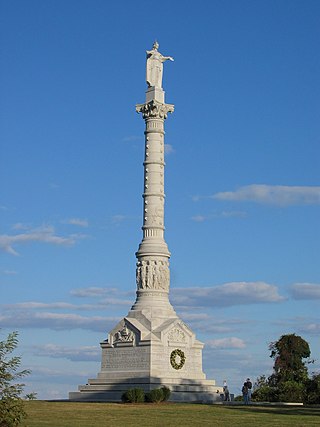
Colonial National Historical Park is a large national historical park located in the Hampton Roads region of Virginia operated by the National Park Service. It protects and interprets several sites relating to the Colony of Virginia and the history of the United States more broadly. These range from the site of the first English settlement at Jamestown, to the battlefields of Yorktown where the British Army was defeated in the American Revolutionary War. Over 3 million people visit the park each year.

The Battle of Newtown was the only major battle of the Sullivan Expedition, an armed offensive led by Major General John Sullivan that was ordered by George Washington to end the threat of the Iroquois who had sided with the British in the American Revolutionary War. Opposing Sullivan's four brigades were 250 Loyalist soldiers from Butler's Rangers, commanded by Major John Butler, and 350 Iroquois and Munsee Delaware. Butler and Mohawk war leader Joseph Brant did not want to make a stand at Newtown, and instead proposed to harass the enemy on the march, but were overruled by Sayenqueraghta and other Indigenous war leaders.
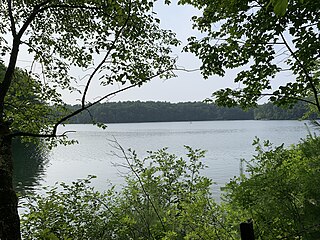
Walden Pond is a celebrated pond in Concord, Massachusetts, in the United States. A good example of a kettle hole, it was formed by retreating glaciers 10,000–12,000 years ago. The pond is protected as part of Walden Pond State Reservation, a 335-acre (136 ha) state park and recreation site managed by the Massachusetts Department of Conservation and Recreation. The reservation was designated a National Historic Landmark in 1962 for its association with the writer Henry David Thoreau (1817–1862), whose two years living in a cabin on its shore provided the foundation for his famous 1854 work, Walden; or, Life in the Woods. The National Historic Preservation Act of 1966 ensured federal support for the preservation of the pond.

Niagara Falls State Park is located in the City of Niagara Falls in Niagara County, New York, United States. The park, recognized as the oldest state park in the United States, contains the American Falls, the Bridal Veil Falls, and a portion of the Horseshoe Falls.
Mary Island State Park is a 13-acre (5.3 ha) state park located in the St. Lawrence River in Jefferson County, New York. The park is situated in the Town of Alexandria on the east end of Wellesley Island, and is accessible only by boat.

Peebles Island State Park is a 190-acre (0.77 km2) state park located at the confluence of the Mohawk and Hudson rivers in New York. A majority of the park is located in Saratoga County, with a smaller portion located in Albany County.
Macomb Reservation State Park is a 600-acre (2.4 km2) state park in the Town of Schuyler Falls in Clinton County, New York, United States. The park is located on the Salmon River, outside the Adirondack Park, and two miles (3.2 km) west of the hamlet of Schuyler Falls.

The New York State Office of Parks, Recreation and Historic Preservation is a state agency within the New York State Executive Department charged with the operation of state parks and historic sites within the U.S. state of New York. As of 2014, the NYS OPRHP manages nearly 335,000 acres of public lands and facilities, including 180 state parks and 35 historic sites, that are visited by over 78 million visitors each year.

Oriskany Battlefield State Historic Site is a historic site in Oneida County, New York, United States that marks the Battle of Oriskany, fought in 1777 during the American Revolution, one of the bloodiest engagements of the war.

Stony Point Battlefield is a historic site in Rockland County, New York; the location of the 1779 Battle of Stony Point during the American Revolutionary War. It is a National Historic Landmark and has a museum.
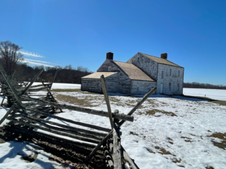
Monmouth Battlefield State Park is a 1,818-acre (7.36 km2) New Jersey state park located on the border of Manalapan and Freehold Township, in Monmouth County, New Jersey, United States. This park preserves the historical battlefield on which the American Revolutionary War's Battle of Monmouth (1778) was waged. It was added to the National Register of Historic Places for its significance in military history.

Sackets Harbor Battlefield State Historic Site is a historically important location in Jefferson County, New York, United States. The historic site is south of the Village of Sackets Harbor, bordering Lake Ontario in the Town of Hounsfield. Two battles were fought near this location during the War of 1812. Some 3,000 men worked at the shipyard building warships, and the village was fortified and garrisoned with thousands of troops.

Donald J. Trump State Park is a 436-acre (1.8 km2) state park in the towns of Yorktown and Putnam Valley in Westchester and Putnam counties, New York.
The Brandywine Battlefield Historic Site is a National Historical Landmark. The historic park is owned and operated by the Pennsylvania Historical and Museum Commission, on 52 acres (210,000 m2), near Chadds Ford, Delaware County, Pennsylvania in the United States.

The Bennington Battlefield is the Rensselaer County, New York, location where the Battle of Bennington occurred on the 16th of August 1777. It is located on New York State Route 67 in Walloomsac, New York, a historic route between Bennington, Vermont and the Hudson River. Here, New Hampshire, Vermont and Massachusetts militia under General John Stark rebuffed a British attempt led by Colonel Friedrich Baum to capture American stores. It was declared a National Historic Landmark in 1961. A portion of the battlefield is preserved in the Bennington Battlefield State Historic Site. The American Battlefield Trust and its partners have acquired and preserved more than 23 acres of the battlefield not already part of the state historic site.
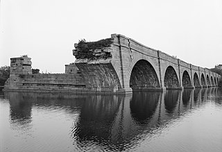
Schoharie Crossing State Historic Site, also known as Erie Canal National Historic Landmark, is a historic district that includes the ruins of the Erie Canal aqueduct over Schoharie Creek, and a 3.5-mile (5.6 km) long part of the Erie Canal, in the towns of Glen and Florida within Montgomery County, New York. It was the first part of the old canal to be designated a National Historic Landmark, prior to the designation of the entire New York State Barge Canal as an NHL in 2017.
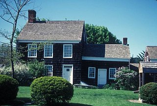
The Walt Whitman Birthplace State Historic Site is a state historic site in West Hills, New York, listed on the National Register of Historic Places. The site preserves the birthplace of American poet Walt Whitman.
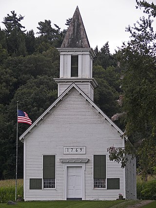
Indian Castle Church is a historic mission church at Indian Castle in Herkimer County, New York. The church is located on NYS Route 5S near present-day Danube. It is a one-story, rectangular wood-frame structure, clad in clapboard with a gable roof and steeple. To the rear of the church is a burial ground containing the remains of both Mohawks and Europeans.


