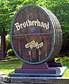
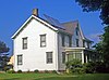
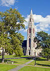
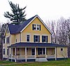
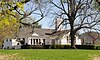
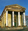
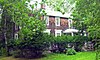
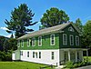
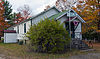
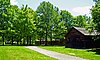
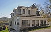
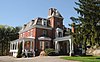
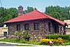
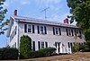
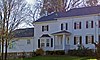
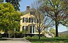
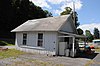
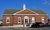
[3] Name on the Register Image Date listed [4] Location City or town Description 1 1841 Goshen Courthouse 1841 Goshen Courthouse March 4, 1975 (# 75001219 101 Main St. 41°24′10″N 74°19′20″W / 41.402778°N 74.322222°W / 41.402778; -74.322222 (1841 Goshen Courthouse ) Goshen (village) Greek Revival building by local architect Thornton Niven used until well into the 20th century 2 Adams–Chadeayne–Taft Estate Adams–Chadeayne–Taft Estate December 18, 2013 (# 13000932 1–2 Riverbank Lane 41°26′47″N 74°00′59″W / 41.4464303°N 74.0162616°W / 41.4464303; -74.0162616 (Adams–Chadeayne–Taft Estate ) Cornwall-on-Hudson Small residential complex remaining intact from village's resort era. 3 African-American Cemetery African-American Cemetery August 16, 1996 (# 96000862 NY 416, approximately .5 miles (0.80 km) south of the junction with NY 211 41°30′16″N 74°15′17″W / 41.504444°N 74.254722°W / 41.504444; -74.254722 (African-American Cemetery ) Montgomery Early, mid-19th century cemetery for slaves and descendants recently cleaned and restored 4 Arden Arden November 13, 1966 (# 66000561 NY 17 41°17′42″N 74°07′20″W / 41.295°N 74.122222°W / 41.295; -74.122222 (Arden ) Harriman Home of railroad magnate Edward H. Harriman in the last years of his life. 5 Balmville Cemetery Balmville Cemetery January 19, 2010 (# 09001229 Albany Post Road 41°30′42″N 74°00′47″W / 41.511686°N 74.013028°W / 41.511686; -74.013028 (Balmville Cemetery ) Balmville 6 Amelia Barr House Amelia Barr House November 23, 1982 (# 82001211 Mountain Rd. 41°25′34″N 74°01′26″W / 41.426111°N 74.023889°W / 41.426111; -74.023889 (Amelia Barr House ) Cornwall-on-Hudson Summer, and later full-time, home of Amelia Edith Huddleston Barr , bestselling American female novelist of the 19th century 7 John G. Beakes House John G. Beakes House November 29, 2010 (# 10000939 134 West Main Street 41°26′53″N 74°25′36″W / 41.448056°N 74.426667°W / 41.448056; -74.426667 (John G. Beakes House ) Middletown 8 Belknap Stone House Belknap Stone House August 15, 2001 (# 01000843 NY 17K 41°30′34″N 74°05′32″W / 41.509444°N 74.092222°W / 41.509444; -74.092222 (Belknap Stone House ) Newburgh 9 John Blake House John Blake House December 20, 1984 (# 84000521 924 Homestead Ave. 41°29′37″N 74°12′33″W / 41.493611°N 74.209167°W / 41.493611; -74.209167 (John Blake House ) Maybrook 1794 home of early settler and later town supervisor is largely intact; shows intersection of Federal style and pre-Revolutionary building traditions of English settlers 10 Bloomer–Dailey House and Balmville Tree Bloomer–Dailey House and Balmville Tree December 7, 2000 (# 00001420 83 Balmville Rd. 41°31′57″N 74°00′46″W / 41.5325°N 74.012778°W / 41.5325; -74.012778 (Bloomer–Dailey House and Balmville Tree ) Balmville Eastern cottonwood tree dating to ca. 1699, early center of Balmville and today New York's smallest state forest. Local legend has it that it was George Washington 's walking stick. It was cut down in 2015 after it became a hazard to traffic. [5] 11 Blooming Grove Church Blooming Grove Church December 6, 1996 (# 96001434 W side of NY 94, jct. with Old Dominion Rd. 41°24′12″N 74°11′55″W / 41.403333°N 74.198611°W / 41.403333; -74.198611 (Blooming Grove Church ) Blooming Grove Federal style -church built in 1824 for congregation that dates to 1758 12 Bodine Farmhouse Bodine Farmhouse May 3, 2006 (# 06000334 50 Wallkill Rd. 41°34′25″N 74°11′52″W / 41.573611°N 74.197778°W / 41.573611; -74.197778 (Bodine Farmhouse ) Town of Montgomery William Bodine was a grandson of Jean Bodine, but that the record of his birth has not been found. He was granted a large tract of land in Montgomery, outside the village of Walden, and his homestead was built in 1769 and occupied by several generations of his descendants, the last about 1908. 13 Bodine's Tavern Bodine's Tavern May 31, 2016 (# 16000307 2 Bodine Tavern Road 41°30′06″N 74°15′55″W / 41.50157°N 74.26514°W / 41.50157; -74.26514 (Bodine's Tavern ) Town of Montgomery Rest stop on Montgomery and Minisink Turnpike (now NY 211 ) built in 1809 and expanded 1835; used until early 20th century. 14 Jacob Bookstaver House Jacob Bookstaver House June 3, 1996 (# 96000558 198 Schmitt Ln. 41°33′22″N 74°14′40″W / 41.556111°N 74.244444°W / 41.556111; -74.244444 (Jacob Bookstaver House ) Montgomery Greek Revival home of early Palatine settler of western Town of Montgomery 15 The Boulders The Boulders August 8, 2001 (# 01000848 99 Shore Ave. 41°11′18″N 74°18′46″W / 41.188333°N 74.312778°W / 41.188333; -74.312778 (The Boulders ) Greenwood Lake 16 Oliver Brewster House Oliver Brewster House March 8, 1996 (# 96000149 66 Willow Ave. 41°26′25″N 74°02′22″W / 41.440278°N 74.039444°W / 41.440278; -74.039444 (Oliver Brewster House ) Cornwall 1850 home of berry farmer later renovated for summer boardinghouse use with accessory farm buildings remaining; all mostly unaltered. 17 Bridge Street Historic District Bridge Street Historic District November 21, 1980 (# 80002736 Bridge St. 41°31′42″N 74°14′23″W / 41.528333°N 74.239722°W / 41.528333; -74.239722 (Bridge Street Historic District ) Montgomery Oldest cluster of buildings in village of Montgomery, dating to when it was named after nearby Ward's Bridge - 18 Samuel Brooks House Samuel Brooks House March 8, 1996 (# 96000148 Pleasant Hill Rd. 41°25′16″N 74°04′12″W / 41.421111°N 74.07°W / 41.421111; -74.07 (Samuel Brooks House ) Cornwall 1860 Gothic Revival cottage used as boardinghouse for summer guests 19 Brotherhood Winery Brotherhood Winery April 21, 2000 (# 00000345 Brotherhood Plaza 41°25′55″N 74°09′46″W / 41.431944°N 74.162778°W / 41.431944; -74.162778 (Brotherhood Winery ) Washingtonville Oldest continuously operated U.S. winery , dating to 1838 20 Brown Farmstead Brown Farmstead December 7, 2005 (# 05001383 238 Browns Rd. 41°32′15″N 74°08′34″W / 41.5375°N 74.142778°W / 41.5375; -74.142778 (Brown Farmstead ) Montgomery Early farmhouse of Town of Montgomery settler 21 Bull Stone House Bull Stone House July 18, 1974 (# 74001287 Hamptonburgh Rd. 41°26′04″N 74°15′41″W / 41.4344°N 74.2614°W / 41.4344; -74.2614 (Bull Stone House ) Hamptonburgh 1722 home of early settler William Bull and his wife Sarah Wells. Nearby New World Dutch barn one of the best-preserved examples of that building, and the only one still standing in Orange County 22 William Bull III House William Bull III House September 25, 1986 (# 86002772 Bart Bull Rd. 41°28′23″N 74°17′12″W / 41.4731°N 74.2867°W / 41.4731; -74.2867 (William Bull III House ) Wallkill 1780 home of one of William Bull's grandsons. Remained in family for five generations 23 Bull-Jackson House Bull-Jackson House May 17, 1974 (# 74001288 NY 416, northwest of Campbell Hall 41°28′07″N 74°16′39″W / 41.4686°N 74.2775°W / 41.4686; -74.2775 (Bull-Jackson House ) Campbell Hall 18th-century stone home of one of Thomas Bull's sons remained in family for almost two centuries. Today a county museum. 24 Camp Olmsted Camp Olmsted November 23, 1982 (# 82001212 114 Bayview Ave. 41°26′17″N 74°00′19″W / 41.4381°N 74.0053°W / 41.4381; -74.0053 (Camp Olmsted ) Cornwall-on-Hudson Summer camp built in 1900 to allow children of New York's Five Points neighborhood to get fresh Hudson Valley air for a few weeks. 25 Canterbury Presbyterian Church Canterbury Presbyterian Church June 3, 1996 (# 96000556 30 Clinton St. 41°26′07″N 74°01′55″W / 41.4353°N 74.0319°W / 41.4353; -74.0319 (Canterbury Presbyterian Church ) Cornwall Federal-style church used until the early 2000s. 26 Carvey-Gatfield House Carvey-Gatfield House March 8, 1996 (# 96000152 375 Angola Rd. 41°24′37″N 74°03′21″W / 41.4103°N 74.0558°W / 41.4103; -74.0558 (Carvey-Gatfield House ) Cornwall Surviving stone house of early Cornwall settler 27 Cash–Draper House Cash–Draper House June 26, 2017 (# 100001245 59 Wickham Avenue 41°27′00″N 74°25′12″W / 41.4501°N 74.4200°W / 41.4501; -74.4200 (Cash–Draper House ) Middletown Temple-style Greek Revival house built for farmer in 1842 28 Checkerboard Inn Checkerboard Inn November 29, 2006 (# 06001078 1292 Orange Turnpike 41°18′00″N 74°11′08″W / 41.3°N 74.1856°W / 41.3; -74.1856 (Checkerboard Inn ) Monroe Ca. 1790 house later used as inn serving travelers on the Orange Turnpike 29 Christ Church Christ Church August 15, 2008 (# 08000771 6 Orchard St. 41°26′46″N 74°25′04″W / 41.4460°N 74.4178°W / 41.4460; -74.4178 (Christ Church ) Middletown 30 Church of the Holy Innocents and Rectory Church of the Holy Innocents and Rectory November 23, 1982 (# 82001213 112 Main St. 41°22′24″N 73°57′54″W / 41.3733°N 73.965°W / 41.3733; -73.965 (Church of the Holy Innocents and Rectory ) Highland Falls 1841 Episcopal church designed by Robert Walter Weir in memory of his children. Louis Comfort Tiffany stained-glass window depicting creation donated in memory of J. Pierpont Morgan , a congregant in summer months. 31 Church Park Historic District Church Park Historic District November 17, 1980 (# 80002735 Park Pl., Main and Webster Sts. 41°24′14″N 74°19′20″W / 41.4039°N 74.3222°W / 41.4039; -74.3222 (Church Park Historic District ) Goshen (village) Core of 19th-century village of Goshen, with many surviving buildings 32 A. J. Clark Store A. J. Clark Store December 6, 1996 (# 96001432 286 Main St. 41°26′08″N 74°02′04″W / 41.4356°N 74.0344°W / 41.4356; -74.0344 (A. J. Clark Store ) Cornwall Intact Italianate commercial building with balcony, built during Cornwall's ascendancy as a resort town in the mid- and late 19th century 33 Hulet Clark Farmstead Hulet Clark Farmstead November 5, 1998 (# 98001343 207 S. Plank Rd. 41°21′20″N 74°32′28″W / 41.3556°N 74.5411°W / 41.3556; -74.5411 (Hulet Clark Farmstead ) Westtown Largely intact early 19th-century home of Clark, a contemporary settler who later became Minisink town supervisor, in English vernacular style 34 Isaac Cocks House Isaac Cocks House March 8, 1996 (# 96000153 Old Pleasant Hill Rd. 41°25′34″N 74°03′54″W / 41.4261°N 74.065°W / 41.4261; -74.065 (Isaac Cocks House ) Cornwall 35 Colden Family Cemetery Colden Family Cemetery February 9, 2005 (# 05000017 Off of Maple Ave. 41°31′17″N 74°08′45″W / 41.5214°N 74.1458°W / 41.5214; -74.1458 (Colden Family Cemetery ) Montgomery Final resting place of immediate descendants of Cadwallader Colden , area landowner and one of the last colonial governors of New York. 36 Colden Hill Farm Colden Hill Farm September 18, 2020 (# 100005568 181 North Drury Ln. 41°31′54″N 74°07′41″W / 41.5316°N 74.1280°W / 41.5316; -74.1280 (Colden Hill Farm ) Montgomery 37 Colden Mansion Ruins Colden Mansion Ruins July 24, 2007 (# 07000758 NY 17K 41°31′35″N 74°07′56″W / 41.5264°N 74.1322°W / 41.5264; -74.1322 (Colden Mansion Ruins ) Montgomery Remains of 18th-century home of Cadwallader Colden Jr., fallen into disrepair after mid-20th century neglect 38 Cornwall Friends Meeting House Cornwall Friends Meeting House December 8, 1988 (# 88002751 275 Quaker Ave. 41°26′02″N 74°02′36″W / 41.4339°N 74.0433°W / 41.4339; -74.0433 (Cornwall Friends Meeting House ) Cornwall Intact Quaker meeting house from late 18th century still in use. Oldest religious building in Cornwall. 39 Cosman Family Cemetery Cosman Family Cemetery November 8, 2006 (# 06001002 Lattintown Rd. 41°34′54″N 74°00′22″W / 41.5817°N 74.0061°W / 41.5817; -74.0061 (Cosman Family Cemetery ) Middle Hope 40 Cottage in the Pines Cottage in the Pines October 6, 2015 (# 15000515 1200 Route 42 41°29′02″N 74°44′16″W / 41.4839°N 74.7378°W / 41.4839; -74.7378 (Cottage in the Pines ) Rio Intact 1895 Catskill boardinghouse complex 41 John A. Crabtree House John A. Crabtree House August 6, 1998 (# 98001001 15 Factory St. 41°31′43″N 74°13′36″W / 41.5286°N 74.2267°W / 41.5286; -74.2267 (John A. Crabtree House ) Montgomery Home of cofounder of nearby Montgomery Worsted Mills 42 Cragston Dependencies Cragston Dependencies November 23, 1982 (# 82001214 NY 218 41°21′09″N 73°58′14″W / 41.3525°N 73.970556°W / 41.3525; -73.970556 (Cragston Dependencies ) Highlands 43 Crane House Crane House May 18, 2018 (# SG100002465 220 Dosen Road 41°30′39″N 74°26′05″W / 41.51074°N 74.43460°W / 41.51074; -74.43460 (Crane House ) Middletown vicinity 1897 Queen Anne farmhouse and associated structures built by successful local dairy farming family 44 David Crawford House David Crawford House September 27, 1972 (# 72000899 189 Montgomery St. 41°30′32″N 74°00′30″W / 41.508889°N 74.008333°W / 41.508889; -74.008333 (David Crawford House ) Newburgh 1834 Greek Revival home of river captain 45 John I Crawford Farm John I Crawford Farm August 6, 1998 (# 98001000 NY 302, 1 mile (1.6 km) northeast of the junction of NY 302 and Thompson Ridge Rd. 41°34′36″N 74°20′12″W / 41.576667°N 74.336667°W / 41.576667; -74.336667 (John I Crawford Farm ) Crawford Home of settler who gave Town of Crawford its name 46 Cromwell Manor Cromwell Manor June 3, 1996 (# 96000555 Angola Rd., approximately 0.25 miles (0.40 km) south of the junction with US 9W 41°25′27″N 74°02′42″W / 41.424167°N 74.045°W / 41.424167; -74.045 (Cromwell Manor ) Cornwall 1835 Greek Revival home of, among others, Joseph Sutherland, son of major early landowner. Today a bed and breakfast . One of the first large houses built in Cornwall not intended to be a farmhouse. 47 Deer Hill Deer Hill November 23, 1982 (# 82001215 58 Deerhill Rd. 41°25′27″N 74°00′59″W / 41.424167°N 74.016389°W / 41.424167; -74.016389 (Deer Hill ) Cornwall 48 Delaware and Hudson Canal Delaware and Hudson Canal November 24, 1968 (# 68000051 Delaware and Hudson Canal 41°27′33″N 74°36′15″W / 41.459236°N 74.604302°W / 41.459236; -74.604302 (Delaware and Hudson Canal ) Cuddebackville , Deer Park , and more Coal-carrying canal historic district that runs through other counties in New York and Pennsylvania as well. Key link in supplying New York City with anthracite coal in the 19th century. 49 Denniston–Steidle House Denniston–Steidle House May 8, 2012 (# 12000257 575 Jackson Ave. 41°27′43″N 74°06′23″W / 41.46194°N 74.10649°W / 41.46194; -74.10649 (Denniston–Steidle House ) New Windsor 1875 farmhouse is a rare example of non-reinforced lime-based concrete construction in region. 50 Abraham Dickerson Farmhouse Abraham Dickerson Farmhouse November 3, 1995 (# 95001286 171 W. Searsville Rd. 41°34′21″N 74°15′11″W / 41.5725°N 74.253056°W / 41.5725; -74.253056 (Abraham Dickerson Farmhouse ) Montgomery Home built in late 18th century by migrant from Long Island. Later a boardinghouse and dance hall. 51 District School No. 9 District School No. 9 September 15, 1988 (# 88001451 NY 17A 41°22′35″N 74°20′59″W / 41.376389°N 74.349722°W / 41.376389; -74.349722 (District School No. 9 ) Goshen (town) School building dating to at least 1790s; according to legend Washington stopped to talk to students one day when passing by 52 Dock Hill Road Extension Stone Arch Bridge Dock Hill Road Extension Stone Arch Bridge January 13, 2010 (# 09001230 Dock Hill Rd. Extension 41°26′34″N 74°00′25″W / 41.442778°N 74.006944°W / 41.442778; -74.006944 (Dock Hill Road Extension Stone Arch Bridge ) Cornwall on Hudson 53 Dodge-Greenleaf House Dodge-Greenleaf House March 5, 2008 (# 08000142 2009 NY 211 41°28′37″N 74°32′29″W / 41.476944°N 74.541389°W / 41.476944; -74.541389 (Dodge-Greenleaf House ) Otisville Well-preserved Gothic Revival home of local businessman from mid-19th century; built when that style was very new. Later home to workers constructing the Otisville Tunnel , which runs beneath the property. 54 Dubois-Phelps House Dubois-Phelps House August 21, 1997 (# 97000939 90 Walkill Rd. 41°34′32″N 74°11′42″W / 41.575556°N 74.195°W / 41.575556; -74.195 (Dubois-Phelps House ) Montgomery Greek Revival home of early Town of Montgomery settlers. 55 Dunning House Dunning House December 28, 2001 (# 01001383 633 Ridgebury Rd. 41°23′05″N 74°27′26″W / 41.384722°N 74.457222°W / 41.384722; -74.457222 (Dunning House ) Wawayanda Late 18th-century house rebuilt and added onto in different, changing styles over the next century. 56 Dutch Reformed Church Dutch Reformed Church December 18, 1970 (# 70000425 132 Grand St. 41°30′16″N 74°00′32″W / 41.504444°N 74.008889°W / 41.504444; -74.008889 (Dutch Reformed Church ) Newburgh 1835 Alexander Jackson Davis church is his only surviving one in Greek Revival style, also his latest surviving church largely unaltered from his design. Currently the focus of intensive restoration efforts. 57 Dutchess Quarry Cave Site Dutchess Quarry Cave Site January 18, 1974 (97000512 # 74001289; 97000512 ) Address Restricted Goshen (town) Artifacts from earliest known inhabitants of Wallkill Valley , 12,000 years ago, found in and around actively used quarry. 58 East End Historic District East End Historic District September 12, 1985 (# 85002426 Roughly bounded by Robinson Ave., LeRoy Pl., Water St., Bay View Terr., Monument & Renwick Sts. 41°30′05″N 74°00′47″W / 41.501389°N 74.013056°W / 41.501389; -74.013056 (East End Historic District ) Newburgh Most contributing properties of any historic district in state, consisting of intact 19th-century buildings and homes. 59 Echo Lawn Estate Echo Lawn Estate March 23, 2009 (# 09000157 River Road at Stone Gate Drive 41°32′05″N 74°00′26″W / 41.534722°N 74.007222°W / 41.534722; -74.007222 (Echo Lawn Estate ) Balmville 60 Edmonston House Edmonston House March 2, 1979 (# 79001616 NY 94 41°27′12″N 74°03′45″W / 41.453333°N 74.0625°W / 41.453333; -74.0625 (Edmonston House ) Vails Gate Medical facilities for Continental Army troops encamped nearby during the last years of the Revolutionary War 61 Erie Railroad Station Erie Railroad Station April 11, 1980 (# 80002739 Jersey Ave. and Fowler St. 41°22′20″N 74°41′30″W / 41.372222°N 74.691667°W / 41.372222; -74.691667 (Erie Railroad Station ) Port Jervis Old Queen Anne -style station built by Erie Railroad and used for passenger service until the 1970s. Today restored and used as professional offices. 62 Everett-Bradner House Everett-Bradner House October 27, 2004 (# 04001204 156 South St. 41°23′22″N 74°19′35″W / 41.389444°N 74.326389°W / 41.389444; -74.326389 (Everett-Bradner House ) Goshen (village) 63 First Congregational Church of Middletown First Congregational Church of Middletown December 7, 2005 (# 05001382 35 E. Main St. 41°26′44″N 74°25′10″W / 41.445556°N 74.419444°W / 41.445556; -74.419444 (First Congregational Church of Middletown ) Middletown One of the oldest buildings in contemporary Middletown, predating city's establishment. 64 First Presbyterian Church of Chester First Presbyterian Church of Chester January 7, 1998 (# 97001622 106-108 Main St. 41°21′24″N 74°16′40″W / 41.356667°N 74.277778°W / 41.356667; -74.277778 (First Presbyterian Church of Chester ) Chester Mostly intact 1854 Greek Revival building is third home to a congregation that dates to 1783 65 First Presbyterian Church of Highland Falls First Presbyterian Church of Highland Falls November 23, 1982 (# 82001216 140 Main St. 41°22′19″N 73°57′55″W / 41.371944°N 73.965278°W / 41.371944; -73.965278 (First Presbyterian Church of Highland Falls ) Highland Falls 1868 Romanesque Revival church by Frederick Clarke Withers 66 Firthcliffe Firehouse Firthcliffe Firehouse June 3, 1996 (# 96000554 196 Willow Ave. 41°26′29″N 74°02′30″W / 41.441389°N 74.041667°W / 41.441389; -74.041667 (Firthcliffe Firehouse ) Cornwall Former firehouse now a hair salon 67 Fort Decker Fort Decker June 13, 1974 (# 74001291 127 W. Main St. 41°22′43″N 74°42′07″W / 41.378611°N 74.701944°W / 41.378611; -74.701944 (Fort Decker ) Port Jervis Oldest building in Port Jervis, made from stones of demolished eponymous trading post. Currently used as local history museum. 68 Fort Montgomery Site Fort Montgomery Site November 28, 1972 (# 72000897 Fort Montgomery State Historic Site 41°19′26″N 73°59′13″W / 41.323889°N 73.986944°W / 41.323889; -73.986944 (Fort Montgomery Site ) Fort Montgomery Site of unsuccessful Colonial stand against British. 69 Fury Brook Farm Fury Brook Farm September 15, 2004 (# 04000995 Kings Highway 41°19′34″N 74°16′50″W / 41.326111°N 74.280556°W / 41.326111; -74.280556 (Fury Brook Farm ) Sugar Loaf First farm established on the old Wawayanda Path in 1731. Horses for Continental Army bred here. 70 Silas Gardner House Silas Gardner House March 28, 1980 (# 80002734 1141 Union Ave. 41°31′36″N 74°04′13″W / 41.526667°N 74.070278°W / 41.526667; -74.070278 (Silas Gardner House ) Gardnertown Stone home of early settler for whom neighborhood is named 71 Gatehouse on Deerhill Road Gatehouse on Deerhill Road November 23, 1982 (# 82001217 Deerhill Rd. 41°25′32″N 74°01′14″W / 41.425556°N 74.020556°W / 41.425556; -74.020556 (Gatehouse on Deerhill Road ) Cornwall Rare example of Norman Revival style gatehouse in Hudson Valley; today in use as residence. 72 Grace Episcopal Church Grace Episcopal Church November 29, 2010 (# 10000945 58 North Street 41°26′48″N 74°25′10″W / 41.446667°N 74.419444°W / 41.446667; -74.419444 (Grace Episcopal Church ) Middletown 73 Gumaer Cemetery Gumaer Cemetery September 18, 2017 (# 100001626 Neversink Preserve , Guymard Tpk. vicinity 41°26′13″N 74°36′52″W / 41.43700°N 74.61432°W / 41.43700; -74.61432 (Gumaer Cemetery ) Godeffroy vicinity Early 18th century settler cemetery is oldest European burial ground in Orange County 74 Benjamin Haines House Benjamin Haines House June 3, 1996 (# 96000560 114 Coleman Rd. 41°32′05″N 74°11′04″W / 41.534722°N 74.184444°W / 41.534722; -74.184444 (Benjamin Haines House ) Montgomery House of an early Montgomery farm family 75 Elias Hand House Elias Hand House August 28, 1998 (# 98001119 NY 32 41°24′01″N 74°04′51″W / 41.400278°N 74.080833°W / 41.400278; -74.080833 (Elias Hand House ) Mountainville 76 Walter Hand House Walter Hand House March 8, 1996 (# 96000154 520 Angola Rd. 41°24′20″N 74°03′52″W / 41.405556°N 74.064444°W / 41.405556; -74.064444 (Walter Hand House ) Cornwall Built in 1870 for use as both boardinghouse in summer and farmhouse year-round 77 Harrison Meeting House Site and Cemetery Harrison Meeting House Site and Cemetery March 9, 1999 (# 98000133 Co. Rd. 416, south of the junction of NY 211 and Co. Rd. 416 41°30′39″N 74°15′09″W / 41.510833°N 74.2525°W / 41.510833; -74.2525 (Harrison Meeting House Site and Cemetery ) Montgomery Site of early meeting house for Palatine settlers of Montgomery; never rebuilt after fire 78 Haskell House Haskell House June 4, 1973 (# 73001244 West of New Windsor off NY 32 41°28′50″N 74°02′33″W / 41.480556°N 74.0425°W / 41.480556; -74.0425 (Haskell House ) New Windsor Demolished 1720s-era home 79 Vermont Hatch Mansion Vermont Hatch Mansion May 2, 1995 (# 95000480 Old Pleasant Hill Rd. 41°25′28″N 74°03′35″W / 41.424444°N 74.059722°W / 41.424444; -74.059722 (Vermont Hatch Mansion ) Cornwall 80 Jacob and Caroline Hawkins House Jacob and Caroline Hawkins House June 21, 2019 (# 100004088 3764 NY 208 41°28′23″N 74°12′30″W / 41.4730°N 74.2083°W / 41.4730; -74.2083 (Jacob and Caroline Hawkins House ) Rock Tavern Intact 1852 Greek Revival farmhouse 81 John R. Hays House John R. Hays House August 22, 2002 (# 02000880 45 Maple St. 41°33′33″N 74°11′19″W / 41.559167°N 74.188611°W / 41.559167; -74.188611 (John R. Hays House ) Walden Second Empire -style home of Walden businessman and Union Army officer in Civil War 82 Highland Falls Railroad Depot Highland Falls Railroad Depot November 23, 1982 (# 82001218 Dock Rd. 41°22′28″N 73°57′41″W / 41.374444°N 73.961389°W / 41.374444; -73.961389 (Highland Falls Railroad Depot ) Highland Falls 1880 Shingle Style building, now house, is one of only two passenger stations left on west side of Hudson 83 Highland Falls Village Hall Highland Falls Village Hall November 23, 1982 (# 82001219 Main St. 41°22′15″N 73°57′57″W / 41.370833°N 73.965833°W / 41.370833; -73.965833 (Highland Falls Village Hall ) Highland Falls 1894 Italianate building that originally housed local bank 84 Nathaniel Hill Brick House Nathaniel Hill Brick House January 5, 1978 (# 78001893 East of Montgomery on NY 17 K 41°31′34″N 74°10′34″W / 41.526111°N 74.176111°W / 41.526111; -74.176111 (Nathaniel Hill Brick House ) Montgomery 1760s Georgian home built by Irish immigrant who had to import bricks from England as they were not then made in the area. 85 Hillside Cemetery Hillside Cemetery September 7, 1994 (# 94001027 Mulberry St. 41°26′32″N 74°25′51″W / 41.442222°N 74.430833°W / 41.442222; -74.430833 (Hillside Cemetery ) Middletown Calvert Vaux -designed cemetery is final resting place of many notable local residents from the 19th century. 86 Historic Track Historic Track October 15, 1966 (# 66000560 Main St. 41°24′11″N 74°19′07″W / 41.403056°N 74.318611°W / 41.403056; -74.318611 (Historic Track ) Goshen (village) Oldest continuously operated horse racing facility in U.S., site of Harness Racing Museum & Hall of Fame 87 Hopewell Presbyterian Church Hopewell Presbyterian Church January 7, 1998 (# 97001621 NY 302, at jct. of County Road 17 41°34′14″N 74°20′08″W / 41.570556°N 74.335556°W / 41.570556; -74.335556 (Hopewell Presbyterian Church ) Thompson Ridge 1831 stone Gothic Revival church; home to congregation established in 1778 88 Webb Horton House Webb Horton House April 26, 1990 (# 90000690 115 South St. 41°26′19″N 74°25′34″W / 41.438611°N 74.426111°W / 41.438611; -74.426111 (Webb Horton House ) Middletown Ornate 1902 mansion of Middletown businessman; now administration building at SUNY Orange 89 House at 116 Main Street House at 116 Main Street November 23, 1982 (# 82001221 365 Main St. 41°22′23″N 73°57′53″W / 41.373056°N 73.964722°W / 41.373056; -73.964722 (House at 116 Main Street ) Highland Falls Most significant Italian villa-style house in village, dating to 1865. Now at 365 Main Street due to renumbering 90 House at 37 Center Street House at 37 Center Street November 23, 1982 (# 82001220 20 Center St. 41°22′12″N 73°58′04″W / 41.37°N 73.967778°W / 41.37; -73.967778 (House at 37 Center Street ) Highland Falls Mid-19th century Greek Revival house is possibly one of the oldest extant buildings in Highland Falls 91 Huguenot Schoolhouse Huguenot Schoolhouse August 21, 1997 (# 97000938 Old Grange Rd., south of the junction of Old Grange and Big Pond Rds. 41°25′11″N 74°37′58″W / 41.419722°N 74.632778°W / 41.419722; -74.632778 (Huguenot Schoolhouse ) Deerpark Well-preserved one-room schoolhouse now used as local history museum 92 The Kellogg House Upload image April 16, 2001 (# 00001414 Old Pleasant Hill Rd. 41°25′31″N 74°03′57″W / 41.425278°N 74.065833°W / 41.425278; -74.065833 (The Kellogg House ) Cornwall 93 Knox Headquarters Knox Headquarters November 9, 1972 (# 72000901 Quassaick Ave. and Forge Hill Rd. 41°27′15″N 74°02′56″W / 41.454167°N 74.048889°W / 41.454167; -74.048889 (Knox Headquarters ) Vails Gate Stone house built by William Bull for Ellison family ca. 1730; later used as headquarters by General Henry Knox during nearby Continental Army encampment 94 LeDoux/Healey House LeDoux/Healey House November 23, 1982 (# 82001222 60 Deerhill Rd. 41°25′27″N 74°01′05″W / 41.424167°N 74.018056°W / 41.424167; -74.018056 (LeDoux/Healey House ) Cornwall One of the best Shingle style houses in the Hudson Highlands. Built in 1910 95 Lower Dock Hill Road Stone Arch Bridge Lower Dock Hill Road Stone Arch Bridge April 28, 2010 (# 10000227 Dock Hill Road 41°26′35″N 74°00′12″W / 41.44295035252286°N 74.0032980393313°W / 41.44295035252286; -74.0032980393313 (Lower Dock Hill Road Stone Arch Bridge ) Cornwall-on-Hudson 96 Maple Lawn Maple Lawn June 28, 1984 (# 84002879 24 Downing St. 41°31′26″N 74°00′44″W / 41.523889°N 74.012222°W / 41.523889; -74.012222 (Maple Lawn ) Balmville Exemplary 1859 Picturesque Frederick Clarke Withers cottage-style house nearly intact 97 Thomas McDowell House Thomas McDowell House July 28, 2004 (# 04000753 517 Lake Rd. 41°28′09″N 74°06′35″W / 41.469167°N 74.109722°W / 41.469167; -74.109722 (Thomas McDowell House ) New Windsor 1770s-era house is well-preserved home of one of Little Britain 's original Irish American settlers. 98 Gomez Mill House Gomez Mill House January 29, 1973 (# 73001245 Mill House Rd. 41°34′42″N 73°58′56″W / 41.578333°N 73.982222°W / 41.578333; -73.982222 (Gomez Mill House ) Newburgh Earliest known residence of a Jewish American still extant. Foundation and first story date to 1712. Home to papermaker Dard Hunter during early 20th century; today a museum 99 Johannes Miller House Johannes Miller House November 21, 1980 (# 80002737 272 Union St. 41°30′43″N 74°15′11″W / 41.511944°N 74.253056°W / 41.511944; -74.253056 (Johannes Miller House ) Montgomery Home of investor in Newburgh–Cochecton Turnpike and other early 19th-century roads 100 Milliken-Smith Farm Milliken-Smith Farm March 25, 2009 (# 09000158 279 Bailey Road 41°32′04″N 74°12′36″W / 41.534444°N 74.21°W / 41.534444; -74.21 (Milliken-Smith Farm ) Montgomery 101 Gilbert Millspaugh House Gilbert Millspaugh House November 7, 2005 (# 05001216 32 Church St. 41°33′32″N 74°11′16″W / 41.558889°N 74.187778°W / 41.558889; -74.187778 (Gilbert Millspaugh House ) Walden Victorian cottage-style home of local merchant 102 Moffat Library Moffat Library August 19, 1994 (# 94001000 W. Main St. 41°25′42″N 74°10′06″W / 41.428333°N 74.168333°W / 41.428333; -74.168333 (Moffat Library ) Washingtonville Built for the village in 1887 by native son David Moffat with Tiffany stained-glass windows. Renovated and restored in 2010s following severe flood damage after Hurricane Irene 103 Montgomery Water Works Building Montgomery Water Works Building February 9, 2005 (# 05000019 239 Ward St. 41°31′30″N 74°13′38″W / 41.525°N 74.227222°W / 41.525; -74.227222 (Montgomery Water Works Building ) Montgomery Built for the village in 1895 by Montgomery Mills cofounder Arthur Pratchett 104 Montgomery Worsted Mills Montgomery Worsted Mills November 21, 1980 (# 80002738 Factory St. 41°31′51″N 74°13′26″W / 41.530833°N 74.223889°W / 41.530833; -74.223889 (Montgomery Worsted Mills ) Montgomery 19th-century textile mill on Wallkill still in business today, although primarily as power generator 105 Montgomery-Grand-Liberty Streets Historic District Montgomery-Grand-Liberty Streets Historic District July 16, 1973 (# 73001246 Montgomery, Grand, and Liberty Sts. 41°30′25″N 74°00′35″W / 41.506944°N 74.009722°W / 41.506944; -74.009722 (Montgomery-Grand-Liberty Streets Historic District ) Newburgh 19th-century homes and churches of city's wealthier residents. 106 Jeremiah Morehouse House Jeremiah Morehouse House April 12, 2006 (# 06000259 11 Hathorn Rd. 41°14′42″N 74°22′08″W / 41.245°N 74.368889°W / 41.245; -74.368889 (Jeremiah Morehouse House ) Warwick 1767 house extensively renovated in 1840s 107 Moses Mould House Moses Mould House August 22, 2002 (# 02000876 1743 NY 17K 41°31′44″N 74°15′57″W / 41.528889°N 74.265833°W / 41.528889; -74.265833 (Moses Mould House ) Montgomery Home of early Palatine settler in Montgomery 108 Mountainville Grange Hall Mountainville Grange Hall June 3, 1996 (# 96000557 NY 32, south of the junction with Creamery Rd. 41°24′01″N 74°04′46″W / 41.400278°N 74.079444°W / 41.400278; -74.079444 (Mountainville Grange Hall ) Cornwall Surviving Grange hall from early 20th century used as local Masonic Lodge 109 Neversink Valley Grange Hall No. 1530 Neversink Valley Grange Hall No. 1530 December 11, 2013 (# 13000910 35 Grange Rd. 41°25′13″N 74°38′02″W / 41.4201588°N 74.6337786°W / 41.4201588; -74.6337786 (Neversink Valley Grange Hall No. 1530 ) Huguenot Classic 1934 Grange hall was early community center. 110 Newburgh Colored Burial Ground Newburgh Colored Burial Ground March 31, 2010 (# 10000137 Broadway & Robinson Avenue (US 9W ) 41°30′03″N 74°01′17″W / 41.500703°N 74.021358°W / 41.500703; -74.021358 (Newburgh Colored Burial Ground ) Newburgh Slave cemetery discovered during courthouse expansion. 111 New Windsor Cantonment New Windsor Cantonment July 31, 1972 (# 72000898 Temple Hill Rd. 41°28′09″N 74°03′35″W / 41.469167°N 74.059722°W / 41.469167; -74.059722 (New Windsor Cantonment ) New Windsor Last encampment of the Continental Army ; here Washington put down the Newburgh Conspiracy 112 New York, Ontario & Western Railway Company Middletown Station New York, Ontario & Western Railway Company Middletown Station April 7, 2014 (# 14000129 2 Low Ave. 41°27′08″N 74°24′55″W / 41.452123°N 74.4153037°W / 41.452123; -74.4153037 (New York, Ontario & Western Railway Company Middletown Station ) Middletown Abandoned yet intact early 20th-century station from major regional railroad 113 New York State Armory New York State Armory June 18, 1981 (# 81000411 Broadway and Johnson St. 41°29′59″N 74°00′50″W / 41.499722°N 74.013889°W / 41.499722; -74.013889 (New York State Armory ) Newburgh John A. Wood-designed late 19th-century building now used as local offices of Orange County Department of Social Services 114 Old Town Cemetery and Palatine Church Site Old Town Cemetery and Palatine Church Site June 30, 2000 (# 00000746 Grand St. 41°30′27″N 74°00′36″W / 41.5075°N 74.01°W / 41.5075; -74.01 (Old Town Cemetery and Palatine Church Site ) Newburgh Burial ground of early Newburgh settlers features Robinson mausoleum, only Egyptian Revival tomb in the world with both a mastaba and a pyramid , possibly designed by Alexander Jackson Davis . 115 Oliver Avenue Bridge Upload image July 19, 1984 (# 84002882 Oliver Ave. 41°27′14″N 74°26′00″W / 41.453889°N 74.433333°W / 41.453889; -74.433333 (Oliver Avenue Bridge ) Middletown Now-demolished railroad bridge 116 Olivet Chapel Olivet Chapel June 9, 2010 (# 10000336 201 W. Main St. 41°24′05″N 74°19′40″W / 41.401458°N 74.327883°W / 41.401458; -74.327883 (Olivet Chapel ) Goshen 117 Orange Mill Historic District Orange Mill Historic District May 1, 1997 (# 97000357 Powder Mill Rd., near jct. with NY 52 41°31′25″N 74°03′39″W / 41.523553°N 74.060811°W / 41.523553; -74.060811 (Orange Mill Historic District ) Newburgh Ruins of extensive 19th-century gunpowder mill complex scattered around county park 118 Palisades Interstate Parkway Palisades Interstate Parkway October 15, 1966 (# 66000890 W bank of the Hudson River to Bear Mountain 40°57′19″N 73°55′54″W / 40.955278°N 73.931667°W / 40.955278; -73.931667 (Palisades Interstate Parkway ) Fort Lee and vicinity Scenic road built to connect New York City with parks in lower Hudson Valley 119 Paramount Theatre Paramount Theatre March 6, 2002 (# 02000136 South St. 41°26′39″N 74°25′17″W / 41.444167°N 74.421389°W / 41.444167; -74.421389 (Paramount Theatre ) Middletown 1930 Art Deco movie theatre in Middletown 120 Parry House Parry House November 23, 1982 (# 82001223 Michel Rd. 41°22′09″N 73°57′45″W / 41.369167°N 73.9625°W / 41.369167; -73.9625 (Parry House ) Highland Falls 121 Patchett House Patchett House November 21, 1980 (# 80004394 232 Ward St. 41°31′34″N 74°13′40″W / 41.526111°N 74.227778°W / 41.526111; -74.227778 (Patchett House ) Montgomery (village) Old way station on Newburgh–Cochecton Turnpike, later home to cofounder of Montgomery Worsted Mills; now an art gallery 122 James "Squire" Patton House James "Squire" Patton House May 12, 2008 (# 08000409 NY 207 W. of jct. with Temple Hill Rd. 41°29′07″N 74°04′24″W / 41.485294°N 74.073211°W / 41.485294; -74.073211 (James "Squire" Patton House ) New Windsor Well-preserved home of early landowner is excellent example of local vernacular styles; today used as Newburgh police K-9 training facility. 123 Peachcroft Peachcroft March 10, 1995 (# 95000211 River Rd. 41°32′48″N 74°12′49″W / 41.546667°N 74.213611°W / 41.546667; -74.213611 (Peachcroft ) Montgomery 1810 Federal farmhouse made over in Queen Anne Style in 1893 124 Peale's Barber Farm Mastodon Exhumation Site Peale's Barber Farm Mastodon Exhumation Site October 20, 2009 (# 09000863 Rt. 17K 41°31′35″N 74°13′04″W / 41.526389°N 74.217778°W / 41.526389; -74.217778 (Peale's Barber Farm Mastodon Exhumation Site ) Montgomery Site of Charles Willson Peale 's 1806 exhumation of a mastodon 125 Gideon Pelton Farm Gideon Pelton Farm November 3, 1995 (# 95001287 250 Rockefellow Ln. 41°30′16″N 74°14′25″W / 41.504444°N 74.240278°W / 41.504444; -74.240278 (Gideon Pelton Farm ) Montgomery Combination of 1770 stone house and later Greek Revival farmhouse 126 Patrick Piggot House Patrick Piggot House August 28, 1998 (# 98001115 105 Angola Rd. 41°25′40″N 74°02′32″W / 41.427778°N 74.042222°W / 41.427778; -74.042222 (Patrick Piggot House ) Cornwall Old farmhouse converted to boardinghouse during Cornwall's resort days. 127 Pine Terrace Pine Terrace November 23, 1982 (# 82001224 Main St. 41°21′52″N 73°57′54″W / 41.364444°N 73.965°W / 41.364444; -73.965 (Pine Terrace ) Highland Falls 128 Powelton Club Powelton Club December 20, 1999 (# 99001488 2963 Balmville Rd. 41°31′21″N 74°01′02″W / 41.5225°N 74.017222°W / 41.5225; -74.017222 (Powelton Club ) Balmville One of the five oldest golf courses in New York, and among ten oldest in U.S. 129 Primitive Baptist Church of Brookfield Primitive Baptist Church of Brookfield November 13, 1976 (# 76001260 US 6 41°23′25″N 74°28′25″W / 41.390278°N 74.473611°W / 41.390278; -74.473611 (Primitive Baptist Church of Brookfield ) Slate Hill 1792 church is one of the first two buildings in Slate Hill's history 130 Culver Randel House and Mill Culver Randel House and Mill May 20, 1998 (# 98000554 65 Randall St. 41°20′29″N 74°21′11″W / 41.341389°N 74.353056°W / 41.341389; -74.353056 (Culver Randel House and Mill ) Florida House, built 1850, is considered an excellent example of Picturesque mode applied to Italianate house 131 Rest Haven Rest Haven June 26, 2017 (# 100001246 236 High St. 41°19′44″N 74°11′44″W / 41.32877°N 74.19548°W / 41.32877; -74.19548 (Rest Haven ) Monroe 1903 home later turned into seasonal home for blind women with support, and frequent visits from, Helen Keller 132 River View House River View House November 23, 1982 (# 82001225 146 Bayview Ave. 41°26′24″N 74°00′08″W / 41.44°N 74.002222°W / 41.44; -74.002222 (River View House ) Cornwall 133 Rushmore Memorial Library Rushmore Memorial Library April 11, 2008 (# 08000276 Weygant Hill Rd. & NY 32 41°20′57″N 74°07′30″W / 41.349053°N 74.125092°W / 41.349053; -74.125092 (Rushmore Memorial Library ) Highland Mills 1924 Arts and Crafts library built with donation from area resident Charles E. Rushmore 134 St. Andrew's Cemetery St. Andrew's Cemetery December 23, 2008 (# 08001232 St. Andrew's Rd. and Plains Rd. 41°34′08″N 74°08′44″W / 41.568853°N 74.145547°W / 41.568853; -74.145547 (St. Andrew's Cemetery ) Walden 135 St. Andrew's Episcopal Church & Rectory St. Andrew's Episcopal Church & Rectory June 13, 2008 (# 08000513 13 & 15 Walnut St. 41°33′36″N 74°11′24″W / 41.559967°N 74.189942°W / 41.559967; -74.189942 (St. Andrew's Episcopal Church & Rectory ) Walden 1871 Gothic Revival church designed by Charles Babcock in Ecclesiological mode 136 St. Mark's Baptist Church St. Mark's Baptist Church January 28, 2004 (# 03001516 213 Main St. 41°22′02″N 73°57′59″W / 41.367222°N 73.966389°W / 41.367222; -73.966389 (St. Mark's Baptist Church ) Highland Falls 137 St. Mark's Episcopal Church St. Mark's Episcopal Church November 23, 1982 (# 82001227 Canterbury Rd. and US 9W 41°19′49″N 73°59′18″W / 41.330278°N 73.988333°W / 41.330278; -73.988333 (St. Mark's Episcopal Church ) Fort Montgomery Built in 1923 to serve weekend vacationers coming over the nearby Bear Mountain Bridge 138 St. Thomas Episcopal Church St. Thomas Episcopal Church July 12, 2006 (# 06000566 47 Old Rte 9W (188 River Rd.) 41°28′13″N 74°01′05″W / 41.470278°N 74.018056°W / 41.470278; -74.018056 (St. Thomas Episcopal Church ) New Windsor Earliest Episcopal congregation in the county, present building completed in 1848 by a drafter for A. J. Davis . Based upon an English church built in 1280 139 Sands-Ring House Sands-Ring House March 8, 1996 (# 96000150 Main St. 41°26′23″N 74°01′57″W / 41.439722°N 74.0325°W / 41.439722; -74.0325 (Sands-Ring House ) Cornwall Home of early Quaker settler in Cornwall; George Washington reportedly dined here 140 Sawyer Farmhouse Sawyer Farmhouse June 30, 2005 (# 05000636 178 Maple Ave. 41°22′28″N 74°22′46″W / 41.374444°N 74.379444°W / 41.374444; -74.379444 (Sawyer Farmhouse ) Goshen (town) 141 Scribner House Scribner House March 8, 1996 (# 96000157 19 Roe Ave. 41°26′15″N 74°01′27″W / 41.4375°N 74.024167°W / 41.4375; -74.024167 (Scribner House ) Cornwall 1910 summer home built for Charles Scribner II combines Shingle and Colonial Revival styles 142 William Henry Seward Memorial Upload image December 9, 1999 (# 99001489 Main St. 41°20′00″N 74°21′26″W / 41.333333°N 74.357222°W / 41.333333; -74.357222 (William Henry Seward Memorial ) Florida Daniel Chester French -sculpted memorial to native who later become Secretary of State 143 Jacob Shafer House Jacob Shafer House August 16, 1996 (# 96000864 388 Kaisertown Rd. 41°31′23″N 74°16′15″W / 41.523056°N 74.270833°W / 41.523056; -74.270833 (Jacob Shafer House ) Montgomery Greek Revival home of early settler 144 Shorter House Shorter House August 24, 1998 (# 98001004 Andrews Rd. 41°34′13″N 74°20′39″W / 41.570278°N 74.344167°W / 41.570278; -74.344167 (Shorter House ) Crawford Greek Revival home of early settler 145 Smith Clove Meetinghouse Smith Clove Meetinghouse January 11, 1974 (# 74001290 Quaker Rd. 41°21′40″N 74°06′40″W / 41.361111°N 74.111111°W / 41.361111; -74.111111 (Smith Clove Meetinghouse ) Highland Mills 1803 Quaker meeting house still used once a year. Oldest religious building in the town and village of Woodbury . 146 The Smith House The Smith House August 8, 1996 (# 96000863 2727 Albany Post Rd. 41°33′09″N 74°14′13″W / 41.5525°N 74.236944°W / 41.5525; -74.236944 (The Smith House ) Montgomery Greek Revival house built on site settled in mid-18th century 147 Southfield Furnace Ruin Southfield Furnace Ruin November 2, 1973 (# 73001243 Southfields off NY 17 41°15′14″N 74°10′57″W / 41.253889°N 74.182500°W / 41.253889; -74.182500 (Southfield Furnace Ruin ) Tuxedo Remnants of 19th-century iron smelting furnace 148 The Squirrels The Squirrels November 23, 1982 (# 82001226 225 Main St. 41°22′03″N 73°57′52″W / 41.3675°N 73.964444°W / 41.3675; -73.964444 (The Squirrels ) Highland Falls 149 Sterling Mountain Fire Observation Tower and Observer's Cabin Sterling Mountain Fire Observation Tower and Observer's Cabin July 28, 2006 (# 06000644 Sterling Forest State Park 41°11′42″N 74°16′44″W / 41.195°N 74.278889°W / 41.195; -74.278889 (Sterling Mountain Fire Observation Tower and Observer's Cabin ) Greenwood Lake 150 General John Hathorn Stone House General John Hathorn Stone House March 12, 2001 (# 01000252 Hathorn Rd. 41°14′48″N 74°22′16″W / 41.246667°N 74.371111°W / 41.246667; -74.371111 (General John Hathorn Stone House ) Warwick First built in 1773, home of general who led militia at Minisink Ford and later served in state legislature and Congress shows German influence on English building traditions. 151 Stonihurst Stonihurst November 23, 1982 (# 82001228 NY 218 41°21′24″N 73°58′01″W / 41.356667°N 73.966944°W / 41.356667; -73.966944 (Stonihurst ) Highland Falls 152 Storm King Highway Storm King Highway November 23, 1982 (# 82001229 NY 218 41°26′15″N 73°59′49″W / 41.4375°N 73.996944°W / 41.4375; -73.996944 (Storm King Highway ) Cornwall and Highlands Scenic highway built in 1916 along mountainside 420 feet (130 m) above Hudson River 153 Daniel Sutherland House Daniel Sutherland House March 8, 1996 (# 96000147 32 Angola Rd. 41°26′00″N 74°02′15″W / 41.433333°N 74.0375°W / 41.433333; -74.0375 (Daniel Sutherland House ) Cornwall Stick-Eastlake-styled house of descendant of early Cornwall landowner, on family lands. 154 David Sutherland House David Sutherland House March 8, 1996 (# 96000146 70 Angola Rd. 41°25′50″N 74°02′21″W / 41.430556°N 74.039167°W / 41.430556; -74.039167 (David Sutherland House ) Cornwall 1770 fieldstone house built by descendant of one of Cornwall's early landowners. 155 Taylor-Corwin House Taylor-Corwin House January 5, 2005 (# 04001442 112 Maple Ave. 41°36′34″N 74°18′10″W / 41.609444°N 74.302778°W / 41.609444; -74.302778 (Taylor-Corwin House ) Pine bush One of the earliest houses in Pine Bush when built in 1840. A popular destination for local railroad passengers due to view of Shawangunk Ridge 156 John Tears Inn John Tears Inn August 21, 1997 (# 97000940 1224 Goshen Tnpk. 41°30′02″N 74°22′22″W / 41.500556°N 74.372778°W / 41.500556; -74.372778 (John Tears Inn ) Wallkill 1770s-era inn was major stopover on the Goshen Turnpike 157 Alexander Thompson House Alexander Thompson House June 13, 1997 (# 97000568 Jct. of NY 302 and Thompson Ridge Rd. 41°34′14″N 74°20′03″W / 41.570556°N 74.334167°W / 41.570556; -74.334167 (Alexander Thompson House ) Thompson Ridge Home of son of original settler of era, later expanded with Federal-style addition in early 19th century 158 Andrew Thompson Farmstead Andrew Thompson Farmstead January 5, 2005 (# 04001443 RD Rte 302 41°33′44″N 74°20′23″W / 41.562222°N 74.339722°W / 41.562222; -74.339722 (Andrew Thompson Farmstead ) Thompson Ridge 1810 home of son of early settler combines late Federal and early Greek Revival elements; has remained intact since 159 Robert A. Thompson House Robert A. Thompson House January 30, 1998 (# 98000039 NY 302, south of the junction of NY 302 and Dickerson Ave. 41°33′37″N 74°20′31″W / 41.560278°N 74.341944°W / 41.560278; -74.341944 (Robert A. Thompson House ) Thompson Ridge 1822 stone house of settler for whom Thompson Ridge is named 160 Tuxedo Park Tuxedo Park March 13, 1980 (# 80002740 Tuxedo Lake and environs 41°12′05″N 74°12′24″W / 41.201389°N 74.206667°W / 41.201389; -74.206667 (Tuxedo Park ) Tuxedo Park First gated community in U.S. 161 Tuxedo Park Railroad Station Tuxedo Park Railroad Station December 13, 2000 (# 00001529 NY 17 41°11′36″N 74°11′14″W / 41.193333°N 74.187222°W / 41.193333; -74.187222 (Tuxedo Park Railroad Station ) Tuxedo Surviving 1885 structure, renovated in early 2010s; built around same time as Tuxedo Park 162 Tweddle Farmstead Tweddle Farmstead September 9, 1999 (# 99001134 263 Beaver Dam Rd. 41°30′27″N 74°13′42″W / 41.5075°N 74.228333°W / 41.5075; -74.228333 (Tweddle Farmstead ) Montgomery Early 19th-century farmhouse renovated in Greek Revival style in the 1830s. 163 U.S. Military Academy U.S. Military Academy October 15, 1966 (# 66000562 NY 218 41°23′43″N 73°58′18″W / 41.395278°N 73.971667°W / 41.395278; -73.971667 (U.S. Military Academy ) West Point Oldest continuously operated military post in U.S., and alma mater of many notable American generals and Army officers. 164 Union Chapel Union Chapel November 21, 2012 (# 12000958 Cornwall Yacht Club, Shore Rd. 41°26′35″N 73°59′58″W / 41.443047°N 73.999502°W / 41.443047; -73.999502 (Union Chapel ) Cornwall-on-Hudson vicinity 165 Union Street-Academy Hill Historic District Union Street-Academy Hill Historic District November 21, 1980 (# 80004395 Roughly bounded by Ward St., Wallkill Ave., Sears and Hanover Sts. 41°31′30″N 74°14′18″W / 41.525°N 74.238333°W / 41.525; -74.238333 (Union Street-Academy Hill Historic District ) Montgomery (village) Historic core of village of Montgomery, with houses and other buildings dating from late 18th to early 20th centuries 166 Upland Lawn Upland Lawn December 6, 1996 (# 96001433 16 Duncan Ln. 41°26′25″N 74°01′13″W / 41.440278°N 74.020278°W / 41.440278; -74.020278 (Upland Lawn ) Cornwall 167 US Bullion Depository, West Point, New York US Bullion Depository, West Point, New York February 18, 1988 (# 88000027 Victor Constant Rd. 41°23′46″N 73°58′56″W / 41.39623°N 73.98214°W / 41.39623; -73.98214 (US Bullion Depository, West Point, New York ) West Point Known in the past as the "Fort Knox of silver", 1937 facility produced pennies and still makes commemorative coins 168 US Post Office-Goshen US Post Office-Goshen May 11, 1989 (# 88002527 20 Grand St. [6] 41°24′09″N 74°19′34″W / 41.4024°N 74.3262°W / 41.4024; -74.3262 (US Post Office-Goshen ) Goshen (village) Brick Colonial Revival post office built as New Deal project in 1935; features interior mural of Historic Track 169 US Post Office-Newburgh US Post Office-Newburgh May 11, 1989 (# 88002367 215-217 Liberty St. 41°30′11″N 74°00′41″W / 41.503056°N 74.011389°W / 41.503056; -74.011389 (US Post Office-Newburgh ) Newburgh Two-story Colonial Revival post office from early 1930s 170 US Post Office-Port Jervis US Post Office-Port Jervis May 11, 1989 (# 88002408 20 Sussex St. 41°22′30″N 74°41′33″W / 41.375°N 74.6925°W / 41.375; -74.6925 (US Post Office-Port Jervis ) Port Jervis Colonial Revival building from the mid-1920s. 171 Mary Van Duzer-Sayer House Mary Van Duzer-Sayer House March 8, 1996 (# 96000155 Taylor Rd. 41°24′37″N 74°05′13″W / 41.410278°N 74.086944°W / 41.410278; -74.086944 (Mary Van Duzer-Sayer House ) Cornwall 1832 Federal-style stone farmhouse 172 Village of Monroe Historic District Village of Monroe Historic District November 19, 1998 (# 98001391 Roughly bounded by Lake St., Carpenter Place, Clark St., Monroe Race Track Site, Ramapo St., and Oakland Ave. 41°19′28″N 74°11′09″W / 41.324444°N 74.185833°W / 41.324444; -74.185833 (Village of Monroe Historic District ) Monroe Early 19th-century residential core of Monroe, mostly spared in 1892 fire. Little new construction since 1940. Contributing properties include birthplace of Velveeta and oldest Masonic lodge in New York. 173 Jacob T. Walden Stone House Jacob T. Walden Stone House March 12, 2002 (# 02000138 N. Montgomery St. 41°33′55″N 74°11′44″W / 41.565278°N 74.195556°W / 41.565278; -74.195556 (Jacob T. Walden Stone House ) Walden 1730s-built stone house is both oldest in Walden and, later, home to miller the village is named for 174 Walden United Methodist Church Walden United Methodist Church February 28, 2008 (# 08000103 125 W. Main St. 41°33′39″N 74°11′32″W / 41.560714°N 74.192278°W / 41.560714; -74.192278 (Walden United Methodist Church ) Walden Intact 1893 brick Victorian Gothic church 175 A. Walsh Stone House and Farm Complex A. Walsh Stone House and Farm Complex December 28, 2001 (# 01001384 1570 NY 94 41°26′27″N 74°06′03″W / 41.440833°N 74.100833°W / 41.440833; -74.100833 (A. Walsh Stone House and Farm Complex ) Cornwall Stone Greek Revival house at center of working farm 176 Walsh-Havemeyer House Walsh-Havemeyer House March 23, 2010 (# 10000101 10 Plympton St. 41°29′20″N 74°01′05″W / 41.488972°N 74.018042°W / 41.488972; -74.018042 (Walsh-Havemeyer House ) New Windsor Rare remaining Greek Revival house overlooking Hudson River 177 Daniel Waring House Daniel Waring House November 3, 1995 (# 95001285 730 River Rd. 41°31′44″N 74°14′14″W / 41.528889°N 74.237222°W / 41.528889; -74.237222 (Daniel Waring House ) Montgomery 18th-century home later renovated into only Greek Revival home in Montgomery with columns 178 Warwick Village Historic District Warwick Village Historic District September 7, 1984 (# 84002886 Roughly bounded by NY 17A, High, and South Sts., Oakland, Maple, and Colonial Aves. 41°29′46″N 74°21′32″W / 41.496111°N 74.358889°W / 41.496111; -74.358889 (Warwick Village Historic District ) Warwick Core of village of Warwick; buildings date from mid-18th to early 20th century, reflecting changing economy of area 179 Washington's Headquarters Washington's Headquarters October 15, 1966 (# 66000887 Liberty and Washington Sts. 41°29′52″N 74°00′39″W / 41.497778°N 74.010833°W / 41.497778; -74.010833 (Washington's Headquarters ) Newburgh Oldest house in city of Newburgh was home to Washington during Continental Army encampment; later became first property in U.S. acquired by a state government for historic preservation purposes. 180 Webb Lane House Webb Lane House November 23, 1982 (# 82001230 Webb Lane 41°22′14″N 73°57′44″W / 41.370556°N 73.962222°W / 41.370556; -73.962222 (Webb Lane House ) Highland Falls 181 George T. Wisner House George T. Wisner House June 30, 2005 (# 05000634 145 South St. 41°23′23″N 74°19′29″W / 41.389722°N 74.324722°W / 41.389722; -74.324722 (George T. Wisner House ) Goshen (village) Victorian home of successful local businessman 182 Wilford Wood House Wilford Wood House August 28, 1998 (# 98001118 58 Pleasant Hill Rd. 41°24′40″N 74°04′25″W / 41.411111°N 74.073611°W / 41.411111; -74.073611 (Wilford Wood House ) Mountainville Built ca. 1890 in an early application of the Colonial Revival style. One of the rare farmhouses built in Cornwall during its resort period; now owned by Storm King Art Center . 183 Woodlawn Farm Woodlawn Farm April 11, 2008 (# 08000277 20 Mount Orange Rd. 41°23′36″N 74°28′34″W / 41.393306°N 74.476219°W / 41.393306; -74.476219 (Woodlawn Farm ) Slate Hill Farm complex with oldest building component dating to 1790; oldest house in Slate Hill 184 Woodruff House Woodruff House March 8, 1996 (# 96000156 NY 32 41°26′56″N 74°03′29″W / 41.448889°N 74.058056°W / 41.448889; -74.058056 (Woodruff House ) Cornwall Rare remaining 19th-century stone house in Cornwall 185 Wyant-Talbot House Wyant-Talbot House March 8, 1996 (# 96000151 42 Clark Ave. 41°26′38″N 74°01′41″W / 41.443889°N 74.028056°W / 41.443889; -74.028056 (Wyant-Talbot House ) Cornwall-on-Hudson 186 Yelverton Inn and Store Yelverton Inn and Store March 28, 1980 (# 80002733 112-116 Main St. 41°21′22″N 74°16′41″W / 41.356111°N 74.278056°W / 41.356111; -74.278056 (Yelverton Inn and Store ) Chester Wooden 1765 inn entertained Alexander Hamilton and Aaron Burr during local land dispute, in addition to George Washington during Revolution; 1841 store is rare surviving Greek Revival commercial building in area.