National Register of Historic Places listings in southern Westchester County, New York

Last updated

Location of Westchester County in New York Map of New York highlighting Westchester County.svg
Location of Westchester County in New York
Map all coordinates using: OpenStreetMap  
Download coordinates as: KML

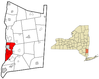
This is a list of the National Register of Historic Places listings in southern Westchester County, New York, excluding the cities of New Rochelle and Yonkers, which have separate lists of their own.

Contents

This is intended to be a complete list of the properties and districts on the National Register of Historic Places in the southern half of Westchester County, New York, United States. The following communities comprise this region:

Latitude and longitude coordinates are provided for many National Register properties and districts; these locations may be seen together in online maps. [1]

Of the 239 properties and districts listed on the National Register in the county, 92, including six National Historic Landmarks (NHLs), are on this list. Two, the Bronx River Parkway and Old Croton Aqueduct, the latter an NHL, are linear listings included on both this list and the northern Westchester list.


    This National Park Service list is complete through NPS recent listings posted July 1, 2022. [2]

Contents: Counties in New York
Albany (Albany)AlleganyBronxBroomeCattaraugusCayugaChautauquaChemungChenangoClintonColumbiaCortlandDelawareDutchess (Poughkeepsie, Rhinebeck)Erie (Buffalo)EssexFranklinFultonGeneseeGreeneHamiltonHerkimerJeffersonKingsLewisLivingstonMadisonMonroe (Rochester)MontgomeryNassauNew York (Below 14th Street, 14th to 59th Streets, 59th to 110th Streets, Above 110th Street, Islands)NiagaraOneidaOnondagaOntarioOrangeOrleansOswegoOtsegoPutnamQueensRensselaerRichmondRocklandSt. LawrenceSaratogaSchenectadySchoharieSchuylerSenecaSteubenSuffolkSullivanTiogaTompkinsUlsterWarrenWashingtonWayneWestchester (Northern, Southern, New Rochelle, Peekskill, Yonkers)WyomingYates

Current listings

[3] Name on the RegisterImageDate listed [4] Location City or townDescription
1 African Cemetery
African Cemetery RyeNY AfricanCemetery Entrance.jpg
African Cemetery
October 3, 2003
(#03000999)
North St.
40°58′34″N73°42′12″W / 40.976111°N 73.703333°W / 40.976111; -73.703333 (African Cemetery)
Rye 
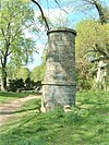
Historic segregated cemetery, established in 1860 and used until 1964, including burial of veterans from the Civil War through World War II; located within Greenwood Union Cemetery.
2 Armour-Stiner House
Armour-Stiner House Armour-Stiner House.jpg
Armour-Stiner House
December 18, 1975
(#75001238)
45 W. Clinton Ave.
41°01′51″N73°52′16″W / 41.030833°N 73.871111°W / 41.030833; -73.871111 (Armour-Stiner House)
Irvington Possibly the only domed octagon house in the world
3 Bar Building
Bar Building Bar Building 2012-09-23 jeh.jpg
Bar Building
May 17, 2007
(#07000331)
199 Main St.
41°01′57″N73°46′05″W / 41.0325°N 73.768056°W / 41.0325; -73.768056 (Bar Building)
White Plains
4 Bird Homestead
Bird Homestead Bird Homestead Rye NY DSCN2013.jpg
Bird Homestead
February 22, 2010
(#10000032)
600 Milton Rd.
40°57′34″N73°41′21″W / 40.959583°N 73.689214°W / 40.959583; -73.689214 (Bird Homestead)
Rye Original Greek Revival home built in 1835 with several farm buildings of the Bird family
5 Bolton Priory
Bolton Priory Bolton Priory, 7 Priory Lane Pelham Manor, Westchester County, New York.JPG
Bolton Priory
June 28, 1974
(#74001320)
7 Priory Lane
40°53′13″N73°47′45″W / 40.886944°N 73.795833°W / 40.886944; -73.795833 (Bolton Priory)
Pelham Manor
6 Evangeline Booth House
Evangeline Booth House Evangeline Booth House.jpg
Evangeline Booth House
February 22, 2011
(#11000040)
101 N. Central Ave.
41°01′12″N73°47′50″W / 41.02°N 73.797222°W / 41.02; -73.797222 (Evangeline Booth House)
Hartsdale
7 Boston Post Road Historic District
Boston Post Road Historic District Whitby-castle-rye.jpg
Boston Post Road Historic District
October 29, 1982
(#82001275)
Roughly bounded by Boston Post Rd. and Milton Harbor
40°57′17″N73°42′01″W / 40.954722°N 73.700278°W / 40.954722; -73.700278 (Boston Post Road Historic District)
Rye 
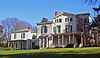
The only National Historic Landmark District in Westchester County. Includes Jay Estate, the childhood home of Founding Father John Jay, a nature preserve Marshlands Conservancy, Rye Golf Club, Lounsbury and the Jay Cemetery.
8 Bronx River Parkway Reservation
Bronx River Parkway Reservation Kensico dam.jpg
Bronx River Parkway Reservation
January 11, 1991
(#90002143)
Bronx River Pkwy. from jct. with Sprain Brook Rd. to and including Kensico Dam Plaza
41°00′59″N73°47′47″W / 41.016389°N 73.796389°W / 41.016389; -73.796389 (Bronx River Parkway Reservation)
Valhalla and Bronxville
9 Bronxville Women's Club
Bronxville Women's Club Bronxville Womens Club cloudy PM jeh.jpg
Bronxville Women's Club
October 3, 2007
(#07001041)
135 Midland Ave.
40°56′30″N73°49′35″W / 40.9418°N 73.8265°W / 40.9418; -73.8265 (Bronxville Women's Club)
Bronxville
10 Bush-Lyon Homestead
Bush-Lyon Homestead PortChesterNY BushLyonHomestead.jpg
Bush-Lyon Homestead
April 22, 1982
(#82003412)
John Lyon Park, King St.
41°00′48″N73°40′03″W / 41.0133°N 73.6675°W / 41.0133; -73.6675 (Bush-Lyon Homestead)
Port Chester
11 Capitol Theater
Capitol Theater PortChesterNY CapitolTheater.jpg
Capitol Theater
June 7, 1984
(#84003426)
147-151 Westchester Ave.
41°00′06″N73°39′56″W / 41.0017°N 73.6656°W / 41.0017; -73.6656 (Capitol Theater)
Port Chester
12 Child Welfare Association of Mamaroneck
Child Welfare Association of Mamaroneck Child Welfare Association of Westchester 0860.jpg
Child Welfare Association of Mamaroneck
August 6, 2021
(#100006781)
234 Stanley Ave.
40°57′04″N73°44′15″W / 40.9512°N 73.7375°W / 40.9512; -73.7375 (Child Welfare Association of Mamaroneck)
Mamaroneck
13 Church of St. Barnabas
Church of St. Barnabas Church of St Barnabas, Irvington, NY.jpg
Church of St. Barnabas
March 24, 2000
(#00000241)
15 N Broadway
41°02′23″N73°51′57″W / 41.039722°N 73.865833°W / 41.039722; -73.865833 (Church of St. Barnabas)
Irvington 1853 stone Gothic Revival church has included Washington Irving, Philip Schuyler and Jay Gould as members
14 Church of St. Joseph of Arimathea
Church of St. Joseph of Arimathea Church of St. Joseph of Arimathea, Oct 2012.jpg
Church of St. Joseph of Arimathea
January 11, 2002
(#01001439)
2172 Saw Mill River Rd.
41°02′37″N73°49′46″W / 41.04359°N 73.82944°W / 41.04359; -73.82944 (Church of St. Joseph of Arimathea)
Greenburgh
15 Jasper F. Cropsey House and Studio
Jasper F. Cropsey House and Studio NCF Ever Rest.jpg
Jasper F. Cropsey House and Studio
May 17, 1973
(#73001287)
49 Washington Ave.
40°59′35″N73°52′55″W / 40.993056°N 73.88194°W / 40.993056; -73.88194 (Jasper F. Cropsey House and Studio)
Hastings-on-Hudson
16 Old Croton Aqueduct
Old Croton Aqueduct Croton Aqueduct Tower 16 Irvington New York.jpg
Old Croton Aqueduct
December 2, 1974
(#74001324)
Runs N from Yonkers to New Croton Dam
41°00′52″N73°53′14″W / 41.014444°N 73.887222°W / 41.014444; -73.887222 (Old Croton Aqueduct)
VariousFirst long-distance aqueduct built to provide water from upstate to New York City. An engineering marvel in its time now used as a linear park
17 John William Draper House
John William Draper House HenryDraperObservatory.jpg
John William Draper House
May 15, 1975
(#75001237)
407 Broadway
40°59′29″N73°52′47″W / 40.991389°N 73.879722°W / 40.991389; -73.879722 (John William Draper House)
Hastings-on-Hudson 
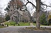
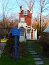
Home of astrophotography pioneer John William Draper, who in the 1840s took the first recognizable photo of the moon through a telescope at his observatory here.
18 East Irvington School
East Irvington School East Irvington School.JPG
East Irvington School
October 6, 1983
(#83004216)
Taxter Rd.
41°02′46″N73°51′21″W / 41.046111°N 73.855833°W / 41.046111; -73.855833 (East Irvington School)
East Irvington Late 19th-century school built for children of growing Irish immigrant population; now apartments.
19 Edgewood House
Edgewood House Edgewood House, 908 Edgewood Ave. Pelham Manor. Westchester County, New York.JPG
Edgewood House
June 26, 1986
(#86001388)
908 Edgewood Ave.
40°53′41″N73°49′13″W / 40.894722°N 73.820278°W / 40.894722; -73.820278 (Edgewood House)
Pelham Manor
20 Elmsford Reformed Church and Cemetery
Elmsford Reformed Church and Cemetery ReformedChurch-Elmsford-NY-2013.tiff
Elmsford Reformed Church and Cemetery
September 15, 1983
(#83001828)
30 S. Central Ave.
41°03′14″N73°49′15″W / 41.053889°N 73.820833°W / 41.053889; -73.820833 (Elmsford Reformed Church and Cemetery)
Elmsford Congregation organized in 1790; church building erected three years later is oldest building in village and oldest church in continuous use in county
21 Estherwood and Carriage House
Estherwood and Carriage House Estherwood, Dobbs Ferry, NY.jpg
Estherwood and Carriage House
November 20, 1979
(#79001646)
Clinton Ave.
41°00′46″N73°52′21″W / 41.0128°N 73.8725°W / 41.0128; -73.8725 (Estherwood and Carriage House)
Dobbs Ferry Late 19th-century mansion and estate of industrial tycoon James Jenning McComb; now part of The Masters School, which he helped endow.
22 First United Methodist Church
First United Methodist Church First United Methodist Church 2012-09-23 10-16-39.jpg
First United Methodist Church
January 7, 2000
(#99001656)
226 E. Lincoln Ave.
40°55′06″N73°49′47″W / 40.9183°N 73.8297°W / 40.9183; -73.8297 (First United Methodist Church)
Mount Vernon
23 Leo Friedlander Studio
Leo Friedlander Studio HartsdaleNY LeoFriedlanderStudio.jpg
Leo Friedlander Studio
July 29, 1982
(#82003416)
825 W. Hartsdale Rd.
41°02′35″N73°48′34″W / 41.0431°N 73.8094°W / 41.0431; -73.8094 (Leo Friedlander Studio)
Greenburgh
24 Good Counsel Complex
Good Counsel Complex WhitePlainsNY GoodCounselBuildings 2.jpg
Good Counsel Complex
April 25, 1997
(#97000358)
52 N. Broadway
41°02′21″N73°45′52″W / 41.0392°N 73.7644°W / 41.0392; -73.7644 (Good Counsel Complex)
White Plains
25 Percy Grainger Home and Studio
Percy Grainger Home and Studio Percy Grainger Home and Studio.jpg
Percy Grainger Home and Studio
April 8, 1993
(#93000234)
7 Cromwell Pl.
41°01′38″N73°46′02″W / 41.0272°N 73.7672°W / 41.0272; -73.7672 (Percy Grainger Home and Studio)
White Plains
26 Hadden-Margolis House
Hadden-Margolis House HarrisonNY HaddenMargolisHouse.jpg
Hadden-Margolis House
March 7, 2008
(#08000146)
61 Winfield Ln.
40°58′19″N73°44′16″W / 40.9719°N 73.7377°W / 40.9719; -73.7377 (Hadden-Margolis House)
Harrison
27 Hartsdale Pet Cemetery
Hartsdale Pet Cemetery Hartsdale Pet Cemetery October 2012.jpg
Hartsdale Pet Cemetery
August 17, 2012
(#12000535)
75 N. Central Park Ave.
41°01′17″N73°47′49″W / 41.0215°N 73.7969°W / 41.0215; -73.7969 (Hartsdale Pet Cemetery)
Hartsdale
28 Hartsdale Railroad Station
Hartsdale Railroad Station Hartsdale Sta house east jeh.jpg
Hartsdale Railroad Station
July 14, 2011
(#11000453)
1 E. Hartsdale Ave.
41°00′40″N73°47′45″W / 41.0112°N 73.7958°W / 41.0112; -73.7958 (Hartsdale Railroad Station)
Hartsdale 1915 railroad station building
29 Hastings Prototype House
Hastings Prototype House Hastings Prototype House, Hastings-on-Hudson, NY.jpg
Hastings Prototype House
December 19, 1991
(#91001873)
546 Farragut Pkwy.
40°59′04″N73°52′17″W / 40.9844°N 73.8714°W / 40.9844; -73.8714 (Hastings Prototype House)
Hastings-on-Hudson 
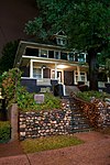
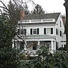
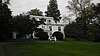
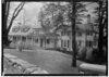
1936 Moderne house, built by local developer, was meant to be pattern for a housing development in Florida that was never built. Architect's only work in this style.
30 Widow Haviland's Tavern
Widow Haviland's Tavern Widow Haviland's Tavern Jul 10.jpg
Widow Haviland's Tavern
April 16, 1974
(#74001322)
Purchase St.
40°58′55″N73°41′05″W / 40.9819°N 73.6847°W / 40.9819; -73.6847 (Widow Haviland's Tavern)
Rye
31 Caleb Hyatt House
Caleb Hyatt House Caleb Hyatt House east cloudy jeh.JPG
Caleb Hyatt House
January 22, 1973
(#73001291)
937 White Plains Post Rd.
40°58′54″N73°48′00″W / 40.9817°N 73.8001°W / 40.9817; -73.8001 (Caleb Hyatt House)
Scarsdale
32 Hyatt-Livingston House
Hyatt-Livingston House Trolley exploring - an electric railroad guide to historic and picturesque places about New York, New Jersey, and New England (1904) (14574250168).jpg
Hyatt-Livingston House
October 5, 1972
(#72000917)
152 Broadway
41°00′32″N73°52′45″W / 41.0089°N 73.8792°W / 41.0089; -73.8792 (Hyatt-Livingston House)
Dobbs Ferry Burned down in 1974
33 Irvington Historic District
Irvington Historic District Main Street north of N. Dutcher Street Irvington.jpg
Irvington Historic District
January 15, 2014
(#13001095)
N. & S. Astor, Broadway, Buckhout, Cottenet, Dearman, Dutcher, Eckar & Ferris Sts., Bridge St., E. & W. Home Pl.
41°02′21″N73°52′20″W / 41.03927°N 73.87232°W / 41.03927; -73.87232 (Irvington Historic District)
Irvington Historic core of small riverside suburb; See map
34 Irvington Town Hall
Irvington Town Hall Irvington Town Hall full.jpg
Irvington Town Hall
November 1, 1984
(#84000205)
85 Main St.
41°02′25″N73°52′06″W / 41.0403°N 73.8683°W / 41.0403; -73.8683 (Irvington Town Hall)
Irvington 
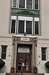
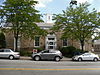
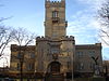
Built in 1902, early use of Colonial Revival in a civic building. Upper floors have an auditorium for performances and community gatherings, was home to public library until 2000.
35 Timothy Knapp House and Milton Cemetery
Timothy Knapp House and Milton Cemetery Knapp House Rye NY DSCN2033.jpg
Timothy Knapp House and Milton Cemetery
June 14, 1982
(#82003413)
265 Rye Beach Ave. and Milton Rd.
40°57′53″N73°41′12″W / 40.9647°N 73.6867°W / 40.9647; -73.6867 (Timothy Knapp House and Milton Cemetery)
Rye Built between 1667 and 1670 by Timothy Knapp
36 Larchmont Avenue Church
Larchmont Avenue Church LarchmontAvenueChurch.jpg
Larchmont Avenue Church
April 22, 2021
(#100006487)
60 Forest Park Ave.
40°55′47″N73°45′16″W / 40.9296°N 73.7545°W / 40.9296; -73.7545 (Larchmont Avenue Church)
Larchmont
37 Lawrence Park Historic District
Lawrence Park Historic District BronxvilleNY ChristChurch.jpg
Lawrence Park Historic District
January 23, 1980
(#80002788)
Roughly bounded by Side Hill, Prescott, Kensington, Garden and Chestnut Ave., Maidens Ln., and Valley and Pondfield Rds.
40°56′27″N73°50′19″W / 40.9408°N 73.8386°W / 40.9408; -73.8386 (Lawrence Park Historic District)
Bronxville
38 Life Savers Building
Life Savers Building PortChesterNY LifesaversBuilding Entry.jpg
Life Savers Building
July 11, 1985
(#85001496)
N. Main St.
41°00′20″N73°39′52″W / 41.0056°N 73.6644°W / 41.0056; -73.6644 (Life Savers Building)
Port Chester Now a condominium complex
39 Lord and Burnham Building
Lord and Burnham Building Lord and Burnham Building.jpg
Lord and Burnham Building
February 12, 1999
(#99000193)
2 Main St.
41°02′22″N73°52′23″W / 41.0394°N 73.8731°W / 41.0394; -73.8731 (Lord and Burnham Building)
Irvington 
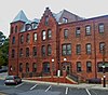
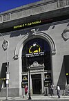
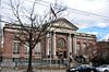
1870 building, home to eponymous maker of conservatories and greenhouses that supplied local estates, is now the village's library after lengthy restoration.
40 Mamaroneck Methodist Church
Mamaroneck Methodist Church Mamaroneck Methodist Church Mar 10.jpg
Mamaroneck Methodist Church
October 2, 1992
(#92001304)
514 Boston Post Rd.
40°57′05″N73°43′48″W / 40.9514°N 73.73°W / 40.9514; -73.73 (Mamaroneck Methodist Church)
Mamaroneck
41 Manor Club
Manor Club The Manor club of Pelham.jpg
Manor Club
May 12, 2014
(#14000207)
1023 Esplanade
40°53′29″N73°48′14″W / 40.8915°N 73.804°W / 40.8915; -73.804 (Manor Club)
Pelham Manor
42 Mapleton
Mapleton Mapleton.JPG
Mapleton
September 28, 1976
(#76001295)
52 N. Broadway
41°02′18″N73°45′54″W / 41.0383°N 73.765°W / 41.0383; -73.765 (Mapleton)
White Plains
43 Marble Schoolhouse
Marble Schoolhouse Marble schoolhouse 800.jpg
Marble Schoolhouse
July 6, 2005
(#05000663)
388 California Rd.
40°55′53″N73°48′41″W / 40.931389°N 73.811389°W / 40.931389; -73.811389 (Marble Schoolhouse)
Eastchester
44 Masterton-Dusenberry House
Masterton-Dusenberry House Masterton-Dusenberry 90 WPR Ridgecroft cloudy jeh.jpg
Masterton-Dusenberry House
April 16, 1980
(#80002789)
90 White Plains Rd.
40°56′13″N73°49′06″W / 40.9369°N 73.8182°W / 40.9369; -73.8182 (Masterton-Dusenberry House)
Bronxville
45 McVickar House
McVickar House McVickar House, Irvington, NY.jpg
McVickar House
January 14, 2004
(#03001398)
131 Main St.
41°02′20″N73°51′57″W / 41.038944°N 73.865847°W / 41.038944; -73.865847 (McVickar House)
Irvington 1853 Greek Revival house is second oldest on village's Main Street
46 New York, Westchester & Boston Railway Highbrook Avenue Bridge
New York, Westchester & Boston Railway Highbrook Avenue Bridge PelhamNY HighbrookAvenueRRBridge.jpg
New York, Westchester & Boston Railway Highbrook Avenue Bridge
August 2, 2016
(#16000487)
Highbrook Ave. between Lincoln & Harmon Aves
40°54′50″N73°48′17″W / 40.913867°N 73.804622°W / 40.913867; -73.804622 (New York, Westchester & Boston Railway Highbrook Avenue Bridge)
Pelham Early example of a reinforced concrete arch bridge, dating to 1911
47 Nuits
Nuits Nuits, Ardsley-on-Hudson, NY.jpg
Nuits
April 13, 1977
(#77000986)
Hudson Rd. and Clifton Pl.
41°01′29″N73°52′31″W / 41.024722°N 73.875278°W / 41.024722; -73.875278 (Nuits)
Ardsley-on-Hudson 1852 Italian villa-style house was early work by Detlef Lienau; later home to Cyrus West Field and John Jacob Astor III. Only extant example of Lienau's early residential work.
48 Odell House
Odell House Odell House 1.jpg
Odell House
March 28, 1973
(#73001286)
425 Ridge Rd.
41°01′10″N73°49′04″W / 41.019444°N 73.817778°W / 41.019444; -73.817778 (Odell House)
Greenburgh
49 Pelham Picture House
Pelham Picture House Pelham Picture House 2011.JPG
Pelham Picture House
May 28, 2010
(#10000305)
175 Wolf's Lane
40°54′26″N73°48′41″W / 40.907311°N 73.811389°W / 40.907311; -73.811389 (Pelham Picture House)
Pelham
50 Pelhamdale
Pelhamdale Pelhamdale - The old stone house. Looking north from Iden Avenue..jpg
Pelhamdale
November 4, 1982
(#82001276)
45 Iden Ave.
40°54′03″N73°48′55″W / 40.900833°N 73.815278°W / 40.900833; -73.815278 (Pelhamdale)
Pelham Manor
51 Peoples National Bank and Trust Company Building
Peoples National Bank and Trust Company Building Peoples National Bank and Trust Company Building 31 Mamaroneck Av jeh.jpg
Peoples National Bank and Trust Company Building
September 14, 2000
(#00001119)
31 Mamaroneck Ave.
41°01′54″N73°46′00″W / 41.031667°N 73.766667°W / 41.031667; -73.766667 (Peoples National Bank and Trust Company Building)
White Plains
52 Playland Amusement Park
Playland Amusement Park Playland Gondola Wheel.jpg
Playland Amusement Park
July 4, 1980
(#80004529)
Playland Pkwy. and Forest Ave.
40°58′08″N73°40′17″W / 40.968889°N 73.671389°W / 40.968889; -73.671389 (Playland Amusement Park)
Rye An early example of an amusement park designed for visitors by car as opposed to public transit; Art Deco stylings on attractions widely copied
53 Presbyterian Rest for Convalescents
Presbyterian Rest for Convalescents WhitePlainsNY YWCA Housing.jpg
Presbyterian Rest for Convalescents
April 27, 2011
(#11000230)
69 N. Broadway
41°02′19″N73°46′03″W / 41.038594°N 73.76752°W / 41.038594; -73.76752 (Presbyterian Rest for Convalescents)
White Plains
54 Jacob Purdy House
Jacob Purdy House Jacob purdy historic house 080105.jpg
Jacob Purdy House
August 31, 1979
(#79001651)
60 Park Ave.
41°02′12″N73°46′26″W / 41.03667°N 73.7739°W / 41.03667; -73.7739 (Jacob Purdy House)
White Plains
55 Quaker Ridge Golf Club
Quaker Ridge Golf Club ScarsdaleNY QuakerRidgeGolfClub2.jpg
Quaker Ridge Golf Club
November 23, 2020
(#100005485)
146 Griffen Ave.
40°57′57″N73°45′42″W / 40.9657°N 73.7616°W / 40.9657; -73.7616 (Quaker Ridge Golf Club)
Scarsdale
56 Putnam and Mellor Engine and Hose Company Firehouse
Putnam and Mellor Engine and Hose Company Firehouse Putnam and Mellor Engine and Hose Company Firehouse, day..JPG
Putnam and Mellor Engine and Hose Company Firehouse
September 15, 1983
(#83001831)
46 S. Main St.
40°59′58″N73°39′55″W / 40.9994°N 73.6653°W / 40.9994; -73.6653 (Putnam and Mellor Engine and Hose Company Firehouse)
Port Chester Torn down in 2007
57 Reid Hall, Manhattanville College
Reid Hall, Manhattanville College ManhattanvilleCollegeCastleSpringtime.jpg
Reid Hall, Manhattanville College
March 22, 1974
(#74001321)
Manhattanville College, Purchase St.
41°01′56″N73°42′58″W / 41.0322°N 73.7161°W / 41.0322; -73.7161 (Reid Hall, Manhattanville College)
Purchase
58 Romer-Van Tassel House
Romer-Van Tassel House GreenburghNY RomerVanTasselHouse.jpg
Romer-Van Tassel House
November 25, 1994
(#94001373)
2121 Saw Mill River Rd.
41°02′39″N73°49′40″W / 41.0442°N 73.8278°W / 41.0442; -73.8278 (Romer-Van Tassel House)
Greenburgh
59 Rye Meeting House
Rye Meeting House Rye Meeting House Library on left DSCN1922.jpg
Rye Meeting House
January 14, 2011
(#10001134)
624 Milton Rd.
40°57′31″N73°41′20″W / 40.9586°N 73.6889°W / 40.9586; -73.6889 (Rye Meeting House)
Rye Original one room school house built in the 1830s, used as a chapel and later as a Quaker meeting house. Built in the Gothic Revival style.
60 Rye Town Park-Bathing Complex and Oakland Beach
Rye Town Park-Bathing Complex and Oakland Beach Rye Beach house jeh.jpg
Rye Town Park-Bathing Complex and Oakland Beach
April 18, 2003
(#03000252)
Forrest Ave., bet. Rye Beach and Dearborn Ave.
40°57′39″N73°40′45″W / 40.9608°N 73.6792°W / 40.9608; -73.6792 (Rye Town Park-Bathing Complex and Oakland Beach)
Rye
61 St. Paul's Church National Historic Site
St. Paul's Church National Historic Site Saint Paul's Church National Historic Site.jpg
St. Paul's Church National Historic Site
October 15, 1966
(#66000580)
Eastchester
40°53′36″N73°49′33″W / 40.8934°N 73.8258°W / 40.8934; -73.8258 (St. Paul's Church National Historic Site)
Mount Vernon
62 St. Peter's Episcopal Church
St. Peter's Episcopal Church PortChesterNY StPetersChurch.jpg
St. Peter's Episcopal Church
April 12, 2006
(#06000260)
19 Smith St.
41°00′14″N73°40′01″W / 41.0039°N 73.6669°W / 41.0039; -73.6669 (St. Peter's Episcopal Church)
Port Chester
63 St. Thomas' Episcopal Church Complex
St. Thomas' Episcopal Church Complex Mamaroneck Church in New York.jpg
St. Thomas' Episcopal Church Complex
August 12, 2003
(#03000242)
158-168 W. Boston Post Rd.
40°56′53″N73°44′07″W / 40.948056°N 73.735278°W / 40.948056; -73.735278 (St. Thomas' Episcopal Church Complex)
Mamaroneck
64 Scarsdale Railroad Station
Scarsdale Railroad Station Scarsdale Railroad Station, East Parkway, Scarsdale (Westchester County, New York).jpg
Scarsdale Railroad Station
July 27, 2000
(#00000837)
Popham Rd. at Bronx River Pkwy.
40°59′22″N73°48′32″W / 40.989444°N 73.808889°W / 40.989444; -73.808889 (Scarsdale Railroad Station)
Scarsdale
65 Scarsdale Woman's Club
Scarsdale Woman's Club Scarsdale Woman's Club 37 Drake Rd, cloudy jeh.jpg
Scarsdale Woman's Club
February 29, 2008
(#08000110)
37 Drake Rd.
40°59′14″N73°47′36″W / 40.9871°N 73.7932°W / 40.9871; -73.7932 (Scarsdale Woman's Club)
Scarsdale
66 Skinny House
Skinny House Seely Skinny House Mamaroneck vert close DSCN1847 01.jpg
Skinny House
May 18, 2015
(#15000235)
175 Grand St.
40°57′17″N73°44′33″W / 40.95486°N 73.74238°W / 40.95486; -73.74238 (Skinny House)
Mamaroneck Depression-era house built by African-American architect on small parcel
67 Soundview Manor
Soundview Manor Soundview Manor 2012-10-25b jeh.jpg
Soundview Manor
November 25, 2009
(#09000957)
283 Soundview Ave.
41°00′15″N73°45′55″W / 41.0043°N 73.7653°W / 41.0043; -73.7653 (Soundview Manor)
White Plains
68 South Presbyterian Church
South Presbyterian Church South Presbyterian Church, Dobbs Ferry, NY.jpg
South Presbyterian Church
May 26, 2000
(#00000548)
343 Broadway
41°00′53″N73°52′22″W / 41.014722°N 73.872778°W / 41.014722; -73.872778 (South Presbyterian Church)
Dobbs Ferry 1869 stone Gothic Revival church is the only known building by Julius Munckowitz, later involved in developing New York City's park system
69 Spanish American War Monument to the 71st Infantry Regiment
Spanish American War Monument to the 71st Infantry Regiment Spanish American War Monument to the 71st Infantry Regiment, Oct 2012.jpg
Spanish American War Monument to the 71st Infantry Regiment
January 14, 2011
(#10001133)
Jackson Avenue & Saw Mill River Road
41°00′38″N73°51′50″W / 41.01068°N 73.863788°W / 41.01068; -73.863788 (Spanish American War Monument to the 71st Infantry Regiment)
Greenburgh
70 John Stevens House
John Stevens House John Stevens House, 29 W., 4-th Street, Mount Vernon, Westchester County, New York.JPG
John Stevens House
April 26, 1972
(#72000919)
29 W. 4th St.
40°54′15″N73°50′10″W / 40.9041258°N 73.8360886°W / 40.9041258; -73.8360886 (John Stevens House)
Mount Vernon
71 Stony Hill Cemetery
Stony Hill Cemetery HarrisonNY StonyHillCemetery1.jpg
Stony Hill Cemetery
June 25, 1999
(#99000753)
Buckout Rd.
41°03′18″N73°44′59″W / 41.055°N 73.749722°W / 41.055; -73.749722 (Stony Hill Cemetery)
Harrison
72 Trinity Episcopal Church Complex
Trinity Episcopal Church Complex Trinity Episcopal Church Complex, 335, Fourth Ave., Mount Vernon, Westchester County, New York.JPG
Trinity Episcopal Church Complex
September 1, 1998
(#97001494)
335 Fourth Ave.
40°54′11″N73°50′02″W / 40.903056°N 73.833889°W / 40.903056; -73.833889 (Trinity Episcopal Church Complex)
Mount Vernon
73 Tuckahoe High School
Tuckahoe High School Tms-front.jpg
Tuckahoe High School
February 24, 2010
(#10000045)
65 Siwanoy Blvd.
40°56′31″N73°48′49″W / 40.942°N 73.8136°W / 40.942; -73.8136 (Tuckahoe High School)
Eastchester
74 US Post Office-Bronxville
US Post Office-Bronxville US Post Office-Bronxville 2012-09-23 10-35-59.jpg
US Post Office-Bronxville
November 17, 1988
(#88002459)
119 Pondfield Rd. [5]
40°56′18″N73°49′57″W / 40.9383°N 73.8325°W / 40.9383; -73.8325 (US Post Office-Bronxville)
Bronxville part of the US Post Offices in New York State, 1858-1943, TR
75 US Post Office-Dobbs Ferry
US Post Office-Dobbs Ferry Dobbs Ferry, NY, post office.jpg
US Post Office-Dobbs Ferry
November 17, 1988
(#88002484)
120 Main St. [6]
41°00′55″N73°52′30″W / 41.0153°N 73.875°W / 41.0153; -73.875 (US Post Office-Dobbs Ferry)
Dobbs Ferry 
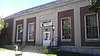
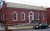
One of many New Deal-era Colonial Revival post offices in the state; one of only three with parapeted gables and window keystones; part of the US Post Offices in New York State, 1858-1943, TR
76 US Post Office-Harrison
US Post Office-Harrison U.S. Post Office Harrison NY Jul 10.jpg
US Post Office-Harrison
May 11, 1989
(#88002524)
258 Halstead Ave.
40°58′07″N73°42′51″W / 40.9686°N 73.7142°W / 40.9686; -73.7142 (US Post Office-Harrison)
Harrison part of the US Post Offices in New York State, 1858-1943, TR
77 US Post Office-Larchmont
US Post Office-Larchmont U.S. Post Office Larchmont NY Jul 10.jpg
US Post Office-Larchmont
May 11, 1989
(#88002341)
1 Chatsworth Ave.
40°55′48″N73°45′05″W / 40.93°N 73.7514°W / 40.93; -73.7514 (US Post Office-Larchmont)
Larchmont part of the US Post Offices in New York State, 1858-1943, TR
78 US Post Office-Mount Vernon
US Post Office-Mount Vernon US Post Office-Mount Vernon 2012-09-23 10-02-26.jpg
US Post Office-Mount Vernon
May 11, 1989
(#88002355)
15 S. First St.
40°54′40″N73°50′02″W / 40.9111°N 73.8339°W / 40.9111; -73.8339 (US Post Office-Mount Vernon)
Mount Vernon part of the US Post Offices in New York State, 1858-1943, TR
79 US Post Office-Port Chester
US Post Office-Port Chester PortChesterNY PostOffice.jpg
US Post Office-Port Chester
May 11, 1989
(#88002406)
245 Westchester Ave.
41°00′12″N73°40′07″W / 41.0032°N 73.6686°W / 41.0032; -73.6686 (US Post Office-Port Chester)
Port Chester part of the US Post Offices in New York State, 1858-1943, TR
80 US Post Office-Rye
US Post Office-Rye US Post Office-Rye NY Oct 06.jpg
US Post Office-Rye
May 11, 1989
(#88002426)
41 Purdy Ave.
40°59′04″N73°40′59″W / 40.9845°N 73.6830°W / 40.9845; -73.6830 (US Post Office-Rye)
Rye part of the US Post Offices in New York State, 1858-1943, TR
81 US Post Office-Scarsdale
US Post Office-Scarsdale ScarsdalePostOffice.JPG
US Post Office-Scarsdale
May 11, 1989
(#88002428)
29 Chase Rd. [7]
40°59′24″N73°48′22″W / 40.9900°N 73.8062°W / 40.9900; -73.8062 (US Post Office-Scarsdale)
Scarsdale part of the US Post Offices in New York State, 1858-1943, TR
82 Villa Lewaro
Villa Lewaro Villa-lewaro.jpg
Villa Lewaro
May 11, 1976
(#76001289)
N. Broadway
41°02′00″N73°51′56″W / 41.0333°N 73.8656°W / 41.0333; -73.8656 (Villa Lewaro)
Irvington Home of Madame C.J. Walker, hair-care products tycoon and first African-American millionaire.
83 Walter's Hot Dog Stand
Walter's Hot Dog Stand WaltersHotDog2005.JPG
Walter's Hot Dog Stand
June 11, 2010
(#10000338)
937 Palmer Ave.
40°56′35″N73°44′49″W / 40.9430°N 73.7469°W / 40.9430; -73.7469 (Walter's Hot Dog Stand)
Mamaroneck 1928 imitation pagoda
84 William E. Ward House
William E. Ward House William E Ward House, Rye Brook, NY-Greenwich, CT.jpg
William E. Ward House
November 7, 1976
(#76001294)
Comly Ave.
41°01′34″N73°40′03″W / 41.0261°N 73.6675°W / 41.0261; -73.6675 (William E. Ward House)
Rye Brook First reinforced concrete structure in U.S., built in the 1870s on state line. Extends into Greenwich, Connecticut
85 Washington Irving Memorial
Washington Irving Memorial Washington Irving Memorial.jpg
Washington Irving Memorial
September 8, 2000
(#00001062)
Broadway and Sunnyside Ln.
41°02′53″N73°51′43″W / 41.0481°N 73.8619°W / 41.0481; -73.8619 (Washington Irving Memorial)
Irvington Daniel Chester French-sculpted memorial to writer who gave Irvington its name, erected in the late 1920s.
86 Wayside Cottage
Wayside Cottage Wayside Inn, Post Road and Wayside Lane, Scarsdale, Westchester County, NY HABS NY,60-SCARD,2-2.tif
Wayside Cottage
May 1, 1981
(#81000418)
1039 Post Rd.
40°59′32″N73°47′40″W / 40.9922°N 73.7944°W / 40.9922; -73.7944 (Wayside Cottage)
Scarsdale
87 White Plains Armory
White Plains Armory ArmoryWhitePlains.jpg
White Plains Armory
April 16, 1980
(#80002796)
35 S. Broadway
41°01′53″N73°45′47″W / 41.0314°N 73.7631°W / 41.0314; -73.7631 (White Plains Armory)
White Plains
88 White Plains Rural Cemetery
White Plains Rural Cemetery White Plains Rural Cemetery 2012-09-23 12-26-49.jpg
White Plains Rural Cemetery
September 19, 2003
(#03000247)
167 N. Broadway
41°02′50″N73°46′20″W / 41.0472°N 73.7722°W / 41.0472; -73.7722 (White Plains Rural Cemetery)
White Plains
89 Albert E. and Emily Wilson House
Albert E. and Emily Wilson House Albert E- and Emily Wilson House 2012-09 jeh.jpg
Albert E. and Emily Wilson House
April 18, 2007
(#07000330)
617 Brook St.
40°57′16″N73°43′46″W / 40.9544°N 73.7294°W / 40.9544; -73.7294 (Albert E. and Emily Wilson House)
Mamaroneck
90 Winged Foot Golf Club
Winged Foot Golf Club Winged Foot Golf Club main entrance.jpg
Winged Foot Golf Club
June 12, 2019
(#100004089)
851 Fenimore Rd.
40°57′28″N73°45′13″W / 40.9578°N 73.7536°W / 40.9578; -73.7536 (Winged Foot Golf Club)
Mamaroneck Country club with two golf courses completed in 1923 is last designed by A.W. Tillinghast that features a Clifford Charles Wendehack clubhouse; has hosted several U.S. Opens
91 Woman's Club of White Plains
Woman's Club of White Plains WhitePlainsNY WomensClub.jpg
Woman's Club of White Plains
October 20, 2010
(#10000853)
305 Ridgeway
41°00′23″N73°44′54″W / 41.0063°N 73.7484°W / 41.0063; -73.7484 (Woman's Club of White Plains)
White Plains
92 Zion Episcopal Church
Zion Episcopal Church Zion Episcopal Church, Dobbs Ferry NY front.jpg
Zion Episcopal Church
December 21, 2020
(#100005921)
55 Cedar St.
41°00′56″N73°52′22″W / 41.0156°N 73.8727°W / 41.0156; -73.8727 (Zion Episcopal Church)
Dobbs Ferry

See also

Related Research Articles

Westchester County, New York County in New York, United States

Westchester County is located in the U.S. state of New York. It is the seventh most populous county in New York State and the most populous north of New York City. According to the 2020 United States Census, the county had a population of 1,004,456, an increase of 55,344 (5.8%) from the 949,113 counted in 2010. Situated in the Hudson Valley, Westchester covers an area of 450 square miles (1,200 km2), consisting of six cities, 19 towns, and 23 villages. Established in 1683, Westchester was named after the city of Chester, England. The county seat is the city of White Plains, while the most populous municipality in the county is the city of Yonkers, with 211,569 residents per the 2020 U.S. Census.

Southern Westchester refers to the southern portion of Westchester County, New York, a dense inner-ring suburban area north of New York City.

National Register of Historic Places listings in Chenango County, New York

List of the National Register of Historic Places listings in Chenango County, New York

National Register of Historic Places listings in Erie County, New York

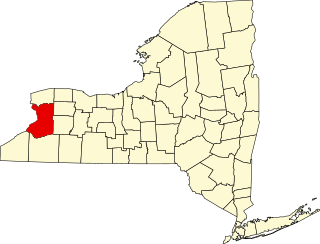
This is a list of the National Register of Historic Places listings in Erie County, New York.

National Register of Historic Places listings in Herkimer County, New York

List of the National Register of Historic Places listings in Herkimer County, New York

National Register of Historic Places listings in Montgomery County, New York

List of the National Register of Historic Places listings in Montgomery County, New York

National Register of Historic Places listings in Otsego County, New York

List of the National Register of Historic Places listings in Otsego County, New York

National Register of Historic Places listings in Queens, New York

List of the National Register of Historic Places listings in Queens, New York

National Register of Historic Places listings in Rockland County, New York

List of the National Register of Historic Places listings in Rockland County, New York

National Register of Historic Places listings in Westchester County, New York

This is a list of the National Register of Historic Places listings in Westchester County, New York.

National Register of Historic Places listings in Wayne County, New York

List of the National Register of Historic Places listings in Wayne County, New York

National Register of Historic Places listings in Warren County, New York

List of Registered Historic Places in Warren County, New York

There are forty-five local police agencies in Westchester County, New York. As well as other county, state, and federal agencies responsible for protecting Westchester County, these agencies frequently work with one another and other agencies located in the surrounding counties and states as well as the NYPD. Current economic times has caused a few Westchester municipalities to consider consolidation of police services. The Westchester County Department of Public Safety started providing primary police services for the Town/Village of Mount Kisco in 2015.

National Register of Historic Places listings in Poughkeepsie, New York

List of the National Register of Historic Places listings in Poughkeepsie, New York

List of the National Register of Historic Places listings in Rhinebeck, New York

National Register of Historic Places listings in Yonkers, New York

This is a list of the National Register of Historic Places entries in Yonkers, New York. See also National Register of Historic Places listings in Westchester County, New York for all others in the county.

This is a list of the National Register of Historic Places entries in New Rochelle, New York. See also National Register of Historic Places listings in Westchester County, New York for all others in the county.

National Register of Historic Places listings in northern Westchester County, New York

This is a list of the National Register of Historic Places listings in northern Westchester County, New York, excluding the city of Peekskill, which has its own list.

History of Westchester County

The history of Westchester County, a county in the state of New York, can be traced back to the founding of a settlement between the Hudson River and Long Island Sound in the 17th century. The area now known as Westchester County had seen human occupation since at least the Archaic period, but significant growth in the settlements that are now incorporated into the county did not occur until the Industrial Revolution.

There are numerous nationally and locally designated historic sites and attractions in Westchester County. These include architecturally significant manors and estates, churches, cemeteries, farmhouses, African-American heritage sites, and underground railroad depots and waystations. There are sites from pre-Revolutionary and Revolutionary times, as well as battlegrounds. Westchester County also played an important role in the development of the modern suburb, and there are many associated heritage sites and museums.

References

  1. The latitude and longitude information provided in this table was derived originally from the National Register Information System, which has been found to be fairly accurate for about 99% of listings. Some locations in this table may have been corrected to current GPS standards.
  2. National Park Service, United States Department of the Interior, "National Register of Historic Places: Weekly List Actions", retrieved July 1, 2022.
  3. Numbers represent an alphabetical ordering by significant words. Various colorings, defined here, differentiate National Historic Landmarks and historic districts from other NRHP buildings, structures, sites or objects.
  4. The eight-digit number below each date is the number assigned to each location in the National Register Information System database, which can be viewed by clicking the number.
  5. Address based on USPS website. Accessed April 2, 2016.
  6. Address based on USPS website. Accessed April 2, 2016.
  7. Address based on USPS website. Accessed April 2, 2016.

Further reading