National Register of Historic Places listings in Cortland County, New York

Last updated

Location of Cortland County in New York Map of New York highlighting Cortland County.svg
Location of Cortland County in New York
Map all coordinates using: OpenStreetMap  
Download coordinates as: KML

List of the National Register of Historic Places listings in Cortland County, New York:

Contents

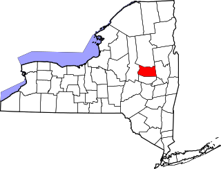
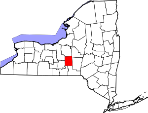
This is intended to be a complete list of properties and districts listed on the National Register of Historic Places in Cortland County, New York. The locations of National Register properties and districts (at least for all showing latitude and longitude coordinates below) may be seen in a map by clicking on "Map of all coordinates". [1]


    This National Park Service list is complete through NPS recent listings posted September 9, 2022. [2]

Contents: Counties in New York
Albany (Albany)AlleganyBronxBroomeCattaraugusCayugaChautauquaChemungChenangoClintonColumbiaCortlandDelawareDutchess (Poughkeepsie, Rhinebeck)Erie (Buffalo)EssexFranklinFultonGeneseeGreeneHamiltonHerkimerJeffersonKingsLewisLivingstonMadisonMonroe (Rochester)MontgomeryNassauNew York (Below 14th Street, 14th to 59th Streets, 59th to 110th Streets, Above 110th Street, Islands)NiagaraOneidaOnondagaOntarioOrangeOrleansOswegoOtsegoPutnamQueensRensselaerRichmondRocklandSt. LawrenceSaratogaSchenectadySchoharieSchuylerSenecaSteubenSuffolkSullivanTiogaTompkinsUlsterWarrenWashingtonWayneWestchester (Northern, Southern, New Rochelle, Peekskill, Yonkers)WyomingYates

Listings county-wide

[3] Name on the RegisterImageDate listed [4] Location City or townDescription
1 Cincinnatus Historic District
Cincinnatus Historic District CINCINNATUS HISTORIC DISTRICT, COURTLAND COUNTY.jpg
Cincinnatus Historic District
September 7, 1984
(#84002208)
Main St. and Taylor Ave.
42°32′31″N75°54′16″W / 42.541944°N 75.904444°W / 42.541944; -75.904444 (Cincinnatus Historic District)
Cincinnatus Historic district in this very small town
2 Cortland County Courthouse
Cortland County Courthouse Cortland County Courthouse (Built 1922-1923), Cortland, New York.jpg
Cortland County Courthouse
October 9, 1974
(#74001228)
Courthouse Park
42°35′56″N76°10′37″W / 42.598889°N 76.176944°W / 42.598889; -76.176944 (Cortland County Courthouse)
Cortland
3 Cortland County Poor Farm
Cortland County Poor Farm CORTLAND COUNTY POOR FARM, CORTLAND COUNTY.jpg
Cortland County Poor Farm
October 29, 1982
(#82001115)
Northeast of Cortland off NY 13
42°37′36″N76°08′14″W / 42.626667°N 76.137222°W / 42.626667; -76.137222 (Cortland County Poor Farm)
Cortland
4 Cortland Fire Headquarters
Cortland Fire Headquarters Cortland Fire Headquarters Aug 09.jpg
Cortland Fire Headquarters
July 12, 1974
(#74001229)
21 Court St.
42°35′57″N76°10′46″W / 42.599167°N 76.179444°W / 42.599167; -76.179444 (Cortland Fire Headquarters)
Cortland
5 Cortland Free Library
Cortland Free Library Cortland Free Library Aug 09.jpg
Cortland Free Library
May 30, 2008
(#08000469)
32 Church Street
42°35′59″N76°10′41″W / 42.599853°N 76.177936°W / 42.599853; -76.177936 (Cortland Free Library)
Cortland
6 Crescent Corset Company
Crescent Corset Company Crescent Corset Company.jpg
Crescent Corset Company
June 21, 2016
(#16000391)
166-177 Main St.
42°35′39″N76°10′48″W / 42.594266°N 76.180061°W / 42.594266; -76.180061 (Crescent Corset Company)
Cortland 1923 clothing factory employed many of the Italian immigrants to the area
7 First Presbyterian Church
First Presbyterian Church FIRST PRESBYTERIAN CHURCH, PREBLE, CORTLAND COUNTY.jpg
First Presbyterian Church
January 24, 2002
(#01001502)
Courtland Cty Rd. 108B
42°44′06″N76°08′47″W / 42.735°N 76.146389°W / 42.735; -76.146389 (First Presbyterian Church)
Preble
8 First Presbyterian Church Complex
First Presbyterian Church Complex First Presbyterian Church Cortland Aug 09.jpg
First Presbyterian Church Complex
March 6, 2002
(#02000142)
23 Church St.
42°35′57″N76°10′41″W / 42.599167°N 76.178056°W / 42.599167; -76.178056 (First Presbyterian Church Complex)
Cortland
9 Glen Haven District No. 4 School and Public Library May 23, 1997
(#97000420)
7325 Fair Haven Rd.
42°45′39″N76°16′04″W / 42.760833°N 76.267778°W / 42.760833; -76.267778 (Glen Haven District No. 4 School and Public Library)
Fair Haven
10 Glenwood Cemetery
Glenwood Cemetery Glenwood Cemetery Homer NY 15.jpg
Glenwood Cemetery
January 31, 2019
(#100003395)
51 S. West St.
42°37′58″N76°11′32″W / 42.632710°N 76.192136°W / 42.632710; -76.192136 (Glenwood Cemetery)
Homer
11 William J. Greenman House
William J. Greenman House WILLIAM J. GREENMAN HOUSE, CORTLAND COUNTY.jpg
William J. Greenman House
August 18, 2011
(#11000542)
27 N. Church St.
42°36′15″N76°10′40″W / 42.604167°N 76.177778°W / 42.604167; -76.177778 (William J. Greenman House)
Cortland
12 Hatheway Homestead
Hatheway Homestead Samuel Gilbert Hathaway House, Solon Road (State Route 41), Cortland (Cortland County, New York).jpg
Hatheway Homestead
January 20, 1978
(#78001848)
NY 41
42°35′50″N76°01′10″W / 42.597273°N 76.019526°W / 42.597273; -76.019526 (Hatheway Homestead)
Solon
13 Little York Pavilion
Little York Pavilion LITTLE YORK PAVILION, CORTLAND COUNTY.jpg
Little York Pavilion
July 27, 1979
(#79001575)
South of Preble off NY 281
42°42′37″N76°09′11″W / 42.710278°N 76.153056°W / 42.710278; -76.153056 (Little York Pavilion)
Preble
14 Main Street Historic District
Main Street Historic District Lamont Library McGraw NY Oct 09.jpg
Main Street Historic District
September 25, 1986
(#86002773)
Roughly on Main St. between South and Washington Sts.
42°35′46″N76°05′35″W / 42.596111°N 76.093056°W / 42.596111; -76.093056 (Main Street Historic District)
McGraw
15 Old Homer Village Historic District
Old Homer Village Historic District Jebediah Barber building Old Homer Village Historic District Aug 09.jpg
Old Homer Village Historic District
October 2, 1973
(#73001176)
N.and S. Main St., Central Park, Clinton, James, Cayuga, and Albany Sts.
42°38′11″N76°10′50″W / 42.636389°N 76.180556°W / 42.636389; -76.180556 (Old Homer Village Historic District)
Homer
16 Peck Memorial Library
Peck Memorial Library PECK MEMORIAL LIBRARY.jpg
Peck Memorial Library
May 19, 1992
(#92000557)
28 E. Main St.
42°26′28″N76°02′00″W / 42.441111°N 76.033333°W / 42.441111; -76.033333 (Peck Memorial Library)
Marathon
17 Presbyterian Church of McGraw
Presbyterian Church of McGraw Presbyterian Church of McGraw Oct 09.jpg
Presbyterian Church of McGraw
September 11, 1986
(#86002517)
3 W. Main St.
42°35′44″N76°05′45″W / 42.595556°N 76.095833°W / 42.595556; -76.095833 (Presbyterian Church of McGraw)
McGraw
18 Randall Farm
Randall Farm RANDALL FARM; CORTLAND COUNTY.jpg
Randall Farm
June 2, 2000
(#00000573)
3713 Page Green Rd.
42°35′06″N76°10′49″W / 42.585°N 76.180278°W / 42.585; -76.180278 (Randall Farm)
Cortland
19 Stage Coach Inn
Stage Coach Inn STAGE COACH INN, COURTLAND COUNTY.jpg
Stage Coach Inn
December 11, 2009
(#09001080)
2548 Clarks Corners Rd.
42°26′27″N76°06′03″W / 42.440811°N 76.100972°W / 42.440811; -76.100972 (Stage Coach Inn)
Lapeer
20 Tarbell Building
Tarbell Building TARBELL BUILDING, MARATHON, COURTLAND COUNTY.jpg
Tarbell Building
November 22, 2000
(#00001408)
2 Cortland St.
42°26′31″N76°01′58″W / 42.441944°N 76.032778°W / 42.441944; -76.032778 (Tarbell Building)
Marathon
21 Taylor Center Methodist Episcopal Church and Taylor District #3 School
Taylor Center Methodist Episcopal Church and Taylor District #3 School TAYLOR CENTER METHODIST EPISCOPAL CHURCH AND TAYLOR DISTRICT NO. 3 SCHOOL, COURTLAND COUNTY.jpg
Taylor Center Methodist Episcopal Church and Taylor District #3 School
July 30, 2010
(#10000513)
4332-4338 Cheningo-Solon Pond Rd.
42°36′59″N75°55′32″W / 42.616389°N 75.925556°W / 42.616389; -75.925556 (Taylor Center Methodist Episcopal Church and Taylor District #3 School)
Taylor Center
22 Tompkins Street Historic District
Tompkins Street Historic District TOMPKINS STREET-MAIN STREET HISTORIC DISTRICT - CORTLAND COUNTY.jpg
Tompkins Street Historic District
March 18, 1975
(#75001179)
Tompkins and intersecting streets from Main St. to Cortland Rural Cemetery
42°35′43″N76°11′12″W / 42.595278°N 76.186667°W / 42.595278; -76.186667 (Tompkins Street Historic District)
Cortland
23 Town Line Bridge
Town Line Bridge TOWN LINE BRIDGE, CORTLAND COUNTY, NY.jpg
Town Line Bridge
May 29, 2008
(#08000470)
Town Line Rd.
42°33′57″N75°52′57″W / 42.565882°N 75.882613°W / 42.565882; -75.882613 (Town Line Bridge)
Taylor
24 Truxton Depot
Truxton Depot Truxton Depot.jpg
Truxton Depot
September 25, 2008
(#08000930)
Railroad St.
42°42′31″N76°01′49″W / 42.708611°N 76.030278°W / 42.708611; -76.030278 (Truxton Depot)
Truxton
25 Union Valley Congregational Church
Union Valley Congregational Church UNION VALLEY CONGREGATIONAL CHURCH, CORTLAND COUNTY.jpg
Union Valley Congregational Church
December 31, 2002
(#02001639)
Union Valley Cross Rd.
42°38′01″N75°53′00″W / 42.633611°N 75.883333°W / 42.633611; -75.883333 (Union Valley Congregational Church)
Taylor
26 Unitarian Universalist Church
Unitarian Universalist Church Unitarian-Universalist Church, 3 Church Street, Cortland (Cortland County, New York).jpg
Unitarian Universalist Church
July 1, 1993
(#93000592)
3 Church St.
42°36′05″N76°10′41″W / 42.601389°N 76.178056°W / 42.601389; -76.178056 (Unitarian Universalist Church)
Cortland Cobblestone church
27 US Post Office-Cortland
US Post Office-Cortland UNITED STATES POST OFFICE - CORTLAND, COURTLAND CT, NY.jpg
US Post Office-Cortland
November 17, 1988
(#88002475)
88 Main St.
42°35′54″N76°10′51″W / 42.598333°N 76.180833°W / 42.598333; -76.180833 (US Post Office-Cortland)
Cortland
28 US Post Office-Homer
US Post Office-Homer Homer, NY, Post Office IMG 1502.JPG
US Post Office-Homer
May 11, 1989
(#88002502)
2 S. Main St.
42°38′44″N76°10′46″W / 42.645556°N 76.179444°W / 42.645556; -76.179444 (US Post Office-Homer)
Homer
29 Water, Wall, and Pine Streets Lenticular Truss Bridges
Water, Wall, and Pine Streets Lenticular Truss Bridges WATER, WALL, AND PINE STREET LENTICULAR TRUSS BRIDGES, CORTLAND CTY.jpg
Water, Wall, and Pine Streets Lenticular Truss Bridges
October 5, 1977
(#77000938)
Wall, Water and Pine Sts.
42°38′15″N76°10′36″W / 42.6375°N 76.176667°W / 42.6375; -76.176667 (Water, Wall, and Pine Streets Lenticular Truss Bridges)
Homer

See also

Related Research Articles

<span class="mw-page-title-main">National Register of Historic Places listings in Delaware County, New York</span>

List of the National Register of Historic Places listings in Delaware County, New York

<span class="mw-page-title-main">National Register of Historic Places listings in Fulton County, New York</span>

List of the National Register of Historic Places listings in Fulton County, New York

<span class="mw-page-title-main">National Register of Historic Places listings in Genesee County, New York</span>

List of the National Register of Historic Places listings in Genesee County, New York

<span class="mw-page-title-main">National Register of Historic Places listings in Greene County, New York</span>

List of the National Register of Historic Places listings in Greene County, New York

<span class="mw-page-title-main">National Register of Historic Places listings in Jefferson County, New York</span>

List of the National Register of Historic Places listings in Jefferson County, New York

<span class="mw-page-title-main">National Register of Historic Places listings in Lewis County, New York</span>

List of the National Register of Historic Places listings in Lewis County, New York

<span class="mw-page-title-main">National Register of Historic Places listings in Livingston County, New York</span>

List of the National Register of Historic Places listings in Livingston County, New York

<span class="mw-page-title-main">National Register of Historic Places listings in Oneida County, New York</span>

List of the National Register of Historic Places listings in Oneida County, New York

<span class="mw-page-title-main">National Register of Historic Places listings in Ontario County, New York</span>

List of the National Register of Historic Places listings in Ontario County, New York

<span class="mw-page-title-main">National Register of Historic Places listings in Oswego County, New York</span>

List of the National Register of Historic Places listings in Oswego County, New York

<span class="mw-page-title-main">National Register of Historic Places listings in Putnam County, New York</span>

List of the National Register of Historic Places listings in Putnam County, New York

<span class="mw-page-title-main">National Register of Historic Places listings in Saratoga County, New York</span>

List of the National Register of Historic Places listings in Saratoga County, New York

<span class="mw-page-title-main">National Register of Historic Places listings in Seneca County, New York</span>

List of Registered Historic Places in Seneca County, New York

<span class="mw-page-title-main">National Register of Historic Places listings in Steuben County, New York</span>

List of the National Register of Historic Places listings in Steuben County, New York

<span class="mw-page-title-main">National Register of Historic Places listings in Yates County, New York</span>

List of the National Register of Historic Places listings in Yates County, New York

<span class="mw-page-title-main">National Register of Historic Places listings in Washington County, New York</span>

List of the National Register of Historic Places listings in Washington County, New York

<span class="mw-page-title-main">National Register of Historic Places listings in Tompkins County, New York</span>

List of the National Register of Historic Places listings in Tompkins County, New York

<span class="mw-page-title-main">National Register of Historic Places listings in Tioga County, New York</span>

List of the National Register of Historic Places listings in Tioga County, New York

<span class="mw-page-title-main">National Register of Historic Places listings in Madison County, New York</span>

List of the National Register of Historic Places listings in Madison County, New York

This is intended to be a complete list of historic properties and districts listed on the National Register of Historic Places located on islands other than Manhattan Island but still in New York County, New York. For all properties and districts in the borough of Manhattan, see National Register of Historic Places listings in New York County, New York. The locations of National Register properties and districts may be seen in an online map by clicking on "Map of all coordinates".

References

  1. The latitude and longitude information provided in this table was derived originally from the National Register Information System, which has been found to be fairly accurate for about 99% of listings. Some locations in this table may have been corrected to current GPS standards.
  2. National Park Service, United States Department of the Interior, "National Register of Historic Places: Weekly List Actions", retrieved September 9, 2022.
  3. Numbers represent an alphabetical ordering by significant words. Various colorings, defined here, differentiate National Historic Landmarks and historic districts from other NRHP buildings, structures, sites or objects.
  4. The eight-digit number below each date is the number assigned to each location in the National Register Information System database, which can be viewed by clicking the number.