National Register of Historic Places listings in Chemung County, New York

Last updated

Location of Chemung County in New York Map of New York highlighting Chemung County.svg
Location of Chemung County in New York
Map all coordinates using: OpenStreetMap

List of the National Register of Historic Places listings in Chemung County, New York

Contents

This is intended to be a complete list of properties and districts listed on the National Register of Historic Places in Chemung County, New York. The locations of National Register properties and districts (at least for all showing latitude and longitude coordinates below) may be seen in a map by clicking on "Map of all coordinates". [1] One site, the Newtown Battlefield, is further designated a National Historic Landmark.


    This National Park Service list is complete through NPS recent listings posted December 22, 2023. [2]

Contents: Counties in New York
Albany (Albany)AlleganyBronxBroomeCattaraugusCayugaChautauquaChemungChenangoClintonColumbiaCortlandDelawareDutchess (Poughkeepsie, Rhinebeck)Erie (Buffalo)EssexFranklinFultonGeneseeGreeneHamiltonHerkimerJeffersonKingsLewisLivingstonMadisonMonroe (Rochester)MontgomeryNassauNew York (Below 14th Street, 14th to 59th Streets, 59th to 110th Streets, Above 110th Street, Islands)Niagara (Niagara Falls)OneidaOnondaga (Syracuse)OntarioOrangeOrleansOswegoOtsegoPutnamQueensRensselaerRichmondRocklandSt. LawrenceSaratogaSchenectadySchoharieSchuylerSenecaSteubenSuffolkSullivanTiogaTompkinsUlsterWarrenWashingtonWayneWestchester (Northern, Southern, New Rochelle, Peekskill, Yonkers)WyomingYates

Listings county-wide

[3] Name on the RegisterImageDate listed [4] Location City or townDescription
1 John Brand Jr. House
John Brand Jr. House John Brand Jr. House Oct 09.jpg
John Brand Jr. House
February 22, 2010
(#10000024)
351 Maple Ave.
42°05′06″N76°47′49″W / 42.084983°N 76.797053°W / 42.084983; -76.797053 (John Brand Jr. House)
Elmira
2 John Brand Sr. House
John Brand Sr. House John Brand Sr House, Elmira NY.JPG
John Brand Sr. House
November 10, 2010
(#10000913)
405 Maple Ave.
42°05′04″N76°47′45″W / 42.084444°N 76.795833°W / 42.084444; -76.795833 (John Brand Sr. House)
Elmira
3 Buildings at 104–116 West Water St.
Buildings at 104-116 West Water St. Buildings at 104 West Water St, Elmira, NY.JPG
Buildings at 104–116 West Water St.
December 17, 2008
(#08001230)
104–116 W. Water St.
42°05′17″N76°48′19″W / 42.088047°N 76.805328°W / 42.088047; -76.805328 (Buildings at 104–116 West Water St.)
Elmira Demolished in 2014 and 2015
4 Chemung Canal Bank Building
Chemung Canal Bank Building Chemung Canal Bank Building Oct 09.jpg
Chemung Canal Bank Building
June 23, 1978
(#78001844)
415 E. Water St.
42°05′18″N76°48′01″W / 42.088333°N 76.800278°W / 42.088333; -76.800278 (Chemung Canal Bank Building)
Elmira Built 1833; oldest commercial building in Elmira
5 Chemung County Courthouse Complex
Chemung County Courthouse Complex Chemung County Courthouse.jpg
Chemung County Courthouse Complex
August 12, 1971
(#71000531)
210-228 Lake St., between Market and E. Church Sts.
42°05′26″N76°48′07″W / 42.090556°N 76.801944°W / 42.090556; -76.801944 (Chemung County Courthouse Complex)
Elmira Courthouse, District Attorney's and Treasurer's Building, County Clerk's Office and Courthouse Annex; built from 1836 through 1899
6 Chemung District School No. 10
Chemung District School No. 10 Chemung District School.jpg
Chemung District School No. 10
May 21, 2008
(#08000449)
Old NY 17 at Lowman Rd.
42°01′44″N76°42′56″W / 42.028889°N 76.715556°W / 42.028889; -76.715556 (Chemung District School No. 10)
Lowman
7 Chemung Railway Depot-Horseheads
Chemung Railway Depot-Horseheads Chemung Railway Depot.jpg
Chemung Railway Depot-Horseheads
December 12, 1996
(#96001442)
312 W. Broad St.
42°09′59″N76°49′27″W / 42.166389°N 76.824167°W / 42.166389; -76.824167 (Chemung Railway Depot-Horseheads)
Horseheads Built 1866; in use through 1956
8 Clinton–Columbia Historic District June 1, 2015
(#15000308)
505-605 College Ave., 300-431 W. Clinton, 608-612 Columbia, 348-354 W. 4th & 513-602 Davis Sts.
42°05′33″N76°49′04″W / 42.092631°N 76.8177017°W / 42.092631; -76.8177017 (Clinton–Columbia Historic District)
Elmira Residential area with many late 19th- and early 20th-century home built during Elmira's industrial boom
9 Warren E. Eaton Motorless Flight Facility September 25, 2013
(#13000778)
62 Soaring Hill Dr.
42°07′18″N76°54′05″W / 42.1217°N 76.9014°W / 42.1217; -76.9014 (Warren E. Eaton Motorless Flight Facility)
Big Flats Site of early development of American gliding
10 Christ Episcopal Church
Christ Episcopal Church Christ Episcopal Church Wellsburg.jpg
Christ Episcopal Church
August 2, 2000
(#00000879)
117 Main St.
42°00′54″N76°43′39″W / 42.015°N 76.7275°W / 42.015; -76.7275 (Christ Episcopal Church)
Wellsburg Designed by Issac O. Perry; built in 1869
11 Elmira Civic Historic District
Elmira Civic Historic District Elmira Civic Historic District.jpg
Elmira Civic Historic District
July 30, 1980
(#80002596)
Portions of Lake, East Church, East Water, Clemens Ctr. Pkwy., East Market, Baldwin, William, & Carroll Sts.
42°05′26″N76°48′09″W / 42.090556°N 76.8025°W / 42.090556; -76.8025 (Elmira Civic Historic District)
Elmira Governmental center of early Elmira; includes Chemung County Courthouse Complex, U.S. Post Office, Armory Building and City Hall
12 Elmira Coca-Cola Bottling Company Works
Elmira Coca-Cola Bottling Company Works Elmira CocaCola.jpg
Elmira Coca-Cola Bottling Company Works
May 23, 1997
(#97000423)
415 W. 2nd St.
42°05′21″N76°48′58″W / 42.089167°N 76.816111°W / 42.089167; -76.816111 (Elmira Coca-Cola Bottling Company Works)
Elmira Art Moderne style building; built in 1939; significant for architecture and contribution to history of industry in Elmira
13 Elmira College Old Campus
Elmira College Old Campus Tompkins Hall.jpg
Elmira College Old Campus
August 23, 1984
(#84002068)
Roughly bounded by College and W. Washington Aves., N. Main St. and Park Pl.
42°05′52″N76°48′53″W / 42.097778°N 76.814722°W / 42.097778; -76.814722 (Elmira College Old Campus)
Elmira First college in the U.S. to have a degree program for women comparable to those at men's schools
14 Elmira Heights Village Hall
Elmira Heights Village Hall Elmira Heights Village Hall.jpg
Elmira Heights Village Hall
May 6, 1982
(#82003349)
268 E. 14th St.
42°07′46″N76°49′18″W / 42.129444°N 76.821667°W / 42.129444; -76.821667 (Elmira Heights Village Hall)
Elmira Heights Built in 1896; designed by local architects Pierce & Bickford
15 Emmanuel Episcopal Church
Emmanuel Episcopal Church Emmanuel Episcopal Elmira.jpg
Emmanuel Episcopal Church
November 19, 1998
(#98001395)
380 Pennsylvania Ave.
42°04′48″N76°48′11″W / 42.08°N 76.803056°W / 42.08; -76.803056 (Emmanuel Episcopal Church)
Elmira
16 Erste Deutsche Evangelische Kirche
Erste Deutsche Evangelische Kirche Erste Deutsche Evangelische Kirche.jpg
Erste Deutsche Evangelische Kirche
October 31, 2007
(#07001121)
160 Madison Ave.
42°05′27″N76°47′56″W / 42.090833°N 76.798889°W / 42.090833; -76.798889 (Erste Deutsche Evangelische Kirche)
Elmira Built 1898-1899; for German American congregation
17 Alexander Eustace House
Alexander Eustace House Alexander Eustace House, Elmira NY.JPG
Alexander Eustace House
January 4, 2012
(#11000996)
401 Maple Ave.
42°05′05″N76°47′46″W / 42.084858°N 76.795989°W / 42.084858; -76.795989 (Alexander Eustace House)
Elmira
18 Dr. Hovey Everett House
Dr. Hovey Everett House Dr Everett House.jpg
Dr. Hovey Everett House
January 25, 2007
(#06001299)
1594 Cty Rte 60
42°03′39″N76°45′29″W / 42.060931°N 76.758153°W / 42.060931; -76.758153 (Dr. Hovey Everett House)
Lowman
19 Fire Station No. 4
Fire Station No. 4 Elmira Fire Station No. 4.jpg
Fire Station No. 4
March 24, 1988
(#88000242)
301 Maxwell Pl.
42°06′17″N76°48′26″W / 42.104722°N 76.807222°W / 42.104722; -76.807222 (Fire Station No. 4)
Elmira Built in 1897; designed by local architects Pierce & Bickford
20 William S. Gerity House
William S. Gerity House William S Gerity House, Elmira, NY.JPG
William S. Gerity House
February 22, 2010
(#10000025)
415 William St.
42°05′38″N76°48′10″W / 42.093925°N 76.802692°W / 42.093925; -76.802692 (William S. Gerity House)
Elmira
21 Goff, Way and Brand Leaf Tobacco Warehouse August 26, 2022
(#100008028)
310 Academy Pl.
42°05′32″N76°48′08″W / 42.0923°N 76.8022°W / 42.0923; -76.8022 (Goff, Way and Brand Leaf Tobacco Warehouse)
Elmira
22 Hanover Square Historic District
Hanover Square Historic District Hanover Square Hist Dist 1.jpg
Hanover Square Historic District
October 29, 1982
(#82001094)
Jct. of E. and W. Franklin and N. and S. Main Sts.
42°10′03″N76°49′16″W / 42.1675°N 76.821111°W / 42.1675; -76.821111 (Hanover Square Historic District)
Horseheads Downtown business district; built mainly 1862-1882 after fire levelled town
23 Horseheads 1855 Extension Historic District
Horseheads 1855 Extension Historic District Horseheads 1855 Ext 3.jpg
Horseheads 1855 Extension Historic District
July 30, 1980
(#80002597)
Grand Central Ave., Fletcher, Sayre, W. Mill and Center Sts.
42°09′46″N76°49′14″W / 42.162778°N 76.820556°W / 42.162778; -76.820556 (Horseheads 1855 Extension Historic District)
Horseheads
24 F. M. Howell and Company
F. M. Howell and Company Buildings 2 & 3.jpg
F. M. Howell and Company
August 27, 1984
(#84002069)
79-105 Pennsylvania Ave., 50 Pennsylvania Ave.
42°05′11″N76°48′04″W / 42.086389°N 76.801111°W / 42.086389; -76.801111 (F. M. Howell and Company)
Elmira
25 John W. Jones Court February 14, 2017
(#100000645)
603-657 Dickinson St.
42°05′44″N76°48′19″W / 42.095687°N 76.805377°W / 42.095687; -76.805377 (John W. Jones Court)
Elmira Extensively renovated in 2018-19, now called Libertad
26 John W. Jones House
John W. Jones House John W Jones House 1.jpg
John W. Jones House
October 10, 2003
(#03001019)
1250 Davis St.
42°06′27″N76°49′26″W / 42.1075°N 76.823889°W / 42.1075; -76.823889 (John W. Jones House)
Elmira Home of former escaped slave, active abolitionist; worked with the Underground Railroad; sexton of Woodlawn Cemetery; buried Confederate dead
27 Maple Avenue Historic District
Maple Avenue Historic District Maple Avenue HD, Elmira NY.JPG
Maple Avenue Historic District
August 13, 2013
(#13000599)
310 to 782 Maple (west side), 351 to 761 Maple (east side)
42°04′53″N76°47′40″W / 42.08143°N 76.7944337°W / 42.08143; -76.7944337 (Maple Avenue Historic District)
Elmira
28 Miller Block and Townhouse June 26, 2017
(#100001244)
226 S. Main & 204-206 W. Henry Sts.
42°04′57″N76°48′19″W / 42.082554°N 76.805185°W / 42.082554; -76.805185 (Miller Block and Townhouse)
Elmira 1887 brick building was one of first major commercial properties in the city's Southside neighborhood; also one of only two extant by local builder Huron O. Smith
29 Mount Saviour Monastery January 27, 2015
(#14001213)
231, 121, 122 Monastery & 65, 212 Fisher Hill Rds
42°05′24″N76°57′34″W / 42.0898883°N 76.9595233°W / 42.0898883; -76.9595233 (Mount Saviour Monastery)
Pine City vicinityFarm in continuous operation since 1865 demonstrates shift from large-scale cash crop production to smaller, sustainable specialty crops after purchase by monks in 1950
30 Near Westside Historic District
Near Westside Historic District Westside Hist Dist 2.jpg
Near Westside Historic District
December 22, 1983
(#83003906)
Roughly bounded by Chemung River, College Ave., 2nd and Hoffman Sts.
42°05′23″N76°49′00″W / 42.089722°N 76.816667°W / 42.089722; -76.816667 (Near Westside Historic District)
Elmira
31 Newtown Battlefield
Newtown Battlefield NewtownBattlefieldMonument.jpg
Newtown Battlefield
November 28, 1972
(#72000826)
6 mi. SE of Elmira on NY 17
42°02′18″N76°43′33″W / 42.038333°N 76.725833°W / 42.038333; -76.725833 (Newtown Battlefield)
Elmira Site of only major battle of the Sullivan Expedition; ordered by the Continental Congress to end the threat of the Iroquois; the Iroquois were defeated decisively
32 North Main and West Water Commercial Historic District February 16, 2016
(#16000015)
100-184 N. Main & 200-233 W. Water Sts.; also 32-261 West Water St. and Wisner Park, North Main, West Grey, West Church and West First Sts.
42°05′15″N76°48′27″W / 42.0876°N 76.8076°W / 42.0876; -76.8076 (North Main and West Water Commercial Historic District)
Elmira Business district reflecting city's westward expansion along trolley lines in late 19th-early 20th centuries; boundary increase approve March 7, 2022.
33 Park Church
Park Church Parkchurch.jpg
Park Church
May 25, 1977
(#77000936)
208 W. Gray St.
42°05′21″N76°48′33″W / 42.089167°N 76.809167°W / 42.089167; -76.809167 (Park Church)
Elmira
34 Pentecostal Holy Temple Church of Jesus Christ
Pentecostal Holy Temple Church of Jesus Christ Holy Temple Church of Jesus Christ empty lot.jpg
Pentecostal Holy Temple Church of Jesus Christ
November 19, 1998
(#98001387)
351 Division St.
42°06′26″N76°48′31″W / 42.107222°N 76.808611°W / 42.107222; -76.808611 (Pentecostal Holy Temple Church of Jesus Christ)
Elmira Address is currently an empty lot
35 Pratt House
Pratt House Pratt House Oct 09.jpg
Pratt House
November 21, 2008
(#08001075)
413 Lake St.
42°05′37″N76°48′15″W / 42.093611°N 76.804167°W / 42.093611; -76.804167 (Pratt House)
Elmira
36 Quarry Farm
Quarry Farm Quarry Farm.jpg
Quarry Farm
March 13, 1975
(#75001177)
Crane Rd.
42°06′37″N76°46′58″W / 42.110278°N 76.782778°W / 42.110278; -76.782778 (Quarry Farm)
Elmira
37 Riverside Cemetery
Riverside Cemetery Riverside Cemetery, Lowman, NY.JPG
Riverside Cemetery
November 21, 2012
(#12000953)
County Route 60
42°01′45″N76°40′37″W / 42.029149°N 76.676826°W / 42.029149; -76.676826 (Riverside Cemetery)
Lowman vicinity
38 St. Matthew's Episcopal Church September 18, 2017
(#100001622)
408 S. Main St.
42°09′55″N76°49′10″W / 42.165149°N 76.819367°W / 42.165149; -76.819367 (St. Matthew's Episcopal Church)
Horseheads
39 St. Patrick's Parochial Residence-Convent and School
St. Patrick's Parochial Residence-Convent and School St Pat Parochial Residence.jpg
St. Patrick's Parochial Residence-Convent and School
November 5, 1992
(#92001561)
515-517 Park Pl.
42°05′36″N76°48′40″W / 42.093333°N 76.811111°W / 42.093333; -76.811111 (St. Patrick's Parochial Residence-Convent and School)
Elmira
40 Scotchtown Cemetery
Scotchtown Cemetery Scotchtown Cemetery.JPG
Scotchtown Cemetery
December 23, 2008
(#08001229)
NY 223
42°10′36″N76°41′55″W / 42.176767°N 76.698656°W / 42.176767; -76.698656 (Scotchtown Cemetery)
Erin
41 Stowell House August 26, 2022
(#100008029)
319 William St.
42°05′34″N76°48′06″W / 42.0929°N 76.8018°W / 42.0929; -76.8018 (Stowell House)
Elmira
42 Teal Park
Teal Park Teal Park.jpg
Teal Park
October 7, 1983
(#83003907)
Steuben, Pine, and W. Main Sts.
42°09′51″N76°49′11″W / 42.164167°N 76.819722°W / 42.164167; -76.819722 (Teal Park)
Horseheads Public greenspace; location of the Zim bandstand; designed by political cartoonist Eugene Zimmerman
43 Trinity Church
Trinity Church Trinity Elmira.jpg
Trinity Church
October 31, 2007
(#07001122)
304 N. Main St.
42°05′24″N76°48′30″W / 42.09°N 76.808333°W / 42.09; -76.808333 (Trinity Church)
Elmira Designed by Henry Dudley; built 1855-1858. Final service held September 6, 2020. [5]
44 George Washington School January 11, 2017
(#100000480)
430 W. Washington Ave.
42°05′51″N76°49′16″W / 42.097482°N 76.821180°W / 42.097482; -76.821180 (George Washington School)
Elmira 1939 Art Deco school built as PWA project; used until 2006
45 Woodlawn Cemetery and Woodlawn National Cemetery
Woodlawn Cemetery and Woodlawn National Cemetery Woodlawn Cemetery Gate.jpg
Woodlawn Cemetery and Woodlawn National Cemetery
October 6, 2004
(#04001117)
Walnut and Davis Sts., West Hill and Bancroft Rds.
42°06′36″N76°49′40″W / 42.109971°N 76.827743°W / 42.109971; -76.827743 (Woodlawn Cemetery and Woodlawn National Cemetery)
Elmira Burial place of Mark Twain, Ernie Davis, Hal Roach, John W. Jones; National portion begun with interment of Confederate prisoners of war during the American Civil War
46 Zimmerman House
Zimmerman House Zimmerman House 1.jpg
Zimmerman House
October 7, 1983
(#83003912)
601 Pine St.
42°09′44″N76°49′12″W / 42.162222°N 76.82°W / 42.162222; -76.82 (Zimmerman House)
Horseheads Home of political cartoonist Eugene Zimmerman

See also

Related Research Articles

<span class="mw-page-title-main">National Register of Historic Places listings in Fulton County, New York</span>

List of the National Register of Historic Places listings in Fulton County, New York

<span class="mw-page-title-main">National Register of Historic Places listings in Genesee County, New York</span>

List of the National Register of Historic Places listings in Genesee County, New York

<span class="mw-page-title-main">National Register of Historic Places listings in Greene County, New York</span>

List of the National Register of Historic Places listings in Greene County, New York

<span class="mw-page-title-main">National Register of Historic Places listings in Hamilton County, New York</span>

List of the National Register of Historic Places listings in Hamilton County, New York

<span class="mw-page-title-main">National Register of Historic Places listings in Lewis County, New York</span>

List of the National Register of Historic Places listings in Lewis County, New York

<span class="mw-page-title-main">National Register of Historic Places listings in Livingston County, New York</span>

List of the National Register of Historic Places listings in Livingston County, New York

<span class="mw-page-title-main">National Register of Historic Places listings in Montgomery County, New York</span>

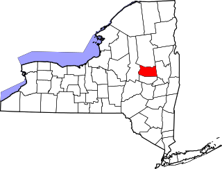
List of the National Register of Historic Places listings in Montgomery County, New York

<span class="mw-page-title-main">National Register of Historic Places listings in Niagara County, New York</span>

This is a list of the National Register of Historic Places listings in Erie County, New York.

<span class="mw-page-title-main">National Register of Historic Places listings in Oneida County, New York</span>

List of the National Register of Historic Places listings in Oneida County, New York

<span class="mw-page-title-main">National Register of Historic Places listings in Ontario County, New York</span>

List of the National Register of Historic Places listings in Ontario County, New York

<span class="mw-page-title-main">National Register of Historic Places listings in Oswego County, New York</span>

List of the National Register of Historic Places listings in Oswego County, New York

<span class="mw-page-title-main">National Register of Historic Places listings in Putnam County, New York</span>

List of the National Register of Historic Places listings in Putnam County, New York

<span class="mw-page-title-main">National Register of Historic Places listings in Saratoga County, New York</span>

List of the National Register of Historic Places listings in Saratoga County, New York

<span class="mw-page-title-main">National Register of Historic Places listings in Schuyler County, New York</span>

List of the National Register of Historic Places listings in Schuyler County, New York

<span class="mw-page-title-main">National Register of Historic Places listings in Seneca County, New York</span>

List of Registered Historic Places in Seneca County, New York

<span class="mw-page-title-main">National Register of Historic Places listings in St. Lawrence County, New York</span>

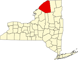
List of the National Register of Historic Places listings in St. Lawrence County, New York

<span class="mw-page-title-main">National Register of Historic Places listings in Washington County, New York</span>

List of the National Register of Historic Places listings in Washington County, New York

<span class="mw-page-title-main">National Register of Historic Places listings in Tompkins County, New York</span>

List of the National Register of Historic Places listings in Tompkins County, New York

<span class="mw-page-title-main">National Register of Historic Places listings in Madison County, New York</span>

List of the National Register of Historic Places listings in Madison County, New York

This is intended to be a complete list of properties and districts listed on the National Register of Historic Places on Manhattan Island below 14th Street, which is a significant portion of the New York City borough of Manhattan. In turn, the borough of Manhattan is coterminous with New York County, New York. For properties and districts in other parts of Manhattan Island, the mainland neighborhood of Marble Hill, and the other islands of New York County, see National Register of Historic Places listings in Manhattan. The locations of National Register properties and districts may be seen in an online map by clicking on "Map of all coordinates".

References

  1. The latitude and longitude information provided in this table was derived originally from the National Register Information System, which has been found to be fairly accurate for about 99% of listings. Some locations in this table may have been corrected to current GPS standards.
  2. National Park Service, United States Department of the Interior, "National Register of Historic Places: Weekly List Actions", retrieved December 22, 2023.
  3. Numbers represent an alphabetical ordering by significant words. Various colorings, defined here, differentiate National Historic Landmarks and historic districts from other NRHP buildings, structures, sites or objects.
  4. The eight-digit number below each date is the number assigned to each location in the National Register Information System database, which can be viewed by clicking the number.
  5. "Trinity Episcopal Church in Elmira closing". 21 August 2020.