List of bridges and tunnels on the National Register of Historic Places in New York

Last updated

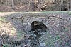
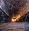
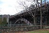
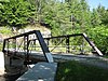
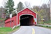
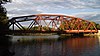
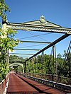
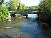
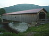
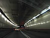
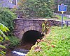
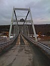
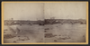
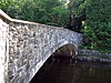
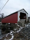
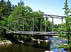
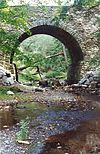
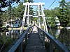
This is a list of bridges and tunnels on the National Register of Historic Places in the U.S. state of New York. [1]

NameImageBuiltListedLocationCountyType
69th Street Transfer Bridge 69th-st-transfer-bridge.jpg 19112003-06-26 New York
40°46′44″N73°59′26″W / 40.77889°N 73.99056°W / 40.77889; -73.99056 (69th Street Transfer Bridge)
New York
Allan Teator Road Stone Arch Bridge Allan Teator Road Stone Arch Bridge 4-23-2016.jpg 18922008-01-09 West Durham
42°24′27″N74°13′12″W / 42.40750°N 74.22000°W / 42.40750; -74.22000 (Allan Teator Road Stone Arch Bridge)
Greene Stone arch bridge
Andrews Street Bridge Rochester - Andrews Street Bridge.jpg 18931984-10-11 Rochester
43°9′32″N77°36′45″W / 43.15889°N 77.61250°W / 43.15889; -77.61250 (Andrews Street Bridge)
Monroe
Ashokan-Turnwood Covered Bridge ASHOKAN COVERED BRIDGE, ULSTER CO. NY.jpg 1885, 19392000-07-20 Olivebridge
41°55′36″N74°11′58″W / 41.92667°N 74.19944°W / 41.92667; -74.19944 (Ashokan-Turnwood Covered Bridge)
Ulster covered bridge
Atlantic Avenue Tunnel Atlantic Ave Tunnel.jpg 18441989-09-07 New York City
40°41′30″N74°0′0″W / 40.69167°N 74.00000°W / 40.69167; -74.00000 (Atlantic Avenue Tunnel)
Kings Cut and cover tunnel
Avon Five Arch Bridge Five Arch Bridge - Avon, New York (5170953402).jpg 2012-1-4 Avon
42°54′52″N77°37′0″W / 42.91444°N 77.61667°W / 42.91444; -77.61667 (Avon Five Arch Bridge)
Livingston
AuSable Chasm Bridge Ausable Chasm Bridge.jpg 1933, 19341999-11-12 AuSable, Chesterfield
44°31′29″N73°27′48″W / 44.52472°N 73.46333°W / 44.52472; -73.46333 (AuSable Chasm Bridge)
Clinton, Essex Steel Arch
Bear Mountain Bridge and Toll House Bear Mountain Bridge from below.jpg 1923, 19241982-11-23 Peekskill, Stony Point
41°19′12″N73°58′49″W / 41.32000°N 73.98028°W / 41.32000; -73.98028 (Bear Mountain Bridge and Toll House)
Rockland, Westchester
Beaverkill Covered Bridge Beaverkill Covered Bridge.jpg 18652007-10-03 Beaverkill
41°58′53″N74°50′12″W / 41.98139°N 74.83667°W / 41.98139; -74.83667 (Beaverkill Covered Bridge)
Sullivan
Bedford Creek Bridge ca. 18251989-10-18 Hounsfield
43°54′32″N76°7′12″W / 43.90889°N 76.12000°W / 43.90889; -76.12000 (Bedford Creek Bridge)
Jefferson Stone arch bridge
Beer's Bridge Beers Bridge, Keene Valley, New York.JPG ca. 1900, ca. 19251999-11-12 Keene Valley
44°10′11″N73°46′57″W / 44.16972°N 73.78250°W / 44.16972; -73.78250 (Beer's Bridge)
Essex Pratt Pony Truss
Brand Hollow Road Stone Arch Bridge Brand Hollow Road Stone Arch Bridge 4-23-2016.jpg 1892, 18932008-04-10 West Durham Greene Stone arch bridge
Bridge L-158 Bridge L-158, Goldens Bridge, NY.jpg 1883, 19041978-11-29 Goldens Bridge
41°17′47″N73°40′59″W / 41.29639°N 73.68306°W / 41.29639; -73.68306 (Bridge L-158)
Westchester Whipple through truss
Brooklyn Bridge Brooklyn Bridge 20080501.JPG 1869, 18831966-10-15 New York Kings, New York Wire cable suspension bridge
Buskirk Covered Bridge Buskirks Bridge 1.jpg ca. 18501978-03-08 Buskirk
42°57′30″N73°26′0″W / 42.95833°N 73.43333°W / 42.95833; -73.43333 (Buskirk Covered Bridge)
Rensselaer, Washington Covered Howe truss
Caneadea Bridge Caneadea Bridge 2012-09-29 21-42-31.jpg 19031998-11-19 Caneadea
42°23′6″N78°8′59″W / 42.38500°N 78.14972°W / 42.38500; -78.14972 (Caneadea Bridge)
Allegany Camel Parker Truss
Carpenter's Flats Bridge Carpenter's Flats Bridge Ausable NY.JPG 19411999-11-12 AuSable, Peru
44°33′32″N73°26′57″W / 44.55889°N 73.44917°W / 44.55889; -73.44917 (Carpenter's Flats Bridge)
Clinton Warren Steel Truss
Copeland Covered Bridge COPELAND COVERED BRIDGE.jpg 18791998-08-06 Edinburg
43°13′15″N74°6′2″W / 43.22083°N 74.10056°W / 43.22083; -74.10056 (Copeland Covered Bridge)
Saratoga
Court Street Bridge Rochester - Court Street Bridge panorama.jpg 18931984-10-11 Rochester
43°9′12″N77°36′34″W / 43.15333°N 77.60944°W / 43.15333; -77.60944 (Court Street Bridge)
Monroe
Delaware and Hudson Railroad Bridge 19131999-11-12 AuSable, Peru
44°33′20″N73°26′5″W / 44.55556°N 73.43472°W / 44.55556; -73.43472 (Delaware and Hudson Railroad Bridge)
Clinton Warren Steel Truss Bridge
Double-Span Metal Pratt Truss Bridge Double-Span Metal Pratt Truss Bridge, Keeseville, NY.jpg 18771983-05-20 Keeseville
44°30′4″N73°29′9″W / 44.50111°N 73.48583°W / 44.50111; -73.48583 (Double-Span Metal Pratt Truss Bridge)
Clinton, Essex Truss Bridge
Double-Span Whipple Bowstring Truss Bridge Shaw Bridge, Claverack, NY.jpg 18701980-04-17 Claverack
42°12′54″N73°43′45″W / 42.21500°N 73.72917°W / 42.21500; -73.72917 (Double-Span Whipple Bowstring Truss Bridge)
Columbia Whipple bowstring truss
Downsville Covered Bridge Downsville-covered-bridge.jpg 18541999-04-29 Downsville
42°4′34″N74°59′28″W / 42.07611°N 74.99111°W / 42.07611; -74.99111 (Downsville Covered Bridge)
Delaware
Eagleville Covered Bridge Eagleville Covered Bridge May 07.jpg 18581978-03-08 Eagleville
43°5′0″N73°18′51″W / 43.08333°N 73.31417°W / 43.08333; -73.31417 (Eagleville Covered Bridge)
Washington Covered Town lattice plank truss
Elm Street Stone Arch Bridge Elm Street Stone Arch Bridge, Pine Hill, NY.jpg ca. 19001996-12-16 Pine Hill
42°8′0″N74°28′48″W / 42.13333°N 74.48000°W / 42.13333; -74.48000 (Elm Street Stone Arch Bridge)
Ulster
Fitches Covered Bridge Fitches Covered Bridge Nov 04.jpg 1870, 18851999-04-29 East Delhi
42°17′53″N74°52′47″W / 42.29806°N 74.87972°W / 42.29806; -74.87972 (Fitches Covered Bridge)
Delaware
Frazier Bridge Frazier Bridge from Lachute River.jpg 1894, 19251998-12-17 Ticonderoga
43°51′1″N73°25′21″W / 43.85028°N 73.42250°W / 43.85028; -73.42250 (Frazier Bridge)
Essex Double arched bridge
Grant Mills Covered Bridge Grant Mills Covered Bridge.jpg 19021998-12-17 Hardenbergh
42°4′48″N74°37′45″W / 42.08000°N 74.62917°W / 42.08000; -74.62917 (Grant Mills Covered Bridge)
Ulster
Hadley Parabolic Bridge Hadley Bow Bridge.jpg 18951977-03-25 Hadley
43°18′50″N73°50′44″W / 43.31389°N 73.84556°W / 43.31389; -73.84556 (Hadley Parabolic Bridge)
Saratoga Semi-deck Lenticular Truss
Hamden Covered Bridge Hamden Covered Bridge May 06.jpg 18591999-04-29 Hamden
42°11′44″N74°59′19″W / 42.19556°N 74.98861°W / 42.19556; -74.98861 (Hamden Covered Bridge)
Delaware
Hankins Stone Arch Bridge Hankins Stone Arch Bridge Apr 09.jpg 19052000-07-27 Hankins
41°48′59″N75°5′31″W / 41.81639°N 75.09194°W / 41.81639; -75.09194 (Hankins Stone Arch Bridge)
Sullivan Stone arch bridge
Hervey Street Road Stone Arch Bridge Hervey Road Stone Arch Bridge 8-13-2016.jpg 18912008-01-09 Hervey Street
42°20′42″N74°7′37″W / 42.34500°N 74.12694°W / 42.34500; -74.12694 (Hervey Street Road Stone Arch Bridge)
Greene Stone arch bridge
High Bridge Aqueduct and Water Tower HarlemRiverBridges.jpg 1838, 1844, 18721972-12-04 New York New York, Bronx
Holland Tunnel Holland tunnel.jpg 1920, 19271993-11-04 New York New York Cast iron subaqueous tunnel
Hyde Hall Covered Bridge Hyde Hall Covered Bridge - west view.jpg 18251998-12-17 East Springfield
42°47′25″N74°51′50″W / 42.79028°N 74.86389°W / 42.79028; -74.86389 (Hyde Hall Covered Bridge)
Otsego
IRT Broadway Line Viaduct BwyWalk0505 Station125thBroadway.jpg 1900, 19041983-09-15 New York
40°49′12″N73°57′20″W / 40.82000°N 73.95556°W / 40.82000; -73.95556 (IRT Broadway Line Viaduct)
New York
Jones Beach State Park, Causeway and Parkway System Jones Beach WantaghPkwy Approach.jpg 2005-04-28 Wantagh Nassau
Joralemon Street Tunnel Joralemon Street Tunnel postcard, 1913.jpg 19082006-02-09 New York
40°41′53″N74°0′27″W / 40.69806°N 74.00750°W / 40.69806; -74.00750 (Joralemon Street Tunnel)
New York
Kingston-Port Ewen Suspension Bridge KingstontoPEbridge.jpg 1919, 1921, 19221980-04-30 Kingston
41°54′53″N73°59′0″W / 41.91472°N 73.98333°W / 41.91472; -73.98333 (Kingston-Port Ewen Suspension Bridge)
Ulster
Lalino Stone Arch Bridge by 18702001-12-28 Middleville
43°8′14″N74°56′42″W / 43.13722°N 74.94500°W / 43.13722; -74.94500 (Lalino Stone Arch Bridge)
Herkimer
Lower Shavertown Covered Bridge Lower Shavertown Covered Bridge Back.JPG 18771999-04-29 Methol
41°55′24″N75°0′49″W / 41.92333°N 75.01361°W / 41.92333; -75.01361 (Lower Shavertown Covered Bridge)
Delaware
Lower Dock Hill Road Stone Arch Bridge 2010-04-28 Cornwall-on-Hudson
Orange Stone arch bridge
Main Street Bridge Main Street Bridge, Main Street East, spanning Genesee River, Rochester (Monroe County, New York).jpg 18571984-10-11 Rochester
43°9′22″N77°36′39″W / 43.15611°N 77.61083°W / 43.15611; -77.61083 (Main Street Bridge)
Monroe
Manhattan Bridge Manhattan Bridge 2007.jpg 1901, 19091983-08-30 New York Kings, New York Suspension
Mill Street Stone Arch Bridge Mill Street Stone Arch Bridge, Pine Hill, NY.jpg ca. 18971996-12-16 Pine Hill
42°8′1″N74°29′0″W / 42.13361°N 74.48333°W / 42.13361; -74.48333 (Mill Street Stone Arch Bridge)
Ulster
Millanville-Skinners Falls Bridge SkinnersFallsMilanvilleBridge.jpg 19041988-11-14 Skinners Falls
41°40′10″N75°3′31″W / 41.66944°N 75.05861°W / 41.66944; -75.05861 (Millanville-Skinners Falls Bridge)
Sullivan Baltimore truss
Moore Road Stone Arch Bridge 18872008-04-10 Cornwallville Greene
Newfield Covered Bridge Newfield Covered Bridge Feb 10.jpg 2000-02-25 Newfield
42°21′47″N76°35′27″W / 42.36306°N 76.59083°W / 42.36306; -76.59083 (Newfield Covered Bridge)
Tompkins
Newport Stone Arch Bridge Stone bridge Newport N. Y. (below the bridge), from Robert N. Dennis collection of stereoscopic views.png 18531992-02-10 Newport
43°11′6″N75°1′4″W / 43.18500°N 75.01778°W / 43.18500; -75.01778 (Newport Stone Arch Bridge)
Herkimer Stone arch bridge
Notman Bridge Notman Bridge, Keene, New York.jpg 19131999-11-12 Keene Valley
44°11′29″N73°47′5″W / 44.19139°N 73.78472°W / 44.19139; -73.78472 (Notman Bridge)
Essex stone-faced, concrete arch
Old Blenheim Bridge BlenheimBridge HAER cropped.jpg 18341966-10-15 North Blenheim
42°28′21″N74°26′29″W / 42.47250°N 74.44139°W / 42.47250; -74.44139 (Old Blenheim Bridge)
Schoharie Single span double-tunnel
Old City Road Stone Arch Bridge Old City Road Stone Arch Bridge.jpg 18982001-12-28 Welch Corners
43°9′51″N74°59′8″W / 43.16417°N 74.98556°W / 43.16417; -74.98556 (Old City Road Stone Arch Bridge)
Herkimer
Old State Road Bridge ca. 1890, 19321999-11-12 AuSable Chasm
44°31′25″N73°27′37″W / 44.52361°N 73.46028°W / 44.52361; -73.46028 (Old State Road Bridge)
Clinton Pratt Pony Truss Bridge
Oliver Avenue Bridge 18951984-07-19 Middletown
41°27′14″N74°26′0″W / 41.45389°N 74.43333°W / 41.45389; -74.43333 (Oliver Avenue Bridge)
Orange Pratt Truss
Ouaquaga Lenticular Truss Bridge Ouaquaga Bridge, Dutchtown Road, spanning Susquehanna River, Ouaquaga (Broome County, New York).jpg 18882003-02-20 Ouaquaga
42°7′24″N75°38′52″W / 42.12333°N 75.64778°W / 42.12333; -75.64778 (Ouaquaga Lenticular Truss Bridge)
Broome Lenticular Truss Bridge
Palmer Brook Bridge 19381999-11-12 AuSable Forks
44°26′37″N73°40′29″W / 44.44361°N 73.67472°W / 44.44361; -73.67472 (Palmer Brook Bridge)
Clinton stone-faced concrete arch
Perrine's Bridge Perrine's bridge.jpg 18441973-04-13 Rosendale Ulster Burr Arch
Pilgrim's Progress Road Bridge Pilgrims Progress Road Bridge, Rhinebeck NY.jpg ca. 18581987-07-09 Rhinebeck
41°56′22″N73°52′50″W / 41.93944°N 73.88056°W / 41.93944; -73.88056 (Pilgrim's Progress Road Bridge)
Dutchess
Pond Eddy Bridge Pond Eddy Bridge from the Pennsylvania side.jpg 19041988-11-14 Pond Eddy
41°26′21″N74°49′13″W / 41.43917°N 74.82028°W / 41.43917; -74.82028 (Pond Eddy Bridge)
Sullivan Pennsylvania truss
Poughkeepsie Railroad Bridge Poughkeepsie Bridge 115997.jpg 1876, 18881979-02-23 Poughkeepsie
41°42′39″N73°55′47″W / 41.71083°N 73.92972°W / 41.71083; -73.92972 (Poughkeepsie Railroad Bridge)
Dutchess Warren Deck-Truss
Queensboro Bridge Queensboro Bridge closeup.jpg 19091978-12-20 New York New York, Queens Through cantilever truss
Ranney Bridge Ranney Bridge, Keene Valley, New York.jpg 1902, ca. 19251999-11-12 Keene Valley
44°10′55″N73°47′3″W / 44.18194°N 73.78417°W / 44.18194; -73.78417 (Ranney Bridge)
Essex Pratt Pony Truss Bridge
Raymondville Parabolic Bridge 18861984-09-07 Raymondville
44°50′23″N74°58′47″W / 44.83972°N 74.97972°W / 44.83972; -74.97972 (Raymondville Parabolic Bridge)
St. Lawrence Lenticular Truss
Rexleigh Covered Bridge Rexleigh Covered Bridge Dec 10.jpg 18741978-03-08 Jackson
42°14′3″N73°22′47″W / 42.23417°N 73.37972°W / 42.23417; -73.37972 (Rexleigh Covered Bridge)
Washington Covered Howe truss
Rockland Road Bridge 18742005-12-07 Village of Piermont
41°2′6″N73°55′10″W / 41.03500°N 73.91944°W / 41.03500; -73.91944 (Rockland Road Bridge)
Rockland
Rorig Bridge 18901983-09-26 Westfield
42°18′58″N79°34′44″W / 42.31611°N 79.57889°W / 42.31611; -79.57889 (Rorig Bridge)
Chautauqua Pratt Through Truss
Route 29 Stone Arch Bridge Route 29 Stone Arch Bridge.jpg by 18702001-01-26 Middleville
43°8′15″N74°56′59″W / 43.13750°N 74.94972°W / 43.13750; -74.94972 (Route 29 Stone Arch Bridge)
Herkimer
Ruhle Road Lenticular Metal Truss Bridge Malta Ruhle Road Lenticular Truss Bridge 1.jpg 2004-09-04 Malta Saratoga
Salisbury Center Covered Bridge Salisbury Covered Bridge May 08.jpg 18751972-06-19 Salisbury Center
43°8′27″N74°47′17″W / 43.14083°N 74.78806°W / 43.14083; -74.78806 (Salisbury Center Covered Bridge)
Herkimer Burr Arch Truss
Salisbury Turnpike Bridge Salisbury Turnpike Bridge, Rhinebeck NY.jpg ca. 18581987-07-09 Rhinebeck
41°56′20″N73°52′46″W / 41.93889°N 73.87944°W / 41.93889; -73.87944 (Salisbury Turnpike Bridge)
Dutchess
Shady Glen Road Stone Arch Bridge 18862008-01-09 Cornwallville
42°22′47″N74°8′44″W / 42.37972°N 74.14556°W / 42.37972; -74.14556 (Shady Glen Road Stone Arch Bridge)
Greene
Shushan Covered Bridge SHUSHAN COVERED BRIDGE.jpg 18581978-03-08 Shushan
43°5′28″N73°20′45″W / 43.09111°N 73.34583°W / 43.09111; -73.34583 (Shushan Covered Bridge)
Washington Covered Town lattice plank truss
Silk Street Bridge ca. 18881998-04-30 Newark Valley
42°13′3″N76°11′38″W / 42.21750°N 76.19389°W / 42.21750; -76.19389 (Silk Street Bridge)
Tioga lenticular pony truss
Slater Bridge ca. 1900, ca. 19321999-11-12 Keene Valley
44°9′31″N73°46′40″W / 44.15861°N 73.77778°W / 44.15861; -73.77778 (Slater Bridge)
Essex Warren pony truss
South Washington Street Parabolic Bridge BingSWashingtonBridge.JPG 1886, 18871978-01-30 Binghamton
42°5′33″N75°54′54″W / 42.09250°N 75.91500°W / 42.09250; -75.91500 (South Washington Street Parabolic Bridge)
Broome Lenticular truss
Sparkill Creek Drawbridge Sparkill Creek Drawbridge, Spanning Sparkill Creek at Bridge Street, Piermont (Rockland County, New York).jpg 18801985-03-28 Piermont
41°2′14″N73°54′58″W / 41.03722°N 73.91611°W / 41.03722; -73.91611 (Sparkill Creek Drawbridge)
Rockland Pratt Pony Truss
Spengler Bridge 18801973-02-23 Chatham
42°25′51″N73°35′59″W / 42.43083°N 73.59972°W / 42.43083; -73.59972 (Spengler Bridge)
Columbia Pratt truss
Stillwater Bridge Stillwater Bridge 2008.JPG 19131997-11-07 Stillwater
43°32′41″N75°55′20″W / 43.54472°N 75.92222°W / 43.54472; -75.92222 (Stillwater Bridge)
Oswego Pratt through Truss
Stone Arch Bridge Keeseville Stone Bridge.jpg 18431999-11-12 Keeseville
44°30′19″N73°28′52″W / 44.50528°N 73.48111°W / 44.50528; -73.48111 (Stone Arch Bridge)
Clinton, Essex Stone Arch
Stone Arch Bridge Stone Arch Bridge, Kenoza Lake NY.JPG ca. 18731976-12-12 Kenoza Lake
41°44′53″N74°57′15″W / 41.74806°N 74.95417°W / 41.74806; -74.95417 (Stone Arch Bridge)
Sullivan
Swing Bridge Keeseville suspension bridge.jpg 18881999-11-12 Keeseville
44°30′13″N73°28′58″W / 44.50361°N 73.48278°W / 44.50361; -73.48278 (Swing Bridge)
Clinton, Essex Pedestrian Suspension Bridge
Tioronda Bridge Tioronda Bridge from west.jpg 1869, 18731976-10-08 Beacon
41°29′19″N73°58′28″W / 41.48861°N 73.97444°W / 41.48861; -73.97444 (Tioronda Bridge)
Dutchess Bowstring Iron-Truss
Town Line Bridge 2008-5-29 Taylor
Cortland
Tusten Stone Arch Bridge 18962000-07-27 Tusten
41°33′22″N75°1′10″W / 41.55611°N 75.01944°W / 41.55611; -75.01944 (Tusten Stone Arch Bridge)
Sullivan stone arch bridge
Walton Bridge Walton Bridge Keene New York.jpg 1840, 19251999-11-12 Keene
44°14′41″N73°47′53″W / 44.24472°N 73.79806°W / 44.24472; -73.79806 (Walton Bridge)
Essex Lenticular Through Truss
Washington Bridge Wash Br square truss jeh.JPG 1886, 18891983-09-22 New York
40°50′53″N73°55′52″W / 40.84806°N 73.93111°W / 40.84806; -73.93111 (Washington Bridge)
Bronx, New York
Water, Wall, and Pine Streets Lenticular Truss Bridges 18811977-10-05 Homer Cortland Lenticular truss
Whipple Cast and Wrought Iron Bowstring Truss Bridge Normanskill Farm Bridge, Albany, NY, deck view from west.jpg 18671971-03-18 Albany
42°38′8″N73°48′4″W / 42.63556°N 73.80111°W / 42.63556; -73.80111 (Whipple Cast and Wrought Iron Bowstring Truss Bridge)
Albany Whipple Iron Bowstring Truss
Wilmington Bridge 1934, 19351999-11-12 Wilmington
44°23′20″N73°49′4″W / 44.38889°N 73.81778°W / 44.38889; -73.81778 (Wilmington Bridge)
Essex Stone faced concrete arch
Wood Road Metal Truss Bridge 18972005-03-15 Campbell
42°15′9″N77°13′2″W / 42.25250°N 77.21722°W / 42.25250; -77.21722 (Wood Road Metal Truss Bridge)
Steuben
Woodward Road Stone Arch Bridge Woodward Road Stone Arch Bridge 8-12-2016.jpg 18872009-3-9 East Durham
42°22′16″N74°5′46″W / 42.37111°N 74.09611°W / 42.37111; -74.09611 (Woodward Road Stone Arch Bridge)
Greene Stone arch bridge
Park Avenue Viaduct
part of Grand Central Terminal
Park Av high west jeh.JPG 1983-08-11 New York
40°44′59″N73°58′40″W / 40.74972°N 73.97778°W / 40.74972; -73.97778 (Park Avenue Viaduct
part of Grand Central Terminal
)
New York
Ruhle Road Stone Arch Bridge Malta Ruhle Road Stone Bridge.jpg ca. 1873
removed 2004-09-04
Malta Saratoga Spandrel arch
Wanakena Footbridge Wanakena Footbridge.jpg 1902, 1912
removed 2016-05-03
Fine
44°7′59″N74°55′18″W / 44.13306°N 74.92167°W / 44.13306; -74.92167 (Wanakena Footbridge)
St. Lawrence Suspension bridge

Related Research Articles

The National Register of Historic Places (NRHP) is the United States federal government's official list of districts, sites, buildings, structures, and objects deemed worthy of preservation for their historical significance or "great artistic value". A property listed in the National Register, or located within a National Register Historic District, may qualify for tax incentives derived from the total value of expenses incurred in preserving the property.

This is a list of properties and historic districts that are listed on the National Register of Historic Places (NRHP) in Puerto Rico. There are 368 NRHP listings in Puerto Rico, with one or more NRHP listings in each of Puerto Rico's 78 municipalities.

<span class="mw-page-title-main">National Register of Historic Places listings in Minnesota</span>

This is a list of sites in Minnesota which are included in the National Register of Historic Places. There are more than 1,700 properties and historic districts listed on the NRHP; each of Minnesota's 87 counties has at least 2 listings. Twenty-two sites are also National Historic Landmarks.

<span class="mw-page-title-main">National Register of Historic Places listings in Florida</span>

There are more than 1,800 properties and districts listed on the National Register of Historic Places in Florida. They are distributed through 66 of the state's 67 counties. Of these, 42 are National Historic Landmarks.
     This National Park Service list is complete through NPS recent listings posted August 4, 2023.

<span class="mw-page-title-main">National Register of Historic Places listings in Arizona</span>

This is a directory of properties and districts listed on the National Register of Historic Places in Arizona. There are about fourteen hundred listed sites in the state, and each of its fifteen counties has at least ten listings on the National Register. Forty-seven of the state's sites are further designated as National Historic Landmarks.

<span class="mw-page-title-main">National Register of Historic Places listings in American Samoa</span>

This is a list of the buildings, sites, districts, and objects listed on the National Register of Historic Places in American Samoa. There are currently 31 listed sites spread across the three districts of American Samoa. There are no sites listed on the unorganized atoll of Swains Island.

<span class="mw-page-title-main">National Register of Historic Places listings in Arkansas</span>

This is a list of properties and historic districts in Arkansas that are listed on the National Register of Historic Places. There are more than 2,600 listings in the state, including at least 8 listings in each of Arkansas's 75 counties.

<span class="mw-page-title-main">National Register of Historic Places listings in Illinois</span>

This is a list of properties and districts in Illinois that are on the National Register of Historic Places. There are over 1,900 in total. Of these, 85 are National Historic Landmarks. There are listings in all of the state's 102 counties.
     This National Park Service list is complete through NPS recent listings posted August 4, 2023.

<span class="mw-page-title-main">National Register of Historic Places listings in Idaho</span>

This is a directory of properties and districts included among the National Register of Historic Places listings in Idaho. There are approximately 1,000 sites in Idaho listed on the National Register. Each of the state's 44 counties has at least one listing on the National Register.

<span class="mw-page-title-main">National Register of Historic Places listings in Maine</span>

There are approximately 1,600 properties and districts listed on the National Register of Historic Places in the U.S. State of Maine. Each of the state's 16 counties has more than forty listings on the National Register.

<span class="mw-page-title-main">National Register of Historic Places listings in North Carolina</span>

This is a list of structures, sites, districts, and objects on the National Register of Historic Places in North Carolina:

<span class="mw-page-title-main">National Register of Historic Places listings in New Jersey</span>

This is a list of properties and districts listed on the National Register of Historic Places in New Jersey. There are more than 1,700 listed sites in New Jersey. Of these, 58 are further designated as National Historic Landmarks. All 21 counties in New Jersey have listings on the National Register.
     This National Park Service list is complete through NPS recent listings posted August 4, 2023.

<span class="mw-page-title-main">National Register of Historic Places listings in New Hampshire</span>

This is a directory of properties and districts listed on the National Register of Historic Places in New Hampshire. There are more than 800 listed sites in New Hampshire. Each of the 10 counties in New Hampshire has at least 30 listings on the National Register.

<span class="mw-page-title-main">National Register of Historic Places listings in Rhode Island</span>

This is a list of properties and districts listed on the National Register of Historic Places in Rhode Island. As of May 29, 2015, there are more than 750 listed sites in Rhode Island. All 5 of the counties in Rhode Island have listings on the National Register.

<span class="mw-page-title-main">National Register of Historic Places listings in South Carolina</span>

This is a list of the properties and historic districts in each of the 46 counties of South Carolina that are designated National Register of Historic Places.

This is a list of properties on the National Register of Historic Places in the U.S. state of Vermont.

<span class="mw-page-title-main">National Register of Historic Places listings in Franklin County, New York</span>

List of the National Register of Historic Places listings in Franklin County, New York

<span class="mw-page-title-main">National Register of Historic Places listings in Fredericksburg, Virginia</span>

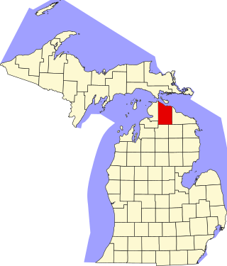
This is a list of the National Register of Historic Places listings in Fredericksburg, Virginia.

References

Map all coordinates using: OpenStreetMap
  1. "National Register Information System". National Register of Historic Places . National Park Service. July 9, 2010.