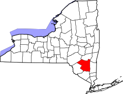
Olivebridge, New York

Last updated

Olivebridge, New York
Shell Gas sign and general store, Olivebridge, New York LOC 38290233531.jpg
Olivebridge Shell gas station & general store
Coordinates: 41°55′17.3″N74°12′54.5″W / 41.921472°N 74.215139°W / 41.921472; -74.215139
Country United States
State New York
County Ulster
Area
[1]
  Total18.47 sq mi (47.8 km2)
  Land18.45 sq mi (47.8 km2)
  Water0.02 sq mi (0.05 km2)
Elevation
568 ft (173 m)
Population
 (2020) [2]
  Total1,661
  Density276.28/sq mi (106.67/km2)
Time zone UTC-5 (EST)
  Summer (DST) UTC-4 (EDT)
ZIP code
12461
Area code 845
GNIS feature ID959342 [3]

Olivebridge is a hamlet in the town of Olive, Ulster County, New York, United States, within Catskill Park and the Catskill Mountains.

The community's name is sometimes written “Olive Bridge,” but the United States Board on Geographic Names lists the name as “Olivebridge.” [3]

The Ashokan-Turnwood Covered Bridge was listed on the National Register of Historic Places in 2000. [4]

The U.S. Postal Service ZIP code for Olivebridge is 12461 which includes the hamlet of Krumville. [5]

Related Research Articles

<span class="mw-page-title-main">Halcott, New York</span> Town in New York, United States

Halcott is a town in Greene County, New York, United States. The population was 249 in 2020, down from 258 at the 2010 census. The town is in the southwestern corner of the county.

<span class="mw-page-title-main">Rockland, New York</span> Town in Sullivan County, New York, US

Rockland is a town in the northern part of Sullivan County, New York, United States. At the 2020 census, the population was 3,290.

<span class="mw-page-title-main">Denning, New York</span> Town in New York, United States

Denning is an isolated town in Ulster County, New York, United States. The population was 493 at the 2020 census. The town is named after an early landowner, William Denning. Denning is located in the western part of the county, deep inside the Catskill Mountains. The location of the town in the Catskill State Park accounts in part for its low population.

<span class="mw-page-title-main">Hardenburgh, New York</span> Town in New York, United States

Hardenburgh is a town located in the western part of Ulster County, New York, United States. The population was 221 at the 2020 census. The town is located inside the Catskill Park.

<span class="mw-page-title-main">Olive, New York</span> Town in New York, United States

Olive is a town in Ulster County, New York, United States. The town is west of Kingston, New York and is inside the Catskill Park. The population was 4,226 at the 2020 census.

<span class="mw-page-title-main">Phoenicia, New York</span> CDP and hamlet in New York, United States

Phoenicia is a hamlet of Shandaken in Ulster County, New York, United States. The population was 268 at the 2020 census, making it the second highest populated community in the town. The village center is located just off Route 28 at its junction with Route 214 and is nestled at the base of three peaks, Mount Tremper, Romer Mountain, and Sheridan Mountain. The community sits at the confluence of the Esopus Creek and Stony Clove Creek. A popular getaway for New Yorkers, the hamlet has frequented many tourism guides as among the best vacation towns in the greater New York City area.

<span class="mw-page-title-main">Pine Hill, New York</span> CDP and hamlet in New York, United States

Pine Hill is a hamlet in the western part of the town of Shandaken in Ulster County, New York, United States. As of the 2020 census, the CDP had a total population of 275.

<span class="mw-page-title-main">Rochester, Ulster County, New York</span> Town in New York, United States

Rochester is a town in Ulster County, New York, United States. The population was 7,272 at the 2020 census. It is an interior town located near the center of Ulster County. The northwestern part of the town is in the Catskill Park.

<span class="mw-page-title-main">Shandaken, New York</span> Town in New York, United States

Shandaken is a town on the northern border of Ulster County, New York, United States, northwest of Kingston, New York. As of the 2020 census, the town had a total population of 2,866. The name is believed to be from an Esopus phrase for "land of rapid waters."

<span class="mw-page-title-main">Wawarsing, New York</span> Town in New York, United States

Wawarsing is a town in Ulster County, New York, United States. The population was 12,771 at the 2020 census. The name Wawarsing was once believed to mean "a place where the streams wind" in the Lenape language, referring to the geography in the hamlet of Wawarsing. Specifically, the joining of the Ver Nooy Kill and the Rondout Creek at Port Ben. The name Wawarsing was used by the Lenape to designate the current hamlet and the fields to the north and south of it for at least six miles in both directions. It is the only Lenape name known to refer to an exact location in Ulster County.

<span class="mw-page-title-main">Delhi, New York</span> Town in New York, United States

Delhi is a town in Delaware County, New York, United States. The population was 4,795 at the 2020 census. The town is in the east-central part of the county and contains the village of Delhi. The State University of New York at Delhi is located in the town.

<span class="mw-page-title-main">Hunter, New York</span> Town in New York, United States

Hunter is a town located in Greene County, New York, United States. The population was 3,035 at the time of the 2020 census. The town contains two villages, one named Hunter on the west, and the second called Tannersville, as well as a number of hamlets such as Haines Falls, Platte Clove, Lanesville and Edgewood. Additionally, there are three residential parks location within town limits: Onteora Park, Twilight Park and Elka Park. The town is on the southern border of Greene County and abuts the towns of Woodstock and Saugerties, located in Ulster County.

<span class="mw-page-title-main">Grahamsville, New York</span> Hamlet and CDP in New York, United States

Grahamsville is a hamlet at the junction of NY 42 and 55 in the Town of Neversink, in Sullivan County, New York, United States. It is near the western end of Rondout Reservoir, and is the southernmost community in the Catskill Park. It has the ZIP Code 12740 and the 985 telephone exchange in the 845 area code.

Krumville is a hamlet in the southeastern corner of the town of Olive in Ulster County, New York, United States. It takes its name from one of the most prominent of the early Dutch families who settled the area. Krumville is bordered on the northwest by the Olive hamlet of Samsonville, on the north by the hamlet of Olivebridge, on the southeast by the town of Marbletown and on the southwest by the town of Rochester. It lies at an elevation of 774 feet above sea level.

Boiceville is a hamlet in the town of Olive, Ulster County, New York, United States. Located at the intersection of New York State Route 28 and New York State Route 28A, Boiceville is within Catskill State Park.

<span class="mw-page-title-main">Lew Beach, New York</span> Hamlet in New York, United States

Lew Beach is a hamlet in the town of Rockland, New York, United States. It is at the northernmost corner of the town and thus also of Sullivan County, near the tripoint with Delaware and Ulster counties, within the Catskill Park. Its ZIP code, 12758, extends into the neighboring sections of the latter county's town of Hardenburgh, and some of those areas are considered part of Lew Beach as well.

Piffard is a census-designated place (CDP) and hamlet in the town of York, Livingston County, New York, United States. As of the 2010 census, its population was 220. The ZIP Code is 14533.

Hunt is a hamlet and census-designated place (CDP) in Livingston County, New York, United States. Its population was 78 as of the 2010 census. Hunt has a post office with ZIP code 14846.

South Cairo is a hamlet. It has 590 people, as of the 2020 census. It is situated in Greene County, New York, United States. The community is located along Catskill Creek and New York State Route 23, 6.3 miles (10.1 km) northwest of Catskill.

<span class="mw-page-title-main">Samsonville, New York</span> Hamlet in New York, United States

Samsonville is a hamlet in the southwestern part of the town of Olive in Ulster County, New York, United States. Bordered to the north by Mombaccus Mountain and Ashokan High Point, it is within the Catskill Park on the southeastern slopes of the high Catskills.

References

  1. "2016 U.S. Gazetteer Files". United States Census Bureau. Retrieved July 5, 2017.
  2. US Census Bureau, 2020 Census, Olivebridge hamlet, Ulster County, New York https://www.census.gov/search-results.html?searchType=web&cssp=SERP&q=Olive%20town,%20Ulster%20County,%20New%20York
  3. 1 2 "Olivebridge". Geographic Names Information System . United States Geological Survey, United States Department of the Interior.
  4. "National Register Information System". National Register of Historic Places . National Park Service. July 9, 2010.
  5. "ZIP Code 12461 in Olivebridge, NY". Zip-Codes.com. 2024.