East Kingston, New York

Last updated
East Kingston, New York
CDP
Ulster County New York incorporated and unincorporated areas East Kingston highlighted.svg
Location in Ulster County and the state of New York.
Coordinates: 41°57′8″N73°58′23″W / 41.95222°N 73.97306°W / 41.95222; -73.97306
Country United States
State New York
County Ulster
Area
[1]
  Total0.70 sq mi (1.80 km2)
  Land0.67 sq mi (1.75 km2)
  Water0.02 sq mi (0.06 km2)
Elevation
151 ft (46 m)
Population
 (2020)
  Total277
  Density410.98/sq mi (158.72/km2)
Time zone UTC-5 (Eastern (EST))
  Summer (DST) UTC-4 (EDT)
FIPS code 36-22370
GNIS feature ID0949148

East Kingston is a hamlet (and census-designated place) in Ulster County, New York, United States. The population was 277 at the 2020 census.

Contents

East Kingston is located in the southeastern corner of the Town of Ulster. The community is immediately north of the City of Kingston.

History

St. Colman's Church

St. Colman's Church was built in 1874 by Rev. M.C. O'Farrell of Rondout. The church is constructed of stone and brick and in the Gothic style and seats about 250 parishioners. In 1892, an annex was added by Dr. Burtsell of Rondout. In 1904 the mission became a parish of the Archdiocese of New York. Rev. Robert A. Weir was appointed the first resident pastor.

in 2015 the parish of St. Colman merged with Saint Catherine Laboure Church in Lake Katrine, but continues to offer weekly Mass. [2]

Geography

East Kingston is located at 41°57′08″N73°58′23″W / 41.952296°N 73.973187°W / 41.952296; -73.973187 . [3]

According to the United States Census Bureau, the CDP has a total area of 0.7 square miles (1.8 km2), all land.

The community is adjacent to the Hudson River.

Demographics

Historical population
CensusPop.Note
2000 285
2010 276−3.2%
2020 2770.4%
U.S. Decennial Census [4]

As of the census [5] of 2000, there were 285 people, 118 households, and 73 families residing in the CDP. The population density was 400.2 inhabitants per square mile (154.5/km2). There were 131 housing units at an average density of 184.0 per square mile (71.0/km2). The racial makeup of the CDP was 94.39% White, 5.26% African American, and 0.35% from two or more races. Hispanic or Latino of any race were 3.86% of the population.

There were 118 households, out of which 33.9% had children under the age of 18 living with them, 41.5% were married couples living together, 14.4% had a female householder with no husband present, and 38.1% were non-families. 34.7% of all households were made up of individuals, and 17.8% had someone living alone who was 65 years of age or older. The average household size was 2.42 and the average family size was 3.07.

In the CDP, the population was spread out, with 27.7% under the age of 18, 8.1% from 18 to 24, 26.7% from 25 to 44, 20.4% from 45 to 64, and 17.2% who were 65 years of age or older. The median age was 39 years. For every 100 females, there were 108.0 males. For every 100 females age 18 and over, there were 104.0 males.

The median income for a household in the CDP was $50,179, and the median income for a family was $56,875. Males had a median income of $33,000 versus $26,250 for females. The per capita income for the CDP was $22,657. About 10.0% of families and 15.3% of the population were below the poverty line, including 39.1% of those under the age of eighteen and 9.0% of those 65 or over.

Related Research Articles

<span class="mw-page-title-main">Kingston, New Jersey</span> Populated place in Middlesex and Somerset counties, New Jersey, US

Kingston is an unincorporated community and census designated place (CDP) along the border of South Brunswick Township in Middlesex County and Franklin Township in Somerset County, and also located relatively near Princeton in Mercer County in New Jersey, United States. The historic settlement is in the Raritan Valley region, located along the course of the Millstone River. As of the 2010 United States Census, the CDP's population was 1,493, of which 1,222 were in South Brunswick Township and 271 in Franklin Township.

<span class="mw-page-title-main">Haviland, New York</span> Census-designated place in New York, United States

Haviland is a community and census-designated place (CDP) in Dutchess County, New York, United States. The population was 3,634 at the 2010 census. It is part of the Poughkeepsie–Newburgh–Middletown, NY Metropolitan Statistical Area as well as the larger New York–Newark–Bridgeport, NY-NJ-CT-PA Combined Statistical Area.

<span class="mw-page-title-main">Accord, New York</span> Hamlet in the state of New York, United States

Accord is a hamlet and census-designated place (CDP) in Ulster County, New York, United States. Accord is located in the eastern part of the Town of Rochester along US 209. Accord is the seat of town government. As of the 2020 census the population is 573.

<span class="mw-page-title-main">Clintondale, New York</span> CDP in New York, United States

Clintondale is a hamlet in Ulster County, New York, United States. The population was 1,938 at the 2020 census.

<span class="mw-page-title-main">Glasco, New York</span> CDP in New York, United States

Glasco is a hamlet in Ulster County, New York, United States. The population was 2,013 at the 2020 census.

<span class="mw-page-title-main">Kerhonkson, New York</span> Hamlet and CDP in New York, United States

Kerhonkson is a hamlet and census-designated place (CDP) in Ulster County, New York, United States. The population was 1,722 at the 2020 census.

<span class="mw-page-title-main">Lake Katrine, New York</span> CDP in New York, United States

Lake Katrine is a hamlet in Ulster County, New York, United States. The population was 2,522 at the 2020 census.

<span class="mw-page-title-main">Lincoln Park, New York</span> CDP in New York, United States

Lincoln Park is a hamlet in Ulster County, New York, United States. The population was 2,545 at the 2020 census.

<span class="mw-page-title-main">Marlboro, New York</span> CDP in New York, United States

Marlboro is a hamlet in Ulster County, New York, United States. The population was 3,669 at the 2020 census. Marlboro is in the southeastern part of the town of Marlborough, located in the southeastern corner of the county.

<span class="mw-page-title-main">Port Ewen, New York</span> CDP in New York, United States

Port Ewen is a hamlet in Ulster County, New York, United States. The population was 3,678 at the 2020 census. Port Ewen is in the Town of Esopus, south of Kingston, along U.S. Route 9W.

<span class="mw-page-title-main">Saugerties South, New York</span> CDP in New York, United States

Saugerties South is a hamlet in Ulster County, New York, United States. The population was 2,442 at the 2020 census.

<span class="mw-page-title-main">Stone Ridge, New York</span> CDP in New York, United States

Stone Ridge is a hamlet in Ulster County, New York, United States. The population was 1,234 at the 2020 census.

<span class="mw-page-title-main">Tillson, New York</span> CDP in New York, United States

Tillson is a hamlet in Ulster County, New York, United States. The population was 1,516 at the 2020 census.

<span class="mw-page-title-main">Zena, New York</span> CDP in New York, United States

Zena is a hamlet in Ulster County, New York, United States. As of the 2020 census the population was 1,038.

<span class="mw-page-title-main">Crompond, New York</span> CDP in New York, United States

Crompond is a hamlet and census-designated place (CDP) located in the town of Yorktown in Westchester County, New York, United States. The population was 2,292 at the 2010 census.

<span class="mw-page-title-main">Heritage Hills, New York</span> Census-designated place in New York, United States

Heritage Hills is a hamlet (CDP) located in the town of Somers in Westchester County, New York, United States. The population was 3,975 at the 2010 census.

<span class="mw-page-title-main">Pine Plains (CDP), New York</span> Census-designated place in New York, United States

Pine Plains is a hamlet and census-designated place (CDP) in Dutchess County, New York, United States. The population was 1,142 at the 2020 census. It is part of the Poughkeepsie–Newburgh–Middletown, NY Metropolitan Statistical Area as well as the larger New York–Newark–Bridgeport, NY-NJ-CT-PA Combined Statistical Area.

<span class="mw-page-title-main">Hurley (CDP), New York</span> CDP in New York, United States

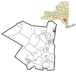
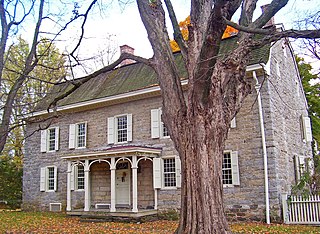
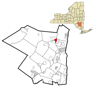
Hurley is a hamlet in the Town of Hurley, Ulster County, New York, United States. The population was 3,346 at the 2020 census.

<span class="mw-page-title-main">Woodstock (CDP), New York</span> CDP in New York, United States

Woodstock is a hamlet in Ulster County, New York, United States. The population was 2,088 at the 2010 census. The community of Woodstock is in eastern part of the Town of Woodstock and is northwest of Kingston. It is located along NY 212 near its junction with NY 375. Although the name of the community and the town lent its name to the Woodstock Festival, that event did not take place in Woodstock.

<span class="mw-page-title-main">Jefferson Valley, New York</span> Census-designated place in New York, United States

Jefferson Valley-Yorktown, commonly known as Jefferson Valley, is a census-designated place (CDP) located in the town of Yorktown in Westchester County, New York, United States. The population was 14,142 at the 2010 census. It is a hot spot for local shoppers, due to its Jefferson Valley Mall.

References

  1. "ArcGIS REST Services Directory". United States Census Bureau. Retrieved September 20, 2022.
  2. Hubert, Brian. "Area churches to merge, close in 2015", Daily Freeman, November 2, 2014
  3. "US Gazetteer files: 2010, 2000, and 1990". United States Census Bureau. 2011-02-12. Retrieved 2011-04-23.
  4. "Census of Population and Housing". Census.gov. Retrieved June 4, 2016.
  5. "U.S. Census website". United States Census Bureau . Retrieved 2008-01-31.