Boiceville, New York

Last updated

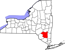
Boiceville is a hamlet in the town of Olive, Ulster County, New York, United States. [1] [2] Located at the intersection of New York State Route 28 and New York State Route 28A, Boiceville is within Catskill State Park.

Boiceville was named for Lemuel Boice (born in Shokan in 1819, died in Boiceville, 1899), who established a tannery in the town. Members of the Boice family owned tanneries, bluestone quarries, stores, farms, lumber businesses and mills in Olive for many years. [3] Boiceville was relocated due to the construction of the Ashokan Reservoir. The current commercial center of the town is subject to severe flooding during exceptionally powerful storms. Some businesses have accepted buyouts from the New York City Department of Environmental Protection. The future of others is in doubt. [4]

The Emile Brunel Studio and Sculpture Garden was listed on the National Register of Historic Places in 1999. [5]

Education

Onteora Central School District operates the public schools in Boiceville, including Onteora High School, Onteora Middle School, and Bennett Elementary School.

Related Research Articles

<span class="mw-page-title-main">Ulster County, New York</span> County in New York, United States

Ulster County is a county in the U.S. state of New York. It is situated along the Hudson River. As of the 2020 census, the population was 181,851. The county seat is Kingston. The county is named after the Irish province of Ulster.

<span class="mw-page-title-main">Prattsville (town), New York</span> Town in New York, United States

Prattsville is a town in Greene County, New York, United States. The town is in the northwestern part of the county. As of the 2020 census, the population was 774.

<span class="mw-page-title-main">Mamakating, New York</span> Town in New York, United States

Mamakating is a town in the southeastern section of Sullivan County, New York, United States. The population was 12,655 at the 2020 census.

<span class="mw-page-title-main">Hardenburgh, New York</span> Town in New York, United States

Hardenburgh is a town located in the western part of Ulster County, New York, United States. The population was 221 at the 2020 census. The town is located inside the Catskill Park.

<span class="mw-page-title-main">Olive, New York</span> Town in New York, United States

Olive is a town in Ulster County, New York, United States. The town is west of Kingston, New York and is inside the Catskill Park. The population was 4,226 at the 2020 census.

<span class="mw-page-title-main">Phoenicia, New York</span> CDP and hamlet in New York, United States

Phoenicia is a hamlet of Shandaken in Ulster County, New York, United States. The population was 268 at the 2020 census, making it the second highest populated community in the town. The village center is located just off Route 28 at its junction with Route 214 and is nestled at the base of three peaks, Mount Tremper, Romer Mountain, and Sheridan Mountain. The community sits at the confluence of the Esopus Creek and Stony Clove Creek. A popular getaway for New Yorkers, the hamlet has frequented many tourism guides as among the best vacation towns in the greater New York City area.

<span class="mw-page-title-main">Shandaken, New York</span> Town in New York, United States

Shandaken is a town on the northern border of Ulster County, New York, United States, northwest of Kingston, New York. As of the 2020 census, the town had a total population of 2,866. The name is believed to be from an Esopus phrase for "land of rapid waters."

<span class="mw-page-title-main">Stamford (village), New York</span> Village in New York, United States

Stamford is a village in Delaware County, New York, United States. The population was 1,119 at the 2010 census. The village is located partly in the town of Stamford and partly in the town of Harpersfield. The village is on routes 23 and 10. The village has termed itself the "Queen of the Catskills".

<span class="mw-page-title-main">Cold Brook station</span>

Cold Brook is a former railroad station in the Boiceville section of the town of Olive, Ulster County, New York, United States. Located on Cold Brook Road, just north of New York State Route 28A next to Esopus Creek, Cold Brook station served the New York Central Railroad's Catskill Mountain Branch, formerly the Ulster and Delaware Railroad. The station was located 22.1 miles (35.6 km) northwest of Kingston Point station in the city of Kingston.

<span class="mw-page-title-main">Grahamsville, New York</span> Hamlet and CDP in New York, United States

Grahamsville is a hamlet at the junction of NY 42 and 55 in the Town of Neversink, in Sullivan County, New York, United States. It is near the western end of Rondout Reservoir, and is the southernmost community in the Catskill Park. It has the ZIP Code 12740 and the 985 telephone exchange in the 845 area code.

<span class="mw-page-title-main">Modena, New York</span> Hamlet in New York, United States

Modena is a hamlet in Ulster County, New York, United States. It is located in the northwestern corner of the town of Plattekill, centered at the junction of the US 44/NY 55 concurrency and NY 32.

Olivebridge is a hamlet in the town of Olive, Ulster County, New York, United States, within Catskill Park and the Catskill Mountains.

<span class="mw-page-title-main">Grahamsville Historic District</span> Historic district in New York, United States

The Grahamsville Historic District is a historic district located along both sides of NY 55 just east of that hamlet in the Town of Neversink in Sullivan County, New York, United States. Its church is across the road from Tri-Valley Central School. In 1979 it was added to the National Register of Historic Places.

Mount Pleasant is a populated place in the town of Shandaken in Ulster County, New York, United States. Mount Pleasant is located along New York State Route 28 within Catskill State Park, to the south of Phoenicia and to the north of Boiceville. The community is located at 42°02′54″N74°17′21″W.

<span class="mw-page-title-main">Gardiner, New York</span> Town in New York, United States

Gardiner is a town in the south-central part of Ulster County, New York, United States. The population was 5,610 at the 2020 census.

<span class="mw-page-title-main">Plattekill, New York</span> Place in New York, United States

Plattekill is a town in Ulster County, New York, United States. The population was 10,424 in 2020, a slight decrease from 10,499 at the 2010 census. The name is derived from a stream, the Platte Kill.

<span class="mw-page-title-main">Onteora High School</span> Public high school in Boiceville, New York, United States

Onteora High School, located in Boiceville, New York, is part of the Onteora Central School District. The High School shares its building with the Onteora Middle School. However, the two schools remain administratively separate.

<span class="mw-page-title-main">Federal Corners, New York</span> Hamlet in New York, United States

Federal Corners is a former hamlet located in the Town of Richfield, New York, in Otsego County, United States, approximately 1.5 miles southeast of the village of Richfield Springs, at the corner of Butternut Road and Cemetery Road.

<span class="mw-page-title-main">Samsonville, New York</span> Hamlet in New York, United States

Samsonville is a hamlet in the southwestern part of the town of Olive in Ulster County, New York, United States. Bordered to the north by Mombaccus Mountain and Ashokan High Point, it is within the Catskill Park on the southeastern slopes of the high Catskills.

References

  1. "Ulster County History and Information". Genealogy Inc. Archived from the original on 2008-10-13. Retrieved 2008-10-22.
  2. "Feature Detail Report for: Boiceville (Ulster County, New York)". Geographic Names Information System . United States Geological Survey, United States Department of the Interior . Retrieved October 22, 2008.
  3. Clearwater, Alphonso Trumpbour (1907). "Alphonso T. Clearwater, The History of Ulster County, New York, Kingston, NY:W.J. Van Deusen, 1907, p. 555-556". "Our Family Tree entry for Lemuel Boice". "Ulster Co. Historical Society, Ulster County Gazette, Vol. 34, No. 1, March 2002".
  4. "Hudson Valley News, 2019/01/05".
  5. "National Register Information System". National Register of Historic Places . National Park Service. July 9, 2010.

42°00′18″N74°15′58″W / 42.005°N 74.266°W / 42.005; -74.266