Cottekill, New York

Last updated

Cottekill, New York
Welcome to Cottekill.JPG
USA New York location map.svg
Red pog.svg
Cottekill, New York
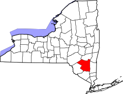
Location within the state of New York
Coordinates: 41°51′05″N74°06′08″W / 41.85139°N 74.10222°W / 41.85139; -74.10222
Country United States
State New York
County Ulster
Area
  Total2.416 sq mi (6.26 km2)
  Land2.395 sq mi (6.20 km2)
  Water0.021 sq mi (0.05 km2)
Elevation
295 ft (90 m)
Population
 (2014)
  Total451
  Density188/sq mi (73/km2)
Time zone UTC-5 (Eastern (EST))
  Summer (DST) UTC-4 (EDT)
ZIP code
12419
Area code 845

Cottekill is a small hamlet in the northwest part of the Town of Rosendale, Ulster County, New York, United States. Located in the Rondout Valley, it is approximately 2.25 miles east of the hamlet of Stone Ridge, 2.5 miles northwest of Rosendale Village, 8.75 miles south of the city of Kingston and 10.9 miles north of the village of New Paltz. As of 2014, the population was listed at 451.

Contents

Institutions and points of interest

Cottekill features a Post Office (12419) and has its own fire department, Cottekill Volunteer Fire Company. The Brookside School, a private school for children with developmental disabilities is located here as well as the Sustainable Living Resource Center, a project of Sustainable Hudson Valley. SUNY Ulster, a community college, is nearby in Stone Ridge.

There is also the Marbletown-Rosendale Rail Trail, curving along the old New York, Ontario and Western Railway (O&W) tracks, paralleling Lucas Avenue. It starts at Leggett Road, crosses the Cottekill Creek on a wooden footbridge and travels north to Cottekill Road, past the Cottekill Fire House. It continues north from the firehouse, along the O&W path, crosses Marcott Road and comes out on Route 209.

Demographics

Climate

Notable people


Related Research Articles

<span class="mw-page-title-main">Ulster County, New York</span> County in New York, United States

Ulster County is a county in the U.S. state of New York. It is situated along the Hudson River. As of the 2020 census, the population was 181,851. The county seat is Kingston. The county is named after the Irish province of Ulster.

<span class="mw-page-title-main">High Falls, New York</span> CDP in New York, United States

High Falls is a hamlet in Ulster County, New York, United States. The population was 700 at the 2020 census.

<span class="mw-page-title-main">Rosendale, New York</span> Town in New York, United States

Rosendale is a town in the center of Ulster County, New York, United States. It once contained a village Rosendale, primarily centered around Main Street, but which was dissolved through vote in 1977. The population was 5,782 at the 2020 census.

<span class="mw-page-title-main">Rosendale (CDP), New York</span> Hamlet & CDP in New York, United States

Rosendale is a hamlet located in the Town of Rosendale in Ulster County, New York, United States. The population was 1,285 at the 2020 census. It was also a census-designated place known as Rosendale Village until 2010, when the U.S. Census Bureau designated it Rosendale Hamlet. Some maps continue to list the place as just Rosendale. As of 2020, the "Hamlet" in the CDP name was dropped.

<span class="mw-page-title-main">Wawarsing, New York</span> Town in New York, United States

<span class="mw-page-title-main">New York State Route 32</span> North-south highway in New Yorks Hudson Valley

New York State Route 32 (NY 32) is a north–south state highway that extends for 176.73 miles (284.42 km) through the Hudson Valley and Capital District regions of the U.S. state of New York. It is a two-lane surface road for nearly its entire length, with few divided and no limited-access sections. From Harriman to Albany, it is closely parallel to Interstate 87 (I-87) and U.S. Route 9W (US 9W), overlapping with the latter in several places.

<span class="mw-page-title-main">Rondout Creek</span> River in New York, United States

Rondout Creek is a 63.3-mile-long (101.9 km) tributary of the Hudson River in Ulster and Sullivan counties, New York, United States. It rises on Rocky Mountain in the eastern Catskills, flows south into Rondout Reservoir, part of New York City's water supply network, then into the valley between the Catskills and the Shawangunk Ridge, where it goes over High Falls and finally out to the Hudson at Kingston, receiving along the way the Wallkill River.

<span class="mw-page-title-main">Perrine's Bridge</span> Bridge

Perrine's Bridge is the second oldest covered bridge in the State of New York, after the Hyde Hall Bridge in East Springfield. Once located in the hamlet called Perrines Bridge between 1850 and 1861. It is located in the modern day town of Esopus-Rosendale, New York just a few hundred feet to the east of Interstate 87 crossing of the Wallkill River in Ulster County, New York. Originally built to aid in the movement of trade between the towns of Rifton and Rosendale, the bridge is about 90 miles north of New York city between mile markers 81 and 82 on the New York State Thruway. In May 1834 the State of New York authorized and provided money ($700) to Ulster county, NY, to build the bridge. In 1835, the bridge was built by Benjamin Wood, the one-lane wooden covered bridge has been closed to vehicular traffic since 1930. The Bridge derives its name from James W. Perrine, a descendant of Daniel Perrin "The Huguenot", who was a tavern keeper that opened an inn on the east side of that future bridge in 1820. Perrine's son was hired each winter as the "snower". He would spread snow the length of the structure so horse-drawn sleighs could cross.

<span class="mw-page-title-main">New York State Route 52</span> East-west route from Narrowsburg to Carmel

New York State Route 52 (NY 52) is a 108.72-mile-long (174.97 km) state highway in the southeastern part of the state. It generally runs from west to east through five counties, beginning at the Pennsylvania state line in the Delaware River near Narrowsburg, crossing the Hudson River on the Newburgh–Beacon Bridge, and ending in Carmel. NY 52 and NY 55, both major east–west routes of the Mid-Hudson Region, run parallel to each other, intersecting in downtown Liberty.

<span class="mw-page-title-main">Area codes 845 and 329</span> Telephone area code in New York state

Area codes 845 and 329 are telephone area codes in the North American Numbering Plan (NANP) for the U.S. state of New York. The numbering plan area comprises the mid- and lower Hudson Valley, specifically Orange, Putnam, Rockland, and Ulster counties, and parts of Columbia, Delaware, Dutchess, Greene, and Sullivan counties.

<span class="mw-page-title-main">Ashokan Reservoir</span> New York City reservoir in Catskill Mountains

The Ashokan Reservoir is a reservoir in Ulster County, New York. It is at the eastern end of the Catskill Park, and is one of several in the region created to provide the City of New York with water. It is the city's deepest reservoir at 190 feet (58 m) near the dam at the former site of Bishop Falls.

<span class="mw-page-title-main">New York State Route 42</span> State highway in New York, US

New York State Route 42 (NY 42) is a north–south, discontinuous state highway in the Catskill Mountains region of New York in the United States. The southernmost of the highway's two segments begins at an intersection with U.S. Route 6 (US 6) and US 209 in Port Jervis and ends at a junction with NY 55 near the Rondout Reservoir in Neversink. NY 42's northern segment runs from NY 28 in Shandaken to NY 23A in Lexington. The 41-mile (66 km) southern segment is located in Orange County and Sullivan County, while the 11-mile (18 km) northern segment is in Ulster County and Greene County.

<span class="mw-page-title-main">New York State Route 213</span> State highway in Ulster County, New York, US

New York State Route 213 (NY 213) is a state highway located entirely in Ulster County. It runs from the eastern Catskills to downtown Kingston.

<span class="mw-page-title-main">Wallkill Valley Railroad</span> Railroad in New York State (1866–1977)

The Wallkill Valley Railroad is a defunct railroad which once operated in Ulster and Orange counties in upstate New York. Its corridor was from Kingston in the north to Montgomery in the south, with a leased extension to Campbell Hall. It crossed both the Wallkill River and Rondout Creek.

<span class="mw-page-title-main">Wallkill Valley Rail Trail</span> Rail Trail in the Wallkill Valley

The Wallkill Valley Rail Trail is a 22.5-mile (36.2 km) rail trail and linear park that runs along the former Wallkill Valley Railroad rail corridor in Ulster County, New York, United States. It stretches from Gardiner through New Paltz, Rosendale and Ulster to the Kingston city line, just south of a demolished, concrete Conrail railroad bridge that was located on a team-track siding several blocks south of the also-demolished Kingston New York Central Railroad passenger station. The trail is separated from the Walden–Wallkill Rail Trail by two state prisons in Shawangunk, though there have been plans to bypass these facilities and to connect the Wallkill Valley Rail Trail with other regional rail-trails. The northern section of the trail forms part of the Empire State Trail.

<span class="mw-page-title-main">Hurley, New York</span> Town in New York, United States

Hurley is a town in Ulster County, New York, United States. The population was 6,178 at the 2020 census. The town is in the northeastern part of the county, west of the city of Kingston. Much of the town is inside the Catskill Park. Located within the town is a hamlet and census-designated place, also named Hurley. The Town of Hurley comprises the hamlets of Hurley, West Hurley and Glenford.

<span class="mw-page-title-main">Rosendale Trestle</span> Railroad truss bridge in New York, U.S.

The Rosendale Trestle is a 940-foot (290-meter) continuous truss bridge and former railroad trestle in Rosendale Village, a hamlet in the town of Rosendale in Ulster County, New York. Originally constructed by the Wallkill Valley Railroad to continue its rail line from New Paltz to Kingston, the bridge rises 150 ft (46 m) above Rondout Creek, spanning both Route 213 and the former Delaware and Hudson Canal. Construction on the trestle began in late 1870, and continued until early 1872. When it opened to rail traffic on April 6, 1872, the Rosendale trestle was the highest span bridge in the United States.

<span class="mw-page-title-main">Joppenbergh Mountain</span> Mountain in Ulster County, New York

Joppenbergh Mountain is a nearly 500-foot (152 m) mountain in Rosendale Village, a hamlet in the town of Rosendale, in Ulster County, New York. The mountain is composed of a carbonate bedrock overlain by glacially deposited material. It was named after Rosendale's founder, Jacob Rutsen, and mined throughout the late 19th century for dolomite that was used in the manufacture of natural cement. Extensive mining caused a large cave-in on December 19, 1899, that destroyed equipment and collapsed shafts within Joppenbergh. Though it was feared that several workers had been killed, the collapse happened while all the miners were outside, eating lunch. Since the collapse, the mountain has experienced shaking and periodic rockfalls.

<span class="mw-page-title-main">Bellvale, New York</span> Hamlet in New York, United States

Bellvale is a wooded hamlet in the town of Warwick in Orange County, New York, United States. Situated in the morning shadow of Bellvale Mountain along New York State Route 17A, Bellvale was the site of an iron forge destroyed by British Army soldiers in 1750; many of its homes and other structures date from before American independence. While close to New York City, its location in the Warwick Valley has prevented suburban development.

<span class="mw-page-title-main">Rosendale Theatre</span> Theater in Rosendale, New York

The Rosendale Theatre is a three-story, 260-seat movie theater and performance venue in Rosendale Village, a hamlet and former village in the town of Rosendale in Ulster County, New York. The building was opened as a casino in 1905, and began showing films in the 1920s. By the 1930s, a stage had been installed for live vaudeville and burlesque acts. The casino was eventually taken over by the local government, and used to house the town's fire department.