Napanoch, New York

Last updated

Napanoch, New York
CDP
Downtown Napanoch, NY.jpg
Downtown Napanoch, 2007, with Hoornbeek Store Complex on right
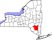
Ulster County New York incorporated and unincorporated areas Napanoch highlighted.svg
Location in Ulster County and the state of New York.
Coordinates: 41°44′54″N74°22′22″W / 41.74833°N 74.37278°W / 41.74833; -74.37278
Country United States
State New York
County Ulster
Area
[1]
  Total1.46 sq mi (3.79 km2)
  Land1.44 sq mi (3.72 km2)
  Water0.03 sq mi (0.07 km2)
Elevation
312 ft (95 m)
Population
 (2020)
  Total1,131
  Density787.60/sq mi (304.00/km2)
Time zone UTC-5 (EST)
  Summer (DST) UTC-4 (EDT)
ZIP code
12458
Area code 845
FIPS code 36-49418
GNIS feature ID0970395

Napanoch is a hamlet in Ulster County, New York, United States. It is at the junction of routes 209 and 55. The population was 1,131 at the 2020 census. Napanoch is on the Shawangunk Ridge National Scenic Byway, and is part of the Hudson River Valley National Heritage Area.

Contents

History

"Napanoch" is from the Munsee dialect of the northern Lenape, and is thought to mean land overflowed by water. [2] It is from the original deed to that area. Old Route 209 and Main Street follow the Minisink Trail, the Lenape path between the Hudson and Delaware Rivers. Louis Bevier, the New Paltz patentee, bought the area for two of his sons, Jean Bevier and Abram Bevier in 1705 or 1706.

The Hoornbeek Store Complex and Ontario and Western Railroad Passenger Station are listed on the National Register of Historic Places. [3] The imposing Eastern Correctional Facility was built by the state in 1900 as a reformatory. Since 1973 it has been a maximum security prison for men. [4]

Geography

Napanoch is in the Town of Wawarsing, in Ulster County (41.748231, -74.372710). [5]

According to the United States Census Bureau, the census-designated place ("CDP") has a total area of 1.2 square miles (3.1 km2), of which 1.2 square miles (3.1 km2) is land and 0.04 square miles (0.10 km2) (2.46%) is water.

Demographics

Historical population
CensusPop.Note
2000 1,168
2010 1,1740.5%
2020 1,131−3.7%
U.S. Decennial Census [6]

As of the census [7] of 2000, there were 1,168 people, 465 households, and 321 families residing in the CDP. The population density was 976.9 inhabitants per square mile (377.2/km2). There were 509 housing units at an average density of 425.7 per square mile (164.4/km2). The racial makeup of the CDP was 95.29% White, 1.20% African American, 0.09% Native American, 1.03% Asian, 0.26% from other races, and 2.14% from two or more races. Hispanic or Latino of any race were 3.00% of the population.

There were 465 households, out of which 32.7% had children under the age of 18 living with them, 52.9% were married couples living together, 12.5% had a female householder with no husband present, and 30.8% were non-families. 27.7% of all households were made up of individuals, and 13.8% had someone living alone who was 65 years of age or older. The average household size was 2.51 and the average family size was 3.01.

In the CDP, the population was spread out, with 26.2% under the age of 18, 6.4% from 18 to 24, 27.7% from 25 to 44, 25.3% from 45 to 64, and 14.3% who were 65 years of age or older. The median age was 38 years. For every 100 females, there were 89.9 males. For every 100 females age 18 and over, there were 85.0 males.

The median income for a household in the CDP was $35,221, and the median income for a family was $47,738. Males had a median income of $36,600 versus $29,063 for females. The per capita income for the CDP was $18,321. About 10.3% of families and 14.4% of the population were below the poverty line, including 24.0% of those under age 18 and 9.4% of those age 65 or over.

Notable people

Related Research Articles

<span class="mw-page-title-main">Fairton, New Jersey</span> Populated place in Cumberland County, New Jersey, US

Fairton is an unincorporated community and census-designated place (CDP) located within Fairfield Township, in Cumberland County, in the U.S. state of New Jersey. It is part of the Vineland-Millville-Bridgeton Primary Metropolitan Statistical Area for statistical purposes. As of the 2010 United States Census, the CDP's population was 1,264.

Stottville is a hamlet and census-designated place (CDP) in Columbia County, New York, United States. The population was 1,375 at the 2010 census.

<span class="mw-page-title-main">East Kingston, New York</span> CDP in New York, United States

East Kingston is a hamlet in Ulster County, New York, United States. The population was 277 at the 2020 census.

<span class="mw-page-title-main">Malden, New York</span> CDP in New York, United States

Malden-on-Hudson (-), commonly known as Malden, is a hamlet in Ulster County, New York, United States. The population was 365 at the 2020 census.

<span class="mw-page-title-main">Phoenicia, New York</span> CDP and hamlet in New York, United States

Phoenicia is a hamlet of Shandaken in Ulster County, New York, United States. The population was 268 at the 2020 census, making it the second highest populated community in the town. The village center is located just off Route 28 at its junction with Route 214 and is nestled at the base of three peaks, Mount Tremper, Romer Mountain, and Sheridan Mountain. The community sits at the confluence of the Esopus Creek and Stony Clove Creek. A popular getaway for New Yorkers, the hamlet has frequented many tourism guides as among the best vacation towns in the greater New York City area.

<span class="mw-page-title-main">Saugerties South, New York</span> CDP in New York, United States

Saugerties South is a hamlet in Ulster County, New York, United States. The population was 2,442 at the 2020 census.
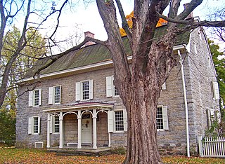
<span class="mw-page-title-main">Stone Ridge, New York</span> CDP in New York, United States

Stone Ridge is a hamlet in Ulster County, New York, United States. The population was 1,234 at the 2020 census.

<span class="mw-page-title-main">Tillson, New York</span> CDP in New York, United States

Tillson is a hamlet in Ulster County, New York, United States. The population was 1,516 at the 2020 census.

<span class="mw-page-title-main">Lenape Heights, Pennsylvania</span> Census-designated place in Pennsylvania, United States

Lenape Heights is a census-designated place (CDP) in Armstrong County, Pennsylvania, United States. The population was 1,144 at the 2020 census.
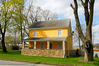
<span class="mw-page-title-main">Toughkenamon, Pennsylvania</span> Census-designated place in Pennsylvania, United States

Toughkenamon is a census-designated place (CDP) in New Garden Township, Chester County, Pennsylvania, United States. The population was 1,492 at the 2010 census.

<span class="mw-page-title-main">Hudson Bend, Texas</span> CDP in Texas, United States

Hudson Bend is a census-designated place (CDP) in Travis County, Texas, United States. The population was 2,981 at the 2010 census.

Germantown is a census-designated place (CDP) in the town of Germantown in Columbia County, New York, United States, on the east side of the Hudson River. The population of the CDP was 845 at the 2010 census, out of a total town population of 1,954.

Ghent is a census-designated place (CDP) in the town of Ghent in Columbia County, New York, United States. The population of the CDP was 564 at the 2010 census, out of a total town population of 5,402.

<span class="mw-page-title-main">Pine Plains (CDP), New York</span> Census-designated place in New York, United States

Pine Plains is a hamlet and census-designated place (CDP) in Dutchess County, New York, United States. The population was 1,142 at the 2020 census. It is part of the Poughkeepsie–Newburgh–Middletown, NY Metropolitan Statistical Area as well as the larger New York–Newark–Bridgeport, NY-NJ-CT-PA Combined Statistical Area.

<span class="mw-page-title-main">Pleasant Valley (CDP), New York</span> Census-designated place in New York, United States

Pleasant Valley is a census-designated place (CDP) in the southwestern part of the town of Pleasant Valley in Dutchess County, New York, United States. The population was 1,145 at the 2010 census. It is part of the Poughkeepsie–Newburgh–Middletown, NY Metropolitan Statistical Area as well as the larger New York–Newark–Bridgeport, NY-NJ-CT-PA Combined Statistical Area.

Cairo is a hamlet and census-designated place (CDP) in the town of Cairo in Greene County, New York, United States. The population of the CDP was 1,402 at the 2010 census, out of 6,610 people in the entire town.

<span class="mw-page-title-main">Hudson (CDP), Massachusetts</span> Census-designated place in Massachusetts, United States

Hudson is a census-designated place (CDP) comprising the densely developed central part of the town of Hudson in Middlesex County, Massachusetts, United States. The population of the CDP was 15,749 at the 2020 census, out of 20,092 in the entire town.

<span class="mw-page-title-main">Gardiner, New York</span> Town in New York, United States

Gardiner is a town in the south-central part of Ulster County, New York, United States. The population was 5,610 at the 2020 census.

<span class="mw-page-title-main">Woodstock (CDP), New York</span> CDP in New York, United States

Woodstock is a hamlet in Ulster County, New York, United States. The population was 2,088 according to the 2010 census. The community of Woodstock is in the eastern part of the Town of Woodstock and is northwest of Kingston. It is located along NY 212 near its junction with NY 375. Although the name of the community and the town lent its name to the Woodstock Festival, that event did not take place in Woodstock.

References

  1. "ArcGIS REST Services Directory". United States Census Bureau. Retrieved September 20, 2022.
  2. "ENYCF railroad station".
  3. "National Register Information System". National Register of Historic Places . National Park Service. July 9, 2010.
  4. "A Second Reformatory". correctionhistory.org. Retrieved September 19, 2016.
  5. "US Gazetteer files: 2010, 2000, and 1990". United States Census Bureau. February 12, 2011. Retrieved April 23, 2011.
  6. "Census of Population and Housing". Census.gov. Retrieved June 4, 2016.
  7. "U.S. Census website". United States Census Bureau . Retrieved January 31, 2008.