Katsbaan, New York

Last updated
View of Catskill Escarpment up New York State Route 32 from Katsbaan NY 32 approaching Catskills.jpg
View of Catskill Escarpment up New York State Route 32 from Katsbaan

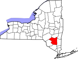
Katsbaan is a hamlet of the town of Saugerties in Ulster County, New York, United States, [1] located north of the village of Saugerties and south of Catskill.

The hamlet existed at least as far back as the American Revolution. The origin of the name, kaatsbaan, which means "tennis court", is linked to the original Dutch visitors to the area who saw lacrosse being played by native Iroquois which they thought resembled tennis.[ citation needed ] The hamlet's name is also at the origin of the name of the Catskill mountains. Note that Katsbaan is originally spelled Kaatsbaan (e.g. on the other side of the Hudson, in Tivoli NY, is a 'Kaatsbaan'). The Dutch double vowel didn't always survive in English (see Haarlem - Harlem). In Dutch, players on a 'kaatsbaan' are 'kaatsers'. North of Katsbaan is a stream (Dutch: 'kill') originally called Kaatsers kill, currently Kaaterskill Creek. Thus the creek gave its name to the mountains where it originated.

The hamlet was settled by Dutch farmers and German Palatines prior to 1730, and was deeded to the Dutch Reformed Church by 1732. A stone church that was constructed at that time was used as a landmark on Colonial American maps, and still stands today. [2]
Related Research Articles

<span class="mw-page-title-main">Ulster County, New York</span> County in New York, United States

Ulster County is a county in the U.S. state of New York. It is situated along the Hudson River. As of the 2020 census, the population was 181,851. The county seat is Kingston. The county is named after the Irish province of Ulster.

Jefferson Heights is a hamlet and census-designated place (CDP) in Greene County, New York, United States. The population was 1,122 at the 2020 census.

Leeds is a hamlet and census-designated place (CDP) in Greene County, New York, United States. The population was 377 at the 2010 census.

<span class="mw-page-title-main">Lexington, New York</span> Town in New York, United States

Lexington is a town in Greene County, New York, United States. The population was 770 at the 2020 census. The town is in the southwestern part of Greene County.

<span class="mw-page-title-main">Phoenicia, New York</span> CDP and hamlet in New York, United States

Phoenicia is a hamlet of Shandaken in Ulster County, New York, United States. The population was 268 at the 2020 census, making it the second highest populated community in the town. The village center is located just off Route 28 at its junction with Route 214 and is nestled at the base of three peaks, Mount Tremper, Romer Mountain, and Sheridan Mountain. The community sits at the confluence of the Esopus Creek and Stony Clove Creek. A popular getaway for New Yorkers, the hamlet has frequented many tourism guides as among the best vacation towns in the greater New York City area.

<span class="mw-page-title-main">Saugerties South, New York</span> CDP in New York, United States

Saugerties South is a hamlet in Ulster County, New York, United States. The population was 2,442 at the 2020 census.

<span class="mw-page-title-main">Shandaken, New York</span> Town in New York, United States

Shandaken is a town on the northern border of Ulster County, New York, United States, northwest of Kingston, New York. As of the 2020 census, the town had a total population of 2,866. The name is believed to be from an Esopus phrase for "land of rapid waters."

Cairo is a hamlet and census-designated place (CDP) in the town of Cairo in Greene County, New York, United States. The population of the CDP was 1,402 at the 2010 census, out of 6,610 people in the entire town.

<span class="mw-page-title-main">Catskill (town), New York</span> Town in New York, United States

Catskill is a town in the southeastern section of Greene County, New York, United States. The population was 11,298 at the 2020 census, the largest town in the county. The western part of the town is in the Catskill Park. The town contains a village, also called Catskill. The village of Catskill has a well-defined Main Street. There is a public boat launch on the Hudson River called Dutchman's Landing.

<span class="mw-page-title-main">Hunter, New York</span> Town in New York, United States

Hunter is a town located in Greene County, New York, United States. The population was 2,732 at the time of the 2010 census. The town contains two villages, one named Hunter on the west, and the second called Tannersville, as well as a number of hamlets such as Haines Falls, Platte Clove, Lanesville and Edgewood. Additionally, there are three residential parks location within town limits: Onteora Park, Twilight Park and Elka Park. The town is on the southern border of Greene County and abuts the towns of Woodstock and Saugerties, located in Ulster County.

<span class="mw-page-title-main">Windham (town), New York</span> Town in New York, United States

Windham is a town in Greene County, New York, United States. The population was 1,708 at the 2020 census. The town was probably named for the town or county of Windham, Connecticut, as many of its earliest settlers came from that state as well as other parts of New England. The town has two nicknames: "Land in the Sky" and "Gem of the Catskills".

<span class="mw-page-title-main">Esopus Creek</span> Tributary of the Hudson River in the Catskill region of New York state

Esopus Creek is a 65.4-mile-long (105.3 km) tributary of the Hudson River that drains the east-central Catskill Mountains in the U.S. state of New York. From its source at Winnisook Lake on the slopes of Slide Mountain, the Catskills' highest peak, it flows across Ulster County to the Hudson at Saugerties. Many tributaries extend its watershed into neighboring Greene County and a small portion of Delaware County. Midway along its length, it is impounded at Olive Bridge to create Ashokan Reservoir, the first of several built in the Catskills as part of New York City's water supply system. Its own flow is supplemented 13 miles (21 km) above the reservoir by the Shandaken Tunnel, which carries water from the city's Schoharie Reservoir into the creek.

<span class="mw-page-title-main">New York State Route 212</span> State highway in Ulster County, New York, US

New York State Route 212 (NY 212) is an east–west state highway located entirely within Ulster County, New York, in the United States. It runs for 21.92 miles (35.28 km) from an intersection with NY 28 in the interior of the Catskill Park to a junction with U.S. Route 9W (US 9W) and NY 32 on the west bank of the Hudson River, providing a key interchange with the New York State Thruway along the way. The mostly rural two-lane route serves the communities of Woodstock and Saugerties while passing Cooper Lake, Kingston's reservoir. NY 212 was assigned as part of the 1930 renumbering of state highways in New York.

<span class="mw-page-title-main">Platte Clove</span> Valley in New York State, USA

Platte Clove, sometimes Plattekill Clove, is a narrow and steep valley in the Catskill Mountains of New York.

<span class="mw-page-title-main">New York State Route 23A</span> State highway in Greene County, New York, US

New York State Route 23A (NY 23A) is an east–west state highway in Greene County, New York, in the United States. It serves as a 34.56-mile (55.62 km) alternate route of NY 23 through the northern Catskill Mountains. The route passes several of the Catskill High Peaks, including Hunter Mountain, before dropping into the Hudson Valley via Kaaterskill Clove and ending at an intersection with U.S. Route 9W (US 9W) in the village of Catskill. NY 23A was assigned in the mid-1920s and has not been changed since. A portion of the route through Kaaterskill Clove was closed for several months in 2006 after landslides triggered by heavy rains damaged the route.

Bearpen Mountain is a mountain located in the Catskill Mountains of New York. The mountain's highest peak is in Greene County, but its northwest subpeak at 42°16.42′N74°29.05′W is the highest point in Delaware County at 3,520 ft. Bearpen Mountain is flanked to the north by Roundtop, and to the southeast by Vly Mountain.

<span class="mw-page-title-main">Saugerties (village), New York</span> Village in Ulster County, New York, United States

Saugerties is a village in Ulster County, New York, United States. The population was 3,899 at the 2020 census, showing a slight decline from the 3,971 counted at the 2010 census.

<span class="mw-page-title-main">Saugerties, New York</span> Town in Ulster County, New York, United States

Saugerties is a town in the northeastern corner of Ulster County, New York. The population was 19,038 at the time of the 2020 Census, a decline from 19,482 in 2010. The village of the same name is located entirely within the town.

Cementon is a hamlet and census-designated place (CDP) in the town of Catskill in Greene County, New York, United States. It was first listed as a CDP prior to the 2020 census.

References

  1. "Katsbaan". Geographic Names Information System . United States Geological Survey, United States Department of the Interior . Retrieved April 28, 2016.
  2. "Village Of Saugerties: History". Village Of Saugerties. Retrieved April 28, 2016.

42°06′39″N73°58′06″W / 42.1109°N 73.9682°W / 42.1109; -73.9682