Related Research Articles

Valley Falls is a village in Rensselaer County, New York, United States. The population was 466 at the 2010 census. The village lies on the boundary of the towns of Pittstown and Schaghticoke, but is mostly in the northwestern part of Pittstown.

Rifton is a hamlet in Ulster County, New York, United States. The population was 481 at the 2020 census.

Shandaken is a town on the northern border of Ulster County, New York, United States, northwest of Kingston, New York. As of the 2020 census, the town had a total population of 2,866. The name is believed to be from an Esopus phrase for "land of rapid waters."

Scottdale is a borough in Westmoreland County, Pennsylvania, United States, 32 miles (51 km) southeast of Pittsburgh.

Morris is a town located in Otsego County, New York, United States. As of the 2010 census, the town had a population of 1,878. The town is named after General Jacob Morris.
Boston Corner is a hamlet of the town of Ancram in Columbia County, New York, United States and the town of Northeast in Dutchess County. The District of Boston Corner was incorporated by Massachusetts in 1838 from a tract of unincorporated land west of the town of Mount Washington, Massachusetts, and was ceded from Massachusetts to New York on January 11, 1855, because its geographical isolation from the rest of Massachusetts made maintaining law and order difficult.
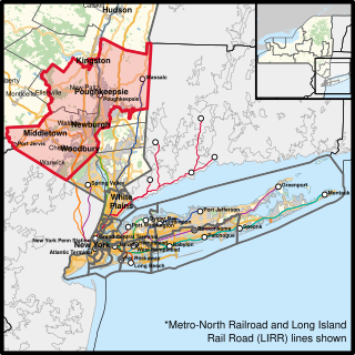
New York’s 18th congressional district is a congressional district for the United States House of Representatives that contains the northern suburbs and exurbs of New York City. It is currently represented by Democrat Pat Ryan.

Mount Vernon is an unincorporated community in the town of Springdale, Dane County, Wisconsin, United States.
West Saugerties is a hamlet in Ulster County, New York, United States and part of the Town of Saugerties.
Centerville is a small community in the Town of Saugerties, Ulster County, New York, United States. Centerville is located along New York State Route 212, approximately 2 mi (3.2 km) west of Interstate 87, and several miles east of Catskill State Park. The community is located at 42°08′42″N74°01′31″W.
Boiceville is a hamlet in the town of Olive, Ulster County, New York, United States. Located at the intersection of New York State Route 28 and New York State Route 28A, Boiceville is within Catskill State Park.
Big Indian is a hamlet within the Town of Shandaken in Ulster County, New York, United States. It is located along State Route 28, within the Catskill Park, 17 miles west of Woodstock. The Esopus Creek flows through the area, as Birch Creek feeds in from the north. Big Indian Hollow is located slightly to the west, while Big Indian Mountain sits to the southwest.
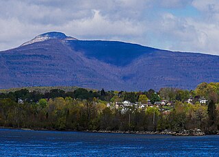
Mount Tremper is a hamlet in the Town of Shandaken in Ulster County, New York, United States. Mount Tremper is situated to the east of New York State Route 28 and to the north of New York State Route 212, within the Catskill Park. The community is located at 42°02′41″N74°16′32″W. It is named for nearby Mount Tremper.
Oliverea is a populated place in Ulster County, New York, United States. It is situated on Esopus Creek along Ulster Country Route 47 within Catskill State Park. The community is located at 42°03′55″N74°27′37″W in the Town of Shandaken.
The West End is the former name of the only neighborhood in Historic Downtown Jersey City, New Jersey that is entirely west of the New Jersey Turnpike's Newark Bay Extension.

The Sourlands is a region in the US state of New Jersey that includes portions of Hunterdon County, Mercer County and Somerset County. It is centered on Sourland Mountain and comprises parts of Lambertville, East Amwell, West Amwell, Hillsborough, Hopewell Boro, Hopewell Township, and Montgomery Township. The region is flanked by the Hopewell Fault to the south and Amwell Valley to the north that runs from Mount Airy to an area just west of Flagtown and a diabase formation running from Lambertville to Mount Airy. The Sourland also include a hilly area towards the southwest called Pleasant Valley, with a number of farms. Although much of the Sourlands is not conducive to farming, Pleasant Valley and the slopes on the surrounding ridges have a number of farms. The slopes of the ridge to the north are also home to Unionville Vineyard.

Gardiner is a town in the south-central part of Ulster County, New York, United States. The population was 5,610 at the 2020 census.
Saugerties is a town in the northeastern corner of Ulster County, New York. The population was 19,038 at the time of the 2020 Census, a decline from 19,482 in 2010. The village of the same name is located entirely within the town.
Mount Pleasant is an unincorporated community located along County Route 519 on the border of Alexandria Township and Holland Township, in Hunterdon County, New Jersey. The Mount Pleasant Historic District was listed on the National Register of Historic Places in 1987.
Gifford is a hamlet in Schenectady County, in the U.S. state of New York. A variant name was "Gifford's Corners".
References
- ↑ "Mount Pleasant". Geographic Names Information System . United States Geological Survey, United States Department of the Interior . Retrieved January 1, 2009.
- ↑ Sylvester, Nathaniel Bartlett. History of Ulster County, New York', Everts & Peck, 1880, p. 308
 This article incorporates text from this source, which is in the public domain .
| | This article about a location in Ulster County, New York is a stub. You can help Wikipedia by expanding it. |
Municipalities and communities of Ulster County, New York, United States | ||
|---|---|---|
| City |  | |
| Towns | ||
| Villages | ||
| CDPs |
| |
| Other hamlets |
| |
| Footnotes | ‡This populated place also has portions in an adjacent county or counties | |