Modena, New York

Last updated
Modena, New York
Country United States
State New York
County Ulster County
Time zone UTC-5 (Eastern (EST))
  Summer (DST) UTC-4 (EDT)
ZIP code
12548
Area code 845
Center of Modena at junction of routes 44/55 and 32. Modena, NY.jpg
Center of Modena at junction of routes 44/55 and 32.

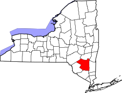
Modena is a hamlet in Ulster County, New York, United States. It is located in the northwestern corner of the town of Plattekill, centered at the junction of the US 44/NY 55 concurrency and NY 32.
Contents

History

The area was first settled in the late 17th century and was originally called "Clark's Corner". The name was changed to Modena in 1829, [1] and the hamlet most likely was named for the Italian city of Modena. [2] [3]

The Cole-Hasbrouck Farm Historic District and Thaddeus Hait Farm are listed on the National Register of Historic Places. [4]

Present Day

Modena has long been a primarily rural community with minimal development, although that has been changing enough for Hannaford to build one of its supermarkets on Route 32 just south of the junction in 2007. Additional commercial development in the immediate area has included a Stewart's gas and convenience store, a renovated Citgo station, a Dollar General, and newly built Dunkin Donuts in 2017.

Notable person

Notes

  1. Clearwater, Alphonso Trumpbour (1907). The History of Ulster County, New York. W. J. Van Deusen. p.  336 . Retrieved 22 July 2014. history of modena new york.
  2. "Profile for Modena, New York, NY". ePodunk. Retrieved July 22, 2014.
  3. Gannett, Henry (1905). The Origin of Certain Place Names in the United States. U.S. Government Printing Office. p.  211.
  4. "National Register Information System". National Register of Historic Places . National Park Service. July 9, 2010.
  5. "BRODHEAD, John Curtis, (1780 - 1859)". Biographical Directory of the United States Congress. Retrieved July 22, 2014.


41°40′05″N74°06′22″W / 41.6680°N 74.1061°W / 41.6680; -74.1061


Related Research Articles

<span class="mw-page-title-main">Clymer, New York</span> Town in New York, United States

Clymer is a town in Chautauqua County, New York, United States. The population was 1,748 at the 2020 census. The town is named for George Clymer, a signer of the Declaration of Independence. Clymer is located in the southwest part of the county.

Dickinson is a town in Franklin County, New York, United States. The population was 823 at the 2010 census. The town was named after Philemon Dickinson, a brigadier general of the New Jersey militia during the American Revolutionary War.

<span class="mw-page-title-main">Glen, New York</span> Town in New York, United States

Glen is a town in Montgomery County, New York, United States. The population was 2,507 at the 2010 census. The town was named after Jacob Glen, an early landowner.

<span class="mw-page-title-main">Roseboom, New York</span> Town in New York, United States

Roseboom is a town in Otsego County, New York, United States. The population was 711 at the 2010 census. The name of the town is taken from those of early landowners and settlers Abram and John Roseboom.

<span class="mw-page-title-main">Hoosick, New York</span> Town in New York, United States

Hoosick is a town in Rensselaer County, New York, United States. The population was 6,924 at the 2010 census. It was named from the Hoosic River.

<span class="mw-page-title-main">Colton, New York</span> Town in New York, United States

Colton is a town in St. Lawrence County, New York, United States. The population was 1,451 at the 2010 census. The town, originally named "Matildaville", is named after early settler Jesse Colton Higley.

<span class="mw-page-title-main">Rockland, New York</span> Town in Sullivan County, New York, US

Rockland is a town in the northern part of Sullivan County, New York, United States. At the 2020 census, the population was 3,290.

<span class="mw-page-title-main">Marlboro, New York</span> CDP in New York, United States

Marlboro is a hamlet in Ulster County, New York, United States. The population was 3,669 at the 2020 census. Marlboro is in the southeastern part of the town of Marlborough, located in the southeastern corner of the county.

<span class="mw-page-title-main">Shandaken, New York</span> Town in New York, United States

Shandaken is a town on the northern border of Ulster County, New York, United States, northwest of Kingston, New York. As of the 2020 census, the town had a total population of 2,866. The name is believed to be from an Esopus phrase for "land of rapid waters."

<span class="mw-page-title-main">Middlesex, New York</span> Town in New York, United States

Middlesex is a town in Yates County, New York, United States. The population was 1,495 at the 2010 census. The name originates from the county of Middlesex, England.

<span class="mw-page-title-main">Nassau (town), New York</span> Town in Rensselaer County, New York, US

Nassau is a town in Rensselaer County, New York, United States. The population was 4,789 at the 2010 census.

<span class="mw-page-title-main">New York State Route 55</span> State highway in southern New York, US

New York State Route 55 (NY 55) is a 122.45-mile-long (197.06 km) east-west state highway in southern New York, running from the Pennsylvania state line at the Delaware River in Barryville to the Connecticut state line at Wingdale. It is the only other state highway beside NY 7 to completely cross the state, from border to border, in an east–west direction, although NY 17 does so and is partially east–west. It also forms a concurrency when it joins US 44 for 33 miles (53 km).

<span class="mw-page-title-main">Grahamsville, New York</span> Hamlet and CDP in New York, United States

Grahamsville is a hamlet at the junction of NY 42 and 55 in the Town of Neversink, in Sullivan County, New York, United States. It is near the western end of Rondout Reservoir, and is the southernmost community in the Catskill Park. It has the ZIP Code 12740 and the 985 telephone exchange in the 845 area code.

Olivebridge is a hamlet in the town of Olive, Ulster County, New York, United States, within Catskill Park and the Catskill Mountains.

John Curtis Brodhead was an American politician in the U.S. state of New York. He represented New York in the United States House of Representatives for two non-consecutive terms from 1831 to 1833, and from 1837 to 1839.

<span class="mw-page-title-main">Cole–Hasbrouck Farm Historic District</span> Historic district in New York, United States

The Cole–Hasbrouck Farm Historic District is a historic home and farm and national historic district located along NY 32 north of the junction with US 44 and NY 55 at Modena, Ulster County, New York, USA. The district encompasses 21 contributing buildings, 4 contributing sites, and 5 contributing structures on a farm established in the 1820s. The main house was built about 1820, and is a two-story, five bay, brick and stone dwelling with a side gable roof. It has a two-story rear frame ell that subsumes and earlier 1 1/2-story kitchen ell. Other contributing resources are related to the house landscape and dependencies, the farm complex, and a hamlet that grew in the 1850s at the crossroads.

Boiceville is a hamlet in the town of Olive, Ulster County, New York, United States. Located at the intersection of New York State Route 28 and New York State Route 28A, Boiceville is within Catskill State Park.

<span class="mw-page-title-main">Gardiner, New York</span> Town in New York, United States

Gardiner is a town in the south-central part of Ulster County, New York, United States. The population was 5,610 at the 2020 census.

<span class="mw-page-title-main">Plattekill (town), New York</span> Place in New York, United States

Plattekill is a town in Ulster County, New York, United States. The population was 10,424 in 2020, a slight decrease from 10,499 at the 2010 census. The name is derived from a stream, the Platte Kill.