
Ulster County is a county in the U.S. state of New York. It is situated along the Hudson River. As of the 2020 census, the population was 181,851. The county seat is Kingston. The county is named after the Irish province of Ulster. The county is part of the Hudson Valley region of the state.

Kingston is an unincorporated community and census designated place (CDP) along the border of South Brunswick Township in Middlesex County and Franklin Township in Somerset County, and also located relatively near Princeton in Mercer County in the U.S. state of New Jersey. The historic settlement is in the Raritan Valley region, located along the course of the Millstone River. As of the 2020 census, the CDP's population was 1,581, of which 1,272 were in South Brunswick Township and 309 in Franklin Township.

Pine Bush is a hamlet located in the town of Crawford and adjacent to Shawangunk, New York, within Orange and adjacent to Ulster counties in the U.S. It is roughly coterminous with the 12566 ZIP code and 744 telephone exchange in the 845 area code. These both extend into adjacent regions of the town of Shawangunk in Ulster County.. The population was 1,751 at the 2020 census.

East Kingston is a hamlet in Ulster County, New York, United States. The population was 277 at the 2020 census.
High Falls is a hamlet in Ulster County, New York, United States. The population was 700 at the 2020 census.
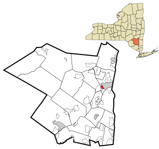
Hillside is a census-designated place (CDP) in Ulster County, New York, United States. The population was 860 at the 2020 census. It is located just south of the city of Kingston, and the Town of Ulster.

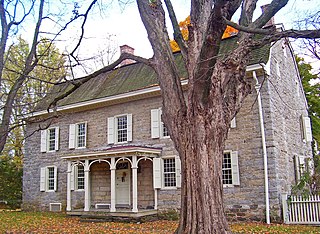
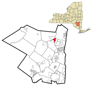
Marbletown is a town in Ulster County, New York, United States. The population was 5,658 at the 2020 census. It is located near the center of Ulster County, southwest of the City of Kingston. US 209 and NY 213 pass through the town. It is at the eastern edge of the Catskill Park.

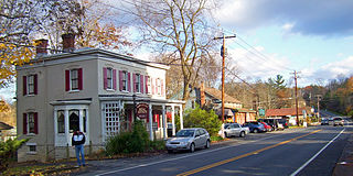
Marlboro is a hamlet in Ulster County, New York, United States. The population was 3,669 at the 2020 census. Marlboro is in the southeastern part of the town of Marlborough, located in the southeastern corner of the county.

Olive is a town in Ulster County, New York, United States. The town is west of Kingston, New York, and is inside the Catskill Park. The population was 4,226 at the 2020 census.

Pine Hill is a hamlet in the western part of the town of Shandaken in Ulster County, New York, United States. As of the 2020 census, the CDP had a total population of 275.

Rifton is a hamlet in Ulster County, New York, United States. The population was 481 at the 2020 census.

Shokan is a hamlet located in the town of Olive in Ulster County, New York, United States, within the Catskill Park. The population was 1,075 at the 2020 census.
Stone Ridge is a hamlet in Ulster County, New York, United States. The population was 1,234 at the 2020 census.

Tillson is a hamlet in Ulster County, New York, United States. The population was 1,516 at the 2020 census.

West Hurley is a hamlet in Ulster County, New York, United States. The population was 1,917 at the 2020 census.
Zena is a hamlet in Ulster County, New York, United States. As of the 2020 census the population was 1,038.

Hurley is a town in Ulster County, New York, United States. The population was 6,178 at the 2020 census. The town is in the northeastern part of the county, west of the city of Kingston. Much of the town is inside the Catskill Park. Located within the town is a hamlet and census-designated place, also named Hurley. The Town of Hurley comprises the hamlets of Hurley, West Hurley and Glenford.

Kingston is the only city in, and the county seat of, Ulster County, New York, United States. It is 91 miles (146 km) north of New York City and 59 miles (95 km) south of Albany. The city's metropolitan area is grouped with the New York metropolitan area around Manhattan by the United States Census Bureau. The population was 24,069 at the 2020 United States Census.

Plattekill is a town in Ulster County, New York, United States. The population was 10,424 in 2020, a slight decrease from 10,499 at the 2010 census. The name is derived from a stream, the Platte Kill.

Clinton is a town in Middlesex County, Connecticut, United States. The town is part of the Lower Connecticut River Valley Planning Region. The population of the town was 13,185 at the 2020 census. The town center along the shore line was listed as a census-designated place (CDP) by the U.S. Census Bureau in the 2020 census.


