Related Research Articles

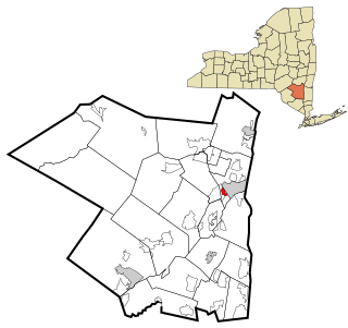
Ulster County is a county in the U.S. state of New York. It is situated along the Hudson River. As of the 2020 census, the population was 181,851. The county seat is Kingston. The county is named after the Irish province of Ulster. The county is part of the Hudson Valley region of the state.

Bethel Township is a civil township of Branch County in the U.S. state of Michigan. As of the 2020 census, the township population was 1,431.

Pine Bush is a hamlet located in the town of Crawford and adjacent to Shawangunk, New York, within Orange and adjacent to Ulster counties in the U.S. It is roughly coterminous with the 12566 ZIP code and 744 telephone exchange in the 845 area code. These both extend into adjacent regions of the town of Shawangunk in Ulster County.. The population was 1,751 at the 2020 census.
Hillside is a census-designated place (CDP) in Ulster County, New York, United States. The population was 860 at the 2020 census. It is located just south of the city of Kingston, and the Town of Ulster.

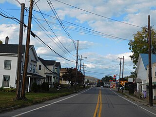
Kerhonkson is a hamlet and census-designated place (CDP) in Ulster County, New York, United States. The population was 1,722 at the 2020 census.

Rochester is a town in Ulster County, New York, United States. The population was 7,272 at the 2020 census. It is an interior town located near the center of Ulster County. The northwestern part of the town is in the Catskill Park.

Wawarsing is a town in Ulster County, New York, United States. The population was 12,771 at the 2020 census. The name Wawarsing was once believed to mean "a place where the streams wind" in the Lenape language, referring to the geography in the hamlet of Wawarsing. Specifically, the joining of the Ver Nooy Kill and the Rondout Creek at Port Ben. The name Wawarsing was used by the Lenape to designate the current hamlet and the fields to the north and south of it for at least six miles in both directions. It is the only Lenape name known to refer to an exact location in Ulster County.
Ulster Township is a township in Bradford County, Pennsylvania. It is part of Northeastern Pennsylvania. The population was 1,337 at the 2010 census.
Little Britain is an area in the town of New Windsor, Orange County, New York, United States, south of and adjacent to Stewart International Airport. The name spread to the surrounding region, which at that time was part of Ulster County.
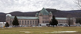
The Eastern Correctional Facility is a state prison for men in Napanoch, Ulster County, New York. Eastern is one of the oldest prison facilities in the state. It has been a maximum security prison for men since 1973.

Area codes 845 and 329 are telephone area codes in the North American Numbering Plan (NANP) for the U.S. state of New York. The numbering plan area comprises the mid- and lower Hudson Valley, specifically Orange, Putnam, Rockland, and Ulster counties, and parts of Columbia, Delaware, Dutchess, Greene, and Sullivan counties.

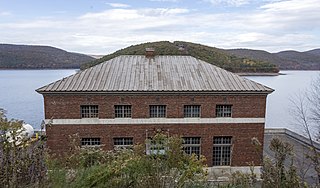
Brown's Station was a hamlet in the Esopus Valley of southeastern Ulster County, New York, United States. It was submerged by the waters of the Ashokan Reservoir, an artificial lake built between 1906 and 1915 to supply fresh water to New York City.

The Catskill Aqueduct, part of the New York City water supply system, brings water from the Catskill Mountains to Yonkers where it connects to other parts of the system.

Modena is a hamlet in Ulster County, New York, United States. It is located in the northwestern corner of the town of Plattekill, centered at the junction of the US 44/NY 55 concurrency and NY 32.
The East Delaware Tunnel is a 25-mile (40 km) aqueduct in the New York City water supply system. Located in the Catskill Mountains of New York State, it was constructed within a six-year period between 1949 and 1955 to transport drinking water from the Pepacton Reservoir to the Rondout Reservoir. The tunnel begins near the former site of Pepacton, New York, and ends near the former site of Eureka, New York, passing through Delaware County, Sullivan County and Ulster County. The tunnel has a maximum transmission capacity of 500 million US gallons (1,900,000 m3) per day and was constructed at a width of 11 feet (3.4 m).
Palentown is a hamlet in Ulster County, New York, United States.
Krumville is a hamlet in the southeastern corner of the town of Olive in Ulster County, New York, United States. It takes its name from one of the most prominent of the early Dutch families who settled the area. Krumville is bordered on the northwest by the Olive hamlet of Samsonville, on the north by the hamlet of Olivebridge, on the southeast by the town of Marbletown and on the southwest by the town of Rochester. It lies at an elevation of 774 feet above sea level.
Woodstock is an unincorporated community in Northampton County, Virginia, United States.

Lichfield Court, on Sheen Road in Richmond, London, consists of two Grade II listed purpose-built blocks of flats. Designed by Bertram Carter and built in fine Streamline Moderne style, it was completed in 1935.
Dwaarkill is a populated place in Ulster County, New York, United States.
References
Municipalities and communities of Ulster County, New York, United States | ||
|---|---|---|
| City |  | |
| Towns | ||
| Villages | ||
| CDPs |
| |
| Other hamlets |
| |
| Footnotes | ‡This populated place also has portions in an adjacent county or counties | |
41°50′51″N74°18′03″W / 41.84750°N 74.30083°W
| | This article about a location in Ulster County, New York is a stub. You can help Wikipedia by expanding it. |