Bearsville, New York

Last updated
Bearsville
Baehr's Store, Bearsville, NY, USA.jpg
Baehr's Store, for which Bearsville was named
USA New York location map.svg
Red pog.svg
Bearsville
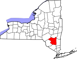
Location within the state of New York
Coordinates: 42°02′26.7″N74°09′18.7″W / 42.040750°N 74.155194°W / 42.040750; -74.155194 Coordinates: 42°02′26.7″N74°09′18.7″W / 42.040750°N 74.155194°W / 42.040750; -74.155194
Country United States
State New York
County Ulster
Government
part of town of Woodstock
  Typeunincorporated area
Elevation
600 ft (200 m)
Population
 (2000)
  Total700
Time zone UTC-5 (Eastern (EST))
  Summer (DST) UTC-4 (EDT)
ZIP codes
12409
Area code 845
GNIS feature ID943336

Bearsville is a hamlet in Ulster County, New York, United States, in the town of Woodstock. It is located along New York State Route 212, within Catskill State Park and just to the west of the hamlet of Woodstock. [1]

Bearsville was named not for the numerous local black bears, but for German peddler and storekeeper Christian Baehr, who built a store on the Sawkill Creek in 1839. [2] Places of interest in Bearsville, or named for it, include Bearsville Records and Bearsville Studios, and The Bearsville Theater and restaurant complex. [3]

The Bearsville post office (ZIP Code 12409) also covers the adjoining hamlets of Shady, and Wittenberg.

The highest known temperature in Bearsville was 101 °F (38 °C), which occurred in 1995. The lowest temperature was −27 °F (−33 °C), recorded in 1994. [4]

Related Research Articles

<span class="mw-page-title-main">Sullivan County, New York</span> County in New York, United States

Sullivan County is a county in the U.S. state of New York. As of the 2020 census, the population was 78,624. The county seat is Monticello. The county's name honors Major General John Sullivan, who was labeled at the time as a hero in the American Revolutionary War in part due to his successful campaign against the Iroquois.

<span class="mw-page-title-main">Scotchtown, New York</span> Hamlet and CDP in New York, United States

Scotchtown is a hamlet in the Town of Wallkill, in Orange County, New York, United States. The population was 10,578 at the 2020 census. It has the ZIP Code 10941. The hamlet is located east of the City of Middletown. It is part of the Poughkeepsie–Newburgh–Middletown, NY Metropolitan Statistical Area as well as the larger New York–Newark–Bridgeport, NY-NJ-CT-PA Combined Statistical Area.

<span class="mw-page-title-main">Wallkill, Orange County, New York</span> Town in New York, United States

Wallkill is a town in Orange County, New York, United States. The population was 30,486 at the 2020 census. It is centrally located in the county. Interstate 84 crosses New York State Route 17 in the southern part of the town. U.S. Route 6 and New York State routes 17K, 211 and 302 also cross portions of the town.

<span class="mw-page-title-main">Schodack, New York</span> Town in New York, United States

Schodack is a town in Rensselaer County, New York, United States. The population was 12,965 at the 2020 census. The town name is derived from the Mahican word, Escotak. The town is in the southwestern part of the county. Schodack is southeast of Albany, New York.

<span class="mw-page-title-main">Clifton Park, New York</span> Town in New York, United States

Clifton Park is a suburban town in Saratoga County, New York, United States. According to the United States Census Bureau, the 2020 population was 38,029. The name is derived from an early land patent. The town is in the southern part of Saratoga County, approximately 12 miles (19 km) north of Albany, 7 miles (11 km) northeast of Schenectady, and 10 miles (16 km) south of Saratoga Springs.

<span class="mw-page-title-main">Bethel, New York</span> Town in New York, United States

Bethel is a town in Sullivan County, New York, United States. The population was estimated at 4,255 in 2010. The town received worldwide attention after it served as the location of Woodstock in 1969, which was originally planned for Wallkill, New York, but was relocated to Bethel after Wallkill withdrew.

<span class="mw-page-title-main">Fremont, Sullivan County, New York</span> Town in New York, United States

Fremont is a town in Sullivan County, New York, United States. The population was 1,381 at the 2010 census.

<span class="mw-page-title-main">Islip, New York</span> Town in New York, United States

Islip is a town in Suffolk County, New York, United States, on the south shore of Long Island. The population was 335,543 at the 2010 census, making it the fourth most populous city or town in the state.

<span class="mw-page-title-main">Woodstock, Vermont</span> Town in Vermont, United States

Woodstock is the shire town of Windsor County, Vermont, United States. As of the 2020 census, the town population was 3,005. It includes the villages of Woodstock, South Woodstock, Taftsville, and West Woodstock.

<span class="mw-page-title-main">Woodstock, New Brunswick</span> Town on the Saint John River, western New Brunswick, Canada

Woodstock is a town in Carleton County, New Brunswick, Canada on the Saint John River, 103 km upriver from Fredericton at the mouth of the Meduxnekeag River. It is near the Canada–United States border and Houlton, Maine and the intersection of Interstate 95 and the Trans-Canada Highway making it a transportation hub. It is also a service centre for the potato industry and for more than 26,000 people in the nearby communities of Hartland, Florenceville-Bristol, Centreville, Bath, Meductic, and Canterbury for shopping, employment and entertainment.

<span class="mw-page-title-main">Tug Hill</span> Region in New York, United States

Tug Hill, sometimes referred to as the Tug Hill Plateau, is an upland region in northern New York State, famous for heavy winter snows. The Tug Hill region is east of Lake Ontario, north of Oneida Lake, and west of the Adirondack Mountains. The region is separated from the Adirondacks by the Black River Valley.

<span class="mw-page-title-main">Geography of Washington, D.C.</span> Overview of the geographical features of Washington, D.C.

Washington, D.C., in the United States, is located at 38°53′42″N77°02′11″W. According to the United States Census Bureau, the city has a geographical area of 68.3 square miles (176.9 km2), 61.4 square miles (159.0 km2) of which is land, and the remaining 6.9 square miles (17.9 km2) (10.16%) of which is water.

<span class="mw-page-title-main">Deadhorse, Alaska</span> Unincorporated community in the state of Alaska, United States

Deadhorse is an unincorporated community located within the CDP of Prudhoe Bay in North Slope Borough, Alaska, United States, along the North Slope near the Arctic Ocean. The town consists mainly of facilities for the workers and companies that operate at the nearby Prudhoe Bay Oil Field. Deadhorse is accessible via the Dalton Highway from Fairbanks, 495 mi (797 km) south, or Deadhorse Airport. Limited accommodation is also available for tourists.

<span class="mw-page-title-main">Woodstock College</span> Former Jesuit seminary in Maryland

Woodstock College was a Jesuit seminary that existed from 1869 to 1974. It was the oldest Jesuit seminary in the United States. The school was located in Woodstock, Maryland, west of Baltimore, from its establishment until 1969, when it moved to New York City, where it operated in cooperation with the Union Theological Seminary and the Jewish Theological Seminary. The school closed in 1974. It was survived by the Woodstock Theological Center, an independent, nonprofit Catholic research institute located at Georgetown University in Washington, D.C.

<span class="mw-page-title-main">New York State Route 212</span>

New York State Route 212 (NY 212) is an east–west state highway located entirely within Ulster County, New York, in the United States. It runs for 21.92 miles (35.28 km) from an intersection with NY 28 in the interior of the Catskill Park to a junction with U.S. Route 9W (US 9W) and NY 32 on the west bank of the Hudson River, providing a key interchange with the New York State Thruway along the way. The mostly rural two-lane route serves the communities of Woodstock and Saugerties while passing Cooper Lake, Kingston's reservoir. NY 212 was assigned as part of the 1930 renumbering of state highways in New York.

Bearsville Sound Studio was a recording studio founded by Albert Grossman 2 mi (3.2 km) west of Woodstock in Bearsville, New York in 1969.

<span class="mw-page-title-main">Gouldsboro State Park</span> State park in Monroe and Wayne counties, Pennsylvania

Gouldsboro State Park is a 2,880-acre (1,165 ha) Pennsylvania state park in Coolbaugh Township, Monroe County and Lehigh Township, Wayne County, Pennsylvania in the United States. The park includes the 250-acre (100 ha) Gouldsboro Lake. Gouldsboro State Park is located very close to Tobyhanna State Park and Pennsylvania State Game Lands 127 and 312. It is on Pennsylvania Route 507 near the small village of Gouldsboro.

<span class="mw-page-title-main">Huletts Landing, New York</span> Hamlet in New York, United States

Huletts Landing is a hamlet in the town of Dresden in northern Washington County, New York, United States. A lakeside community on the eastern shore of Lake George in the Adirondack Mountains, Huletts Landing is located entirely within the Adirondack Park. There is only one roadway access to the hamlet, County Route 6 and its suffixed routes, which head north–south. Huletts Landing is geographically located at 43°38′21″N73°30′25″W and has approximately two centuries of written history.

<span class="mw-page-title-main">Woodstock, New York</span> Town in New York, United States

Woodstock is a town in Ulster County, New York, United States, in the northern part of the county, northwest of Kingston, NY. It lies within the borders of the Catskill Park. The population was 5,884 at the 2010 census, down from 6,241 in 2000.

<span class="mw-page-title-main">F. H. Gillingham & Sons</span> General store in Woodstock, Vermont, U.S.

F. H. Gillingham & Sons is a historic general store in Woodstock, Vermont. Specializing in retail and mail order, the company was established in 1886 and is operated by the Billings family.

References

  1. "Bearsville, New York". Geographic Names Information System . United States Geological Survey, United States Department of the Interior . Retrieved 2008-10-22.
  2. "Baehr's Store - New York Historical Markers" . Retrieved 2012-04-26.
  3. "Bearsville Theater" . Retrieved 2012-04-26.
  4. "Monthly Averages for Bearsville, New York". The Weather Channel. Retrieved 2008-10-08.