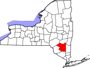
Greene County is a county located in the U.S. state of New York. As of the 2010 census, the population was 49,221. Its county seat is Catskill. The county's name is in honor of the American Revolutionary War general Nathanael Greene.
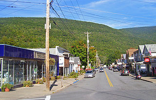
Phoenicia is a hamlet in Ulster County, New York, United States. The population was 309 at the 2010 census.

West Hurley is a hamlet in Ulster County, New York, United States. The population was 1,939 at the 2010 census.
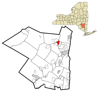
Zena is a hamlet in Ulster County, New York, United States. United States. As of the 2010 census the population was 1,031.
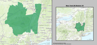
United States House of Representatives, New York District 19 is located in New York's Hudson Valley and Catskills regions. District 19 lies partially in the northernmost region of the New York metropolitan area and mostly south of Albany. It is currently represented by Democrat Antonio Delgado.
Shady is a hamlet in Ulster County, New York, United States. It is part of the town of Woodstock and lies on New York State Route 212.

The Shandaken Tunnel is an aqueduct in Eastern New York State, part of the New York City water supply system. It was constructed between 1916 and 1924. The tunnel starts in Gilboa, New York at the Schoharie Reservoir, which is in the counties of Schoharie, Delaware, and Greene. The water flows south towards the Esopus Creek in Ulster County. It finally empties into a man-made pool in Allaben, New York, within the Town of Shandaken, and enters Esopus Creek there.
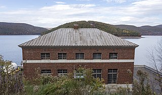
The East Delaware Tunnel is a 25-mile (40 km) aqueduct in the New York City water supply system. Located in the Catskill Mountains of New York State, it was constructed within a six-year period between 1949 and 1955 to transport drinking water from the Pepacton Reservoir to the Rondout Reservoir. The tunnel begins near the former site of Pepacton, New York, and ends near the former site of Eureka, New York, passing through Delaware County, Sullivan County and Ulster County. The tunnel has a maximum transmission capacity of 500 million US gallons (1,900,000 m3) per day and was constructed at a width of 11 feet (3.4 m).

The Ulster & Delaware Railroad Historical Society is a chapter of the National Railway Historical Society (NRHS). It focuses on the history of the railroads and related social, economic, and cultural institutions of the Catskill and Hudson Valley regions. That history, which began with the charter of the Catskill & Ithaca Railroad in 1828, encompasses numerous proposed and built railroads and trolley lines within Ulster, Delaware, Greene, Schoharie, Albany and Otsego counties.

Seager, New York is a former village in Ulster County, New York, U.S.A. within Catskill Park and the Catskill Mountains.
Vermontville is a hamlet in Franklin County in the state of New York. It is the seat of government of the town of Franklin. It is located near the south town line on New York State Route 3.

Echo Lake is a mountain lake within the Indian Head Wilderness of the Catskill Mountains, located in the valley between the two mountains Plattekill and Overlook, near Woodstock, New York, United States of America.
Centerville is a small community in Ulster County, New York, USA. Centerville is located along New York State Route 212, about 2 mi (3.2 km) west of Interstate 87, and several miles east of Catskill State Park. The community is located at 42°08′42″N74°01′31″W.
Boiceville is a community in the Ulster County, New York, USA. Boiceville is located at the intersection of New York State Route 28 and New York State Route 28A, within Catskill State Park and the Town of Olive.
Mount Pleasant is a populated place in Ulster County, New York, USA. Mount Pleasant is located along New York State Route 28 within Catskill State Park, to the south of Phoenicia and to the north of Boiceville. The community is located at 42°02′54″N74°17′21″W.
Mount Tremper is a hamlet in the Town of Shandaken in Ulster County, New York, United States. Mount Tremper is situated to the east of New York State Route 28 and to the north of New York State Route 212, within the Catskill Park. The community is located at 42°02′41″N74°16′32″W. It is named for nearby Mount Tremper.
Dwaarkill is a populated place in Ulster County, New York. The name was collected by the United States Geological Survey between 1976 and 1980 and entered into the Geographic Names Information System on January 23, 1980.

Woodstock is a hamlet in Ulster County, New York, United States. The population was 2,088 at the 2010 census. The community of Woodstock is in eastern part of the Town of Woodstock and is northeast of Kingston, New York. It is located along NY 212 near its junction with NY 375. Although the name of the community and the town lent its name to the Woodstock Festival, that event did not take place in Woodstock.


