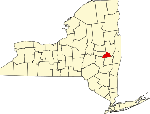
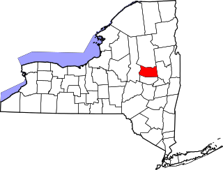
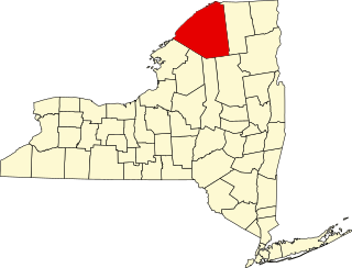
[3] Name on the Register Image Date listed [4] Location City or town Description 1 Abrahams Farmhouse Upload image October 11, 1984 (# 84003092 Hardin Rd. 42°48′30″N 74°11′25″W / 42.8083°N 74.1903°W / 42.8083; -74.1903 (Abrahams Farmhouse ) Duanesburg 2 Alexandra Apartment Hotel Upload image August 8, 2019 (# 100004246 1-3 State Street 42°48′55″N 73°56′57″W / 42.8154°N 73.9491°W / 42.8154; -73.9491 (Alexandra Apartment Hotel ) Schenectady 1900 long-term residence built in Queen Anne Style for workers at nearby GE facility 3 Avery Farmhouse Upload image October 11, 1984 (# 84003106 NY 30 42°46′11″N 74°14′00″W / 42.7697°N 74.2333°W / 42.7697; -74.2333 (Avery Farmhouse ) Duanesburg 4 H. S. Barney Building Upload image July 19, 1984 (# 84002965 217-229 State St. 42°48′55″N 73°56′44″W / 42.8153°N 73.9456°W / 42.8153; -73.9456 (H. S. Barney Building ) Schenectady 5 Becker Farmhouse Upload image October 11, 1984 (# 84003114 Creek Rd. 42°45′07″N 74°15′43″W / 42.7519°N 74.2619°W / 42.7519; -74.2619 (Becker Farmhouse ) Duanesburg 6 Bishop Family Lustron House Upload image March 6, 2008 (# 08000144 26 Slater Dr. 42°53′20″N 73°54′52″W / 42.8889°N 73.9144°W / 42.8889; -73.9144 (Bishop Family Lustron House ) Glenville 7 Joseph Braman House Joseph Braman House April 24, 1987 (# 87000917 Braman's Corners 42°48′31″N 74°13′10″W / 42.8086°N 74.2194°W / 42.8086; -74.2194 (Joseph Braman House ) Duanesburg 8 Brandywine Avenue School Upload image December 9, 1999 (# 99001491 108 Brandywine Ave. 42°48′08″N 73°55′29″W / 42.8022°N 73.9247°W / 42.8022; -73.9247 (Brandywine Avenue School ) Schenectady Destroyed by fire in November 2007 9 George Washington Carver Community Center Upload image October 16, 2020 (# 100005677 700 Craig St. 42°48′09″N 73°56′16″W / 42.8025°N 73.9378°W / 42.8025; -73.9378 (George Washington Carver Community Center ) Schenectady 10 Central Fire Station Upload image April 11, 1985 (# 85000729 Erie Blvd. 42°48′48″N 73°56′47″W / 42.8133°N 73.9464°W / 42.8133; -73.9464 (Central Fire Station ) Schenectady 11 Chadwick Farmhouse Upload image October 11, 1984 (# 84003175 Schoharie Tpk. 42°44′17″N 74°10′16″W / 42.7381°N 74.1711°W / 42.7381; -74.1711 (Chadwick Farmhouse ) Duanesburg 12 Chapman Farmhouse Chapman Farmhouse October 11, 1984 (# 84003176 Miller's Corners Rd. 42°48′44″N 74°13′16″W / 42.8122°N 74.2211°W / 42.8122; -74.2211 (Chapman Farmhouse ) Duanesburg 13 Christ Episcopal Church Christ Episcopal Church April 24, 1987 (# 87000911 NY 20 42°46′07″N 74°09′17″W / 42.7686°N 74.1547°W / 42.7686; -74.1547 (Christ Episcopal Church ) Duanesburg 14 Christman Bird and Wildlife Sanctuary Christman Bird and Wildlife Sanctuary August 25, 1970 (# 70000433 Schoharie Tpke. 42°44′27″N 74°07′30″W / 42.7408°N 74.125°W / 42.7408; -74.125 (Christman Bird and Wildlife Sanctuary ) Delanson 15 Clark Witbeck Co. Warehouse Upload image July 31, 2023 (# 100009168 132-136 Broadway 42°48′50″N 73°56′32″W / 42.8140°N 73.9422°W / 42.8140; -73.9422 (Clark Witbeck Co. Warehouse ) Schenectady 16 Delanson Historic District Delanson Historic District October 11, 1984 (# 84003181 Main St. 42°44′35″N 74°11′16″W / 42.7431°N 74.1878°W / 42.7431; -74.1878 (Delanson Historic District ) Delanson 17 Dellemont-Wemple Farm Upload image October 25, 1973 (# 73001266 W of Schenectady on Wemple Rd. 42°46′16″N 74°00′30″W / 42.7711°N 74.0083°W / 42.7711; -74.0083 (Dellemont-Wemple Farm ) Rotterdam 18 Duane Mansion Duane Mansion April 24, 1987 (# 87000910 NY 20 42°45′16″N 74°07′41″W / 42.7544°N 74.1281°W / 42.7544; -74.1281 (Duane Mansion ) Duanesburg 19 Duanesburg-Florida Baptist Church Upload image October 11, 1984 (# 84003185 NY 30 42°48′31″N 74°12′58″W / 42.8086°N 74.2161°W / 42.8086; -74.2161 (Duanesburg-Florida Baptist Church ) Duanesburg 20 Eatons Corners Historic District Upload image October 11, 1984 (# 84003196 Eatons Corners Rd. 42°48′21″N 74°14′50″W / 42.8058°N 74.2472°W / 42.8058; -74.2472 (Eatons Corners Historic District ) Duanesburg 21 Elmer Avenue School Upload image November 21, 2022 (# 100008387 90 Elmer Ave. 42°48′37″N 73°55′17″W / 42.8102°N 73.9213°W / 42.8102; -73.9213 (Elmer Avenue School ) Schenectady 22 Enlarged Double Lock No. 23, Old Erie Canal Enlarged Double Lock No. 23, Old Erie Canal March 6, 2008 (# 08000145 Rice Rd. 42°49′25″N 73°59′13″W / 42.8236°N 73.9869°W / 42.8236; -73.9869 (Enlarged Double Lock No. 23, Old Erie Canal ) Rotterdam 23 Ferguson Farm Complex Ferguson Farm Complex April 24, 1987 (# 87000913 NY 20 42°45′37″N 74°06′56″W / 42.7603°N 74.1156°W / 42.7603; -74.1156 (Ferguson Farm Complex ) Duanesburg 24 First Unitarian Society Church First Unitarian Society Church February 5, 2014 (# 13001157 1221 Wendell Ave. 42°48′57″N 73°55′28″W / 42.8157314°N 73.9243425°W / 42.8157314; -73.9243425 (First Unitarian Society Church ) Schenectady Modernist Edward Durrell Stone church in GE Realty Plot district 25 Fitzgerald Building Upload image May 19, 2021 (# 100006517 144-148 Clinton St. 42°48′45″N 73°56′24″W / 42.8126°N 73.9401°W / 42.8126; -73.9401 (Fitzgerald Building ) Schenectady 26 Foster Building Foster Building June 3, 1991 (# 91000664 508 State St. 42°48′42″N 73°56′27″W / 42.811667°N 73.940833°W / 42.811667; -73.940833 (Foster Building ) Schenectady First terra-cotta building in city, and first building to show influence of City Beautiful movement , when built in 1907 27 Franklin School Upload image June 30, 1983 (# 83001791 Ave. B and Mason St. 42°49′23″N 73°55′21″W / 42.823056°N 73.9225°W / 42.823056; -73.9225 (Franklin School ) Schenectady 28 Gaige Homestead Upload image October 11, 1984 (# 84003202 Weaver Rd. 42°44′53″N 74°09′09″W / 42.748056°N 74.1525°W / 42.748056; -74.1525 (Gaige Homestead ) Duanesburg 29 General Electric Realty Plot General Electric Realty Plot November 18, 1980 (# 80002763 Roughly bounded by Oxford Pl., Union Ave., Nott St., Lenox and Lowell Rds. 42°49′01″N 73°55′14″W / 42.816944°N 73.920556°W / 42.816944; -73.920556 (General Electric Realty Plot ) Schenectady Former Union College property bought by GE in late 19th century for executives and researchers to build upscale homes on. 30 General Electric Research Laboratory General Electric Research Laboratory May 15, 1975 (# 75001227 General Electric main plant 42°48′39″N 73°57′06″W / 42.810833°N 73.951667°W / 42.810833; -73.951667 (General Electric Research Laboratory ) Schenectady First research laboratory established by an American corporation 31 Gilbert Farmhouse Upload image October 11, 1984 (# 84003207 Thousand Acre Rd. 42°44′30″N 74°14′38″W / 42.741667°N 74.243889°W / 42.741667; -74.243889 (Gilbert Farmhouse ) Duanesburg 32 Abraham Glen House Abraham Glen House July 14, 2004 (# 04000708 Mohawk Ave. 42°49′27″N 73°57′35″W / 42.824167°N 73.959722°W / 42.824167; -73.959722 (Abraham Glen House ) Scotia Rare Dutch heavy timber frame house, built in 1730s, is now Scotia's branch of the county public library 33 Glenville District No. 5 Schoolhouse Upload image May 19, 2014 (# 14000226 2140 Potter Rd. 42°56′22″N 74°04′53″W / 42.9394787°N 74.0814489°W / 42.9394787; -74.0814489 (Glenville District No. 5 Schoolhouse ) Glenville 34 Joseph Green Farmhouse Upload image October 11, 1984 (# 84003209 NY 159 42°49′43″N 74°10′43″W / 42.828611°N 74.178611°W / 42.828611; -74.178611 (Joseph Green Farmhouse ) Duanesburg 35 Halladay Farmhouse Upload image October 11, 1984 (# 84003213 US 20 42°45′59″N 74°12′49″W / 42.766389°N 74.213611°W / 42.766389; -74.213611 (Halladay Farmhouse ) Duanesburg 36 Hawes Homestead Upload image October 11, 1984 (# 84003217 Herrick Rd. 42°47′35″N 74°12′39″W / 42.793056°N 74.210833°W / 42.793056; -74.210833 (Hawes Homestead ) Duanesburg 37 Hotel Van Curler Hotel Van Curler September 12, 1985 (# 85002277 78 Washington Ave. 42°48′54″N 73°56′58″W / 42.815°N 73.949444°W / 42.815; -73.949444 (Hotel Van Curler ) Schenectady 1925 building now Elston Hall of the Schenectady County Community College 38 Horace Mann School Upload image November 24, 2015 (# 15000824 602 Craig St. 42°48′12″N 73°56′24″W / 42.803373°N 73.9398947°W / 42.803373; -73.9398947 (Horace Mann School ) Schenectady 1908 school built to accommodate rising enrollment in a growing neighborhood 39 Howard Homestead Upload image October 11, 1984 (# 84003220 McGuire School Rd. 42°46′39″N 74°13′44″W / 42.7775°N 74.228889°W / 42.7775; -74.228889 (Howard Homestead ) Duanesburg 40 Jenkins House Jenkins House October 11, 1984 (# 84003071 57 Main St. 42°44′46″N 74°11′19″W / 42.746111°N 74.188611°W / 42.746111; -74.188611 (Jenkins House ) Delanson 41 Jenkins Octagon House Jenkins Octagon House October 11, 1984 (# 84003227 NY 395 42°45′31″N 74°11′07″W / 42.758611°N 74.185278°W / 42.758611; -74.185278 (Jenkins Octagon House ) Duanesburg 42 A.D. (Boss) Jones House A.D. (Boss) Jones House October 11, 1984 (# 84003231 McGuire School Rd. 42°46′20″N 74°12′53″W / 42.772222°N 74.214722°W / 42.772222; -74.214722 (A.D. (Boss) Jones House ) Duanesburg 43 George Westinghouse Jones House Upload image September 15, 2004 (# 04000998 1944 Union St. 42°47′39″N 73°53′11″W / 42.794167°N 73.886389°W / 42.794167; -73.886389 (George Westinghouse Jones House ) Niskayuna 44 Ladd Farmhouse Upload image October 11, 1984 (# 84003238 Dare Rd. 42°47′18″N 74°13′33″W / 42.788333°N 74.225833°W / 42.788333; -74.225833 (Ladd Farmhouse ) Duanesburg 45 Irving Langmuir House Irving Langmuir House January 7, 1976 (# 76001275 1176 Stratford Rd. 42°48′58″N 73°55′09″W / 42.816111°N 73.919167°W / 42.816111; -73.919167 (Irving Langmuir House ) Schenectady Home of Irving Langmuir , 1932 Nobel laureate in chemistry and first industrial chemist so honored. During his career at GE, improved functioning of light bulb, developed concentric model of atom, co-developed cloud seeding and was among first scientists to work with plasmas. 46 George Lasher House Upload image October 11, 1984 (# 84003242 Levey Rd. 42°50′11″N 74°09′16″W / 42.836389°N 74.154444°W / 42.836389; -74.154444 (George Lasher House ) Duanesburg 47 Alexander Liddle Farmhouse Upload image October 11, 1984 (# 84003256 Gamsey Rd. 42°46′42″N 74°12′26″W / 42.778333°N 74.207222°W / 42.778333; -74.207222 (Alexander Liddle Farmhouse ) Duanesburg 48 Robert Liddle Farmhouse Upload image October 11, 1984 (# 84003265 Little Dale Farm Rd. 42°46′34″N 74°07′21″W / 42.776111°N 74.1225°W / 42.776111; -74.1225 (Robert Liddle Farmhouse ) Duanesburg 49 Thomas Liddle Farm Complex Upload image October 11, 1984 (# 84003247 Eaton Corners Rd. 42°47′51″N 74°14′23″W / 42.7975°N 74.239722°W / 42.7975; -74.239722 (Thomas Liddle Farm Complex ) Duanesburg 50 Mabee House Mabee House May 22, 1978 (# 78001907 S of Rotterdam Junction on NY 5S 42°51′56″N 74°01′56″W / 42.865556°N 74.032222°W / 42.865556; -74.032222 (Mabee House ) Rotterdam Junction 51 Macomber Stone House Upload image October 11, 1984 (# 84003266 Barton Hill Rd. 42°43′17″N 74°12′52″W / 42.721389°N 74.214444°W / 42.721389; -74.214444 (Macomber Stone House ) Duanesburg 52 Mariaville Historic District Mariaville Historic District October 11, 1984 (# 84003267 NY 159 42°49′42″N 74°08′08″W / 42.828333°N 74.135556°W / 42.828333; -74.135556 (Mariaville Historic District ) Duanesburg 53 Mica Insulator Company Upload image January 4, 2012 (# 11001007 797 & 845 Broadway 42°48′14″N 73°57′06″W / 42.803817°N 73.951756°W / 42.803817; -73.951756 (Mica Insulator Company ) Schenectady 54 New York State Barge Canal New York State Barge Canal October 15, 2014 (# 14000860 Linear across county 42°49′13″N 73°56′44″W / 42.820191°N 73.945574°W / 42.820191; -73.945574 (New York State Barge Canal ) Schenectady, Glenville, Niskayuna, Rotterdam, Scotia Successor to Erie Canal approved by state voters in early 20th century to compete with railroads 55 Niskayuna Railroad Station Niskayuna Railroad Station November 19, 2007 (# 07001205 N. side River Rd., Lyons Park 42°46′47″N 73°49′25″W / 42.779722°N 73.823611°W / 42.779722; -73.823611 (Niskayuna Railroad Station ) Niskayuna 56 Niskayuna Reformed Church Niskayuna Reformed Church April 18, 1979 (# 79001628 3041 Troy-Schenectady Rd. 42°46′34″N 73°49′56″W / 42.776111°N 73.832222°W / 42.776111; -73.832222 (Niskayuna Reformed Church ) Niskayuna 57 North Mansion and Tenant House North Mansion and Tenant House April 24, 1987 (# 87000909 North Mansion Rd. 42°45′13″N 74°06′52″W / 42.753611°N 74.114444°W / 42.753611; -74.114444 (North Mansion and Tenant House ) Duanesburg 58 Nott Memorial Hall Nott Memorial Hall May 5, 1972 (# 72000912 Union College campus 42°49′02″N 73°55′49″W / 42.817222°N 73.930278°W / 42.817222; -73.930278 (Nott Memorial Hall ) Schenectady 16-sided domed building at center of campus considered fine example of Victorian Gothic . Has had many uses over years; completely restored in 1990s. 59 Nott Street School Upload image December 29, 2011 (# 11000970 487 Nott St. 42°49′14″N 73°55′52″W / 42.820683°N 73.931133°W / 42.820683; -73.931133 (Nott Street School ) Schenectady 60 F. F. Proctor Theatre and Arcade F. F. Proctor Theatre and Arcade October 4, 1979 (# 79003237 432 State St. 42°48′44″N 73°56′31″W / 42.812222°N 73.941944°W / 42.812222; -73.941944 (F. F. Proctor Theatre and Arcade ) Schenectady 1926 theater recently renovated. One of the most lavish in nation when built; hosted first public demonstration of television in 1930. 61 Quaker Street Historic District Quaker Street Historic District October 11, 1984 (# 84003270 Schoharie Tpk., Gallupville and Darby Hill Rds. 42°44′01″N 74°11′16″W / 42.733611°N 74.187778°W / 42.733611; -74.187778 (Quaker Street Historic District ) Duanesburg 62 Reformed Presbyterian Church Parsonage Upload image October 11, 1984 (# 84003271 Duanesburg Churches Rd. 42°46′16″N 74°09′26″W / 42.771111°N 74.157222°W / 42.771111; -74.157222 (Reformed Presbyterian Church Parsonage ) Duanesburg 63 Rosendale Common School Upload image July 19, 2010 (# 10000482 2572 Rosendale Rd. 42°47′46″N 73°51′31″W / 42.796111°N 73.858611°W / 42.796111; -73.858611 (Rosendale Common School ) Niskayuna vicinity 64 Schenectady Armory Schenectady Armory March 2, 1995 (# 95000087 125 Washington Ave. 42°48′48″N 73°56′58″W / 42.813333°N 73.949444°W / 42.813333; -73.949444 (Schenectady Armory ) Schenectady Intact 1936 Art Deco armory, unusually located in center (at the time) of city rather than outskirts 65 Schenectady City Hall and Post Office Schenectady City Hall and Post Office October 11, 1978 (# 78001908 Jay St. 42°48′51″N 73°56′22″W / 42.814167°N 73.939444°W / 42.814167; -73.939444 (Schenectady City Hall and Post Office ) Schenectady 1931 McKim, Mead and White building with window arches matching nearby post office 66 Schenectady Police Department Upload image August 5, 2022 (# 100007961 301 Clinton St. 42°48′40″N 73°56′32″W / 42.8110°N 73.9422°W / 42.8110; -73.9422 (Schenectady Police Department ) Schenectady 67 Schenectady Public Market and Scale House Upload image January 27, 2022 (# 100007377 Bounded by Clinton St., Van Guysling Ave., Broadway, and Hamilton St. 42°48′36″N 73°56′42″W / 42.8101°N 73.9451°W / 42.8101; -73.9451 (Schenectady Public Market and Scale House ) Schenectady 68 Schenectady Savings Bank Upload image March 16, 2022 (# 100007378 500 State St. 42°48′43″N 73°56′26″W / 42.8119°N 73.9406°W / 42.8119; -73.9406 (Schenectady Savings Bank ) Schenectady 69 Seeley Farmhouse Upload image May 23, 1978 (# 78001909 2 Freeman's Bridge Rd. 42°49′54″N 73°55′50″W / 42.831667°N 73.930556°W / 42.831667; -73.930556 (Seeley Farmhouse ) Glenville 70 Sheldon Farmhouse Upload image October 11, 1984 (# 84003273 NY 7 42°43′27″N 74°15′20″W / 42.724167°N 74.255556°W / 42.724167; -74.255556 (Sheldon Farmhouse ) Duanesburg 71 Shute Octagon House Shute Octagon House October 11, 1984 (# 84003276 McGuire School Rd. 42°46′28″N 74°13′10″W / 42.774444°N 74.219444°W / 42.774444; -74.219444 (Shute Octagon House ) Duanesburg 72 St. Columba's School Upload image December 1, 2015 (# 15000853 400 Craig St. 42°48′19″N 73°56′18″W / 42.8052632°N 73.9383525°W / 42.8052632; -73.9383525 (St. Columba's School ) Schenectady 1923 school was central to city's Irish Catholic population 73 St. Mary's Catholic Church Complex Upload image June 12, 2017 (# 100001071 820-828 Eastern Ave. & 104 Irving St. 42°48′41″N 73°55′41″W / 42.811425°N 73.927928°W / 42.811425; -73.927928 (St. Mary's Catholic Church Complex ) Schenectady vicinity Stone church and several other buildings erected in early 20th century to serve the city's growing Polish immigrant population remained in use until 2009 74 Stockade Historic District Stockade Historic District April 3, 1973 (# 73001267 Roughly bounded by Mohawk River, RR tracks, and Union St. 42°49′07″N 73°56′47″W / 42.818611°N 73.946389°W / 42.818611; -73.946389 (Stockade Historic District ) Schenectady Oldest section of city, with many houses dating to 18th century 75 Swart House and Tavern Upload image January 4, 2007 (# 06001211 130 Johnson Rd. 42°53′10″N 74°03′02″W / 42.886111°N 74.050556°W / 42.886111; -74.050556 (Swart House and Tavern ) Glenville 76 Union Street Historic District Union Street Historic District November 17, 1982 (# 82001268 Union St. from Hudson River to Phoenix Ave. 42°48′46″N 73°55′41″W / 42.812778°N 73.928056°W / 42.812778; -73.928056 (Union Street Historic District ) Schenectady Intact 19th century development along main axis of city's expansion during that period. 77 US Post Office-Schenectady US Post Office-Schenectady May 11, 1989 (# 88002429 29 Jay St. [5] 42°48′53″N 73°56′21″W / 42.814722°N 73.939167°W / 42.814722; -73.939167 (US Post Office-Schenectady ) Schenectady 1912 neoclassical building added onto during Depression 78 US Post Office-Scotia Station US Post Office-Scotia Station May 11, 1989 (# 88002430 224 Mohawk Ave. 42°49′38″N 73°57′59″W / 42.827222°N 73.966389°W / 42.827222; -73.966389 (US Post Office-Scotia Station ) Scotia Detailed Colonial Revival post office built 1939–40 79 Vale Cemetery and Vale Park Vale Cemetery and Vale Park September 24, 2004 (# 04001053 907 State St., Nott Terrace 42°48′26″N 73°55′45″W / 42.807222°N 73.929167°W / 42.807222; -73.929167 (Vale Cemetery and Vale Park ) Schenectady (Article on the combo of Vale Cemetery AND the park is needed) 80 Wedgeway Building Wedgeway Building June 17, 2022 (# 100007805 271-277 State St. 42°48′52″N 73°56′39″W / 42.8144°N 73.9443°W / 42.8144; -73.9443 (Wedgeway Building ) Schenectady Originally the old Proctor's Theatre, which opened April 8, 1912 and closed in December 1926 when the new Proctor's Theatre opened at 432 State Street. Re-opened in April 1927 as Wedgeway Theatre and renamed Erie Theatre in September 1930. [6] 81 Joseph Wing Farm Complex Upload image October 11, 1984 (# 84003279 NY 30 42°43′47″N 74°17′10″W / 42.729722°N 74.286111°W / 42.729722; -74.286111 (Joseph Wing Farm Complex ) Duanesburg 82 William R. Wing Farm Complex Upload image October 11, 1984 (# 84003281 US 20 42°45′52″N 74°14′15″W / 42.764444°N 74.2375°W / 42.764444; -74.2375 (William R. Wing Farm Complex ) Duanesburg 83 Yates House Upload image January 31, 2019 (# 100003396 133 Maple Ave. 42°51′31″N 73°54′29″W / 42.858545°N 73.908079°W / 42.858545; -73.908079 (Yates House ) Schenectady 84 Young Men's Christian Association of Schenectady Upload image December 1, 2015 (# 15000854 9–13 State St. 42°48′55″N 73°57′03″W / 42.8153687°N 73.9507533°W / 42.8153687; -73.9507533 (Young Men's Christian Association of Schenectady ) Schenectady 1928 building dates to first national spurt of YMCA growth