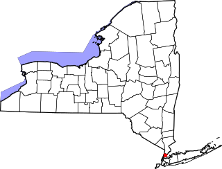
[3] Name on the Register Image Date listed [4] Location City or town Description 1 Albany Felt Company Complex Albany Felt Company Complex February 14, 2014 (# 14000001 1373 Broadway 42°40′34″N 73°44′12″W / 42.676164°N 73.7365487°W / 42.676164; -73.7365487 (Albany Felt Company Complex ) Menands Early 20th-century factory complex with extensive landscaping 2 Albany Glassworks Site Upload image July 22, 1980 (# 80002583 Address Restricted Guilderland 3 Albany Rural Cemetery Albany Rural Cemetery October 25, 1979 (# 79001566 Cemetery Ave. 42°42′21″N 73°44′12″W / 42.705833°N 73.736667°W / 42.705833; -73.736667 (Albany Rural Cemetery ) Colonie Albany Rural Cemetery was incorporated in 1841, and is one of the oldest examples of the rural cemetery movement in America. The cemetery was consecrated on October 7, 1844. 4 Alcove Historic District Alcove Historic District July 24, 1980 (# 80002582 SR 11 and Alcove Rd. 42°28′10″N 73°55′36″W / 42.469444°N 73.926667°W / 42.469444; -73.926667 (Alcove Historic District ) Alcove 5 Altamont Historic District Altamont Historic District November 10, 1982 (# 82001054 Main St. between Thacher Dr. and the RR station 42°42′06″N 74°01′51″W / 42.701667°N 74.030833°W / 42.701667; -74.030833 (Altamont Historic District ) Altamont 6 Apple Tavern Apple Tavern November 10, 1982 (# 82001055 4450 Altamont Rd. 42°42′37″N 73°58′28″W / 42.710278°N 73.974444°W / 42.710278; -73.974444 (Apple Tavern ) Guilderland 7 Aumic House Upload image November 10, 1982 (# 82001056 Leesome Ln. 42°41′15″N 74°02′05″W / 42.6875°N 74.034722°W / 42.6875; -74.034722 (Aumic House ) Guilderland 8 Dr. John Babcock House Upload image December 10, 2003 (# 03001278 101 Lasher Rd. 42°32′58″N 73°48′47″W / 42.549444°N 73.813056°W / 42.549444; -73.813056 (Dr. John Babcock House ) Selkirk 9 Bacon-Stickney House Bacon-Stickney House October 3, 1985 (# 85002709 441 Loudon Rd. 42°42′23″N 73°45′18″W / 42.706389°N 73.755°W / 42.706389; -73.755 (Bacon-Stickney House ) Colonie 10 Beattie Machine Works Beattie Machine Works November 23, 2022 (# 100008404 24 Amity St. 42°46′14″N 73°42′43″W / 42.7705°N 73.7120°W / 42.7705; -73.7120 (Beattie Machine Works ) Cohoes 11 Bennett Hill Farm Upload image December 5, 2003 (# 03001241 Bennett Hill Rd. at Rowe Rd. 42°34′13″N 73°57′22″W / 42.570278°N 73.956111°W / 42.570278; -73.956111 (Bennett Hill Farm ) New Scotland 12 Bethlehem Grange No. 137 Upload image January 11, 2002 (# 01001443 24 Bridge St. 42°32′54″N 73°48′38″W / 42.548333°N 73.810556°W / 42.548333; -73.810556 (Bethlehem Grange No. 137 ) Selkirk 13 Bethlehem House Bethlehem House April 11, 1973 (# 73001158 E of Bethlehem off NY 144 42°32′38″N 73°46′00″W / 42.543889°N 73.766667°W / 42.543889; -73.766667 (Bethlehem House ) Bethlehem 14 Fletcher Blaisdell Farm Complex Upload image March 12, 2001 (# 01000246 Westerlo St. 42°28′20″N 73°48′00″W / 42.472222°N 73.8°W / 42.472222; -73.8 (Fletcher Blaisdell Farm Complex ) Coeymans 15 Dr. Wesley Blaisdell House Dr. Wesley Blaisdell House July 17, 2012 (# 12000418 S. Main St. 42°28′20″N 73°47′35″W / 42.4721619°N 73.7930043°W / 42.4721619; -73.7930043 (Dr. Wesley Blaisdell House ) Coeymans Landing 16 Bryan's Store Bryan's Store October 4, 1979 (# 79003246 435 Loudon Rd. 42°42′20″N 73°45′17″W / 42.705556°N 73.754722°W / 42.705556; -73.754722 (Bryan's Store ) Loudonville 17 Senator William T. Byrne House Upload image October 3, 1985 (# 85002703 463 Loudon Rd. 42°42′35″N 73°45′19″W / 42.709722°N 73.755278°W / 42.709722; -73.755278 (Senator William T. Byrne House ) Colonie 18 Chapel House Upload image November 10, 1982 (# 82001057 Western Ave. 42°40′55″N 73°49′51″W / 42.681944°N 73.830833°W / 42.681944; -73.830833 (Chapel House ) Guilderland 19 Clarksville Elementary School Upload image July 3, 2008 (# 08000580 58 Verda Lane 42°34′38″N 73°57′16″W / 42.577303°N 73.954325°W / 42.577303; -73.954325 (Clarksville Elementary School ) Clarksville Modern Movement -style school built in 1949 20 Coeymans Landing Historic District Upload image March 26, 2018 (# RS100001767 4th and Main Sts. 42°28′29″N 73°47′34″W / 42.4748°N 73.7928°W / 42.4748; -73.7928 (Coeymans Landing Historic District ) Coeymans One of state's oldest continuously occupied settlements, since 1673 21 Coeymans School Coeymans School December 29, 1970 (# 70000418 SW corner of Westerlo St. and Civill Ave. 42°28′22″N 73°47′55″W / 42.472778°N 73.798611°W / 42.472778; -73.798611 (Coeymans School ) Coeymans 22 Ariaanje Coeymans House Ariaanje Coeymans House October 18, 1972 (# 72000819 Stone House Rd. 42°28′35″N 73°47′32″W / 42.476389°N 73.792222°W / 42.476389; -73.792222 (Ariaanje Coeymans House ) Coeymans 23 Coeymans-Bronck Stone House Upload image November 15, 2003 (# 03001148 NY 144 42°27′59″N 73°47′30″W / 42.466389°N 73.791667°W / 42.466389; -73.791667 (Coeymans-Bronck Stone House ) Coeymans 24 Conkling–Boardman–Eldridge Farm Upload image February 2, 2016 (# 15001022 348 Albany Hill Road 42°31′13″N 74°07′23″W / 42.520295°N 74.122964°W / 42.520295; -74.122964 (Conkling–Boardman–Eldridge Farm ) Rensselaerville 1806 farm established by one of the first families to settle in Rensselaerville 25 Coppola House Upload image November 10, 1982 (# 82001058 Leesome Ln. 42°41′28″N 74°02′32″W / 42.691111°N 74.042222°W / 42.691111; -74.042222 (Coppola House ) Guilderland 26 Frederick Cramer House Frederick Cramer House October 3, 1985 (# 85002704 410 Albany-Shaker Rd. 42°41′53″N 73°46′12″W / 42.698056°N 73.77°W / 42.698056; -73.77 (Frederick Cramer House ) Colonie 27 Frederick Crouse House Upload image November 10, 1982 (# 82001059 3960 Altamont-Voorheesville Rd. 42°40′49″N 74°01′13″W / 42.680278°N 74.020278°W / 42.680278; -74.020278 (Frederick Crouse House ) Guilderland 28 Jacob Crouse Inn Upload image November 10, 1982 (# 82001060 3933 Altamont Rd. 42°42′18″N 74°01′10″W / 42.705°N 74.019444°W / 42.705; -74.019444 (Jacob Crouse Inn ) Guilderland 29 John and Henry Crouse Farm Complex Upload image November 10, 1982 (# 82001061 3970 Altamont-Voorheesville Rd. 42°40′33″N 74°01′01″W / 42.675833°N 74.016944°W / 42.675833; -74.016944 (John and Henry Crouse Farm Complex ) Guilderland 30 D. D. T. Moore Farmhouse Upload image October 4, 1979 (# 79003244 352 Loudon Rd. 42°41′36″N 73°45′20″W / 42.693333°N 73.755556°W / 42.693333; -73.755556 (D. D. T. Moore Farmhouse ) Loudonville 31 Delaware and Hudson Railroad Freight House Delaware and Hudson Railroad Freight House February 20, 1998 (# 98000135 116 Saratoga Ave. 42°46′20″N 73°41′56″W / 42.772222°N 73.698889°W / 42.772222; -73.698889 (Delaware and Hudson Railroad Freight House ) Cohoes 32 Delaware and Hudson Railroad Passenger Station Delaware and Hudson Railroad Passenger Station August 12, 1971 (# 71000524 Main St. and the Delaware and Hudson RR 42°42′03″N 74°01′59″W / 42.700833°N 74.033056°W / 42.700833; -74.033056 (Delaware and Hudson Railroad Passenger Station ) Altamont 33 William J. Dickey House William J. Dickey House February 20, 1998 (# 98000138 16 Imperial Ave. 42°46′16″N 73°42′23″W / 42.771111°N 73.706389°W / 42.771111; -73.706389 (William J. Dickey House ) Cohoes Intact 1890 Stick -Eastlake home with jerkined front roof built for textile mill manager. 34 District School No. 1 Upload image May 20, 1998 (# 98000553 NY 144 42°33′11″N 73°46′12″W / 42.553056°N 73.77°W / 42.553056; -73.77 (District School No. 1 ) Bethlehem 35 District School No. 7 District School No. 7 May 16, 1996 (# 96000562 NY 143, approximately .25 miles (0.40 km) west of the junction with Co. Rt. 103 42°28′26″N 73°54′01″W / 42.473889°N 73.900278°W / 42.473889; -73.900278 (District School No. 7 ) Coeymans Hollow 36 Downtown Cohoes Historic District Downtown Cohoes Historic District September 13, 1984 (# 84002060 Roughly bounded by Oneida, Van Rensselaer, Columbia, Main, and Olmstead Sts. 42°46′24″N 73°42′03″W / 42.773333°N 73.700833°W / 42.773333; -73.700833 (Downtown Cohoes Historic District ) Cohoes 1820-1930 core of community showing effects of development started by canal and textile industry 37 Martin Dunsbach House Upload image October 3, 1985 (# 85002705 140 Dunsbach Ferry Rd. 42°47′06″N 73°45′25″W / 42.785°N 73.756944°W / 42.785; -73.756944 (Martin Dunsbach House ) Colonie 38 Enlarged Erie Canal Historic District (Discontiguous) Enlarged Erie Canal Historic District (Discontiguous) May 14, 2004 (# 04000434 City of Cohoes, roughly from S to NW city boundary 42°51′20″N 73°42′09″W / 42.855556°N 73.7025°W / 42.855556; -73.7025 (Enlarged Erie Canal Historic District (Discontiguous) ) Cohoes 39 Fine Arts and Flower Building Altamont Fairground Fine Arts and Flower Building Altamont Fairground January 28, 2004 (# 03001518 Altamont Fairgrounds, vic. of Grand St. 42°41′54″N 74°01′46″W / 42.698333°N 74.029444°W / 42.698333; -74.029444 (Fine Arts and Flower Building Altamont Fairground ) Altamont 40 Fonda House Upload image April 21, 2004 (# 04000351 55 Western Ave. 42°46′09″N 73°43′41″W / 42.769167°N 73.728056°W / 42.769167; -73.728056 (Fonda House ) Cohoes 41 Freeman House Freeman House November 10, 1982 (# 82001062 136 Main St. 42°42′08″N 73°57′50″W / 42.702222°N 73.963889°W / 42.702222; -73.963889 (Freeman House ) Guilderland 42 Fuller's Tavern Upload image November 10, 1982 (# 82001063 6861 Western Tpk. 42°43′12″N 73°57′26″W / 42.72°N 73.957222°W / 42.72; -73.957222 (Fuller's Tavern ) Guilderland 43 Royal K. Fuller House Upload image October 3, 1985 (# 85002706 294 Loudon Rd. 42°41′00″N 73°45′11″W / 42.683333°N 73.753056°W / 42.683333; -73.753056 (Royal K. Fuller House ) Colonie 44 Gardner House Upload image November 10, 1982 (# 82001064 5661 Gardner Rd. 42°40′19″N 74°00′04″W / 42.671944°N 74.001111°W / 42.671944; -74.001111 (Gardner House ) Guilderland 45 Gifford Grange Hall Gifford Grange Hall November 10, 1982 (# 82001065 Western Tpk. 42°44′23″N 74°00′54″W / 42.739722°N 74.015°W / 42.739722; -74.015 (Gifford Grange Hall ) Guilderland 46 Gillespie House Gillespie House November 10, 1982 (# 82001066 2554 Western Tpk 42°42′45″N 73°55′48″W / 42.7125°N 73.93°W / 42.7125; -73.93 (Gillespie House ) Guilderland 47 Godfrey Farmhouse Upload image October 4, 1979 (# 79003240 1313 Loudon Rd. 42°48′28″N 73°44′05″W / 42.807778°N 73.734722°W / 42.807778; -73.734722 (Godfrey Farmhouse ) Cohoes 48 Goodrich School Goodrich School September 22, 2000 (# 00001156 Fiddlers Ln. 42°43′43″N 73°44′46″W / 42.728611°N 73.746111°W / 42.728611; -73.746111 (Goodrich School ) Colonie 49 Gorham House Upload image October 4, 1979 (# 79003239 347 Loudon Rd. 42°41′30″N 73°45′06″W / 42.691667°N 73.751667°W / 42.691667; -73.751667 (Gorham House ) Loudonville 50 Hiram Griggs House Upload image July 19, 2010 (# 10000483 111 Prospect Terrace 42°42′06″N 74°02′07″W / 42.701667°N 74.035278°W / 42.701667; -74.035278 (Hiram Griggs House ) Altamont 51 Guilderland Cemetery Vault Upload image November 10, 1982 (# 82001067 In Guilderland Cemetery, NY 158 42°42′45″N 73°59′16″W / 42.7125°N 73.987778°W / 42.7125; -73.987778 (Guilderland Cemetery Vault ) Guilderland 52 Hamilton Union Church Rectory Upload image November 10, 1982 (# 82001068 2267 Western Tpk. 42°42′10″N 73°54′27″W / 42.702778°N 73.9075°W / 42.702778; -73.9075 (Hamilton Union Church Rectory ) Guilderland 53 Hamilton Union Presbyterian Church Hamilton Union Presbyterian Church November 10, 1982 (# 82001069 2291 Western Tpk. 42°42′14″N 73°54′32″W / 42.703889°N 73.908889°W / 42.703889; -73.908889 (Hamilton Union Presbyterian Church ) Guilderland 54 Harmony Mill No. 3 Harmony Mill No. 3 February 18, 1971 (# 71000525 100 N. Mohawk St. 42°46′54″N 73°42′19″W / 42.781667°N 73.705278°W / 42.781667; -73.705278 (Harmony Mill No. 3 ) Cohoes 55 Harmony Mills Historic District Harmony Mills Historic District January 12, 1978 (# 78003151 Between Mohawk River and RR tracks 42°46′54″N 73°42′34″W / 42.781667°N 73.709444°W / 42.781667; -73.709444 (Harmony Mills Historic District ) Cohoes Thousand-foot-long textile mill built in 1872 is preserved in excellent condition. The largest cotton mill in the United States when first built; was a major employer in the city when open. 56 Isaac M. Haswell House Upload image October 3, 1985 (# 85002707 67 Haswell Rd. 42°44′54″N 73°43′34″W / 42.748333°N 73.726111°W / 42.748333; -73.726111 (Isaac M. Haswell House ) Colonie 57 Hayes House Hayes House January 17, 1973 (# 73001157 104 Fairview Ave. 42°41′57″N 74°01′52″W / 42.699167°N 74.031111°W / 42.699167; -74.031111 (Hayes House ) Altamont 58 Hedge Lawn Upload image October 3, 1985 (# 85002710 592 Broadway 42°42′21″N 73°42′55″W / 42.705833°N 73.715278°W / 42.705833; -73.715278 (Hedge Lawn ) Colonie 59 Helderberg Reformed Dutch Church Upload image November 10, 1982 (# 82001070 140 Main St. 42°42′10″N 73°57′52″W / 42.702778°N 73.964444°W / 42.702778; -73.964444 (Helderberg Reformed Dutch Church ) Guilderland 60 Henry-Remsen House Upload image October 3, 1985 (# 85002711 34 Spring St. 42°42′58″N 73°45′02″W / 42.716111°N 73.750556°W / 42.716111; -73.750556 (Henry-Remsen House ) Colonie 61 Ebenezer Hills Jr. Farmhouse Upload image October 3, 1985 (# 85002712 1010 Troy–Schenectady Rd. 42°45′44″N 73°48′10″W / 42.762222°N 73.802778°W / 42.762222; -73.802778 (Ebenezer Hills Jr. Farmhouse ) Colonie 62 Adam Hilton House Upload image November 10, 1982 (# 82001071 6073 Leesome Ln. 42°41′31″N 74°02′19″W / 42.691944°N 74.038611°W / 42.691944; -74.038611 (Adam Hilton House ) Guilderland 63 Houck Farmhouse Upload image November 10, 1982 (# 82001072 6156 Ostrander Rd. 42°41′53″N 73°56′48″W / 42.698056°N 73.946667°W / 42.698056; -73.946667 (Houck Farmhouse ) Guilderland 64 Abraham Houghtaling House Upload image February 20, 1998 (# 98000134 54 Church St. 42°28′28″N 73°47′56″W / 42.474444°N 73.798889°W / 42.474444; -73.798889 (Abraham Houghtaling House ) Coeymans Landing 65 Teunis Houghtaling House Upload image July 28, 2004 (# 04000751 1045 Clarksville South Rd. 42°33′53″N 73°58′32″W / 42.564722°N 73.975556°W / 42.564722; -73.975556 (Teunis Houghtaling House ) Clarksville 66 House at 698 Kenwood Avenue House at 698 Kenwood Avenue February 7, 2012 (# 11001087 698 Kenwood Avenue 42°37′43″N 73°51′45″W / 42.628473°N 73.862481°W / 42.628473; -73.862481 (House at 698 Kenwood Avenue ) Slingerlands 67 Hughson Mansion Upload image October 4, 1979 (# 79003245 374 Loudon Rd. 42°41′45″N 73°45′19″W / 42.695833°N 73.755278°W / 42.695833; -73.755278 (Hughson Mansion ) Loudonville 68 Friend Humphrey House Upload image October 3, 1985 (# 85002713 372 Albany-Shaker Rd. 42°41′32″N 73°45′49″W / 42.692222°N 73.763611°W / 42.692222; -73.763611 (Friend Humphrey House ) Colonie 69 John Wolf Kemp House Upload image October 3, 1985 (# 85002714 216 Wolf Rd. 42°43′33″N 73°47′57″W / 42.725833°N 73.799167°W / 42.725833; -73.799167 (John Wolf Kemp House ) Colonie Was demolished in May 2003 [5] 70 Knower House Upload image November 10, 1982 (# 82001073 3921 Altamont Rd. 42°42′17″N 74°01′13″W / 42.704722°N 74.020278°W / 42.704722; -74.020278 (Knower House ) Guilderland 71 Knox District School No. 5 Upload image May 19, 2005 (# 05000441 Ketchum Rd. 42°39′38″N 74°02′43″W / 42.660556°N 74.045278°W / 42.660556; -74.045278 (Knox District School No. 5 ) Knox 72 J. Leonard Lackman House J. Leonard Lackman House February 20, 1998 (# 98000136 28 Imperial Ave. 42°46′15″N 73°42′23″W / 42.770833°N 73.706389°W / 42.770833; -73.706389 (J. Leonard Lackman House ) Cohoes Intact 1895 Queen Anne-style home of local gunsmith-locksmith 73 Lainhart Farm Complex and Dutch Barn Lainhart Farm Complex and Dutch Barn June 8, 2001 (# 01000579 6755 Lainhart 42°43′26″N 74°01′56″W / 42.723889°N 74.032222°W / 42.723889; -74.032222 (Lainhart Farm Complex and Dutch Barn ) Altamont 74 John V. A. Lansing Farmhouse and Billsen Cemetery and Archeological Site Upload image October 3, 1985 (# 85002715 Address Restricted Colonie 75 George H. Lawton House Upload image October 3, 1985 (# 85002741 27 Maxwell Rd. 42°43′28″N 73°45′24″W / 42.724444°N 73.756667°W / 42.724444; -73.756667 (George H. Lawton House ) Colonie 76 LeGrange Farmstead LeGrange Farmstead December 7, 2005 (# 05001384 122 Pauley Ln. 42°39′13″N 73°52′56″W / 42.653611°N 73.882222°W / 42.653611; -73.882222 (LeGrange Farmstead ) Slingerlands 77 Lock 18 of Enlarged Erie Canal Lock 18 of Enlarged Erie Canal February 18, 1971 (# 71000526 W of 252 N. Mohawk St., E of Reservoir St. near Manor Ave. 42°47′08″N 73°42′44″W / 42.785556°N 73.712222°W / 42.785556; -73.712222 (Lock 18 of Enlarged Erie Canal ) Cohoes High-quality stonework of this ca. 1840 lock on Erie Canal remains; only one of ten in city of Cohoes listed. 78 Loudon Road Historic District Upload image October 4, 1979 (# 79003247 Loudon Rd. from Crumite Rd. to Menands Rd. 42°42′02″N 73°45′17″W / 42.700556°N 73.754722°W / 42.700556; -73.754722 (Loudon Road Historic District ) Loudonville 79 Mark House Upload image August 29, 2022 (# 100008066 99 Johnson Rd. 42°45′54″N 73°44′02″W / 42.7649°N 73.7339°W / 42.7649; -73.7339 (Mark House ) Colonie 80 Matton Shipyard Matton Shipyard July 24, 2009 (# 09000553 Delaware Ave. 42°46′46″N 73°40′50″W / 42.779444°N 73.680556°W / 42.779444; -73.680556 (Matton Shipyard ) Cohoes 81 Brigadier General David McCarty Stone Cottage Upload image July 28, 2015 (# 15000474 29 2nd St. 42°28′29″N 73°47′32″W / 42.4746°N 73.7921°W / 42.4746; -73.7921 (Brigadier General David McCarty Stone Cottage ) Coeymans Landing Mid-18th-century residence of militia officer who served in the Continental Army 82 McKownville-Country Club Highlands Historic District Upload image June 2, 2022 (# 100007747 Western Ave., Waverly Pl., Norwood, Glenwood, Parkwood, and Elmwood Sts. 42°40′51″N 73°50′06″W / 42.6807°N 73.8351°W / 42.6807; -73.8351 (McKownville-Country Club Highlands Historic District ) Guilderland 83 McNiven Farm Complex Upload image November 10, 1982 (# 82001074 4178 Altamont Rd. 42°42′20″N 74°00′10″W / 42.705556°N 74.002778°W / 42.705556; -74.002778 (McNiven Farm Complex ) Guilderland 84 Menand Park Historic District Upload image October 3, 1985 (# 85002708 Roughly bounded by Menand Rd., Broadway, and Tillinghast Ave. 42°41′38″N 73°43′27″W / 42.693889°N 73.724167°W / 42.693889; -73.724167 (Menand Park Historic District ) Menands 85 Louis Menand House Upload image October 3, 1985 (# 85002742 40 Cemetery Ave. 42°42′10″N 73°43′24″W / 42.702778°N 73.723333°W / 42.702778; -73.723333 (Louis Menand House ) Colonie 86 Menands Manor Upload image October 3, 1985 (# 85002743 272 Broadway 42°41′35″N 73°43′31″W / 42.693056°N 73.725278°W / 42.693056; -73.725278 (Menands Manor ) Colonie 87 Mull House and Cemetery Mull House and Cemetery July 22, 1999 (# 99000871 65 Fox St. 42°30′17″N 73°46′55″W / 42.504722°N 73.781944°W / 42.504722; -73.781944 (Mull House and Cemetery ) Coeymans 88 Music Hall Music Hall February 18, 1971 (# 71000527 NW corner of Remsen and Oneida Sts. 42°46′34″N 73°42′07″W / 42.776111°N 73.701944°W / 42.776111; -73.701944 (Music Hall ) Cohoes 1874 brick building is most significant Second Empire building in Cohoes, with highly decorated facade unusual for the style. Still in use as theater after 1975 restoration, making it fourth-oldest music hall in use in the nation. 89 Mynderse-Frederick House Mynderse-Frederick House November 10, 1982 (# 82001075 152 Main St. 42°42′10″N 73°57′55″W / 42.702778°N 73.965278°W / 42.702778; -73.965278 (Mynderse-Frederick House ) Guilderland 90 Newtonville Post Office Newtonville Post Office March 14, 1973 (# 73001162 552 New Loudon Rd. (NY 9) [6] 42°43′20″N 73°45′26″W / 42.722222°N 73.757222°W / 42.722222; -73.757222 (Newtonville Post Office ) Newtonville 91 Newtonville School Upload image September 22, 2000 (# 00001155 543 Loudon Rd. 42°43′15″N 73°45′21″W / 42.720833°N 73.755833°W / 42.720833; -73.755833 (Newtonville School ) Newtonville 92 Newtonville United Methodist Church Newtonville United Methodist Church May 30, 2001 (# 01000580 Louden Rd. at Maxwell Rd. 42°43′28″N 73°45′36″W / 42.724444°N 73.76°W / 42.724444; -73.76 (Newtonville United Methodist Church ) Newtonville 93 New York State Barge Canal New York State Barge Canal October 15, 2014 (# 14000860 Linear across county 42°47′43″N 73°42′51″W / 42.795153°N 73.714231°W / 42.795153; -73.714231 (New York State Barge Canal ) Colonie and Cohoes Successor to Erie Canal approved by state voters in early 20th century to compete with railroads 94 Norman Vale Upload image December 11, 2009 (# 09001079 6030 Nott Rd. 42°41′21″N 73°54′20″W / 42.6893°N 73.905478°W / 42.6893; -73.905478 (Norman Vale ) Guilderland 95 Ohio Street Methodist Episcopal Church Complex Ohio Street Methodist Episcopal Church Complex December 8, 2005 (# 05001393 1921 Third Ave. 42°43′52″N 73°42′11″W / 42.731092°N 73.702939°W / 42.731092; -73.702939 (Ohio Street Methodist Episcopal Church Complex ) Watervliet 96 Olmstead Street Historic District Olmstead Street Historic District June 19, 1973 (# 73001159 Olmstead St. between Ontario and Cayuga Sts. 42°46′30″N 73°42′12″W / 42.775°N 73.703333°W / 42.775; -73.703333 (Olmstead Street Historic District ) Cohoes Mill, portion of original Erie Canal and homes built for millworkers, all dating from mid-19th century. A microcosm of the city's economy of that era. 97 Onesquethaw Valley Historic District Upload image January 17, 1974 (# 74001216 About 10 miles (16 km) southwest of Albany off NY 43 42°33′20″N 73°54′15″W / 42.555556°N 73.904167°W / 42.555556; -73.904167 (Onesquethaw Valley Historic District ) New Scotland 98 Stephen Pangburn House Stephen Pangburn House November 10, 1982 (# 82001076 2357 Old State 42°44′35″N 73°58′58″W / 42.743056°N 73.982778°W / 42.743056; -73.982778 (Stephen Pangburn House ) Guilderland 99 Charles Parker House Charles Parker House November 10, 1982 (# 82001077 2273 Old State 42°44′31″N 73°59′21″W / 42.741944°N 73.989167°W / 42.741944; -73.989167 (Charles Parker House ) Guilderland 100 Patterson Farmhouse Upload image April 28, 1997 (# 96001427 47 Murray Ave. 42°36′38″N 73°50′33″W / 42.610556°N 73.8425°W / 42.610556; -73.8425 (Patterson Farmhouse ) Delmar 101 Potter Hollow District No. 19 School Potter Hollow District No. 19 School January 4, 2012 (# 11000993 County Road 354 42°25′25″N 74°13′35″W / 42.423571°N 74.226412°W / 42.423571; -74.226412 (Potter Hollow District No. 19 School ) Potter Hollow 102 Presbyterian Church in New Scotland and the New Scotland Cemetery Presbyterian Church in New Scotland and the New Scotland Cemetery August 29, 2010 (# 10000592 2010 New Scotland Rd. and 42°37′53″N 73°54′22″W / 42.6314°N 73.9061°W / 42.6314; -73.9061 (Presbyterian Church in New Scotland and the New Scotland Cemetery ) New Scotland 103 Prospect Hill Cemetery Building Prospect Hill Cemetery Building November 10, 1982 (# 82001078 Western Tpk. 42°41′58″N 73°53′58″W / 42.699444°N 73.899444°W / 42.699444; -73.899444 (Prospect Hill Cemetery Building ) Guilderland 104 Casparus F. Pruyn House Casparus F. Pruyn House October 3, 1985 (# 85002744 207 Old Niskayuna Rd. 42°43′55″N 73°46′43″W / 42.731944°N 73.778611°W / 42.731944; -73.778611 (Casparus F. Pruyn House ) Colonie 105 Reformed Dutch Church of Rensselaer in Watervliet Reformed Dutch Church of Rensselaer in Watervliet October 3, 1985 (# 85002745 210 Old Loudon Rd. 42°44′52″N 73°45′35″W / 42.747778°N 73.759722°W / 42.747778; -73.759722 (Reformed Dutch Church of Rensselaer in Watervliet ) Colonie 106 Alfred H. Renshaw House Upload image October 3, 1985 (# 85002746 33 Fiddlers Ln. 42°43′26″N 73°45′02″W / 42.723889°N 73.750556°W / 42.723889; -73.750556 (Alfred H. Renshaw House ) Colonie 107 Rensselaer and Saratoga Railroad: Green Island Shops Rensselaer and Saratoga Railroad: Green Island Shops May 24, 1973 (# 73001161 James and Tibbits Sts. and the Delaware and Hudson RR tracks 42°45′02″N 73°41′34″W / 42.750556°N 73.692778°W / 42.750556; -73.692778 (Rensselaer and Saratoga Railroad: Green Island Shops ) Green Island 108 Rensselaerville Historic District Rensselaerville Historic District September 15, 1983 (# 83001635 Old Albany, Pond Hill, Methodist Hill Rds. and Main St. 42°30′59″N 74°08′06″W / 42.516389°N 74.135°W / 42.516389; -74.135 (Rensselaerville Historic District ) Rensselaerville 109 Rose Hill Rose Hill November 10, 1982 (# 82001079 2259 Western Tpk. 42°42′09″N 73°54′20″W / 42.7025°N 73.905556°W / 42.7025; -73.905556 (Rose Hill ) Guilderland 110 Rowe Farm Upload image February 3, 2012 (# 11001088 281 Bridge St. 42°32′17″N 73°49′34″W / 42.537953°N 73.826033°W / 42.537953; -73.826033 (Rowe Farm ) South Bethlehem 111 Henry M. Sage Estate Upload image July 4, 1980 (# 80004398 1 Sage Rd. 42°41′38″N 73°44′02″W / 42.693889°N 73.733889°W / 42.693889; -73.733889 (Henry M. Sage Estate ) Menands 112 St. Agnes Cemetery Upload image February 28, 2008 (# 08000095 48 Cemetery Ave. 42°42′08″N 73°43′41″W / 42.702169°N 73.728008°W / 42.702169; -73.728008 (St. Agnes Cemetery ) Menands 113 St. Mark's Episcopal Church St. Mark's Episcopal Church November 7, 1978 (# 78001839 69-75 Hudson Ave. 42°44′30″N 73°41′30″W / 42.741667°N 73.691667°W / 42.741667; -73.691667 (St. Mark's Episcopal Church ) Green Island 114 St. Mark's Lutheran Church St. Mark's Lutheran Church November 10, 1982 (# 82001080 Main St. 42°42′16″N 73°58′10″W / 42.704444°N 73.969444°W / 42.704444; -73.969444 (St. Mark's Lutheran Church ) Guilderland Now "Centerpointe Church" 115 St. Nicholas Ukrainian Catholic Church St. Nicholas Ukrainian Catholic Church April 15, 2004 (# 04000288 4th Ave. and 24th St. 42°44′04″N 73°42′13″W / 42.734444°N 73.703611°W / 42.734444; -73.703611 (St. Nicholas Ukrainian Catholic Church ) Watervliet 116 St. Paul's Evangelical Lutheran Church Upload image November 2, 2016 (# 16000751 1728 Helderberg Trail 42°37′31″N 74°08′31″W / 42.625375°N 74.141960°W / 42.625375; -74.141960 (St. Paul's Evangelical Lutheran Church ) Berne 1835 brick church marks transition between Federal and Greek Revival styles; hosted first state Anti-Rent convention ten years after construction. 117 John Schoolcraft House John Schoolcraft House November 10, 1982 (# 82001081 2299 Western Tpk. 42°42′14″N 73°54′36″W / 42.703889°N 73.91°W / 42.703889; -73.91 (John Schoolcraft House ) Guilderland 118 Schoolhouse No. 6 Schoolhouse No. 6 November 10, 1982 (# 82001082 206 Main St. 42°42′14″N 73°58′08″W / 42.703889°N 73.968889°W / 42.703889; -73.968889 (Schoolhouse No. 6 ) Guilderland 119 Schoonmaker House Upload image December 28, 2001 (# 01001396 283 Beaver Dam Rd. 42°32′40″N 73°47′47″W / 42.544444°N 73.796389°W / 42.544444; -73.796389 (Schoonmaker House ) Selkirk 120 Schuyler Flatts Archaeological District Schuyler Flatts Archaeological District January 21, 1974 (# 74001217 Address Restricted Menands Area with evidence of 4,000 years of human habitation 121 Sharp Brothers House Upload image November 10, 1982 (# 82001083 4382 Western Tpk. 42°44′07″N 73°59′20″W / 42.735278°N 73.988889°W / 42.735278; -73.988889 (Sharp Brothers House ) Guilderland 122 Sharp Farmhouse Upload image November 10, 1982 (# 82001084 4379 Western Tpk. 42°44′10″N 73°59′20″W / 42.736111°N 73.988889°W / 42.736111; -73.988889 (Sharp Farmhouse ) Guilderland 123 Israel Shear House Israel Shear House December 6, 1996 (# 96001436 NY 143, NW of jct. with Gedney Hill Rd., Hamlet of Coymans Hollow 42°28′20″N 73°53′56″W / 42.472222°N 73.898889°W / 42.472222; -73.898889 (Israel Shear House ) Ravena 124 Silliman Memorial Presbyterian Church Silliman Memorial Presbyterian Church August 1, 1979 (# 79001565 Mohawk and Seneca Sts. 42°46′28″N 73°42′02″W / 42.774444°N 73.700556°W / 42.774444; -73.700556 (Silliman Memorial Presbyterian Church ) Cohoes 1896 Romanesque church demolished in 1998. 125 Simmons Stone House Upload image October 3, 1985 (# 85002747 554 Boght Rd. 42°47′01″N 73°44′15″W / 42.783611°N 73.7375°W / 42.783611; -73.7375 (Simmons Stone House ) Colonie 126 Slingerlands Historic District Slingerlands Historic District February 14, 2012 (# 12000007 New Scotland & Mullens Rds., Bridge St. 42°37′47″N 73°51′45″W / 42.629838°N 73.86259°W / 42.629838; -73.86259 (Slingerlands Historic District ) Slingerlands 127 Albert Slingerland House Albert Slingerland House February 14, 1997 (# 97000068 36 Bridge St. 42°37′43″N 73°51′29″W / 42.628611°N 73.858056°W / 42.628611; -73.858056 (Albert Slingerland House ) Slingerlands 128 Springwood Manor Upload image October 4, 1979 (# 79003243 498 Loudon Rd. 42°42′50″N 73°45′26″W / 42.713889°N 73.757222°W / 42.713889; -73.757222 (Springwood Manor ) Loudonville 129 Jedediah Strong House Upload image October 3, 1985 (# 85002748 379 Vly Rd. 42°46′00″N 73°49′42″W / 42.766667°N 73.828333°W / 42.766667; -73.828333 (Jedediah Strong House ) Colonie 130 Tobias Ten Eyck House and Cemeteries Upload image November 25, 1994 (# 94001375 Old Ravena Rd. (Pictuay Rd.) N of jct. with US 9W 42°30′45″N 73°48′18″W / 42.5125°N 73.805°W / 42.5125; -73.805 (Tobias Ten Eyck House and Cemeteries ) Coeymans 131 Treemont Manor Upload image October 3, 1985 (# 85002749 71 Old Niskayuna Rd. 42°42′52″N 73°45′49″W / 42.714444°N 73.763611°W / 42.714444; -73.763611 (Treemont Manor ) Colonie 132 George Trimble House Upload image October 3, 1985 (# 85002750 158 Spring Street Rd. 42°42′49″N 73°43′34″W / 42.713611°N 73.726111°W / 42.713611; -73.726111 (George Trimble House ) Colonie 133 Turner Farmhouse Upload image November 23, 2022 (# 100008395 475 Loudon Rd. 42°42′40″N 73°45′19″W / 42.7112°N 73.7554°W / 42.7112; -73.7554 (Turner Farmhouse ) Loudonville 134 US Post Office-Delmar US Post Office-Delmar November 17, 1988 (# 88002480 357 Delaware Ave. 42°37′22″N 73°49′57″W / 42.622778°N 73.8325°W / 42.622778; -73.8325 (US Post Office-Delmar ) Delmar 1940 building, is only one of 13 Louis Simon post offices in state without a cupola . WPA mural in lobby. 135 Valley Paper Mill Chimney and Site Valley Paper Mill Chimney and Site April 21, 2004 (# 04000350 NY 143 at Cty Rd. 111 42°28′24″N 73°55′24″W / 42.473333°N 73.923333°W / 42.473333; -73.923333 (Valley Paper Mill Chimney and Site ) Alcove 136 Van Denbergh-Simmons House Upload image October 3, 1985 (# 85002751 537 Boght Rd. 42°47′07″N 73°44′05″W / 42.785278°N 73.734722°W / 42.785278; -73.734722 (Van Denbergh-Simmons House ) Colonie 137 C. Van Der Zee House Upload image January 11, 2002 (# 01001434 NY 143 at Blossom Hill Rd. 42°28′11″N 73°52′46″W / 42.469722°N 73.879444°W / 42.469722; -73.879444 (C. Van Der Zee House ) Coeymans Hollow 138 Van Derheyden House Upload image May 30, 2001 (# 01000582 823 Delaware Ave. 42°36′37″N 73°52′02″W / 42.610278°N 73.867222°W / 42.610278; -73.867222 (Van Derheyden House ) Delmar 139 Cornelius and Agnietje Van Derzee House Upload image April 6, 2005 (# 05000259 Van Derzee Rd. 42°27′18″N 73°51′49″W / 42.455°N 73.863611°W / 42.455; -73.863611 (Cornelius and Agnietje Van Derzee House ) Coeymans 140 Van Patten Barn Complex Upload image November 10, 1982 (# 82001086 4773 Western Tpk. 42°43′35″N 73°57′51″W / 42.726389°N 73.964167°W / 42.726389; -73.964167 (Van Patten Barn Complex ) Guilderland 141 Van Schaick House Van Schaick House March 18, 1971 (# 71000528 Van Schaick Ave. and the Delaware & Hudson RR track 42°46′03″N 73°41′13″W / 42.7675°N 73.686944°W / 42.7675; -73.686944 (Van Schaick House ) Cohoes 142 Vanderpool Farm Complex Upload image November 10, 1982 (# 82001085 3647 Settles Hill Rd. 42°43′50″N 74°02′13″W / 42.730556°N 74.036944°W / 42.730556; -74.036944 (Vanderpool Farm Complex ) Guilderland 143 Veeder Farmhouse No. 1 Upload image November 10, 1982 (# 82001087 3770 Western Tpk. 42°44′32″N 74°01′29″W / 42.742222°N 74.024722°W / 42.742222; -74.024722 (Veeder Farmhouse No. 1 ) Guilderland 144 Veeder Farmhouse No. 2 Upload image November 10, 1982 (# 82001088 3858 Western Tpk 42°44′33″N 74°01′39″W / 42.7425°N 74.0275°W / 42.7425; -74.0275 (Veeder Farmhouse No. 2 ) Guilderland 145 Verdoy Schoolhouse Verdoy Schoolhouse March 9, 1997 (# 97000117 207 Old Niskayuna Rd. 42°43′56″N 73°46′42″W / 42.732222°N 73.778333°W / 42.732222; -73.778333 (Verdoy Schoolhouse ) Newtonville Originally added to the National Register on October 3, 1985 with reference number 85002752, then delisted and relisted 146 Watervliet Arsenal Watervliet Arsenal November 13, 1966 (# 66000503 S. Broadway 42°43′02″N 73°42′33″W / 42.717222°N 73.709167°W / 42.717222; -73.709167 (Watervliet Arsenal ) Watervliet Oldest U.S. arsenal in continuous use. 147 Watervliet Shaker Historic District Watervliet Shaker Historic District February 20, 1973 (# 73001160 Watervliet Shaker Rd. 42°44′23″N 73°49′06″W / 42.739722°N 73.818333°W / 42.739722; -73.818333 (Watervliet Shaker Historic District ) Colonie 148 Watervliet Side Cut Locks Watervliet Side Cut Locks August 12, 1971 (# 71000529 23rd St. at the Hudson River 42°43′55″N 73°41′55″W / 42.731944°N 73.698611°W / 42.731944; -73.698611 (Watervliet Side Cut Locks ) Watervliet 149 Wheeler Home Upload image October 4, 1979 (# 79003241 485 Loudon Rd. 42°42′46″N 73°45′11″W / 42.712778°N 73.753056°W / 42.712778; -73.753056 (Wheeler Home ) Loudonville 150 Sidney White House Upload image December 7, 2005 (# 05001394 483 Travis Hill Rd. 42°28′09″N 74°11′59″W / 42.469167°N 74.199722°W / 42.469167; -74.199722 (Sidney White House ) Preston Hollow 151 Whitney Mansion Upload image October 4, 1979 (# 79003242 489 Loudon Rd. 42°42′51″N 73°45′13″W / 42.714167°N 73.753611°W / 42.714167; -73.753611 (Whitney Mansion ) Loudonville 152 Alexander Willis House Upload image April 16, 2004 (# 04000289 NY 143 42°28′28″N 73°47′48″W / 42.474444°N 73.796667°W / 42.474444; -73.796667 (Alexander Willis House ) Coeymans Landing