Lock 18 of Enlarged Erie Canal

Last updated
Lock 18 of Enlarged Erie Canal

Lock 18, Enlarged Erie Canal.jpg

West end of lock, 2008
Location Cohoes, NY
Coordinates 42°47′05″N73°42′41″W / 42.78472°N 73.71139°W / 42.78472; -73.71139 Coordinates: 42°47′05″N73°42′41″W / 42.78472°N 73.71139°W / 42.78472; -73.71139
Built 1837-1842 [1]
Architect Holmes Hutchinson
NRHP reference # 71000526
Added to NRHP 1971

Lock 18 of the Enlarged Erie Canal is located off North Mohawk Street in Cohoes, New York, United States. It is made of stone blocks 3 by 2 by 1.5 feet (90 by 50 by 40 cm) in size, roughly 150 feet (46 m) in length, laid in a random ashlar pattern. The lock's wooden gates are no longer extant.

Cohoes, New York City in New York, United States

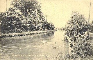
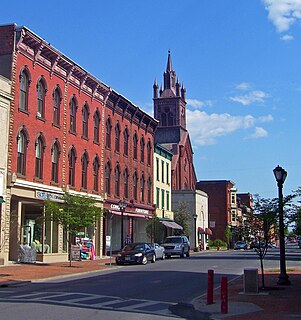
Cohoes is an incorporated city located in the northeast corner of Albany County in the U.S. state of New York. It is called the "Spindle City" because of the importance of textile manufacturing to its growth in the 19th century. The city's factories processed cotton from the Deep South, produced on plantations in the slave states.

New York (state) State of the United States of America

New York is a state in the Northeastern United States. New York was one of the original thirteen colonies that formed the United States. With an estimated 19.54 million residents in 2018, it is the fourth most populous state. To distinguish the state from the city with the same name, it is sometimes called New York State.

United States Federal republic in North America

The United States of America (USA), commonly known as the United States or America, is a country comprising 50 states, a federal district, five major self-governing territories, and various possessions. At 3.8 million square miles, the United States is the world's third or fourth largest country by total area and is slightly smaller than the entire continent of Europe's 3.9 million square miles. With a population of over 327 million people, the U.S. is the third most populous country. The capital is Washington, D.C., and the largest city by population is New York City. Forty-eight states and the capital's federal district are contiguous in North America between Canada and Mexico. The State of Alaska is in the northwest corner of North America, bordered by Canada to the east and across the Bering Strait from Russia to the west. The State of Hawaii is an archipelago in the mid-Pacific Ocean. The U.S. territories are scattered about the Pacific Ocean and the Caribbean Sea, stretching across nine official time zones. The extremely diverse geography, climate, and wildlife of the United States make it one of the world's 17 megadiverse countries.

The lock was built as part of an 1837-1842 plan to make the canal bed larger, heading off competition from railroads, and allowing a detour around the section of canal between Albany and Schenectady to the south, which had fewer locks and was difficult to navigate. Holmes Hutchinson, a canal engineer who later became chief of that department and a director of several railroads, surveyed the route and drew up the plans for all locks in the mid-1830s. [1] The canal was relocated slightly within the city of Cohoes; North Mohawk Street today parallels the original alignment, with sections of the original canal kept open to provide water power to nearby mill complexes along the Mohawk River. [2]

Erie Canal Waterway in New York, USA

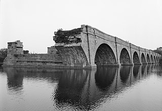
The Erie Canal is a canal in New York, United States that is part of the east–west, cross-state route of the New York State Canal System. Originally, it ran 363 miles (584 km) from where Albany meets the Hudson River to where Buffalo meets Lake Erie. It was built to create a navigable water route from New York City and the Atlantic Ocean to the Great Lakes. When completed in 1825, it was the second longest canal in the world and greatly affected the development and economy of New York, New York City, and the United States.
Albany, New York Capital of New York

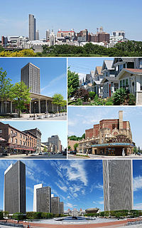
Albany is the capital of the U.S. state of New York and the seat of Albany County. Albany is located on the west bank of the Hudson River approximately 10 miles (16 km) south of its confluence with the Mohawk River and approximately 135 miles (220 km) north of New York City.
Schenectady, New York City in New York, United States

Schenectady is a city in Schenectady County, New York, United States, of which it is the county seat. As of the 2010 census, the city had a population of 66,135. The name "Schenectady" is derived from a Mohawk word, skahnéhtati, meaning "beyond the pines". Schenectady was founded on the south side of the Mohawk River by Dutch colonists in the 17th century, many from the Albany area. They were prohibited from the fur trade by the Albany monopoly, which kept its control after the English takeover in 1664. Residents of the new village developed farms on strip plots along the river.

Ten of the locks from the Enlarged Erie Canal remain within Cohoes. [3] Lock 18 was individually listed on the National Register of Historic Places, added in 1970 in recognition of the high quality of its remaining stonework; the remainder of the locks on city-owned land were added to the National Register in 2004 as a non-contiguous historic district. A city-owned trail along the former towpath allows visitors to see them. There is also a small parking lot along the street northeast of the lock with an interpretive sign.

National Register of Historic Places federal list of historic sites in the United States

The National Register of Historic Places (NRHP) is the United States federal government's official list of districts, sites, buildings, structures, and objects deemed worthy of preservation for their historical significance. A property listed in the National Register, or located within a National Register Historic District, may qualify for tax incentives derived from the total value of expenses incurred preserving the property.

Towpath canal path for boat use

A towpath is a road or trail on the bank of a river, canal, or other inland waterway. The purpose of a towpath is to allow a land vehicle, beasts of burden, or a team of human pullers to tow a boat, often a barge. This mode of transport was common where sailing was impractical due to tunnels and bridges, unfavourable winds, or the narrowness of the channel.
Related Research Articles

Wabash and Erie Canal

The Wabash and Erie Canal was a shipping canal that linked the Great Lakes to the Ohio River via an artificial waterway. The canal provided traders with access from the Great Lakes all the way to the Gulf of Mexico. Over 460 miles long, it was the longest canal ever built in North America.

Miami and Erie Canal canal

The Miami and Erie Canal was a 274-mile (441 km) canal that ran from Cincinnati to Toledo, Ohio, creating a water route between the Ohio River and Lake Erie. Construction on the canal began in 1825 and was completed in 1845 at a cost to the state government of $8,062,680.07. At its peak, it included 19 aqueducts, three guard locks, 103 canal locks, multiple feeder canals, and a few man-made water reservoirs. The canal climbed 395 feet (120 m) above Lake Erie and 513 feet (156 m) above the Ohio River to reach a topographical peak called the Loramie Summit, which extended 19 miles (31 km) between New Bremen, Ohio to lock 1-S in Lockington, north of Piqua, Ohio. Boats up to 80 feet long were towed along the canal by mules, horses, or oxen walking on a prepared towpath along the bank, at a rate of four to five miles per hour.

Chesapeake and Ohio Canal National Historical Park National Historical Park located in the District of Columbia and the states of Maryland and West Virginia

The Chesapeake and Ohio Canal National Historical Park is located in the District of Columbia and the states of Maryland and West Virginia. The park was established in 1961 as a National Monument by President Dwight D. Eisenhower to preserve the neglected remains of the Chesapeake and Ohio Canal and many of its original structures. The canal and towpath trail extends along the Potomac River from Georgetown, Washington, D.C., to Cumberland, Maryland, a distance of 184.5 miles (296.9 km). In 2013, the path was designated as the first section of U.S. Bicycle Route 50.

Ohio and Erie Canal place in Ohio listed on National Register of Historic Places

The Ohio and Erie Canal was a canal constructed during the 1820s and early 1830s in Ohio. It connected Akron with the Cuyahoga River near its outlet on Lake Erie in Cleveland, and a few years later, with the Ohio River near Portsmouth. It also had connections to other canal systems in Pennsylvania.

Delaware and Hudson Canal canal in New York, United States of America

The Delaware and Hudson Canal was the first venture of the Delaware and Hudson Canal Company, which would later build the Delaware and Hudson Railway. Between 1828 and 1899, the canal's barges carried anthracite coal from the mines of Northeastern Pennsylvania to the Hudson River and thence to market in New York City.

Blackstone Canal waterway linking Worcester, Massachusetts, to Providence, Rhode Island (and Narragansett Bay) through the Blackstone Valley via a series of locks and canals during the early 19th century

The Blackstone Canal was a waterway linking Worcester, Massachusetts, to Providence, Rhode Island through the Blackstone Valley via a series of locks and canals during the early 19th century.

Cohoes Falls waterfall

Cohoes Falls [Kahon:ios, Mohawk for "Canoe Falls"] is a waterfall on the Mohawk River shared by the city of Cohoes and the town of Waterford, New York, United States. Discovered by the indigenous people, the falls were called Ga-ha-oose or Ga-ho'n'-yoos by the Mohawks, which is believed to mean "The Place of the Falling Canoe." Cohoes historian Arthur Masten wrote in his 1880 history that the phrase might mean "Potholes in the River," referring to the potholes that appear in the riverbed when it is dry. In the oral tradition of the Haudenosaunee (Iroquois), the Cohoes Falls are the site where The Great Peacemaker, performed a feat of supernatural strength, convincing the Mohawk people to become the founders of the Iroquois League of Nations or Confederacy. Some historians believe the Mohawks launched the Confederacy as early as 1142 CE, though other experts report dates ranging from 1450-1650.

The Whitewater Canal, which was built between 1836 and 1847, spanned a distance of seventy-six miles and stretched from Lawrenceburg, Indiana on the Ohio River to Hagerstown, Indiana.

Lehigh Canal canal in Pennsylvania, United States of America

The Lehigh Canal or the Lehigh Navigation Canal is a navigable canal, beginning at the mouth of Nesquehoning Creek on the Lehigh River in Eastern Pennsylvania. It was built in two sections over a span of twenty years, beginning in 1818. The lower section spanned the distance between Easton, Pennsylvania and the town of Mauch Chunk, present-day Jim Thorpe, Pennsylvania. In Easton the canal met the Delaware and Morris Canals, with which goods could be brought further up the east coast. At its height, the Lehigh Canal was 72 miles (116 km) long.

Schoharie Crossing State Historic Site

Schoharie Crossing State Historic Site, also known as Erie Canal National Historic Landmark, is a historic district that includes the ruins of the Erie Canal aqueduct over Schoharie Creek, and a 3.5-mile (5.6 km) long part of the Erie Canal, in the towns of Glen and Florida within Montgomery County, New York. It was the first part of the old canal to be designated a National Historic Landmark, prior to the designation of the entire New York State Barge Canal as a NHL in 2017.

The Mohawk Towpath Scenic Byway is a National Scenic Byway in the Capital District region of New York in the United States. It extends from Schenectady to Waterford by way of a series of local, county, and state highways along the Mohawk River and the Erie Canal. The byway is intended to showcase the history of the waterway, from Native American times through the creation of the Erie Canal and the role the waterside communities played in the Industrial Revolution and the westward expansion of the United States. At its east end, the byway connects to the Lakes to Locks Passage, an All-American Road.

Downtown Cohoes Historic District

The Downtown Cohoes Historic District takes up 35 acres (14 ha) of the city of Cohoes, New York, United States. Many of the 165 contributing properties date from the 1820-1930 period when the Erie Canal and Harmony Mills were the mainstay of the city's economy. It was recognized as a historic district and added to the National Register of Historic Places in 1984. After years of neglect and decline, it has recently started to see an upswing in business activity due to its historic character and the city's efforts to protect it.

Cohoes Music Hall

Cohoes Music Hall, is a vintage music hall located at 58 Remsen Street in Cohoes, New York, United States. It is a four-story brick building in the Second Empire architectural style. Built in 1874, it is considered the best example of that style in the city, with an unusually decorative front facade.

Olmstead Street Historic District

The Olmstead Street Historic District is located along two blocks of that street in Cohoes, New York, United States. It is a microcosm of the city's economy at its peak in the mid- to late 19th century, consisting of a former textile mill complex, a filled-in section of the original Erie Canal, and three long blocks of row houses built for the millworkers.

Enlarged Erie Canal Historic District (Discontiguous)

Enlarged Erie Canal Historic District (Discontiguous) is a national historic district located at Cohoes in Albany County, New York. It includes two contributing buildings and 10 contributing structures. It encompasses resources associated with the Enlarged Erie Canal, 1835-1862, Locks 9 through 18, and located within the City of Cohoes. The district includes five numbered units with each unit representing a cohesive grouping of resources highlighted by one or more extant canal locks. Each unit consists of at least one remaining lock and the associated elements including sections of towpath, berm walls, engineering features, and canal prism.

Cascade Locks Historic District historic district in Akron, Ohio, USA

The Cascade Locks Historic District is a historic district located in Akron, Ohio. It was added to the National Register of Historic Places in 1992.

New York State Canalway Trail

The New York State Canalway Trail is a network of multi-use trails that runs parallel to current or former sections of the Erie, Oswego, Cayuga-Seneca, and Champlain canals. When completed, the system will have 524 miles (843 km) of trails following current and former sections of the canals. The longest of these is the 365 miles (587 km) long Erie Canalway Trail. It will form the east-west portion of the Empire State Trail.

Canal Age

The Canal Age is a term of art used by historians of Science, Technology, and Industry. The Canal eras in various parts of the world have varied in the world timeline, in the main, by civilizations, dynastic Empires of India, China, and Southeast Asia, and of European mercantilism. Canals are culturally dependent, and culture creating, part of industry, and industry creating and until the coming into an era when steam locomotives generated refined speeds and sufficient power, the canal was by far the fastest way to travel long distances quickly, for commercial canals generally had boatmen shifts that kept the barges moving behind mule teams 24 hours a day. Like many North American canals of the 1820s-1840s, the canal operating companies partnered with or founded short feeder railroads as were necessary appendages to connect to their sources or markets. Two good examples of this were funded by private enterprise:

  1. The Lehigh Coal & Navigation Company used vertically integrated mining raw materials, transporting them, manufacturing with them, and merchandising by building coal mines, the instrumental Lehigh Canal, and feeding their own iron goods manufacturing industries and assuaging the American Republic's first energy crisis by increasing coal production from 1820 onwards using the nation's second constructed railway, the Summit Hill and Mauch Chunk Railroad.
  2. The second coal road and canal system was inspired by LC&N's success. The Delaware and Hudson Canal and Delaware and Hudson Gravity Railroad. The LC&N operation was aimed at supplying the country's premier city, Philadelphia with much needed fuel. The D&H companies were founded purposefully to supply the explosively growing city of New York's energy needs.

References

  1. 1 2 Waite, Diana (July 1970). "National Register of Historic Places nomination, Lock 18 of Enlarged Erie Canal". New York State Office of Parks, Recreation and Historic Preservation . Retrieved 2008-09-09.
  2. Rossi, Louis; "History/Mystery Bike Tour: Erie and Champlain Canals in Cohoes and Waterford" (PDF). Archived from the original (PDF) on 2010-08-27., retrieved September 9, 2008.
  3. "Mill District" (PDF). Archived from the original (PDF) on 2010-08-27., Spindle City Historic Society, Mohawk Towpath Scenic Byway website, retrieved September 9, 2008.