Fine, New York

Last updated

Fine, New York
SUNY ESF Ranger School at Wanakena, NY.jpg
Fine NY Locator Map.png
Map highlighting Fine's location within St. Lawrence County.
New York Adirondack.svg
Red pog.svg
Fine, New York
Location within the state of New York
Coordinates: 44°12′36″N75°5′25″W / 44.21000°N 75.09028°W / 44.21000; -75.09028
CountryUnited States
State New York
County St. Lawrence
Area
[1]
  Total169.42 sq mi (438.79 km2)
  Land166.65 sq mi (431.61 km2)
  Water2.77 sq mi (7.18 km2)
Elevation
1,549 ft (472 m)
Population
 (2010)
  Total1,512
  Estimate 
(2016) [2]
1,471
  Density8.83/sq mi (3.41/km2)
Time zone UTC-5 (Eastern (EST))
  Summer (DST) UTC-4 (EDT)
FIPS code 36-25791
GNIS feature ID0978957

Fine is a town in St. Lawrence County, New York, United States. The population was 1,512 at the 2010 census. The town is named after Judge John Fine, [3] a businessman involved in settling the town.

Contents

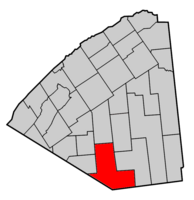
The Town of Fine is in the southern part of the county, south of Canton.

The SUNY-ESF Ranger School is in the eastern part of the town.

The Griffin Memorial Forest is located in Fine.

History

The first settlement was begun by Elias Teall, who made a contract on October 24, 1823, with the proprietors of the east half of Scriba, and undertook to secure settlers on the tract. He built a mill on the east branch of the Oswegatchie and made some small improvements; but his undertaking failed. September 6, 1828, James C. Haile made a contract with the proprietors, and built a sawmill and a small grist mill on the Oswegatchie; he induced other settlers to come. In May 1833, he also left the town, his settlers having abandoned him. In February 1834, Arnasa I. Brown contracted with the owners for the Haile improvements and an additional tract of land, and in March of that year moved his family in; his nearest neighbors were ten miles away. A few others joined him, and by 1843 there were 43 or 44 voters. [4]

The little hamlet of Fine is on the east branch of the Oswegatchie River about five miles southeast of South Edwards. It has been locally known as "Smithville" from William P. Smith, who was an early resident there.

The town was organized in 1849 from parts of the Towns of Pierrepont and Russell.

The Fine Town Hall was listed on the National Register of Historic Places in 1996. [5]

Geography

According to the United States Census Bureau, the town has a total area of 169.4 square miles (439 km2), of which 167.1 square miles (433 km2) is land and 2.3 square miles (6.0 km2) (1.36%) is water.

The town lies within the Adirondack Park.

The southern town line is the border of Lewis and Herkimer counties.

New York State Route 3, an east–west highway, crosses the town. New York State Route 58 intersects NY-3 near Fine village.

The east branch of the Oswegatchie River flows in a northwesterly direction from Cranberry Lake, through Fine.

Demographics

Historical population
CensusPop.Note
1850 293
1860 51977.1%
1870 60316.2%
1880 89348.1%
1890 1,20735.2%
1900 1,69440.3%
1910 2,23431.9%
1920 1,459−34.7%
1930 1,053−27.8%
1940 1,20814.7%
1950 1,87555.2%
1960 2,39127.5%
1970 2,302−3.7%
1980 2,243−2.6%
1990 1,813−19.2%
2000 1,622−10.5%
2010 1,512−6.8%
2016 (est.)1,471 [2] −2.7%
U.S. Decennial Census [6]

As of the census [7] of 2000, there were 1,622 people, 667 households, and 452 families residing in the town. The population density was 9.7 people per square mile (3.7/km2). There were 1,137 housing units at an average density of 6.8 per square mile (2.6/km2). The racial makeup of the town was 97.29% White, 0.68% African American, 0.68% Native American, 0.37% Asian, 0.06% from other races, and 0.92% from two or more races. Hispanic or Latino of any race were 0.37% of the population.

There were 667 households, out of which 25.8% had children under the age of 18 living with them, 54.9% were married couples living together, 7.5% had a female householder with no husband present, and 32.2% were non-families. 27.1% of all households were made up of individuals, and 13.9% had someone living alone who was 65 years of age or older. The average household size was 2.36 and the average family size was 2.83.

In the town, the population was spread out, with 21.1% under the age of 18, 8.2% from 18 to 24, 26.0% from 25 to 44, 27.7% from 45 to 64, and 17.0% who were 65 years of age or older. The median age was 42 years. For every 100 females, there were 97.8 males. For every 100 females age 18 and over, there were 100.0 males.

The median income for a household in the town was $32,112, and the median income for a family was $38,618. Males had a median income of $38,043 versus $20,875 for females. The per capita income for the town was $16,744. About 13.7% of families and 17.3% of the population were below the poverty line, including 24.1% of those under age 18 and 10.8% of those age 65 or over.

Western Adirondack Presbyterian Church in Wanakena Western Adirondack Presbyterian Church, Wanakena, NY.jpg
Western Adirondack Presbyterian Church in Wanakena

Communities and locations in Fine

Related Research Articles

<span class="mw-page-title-main">Caroga, New York</span> Town in New York, United States

Caroga is a town in Fulton County, New York, United States. The population was 1,205 at the 2010 census. The town was named after a local creek.

<span class="mw-page-title-main">Columbia, New York</span> Town in New York, United States

Columbia is a town in Herkimer County, New York, United States. As of the 2010 census, the town population was 1,580. The town is at the southern border of the county and is southeast of Utica.

<span class="mw-page-title-main">Manheim, New York</span> Town in New York, United States

Manheim is a town in Herkimer County, New York, United States. The population was 3,334 at the 2010 census. The town name is derived from Mannheim in Baden, Germany.

Diana is a town in Lewis County, New York, United States. The population was 1,709 at the 2010 census. The town is on the northeastern border of the county and is located northeast of Watertown. The northwestern section of Diana is in the Fort Drum military reservation.

<span class="mw-page-title-main">Clifton, New York</span> Town in New York, United States

Clifton is a town in St. Lawrence County, New York, United States. The population was 675 at the 2020 census. The town takes its name from a mining company.

<span class="mw-page-title-main">De Kalb, New York</span> Town in New York, United States

DeKalb is a town in St. Lawrence County, New York, United States. The population was 2,434 at the 2010 census. The town is named after American general Baron de Kalb, a German officer serving under George Washington.

<span class="mw-page-title-main">De Peyster, New York</span> Town in New York, United States

DePeyster is a town in St. Lawrence County, New York, United States. The population was 998 at the 2010 census. The name is taken from that of one of the land owners of the region, Frederic de Peyster, grandfather of John Watts de Peyster.

<span class="mw-page-title-main">Fowler, New York</span> Town in New York, United States

Fowler is a town in St. Lawrence County, New York, United States. The population was 2,202 at the 2010 census.

<span class="mw-page-title-main">Hopkinton, New York</span> Town in New York, United States

Hopkinton is a town in St. Lawrence County, New York, United States. The population was 1,105 at the 2020 census and has a Population density of 5.9 square miles. The town is named for Roswell Hopkins, a pioneer settler and a government official.

<span class="mw-page-title-main">Oswegatchie, New York</span> Town in New York, United States

Oswegatchie is a town in St. Lawrence County, New York, United States. The population was 4,397 at the 2010 census. The name reportedly means "Black Water". It is on the northern border of the county and is adjacent to the city of Ogdensburg.

<span class="mw-page-title-main">Piercefield, New York</span> Town in New York, United States

Piercefield is a town in St. Lawrence County, New York, United States. The population was 310 at the 2010 census.

<span class="mw-page-title-main">Rossie, New York</span> Town in New York, United States

Rossie is a town in St. Lawrence County, New York, United States. The population was 877 at the 2010 census. The town is named after the sister of an early land owner.

<span class="mw-page-title-main">Putnam, New York</span> Town in Washington County, New York, US

Putnam is a town in northern Washington County, New York, United States. It is part of the Glens Falls Metropolitan Statistical Area. The town population was 645 at the 2000 census. The town is named after Israel Putnam, a hero of the American Revolution.

<span class="mw-page-title-main">Milo, New York</span> Town in New York, United States

Milo is a town in Yates County, New York, United States. The population was 7,006 at the 2010 census. The town was named after Milo of Croton, a famous athlete from Ancient Greece.

<span class="mw-page-title-main">New Berlin, New York</span> Town in New York, United States

New Berlin is a town in Chenango County, central New York, United States. The population was 2,682 at the 2010 census. The town contains the village of New Berlin. The town is at the eastern border of the county and is northeast of Norwich.

<span class="mw-page-title-main">Croghan, New York</span> Town in New York, United States

Croghan is a town in Lewis County, New York, United States. The population was 3,093 at the 2010 census. The town is in the northern part of the county and located northeast of the county seat, Lowville. The town contains a village also named Croghan, a small part of which is located in the adjacent town of New Bremen. Both the village and town are locally pronounced \Krō-gun\.

<span class="mw-page-title-main">Gouverneur, New York</span> Town in New York, United States

Gouverneur is a town in St. Lawrence County, New York, United States. As of the 2020 census, the population was 6,551. That was down from 7,085 in 2010. The town is named after statesman and landowner Gouverneur Morris.

<span class="mw-page-title-main">Morristown, New York</span>

Morristown is a town in St. Lawrence County, New York, United States. The population was 1,974 at the 2010 census. The town is named after Gouverneur Morris, a signer of the United States Declaration of Independence and landowner in New York.

<span class="mw-page-title-main">Wanakena, New York</span>

Wanakena is a hamlet located on the shore of Cranberry Lake in the town of Fine in St. Lawrence County, New York, United States. Tourism is a major industry in the area; a small year-round population is supplemented by an influx seasonal residents each summer. It is the location of the SUNY-ESF Ranger School.

<span class="mw-page-title-main">Dryden, New York</span> Town in New York, United States

Dryden is a town in Tompkins County, New York, United States. The population was 14,435 at the 2010 census. The town administers an area that includes two villages, one also named Dryden and one named Freeville, as well as a number of hamlets. The town is on the county's eastern border, east of Ithaca, in the Finger Lakes region.

References

  1. "2016 U.S. Gazetteer Files". United States Census Bureau. Retrieved July 5, 2017.
  2. 1 2 "Population and Housing Unit Estimates" . Retrieved June 9, 2017.
  3. Gannett, Henry (1905). The Origin of Certain Place Names in the United States. Govt. Print. Off. pp.  126.
  4. Hough, Franklin B. (1853) "A history of St. Lawrence and Franklin counties, New York: from the earliest period to the present time"
  5. "National Register Information System". National Register of Historic Places . National Park Service. March 13, 2009.
  6. "Census of Population and Housing". Census.gov. Retrieved June 4, 2015.
  7. "U.S. Census website". United States Census Bureau . Retrieved January 31, 2008.

44°14′52″N75°08′16″W / 44.24778°N 75.13778°W / 44.24778; -75.13778