Clare, New York

Last updated

Clare, New York
Clare NY Locator Map.png
Map highlighting Clare's location within St. Lawrence County.
New York Adirondack.svg
Red pog.svg
Clare, New York
Location within the state of New York
Coordinates: 44°22′55″N74°59′31″W / 44.38194°N 74.99194°W / 44.38194; -74.99194
CountryUnited States
State New York
County St. Lawrence
Area
[1]
  Total97.26 sq mi (251.89 km2)
  Land96.50 sq mi (249.92 km2)
  Water0.76 sq mi (1.97 km2)
Elevation
1,148 ft (350 m)
Population
 (2010)
  Total105
  Estimate 
(2016) [2]
105
  Density1.09/sq mi (0.42/km2)
Time zone UTC-5 (Eastern (EST))
  Summer (DST) UTC-4 (EDT)
FIPS code 36-15792
GNIS feature ID0978828
Clare Town Hall Clare Hall.jpg
Clare Town Hall

Clare is a town in St. Lawrence County, New York, United States. The population was 105 at the 2010 census.

Contents

The Town of Clare is in the south-central part of the county and is south of the Village of Canton, the county seat.

History

The town of Clare, formed in 1880 from part of the town of Pierrepont, was the last town formed in the county. Madam De Stael, a French author, at one time invested in the town lands, on the advice of her friend Gouverneur Morris, while it was still part of Pierrepont.

A history in 1894 indicated that almost no business existed in the town, and there were no organized churches.

The Clare Town Hall was listed on the National Register of Historic Places in 2004. [3]

Geography

According to the United States Census Bureau, the town has a total area of 97.3 square miles (252 km2), of which 96.6 square miles (250 km2) is land and 0.6 square miles (1.6 km2) (0.67%) is water.

The town is in the Adirondack Park, and two branches of the Grasse River flow through it.

Demographics

Historical population
CensusPop.Note
1890 281
1900 33017.4%
1910 42027.3%
1920 152−63.8%
1930 22749.3%
1940 139−38.8%
1950 107−23.0%
1960 87−18.7%
1970 9711.5%
1980 12124.7%
1990 78−35.5%
2000 11243.6%
2010 105−6.2%
2016 (est.)105 [2] 0.0%
U.S. Decennial Census [4]

As of the census [5] of 2000, there were 112 people, 46 households, and 32 families residing in the town. The population density was 1.2 people per square mile (0.46 people/km2). There were 106 housing units at an average density of 1.1 units per square mile (0.42 units/km2). The racial makeup of the town was 95.54% white, 1.79% Native American, 0.89% from other races, and 1.79% from two or more races. Hispanic or Latino of any race were 0.89% of the population.

There were 46 households, out of which 28.3% had children under the age of 18 living with them, 65.2% were married couples] living together, 4.3% had a female householder with no husband present, and 28.3% were non-families. 26.1% of all households were made up of individuals, and 8.7% had someone living alone who was 65 years of age or older. The average household size was 2.43 and the average family size was 2.91.

In the town, the population was spread out, with 24.1% under the age of 18, 6.3% from 18 to 24, 28.6% from 25 to 44, 27.7% from 45 to 64, and 13.4% who were 65 years of age or older. The median age was 43 years. For every 100 female residents, there were 111.3 male residents. For every 100 female residents age 18 and over, there were 107.3 male residents.

The median income for a household in the town was $26,667, and the median income for a family was $36,250. Male residents had a median income of $25,625 versus $50,833 for female residents. The per capita income for the town was $14,453. There were 6.7% of families and 12.8% of the population living below the poverty line, including 6.5% of under eighteens and none of those over 64.

Communities and locations in Clare

Related Research Articles

<span class="mw-page-title-main">Shorter, Alabama</span> Town in Alabama, United States

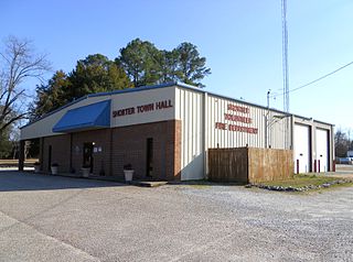
Shorter is a town in Macon County, Alabama, United States. At the 2020 census the population was 385, down from 474 at the 2010 census. According to the 1990 U.S. Census records, it was incorporated in 1984.

<span class="mw-page-title-main">Gum Springs, Arkansas</span> Town in Arkansas, United States

Gum Springs is a town in Clark County, Arkansas, United States. The population was 120 at the 2010 census, down from 194 in 2000.

<span class="mw-page-title-main">Bodcaw, Arkansas</span> Town in Arkansas, United States

Bodcaw is a town in Nevada County, Arkansas, United States. The population was 121 at the 2020 census. It is part of the Hope Micropolitan Statistical Area.

<span class="mw-page-title-main">Oglethorpe, Georgia</span> City in Georgia, United States

Oglethorpe is a city in Macon County, Georgia, United States. The population was 995 at the 2020 census, down from 1,328 in 2010. The city is the county seat of Macon County. It was named for Georgia's founder, James Oglethorpe.

<span class="mw-page-title-main">Chesterfield, Indiana</span> Town in Indiana, United States

Chesterfield is a town in the U.S. state of Indiana which lies in Union Township, Madison County, and Salem Township, Delaware County. The population was 2,490 at the 2020 census. It is part of the Indianapolis–Carmel–Anderson metropolitan statistical area.

<span class="mw-page-title-main">Oakfield, Maine</span> Town in the state of Maine, United States

Oakfield is a town in Aroostook County, Maine, United States. The population was 661 at the 2020 census. The village of Oakfield, listed as a census-designated place, is in the northwestern corner of the town.

<span class="mw-page-title-main">Peru, Maine</span> Town in Maine, US

Peru is a town in Oxford County, Maine, United States. The population was 1,488 at the 2020 census.

<span class="mw-page-title-main">Goodview, Minnesota</span> City in Minnesota, United States

Goodview is a city in Winona County, Minnesota, United States. The population was 4,158 at the 2020 census.

<span class="mw-page-title-main">Holcomb, Missouri</span> City in Missouri, United States

HolcombHAW-kəm is a city in Dunklin County, Missouri, United States. The population was 635 at the 2010 census.

<span class="mw-page-title-main">Clifton, New York</span> Town in New York, United States

Clifton is a town in St. Lawrence County, New York, United States. The population was 675 at the 2020 census. The town takes its name from a mining company.

<span class="mw-page-title-main">Fine, New York</span> Town in New York, United States

Fine is a town in St. Lawrence County, New York, United States. The population was 1,512 at the 2010 census. The town is named after Judge John Fine, a businessman involved in settling the town.

<span class="mw-page-title-main">Pierrepont, New York</span> Town in New York, United States

Pierrepont is a town and hamlet in St. Lawrence County, New York, United States. As of the 2020 census, the town population was 2,523. It was named after Hezekiah Pierrepont, the early owner of much of the town's territory. The Town of Pierrepont is centrally located in the county and is southeast of Canton. A hamlet of the same name is in the town of Pierrepont. Pierrepont Manor, however, is located in Jefferson County.

<span class="mw-page-title-main">Dillonvale, Hamilton County, Ohio</span> Census-designated place in Ohio, United States

Dillonvale is a census-designated place (CDP) in Sycamore Township, Hamilton County, Ohio, United States. The population was 3,436 at the 2020 census.

<span class="mw-page-title-main">Marengo, Ohio</span> Village in Ohio, United States

Marengo is a village in Morrow County, Ohio, United States. The population was 283 at the 2020 census. Marengo is south of Mount Gilead, the county seat.

Sycamore is a census-designated place (CDP) in Delaware County, Oklahoma, United States. The population was 177 at the 2010 census.

<span class="mw-page-title-main">Ramey, Pennsylvania</span> Borough in Pennsylvania, United States

Ramey is a borough in Clearfield County, Pennsylvania, United States. The population was 436 at the 2020 census.

<span class="mw-page-title-main">West Brunswick Township, Schuylkill County, Pennsylvania</span> Township in Pennsylvania, United States

West Brunswick Township is a township hat is located in Schuylkill County, Pennsylvania, United States.

<span class="mw-page-title-main">Lamar, South Carolina</span> Town in South Carolina, United States

Lamar is a town in Darlington County, South Carolina, United States. The population was 989 at the 2010 census. It is part of the Florence, SC Metropolitan Statistical Area.

<span class="mw-page-title-main">Stanton, Tennessee</span> Town in Tennessee, United States

Stanton is a town in Haywood County, Tennessee. The population was 615 as of the 2000 census and 452 at the 2010 census, showing a population decrease of 163.

Skamokawa is a census-designated place (CDP) in Wahkiakum County, Washington, north of the town of Cathlamet. The population was 401 as of the 2010 census. The CDP includes the Sleepy Hollow community. The Skamokawa community is part of the Wahkiakum School District, a K-12 school district of about 430 students. The name of the CDP comes from that of the Wahkiakum Chief Skamokawa who met with Meriwether Lewis and William Clark while their expedition spent the winter of 1805–06 at Fort Clatsop. His name, Skamokawa, is a Chinook word meaning “smoke over the water,” a reference to the area's foggy climate.

References

  1. "2016 U.S. Gazetteer Files". United States Census Bureau. Retrieved July 5, 2017.
  2. 1 2 "Population and Housing Unit Estimates" . Retrieved June 9, 2017.
  3. "National Register Information System". National Register of Historic Places . National Park Service. March 13, 2009.
  4. "Census of Population and Housing". Census.gov. Retrieved June 4, 2015.
  5. "U.S. Census website". United States Census Bureau . Retrieved January 31, 2008.
  6. "AirNav: 1E8 - Moores Airport".

44°24′05″N75°03′45″W / 44.40139°N 75.06250°W / 44.40139; -75.06250