Truxton, New York | |
---|---|
Coordinates: 42°42′33″N76°1′25″W / 42.70917°N 76.02361°W | |
Country | United States |
State | New York |
County | Cortland |
Government | |
• Type | Town Council |
• Town Supervisor | Lloyd Sutton |
• Town Council | Members' List |
Area | |
• Total | 44.73 sq mi (115.84 km2) |
• Land | 44.65 sq mi (115.64 km2) |
• Water | 0.08 sq mi (0.20 km2) |
Elevation | 1,142 ft (348 m) |
Population (2010) | |
• Total | 1,133 |
1,093 | |
• Density | 24.48/sq mi (9.45/km2) |
Time zone | UTC-5 (Eastern (EST)) |
• Summer (DST) | UTC-4 (EDT) |
ZIP codes | 13056, 13158 |
Area code | 607 |
FIPS code | 36-023-75550 |
GNIS feature ID | 0979560 |
Website | www |
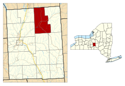
Truxton is a town in Cortland County, New York, United States. The population was 1,133 at the 2010 census. [3] The town is named for Commodore Thomas Truxtun, a privateer in the American Revolution and one of the US Navy's first commanding officers.
Truxton is in the northeastern part of the county, northeast of the city of Cortland.
The region that includes Cortland County was part of the Central New York Military Tract.
The first settler arrived around 1793. The town of Truxton was formed from part of the town of Fabius (in Onondaga County) when Cortland County was created in 1808. An addition was made in 1811 to Truxton from the town of Solon. In 1858, the eastern part of Truxton was used to form the town of Cuyler.
In 1865, the population was 1,689.
The Truxton Depot was listed on the National Register of Historic Places in 2008. [4]
According to the United States Census Bureau, the town has a total area of 44.7 square miles (115.8 km2), of which 44.6 square miles (115.6 km2) is land and 0.077 square miles (0.2 km2), or 0.17%, is water. [3]
The northern town line is the border of Onondaga County.
The East Branch of the Tioughnioga River passes through the town.
New York State Route 13 intersects New York State Route 91 at Truxton village.
Census | Pop. | Note | %± |
---|---|---|---|
1820 | 2,956 | — | |
1830 | 3,888 | 31.5% | |
1840 | 3,587 | −7.7% | |
1850 | 3,444 | −4.0% | |
1860 | 1,914 | −44.4% | |
1870 | 1,618 | −15.5% | |
1880 | 1,550 | −4.2% | |
1890 | 1,328 | −14.3% | |
1900 | 1,217 | −8.4% | |
1910 | 1,132 | −7.0% | |
1920 | 920 | −18.7% | |
1930 | 997 | 8.4% | |
1940 | 1,008 | 1.1% | |
1950 | 922 | −8.5% | |
1960 | 907 | −1.6% | |
1970 | 955 | 5.3% | |
1980 | 988 | 3.5% | |
1990 | 1,064 | 7.7% | |
2000 | 1,225 | 15.1% | |
2010 | 1,133 | −7.5% | |
2016 (est.) | 1,093 | [2] | −3.5% |
U.S. Decennial Census [5] |
As of the census [6] of 2000, there were 1,225 people, 440 households, and 337 families residing in the town. The population density was 27.4 inhabitants per square mile (10.6/km2). There were 536 housing units at an average density of 12.0 per square mile (4.6/km2). The racial makeup of the town was 97.55% White, 0.57% Black or African American, 0.16% Native American, 0.16% Asian, and 1.55% from two or more races. Hispanic or Latino of any race were 0.65% of the population.
There were 440 households, out of which 37.5% had children under the age of 18 living with them, 61.4% were married couples living together, 11.1% had a female householder with no husband present, and 23.2% were non-families. 16.4% of all households were made up of individuals, and 7.0% had someone living alone who was 65 years of age or older. The average household size was 2.77 and the average family size was 3.08.
In the town, the population was spread out, with 29.6% under the age of 18, 6.3% from 18 to 24, 31.3% from 25 to 44, 22.0% from 45 to 64, and 10.9% who were 65 years of age or older. The median age was 36 years. For every 100 females, there were 99.5 males. For every 100 females age 18 and over, there were 97.0 males.
The median income for a household in the town was $39,115, and the median income for a family was $41,000. Males had a median income of $29,306 versus $21,384 for females. The per capita income for the town was $16,516. About 8.9% of families and 11.6% of the population were below the poverty line, including 13.3% of those under age 18 and 12.0% of those age 65 or over.
Barker is a town in Broome County, New York, United States. The population was 2,516 at the 2020 census. The town is named after John Barker, an early settler. The town is in the northern part of Broome County and is north of Binghamton.
Triangle is a town in Broome County, New York, United States. The population was 2,946 at the 2010 census. The town's primary settlement is the village of Whitney Point.
Summerhill is a town in Cayuga County, New York, United States. The population was 1,217 at the 2010 census. The town name is that of a location in Ireland. Summerhill is in the southeastern corner of the county and is northeast of Ithaca.
Lincklaen is a town in Chenango County, New York, United States. The population was 392 at the 2020 census. The town was named after Colonel John Lincklaen, an agent of the Holland Land Company and a land owner. The town is in the northwestern corner of the county, northwest of the city Norwich and northeast of Cortland.
Pitcher is a town in Chenango County, New York, United States. The population was 803 at the 2010 census. The town is named after Nathaniel Pitcher, the eighth governor of New York. The town is on the western border of Chenango County, west of the city of Norwich.
Cortlandville is a town in Cortland County, New York, United States. The population was 8,509 at the 2010 census.
Cuyler is a town in Cortland County, New York, United States. The population was 908 at the 2020 census.
Freetown is a town in Cortland County, New York, United States. The population was 757 at the 2010 census. Freetown is in the southeastern part of the county and is southeast of Cortland.
Lapeer is a town in Cortland County, New York, United States. The population was 767 at the 2010 census. Lapeer is on the southern border of Cortland County and is south of the city of Cortland.
Preble is a town in Cortland County, New York, United States. The population was 1,357 at the 2020 census, down from 1,393 at the 2010 census. The town is named after Commodore Edward Preble, a naval hero.
Scott is a town in Cortland County, New York, United States. The population was 1,176 at the 2010 census. The town was named after General Winfield Scott. It is in the northwestern corner of Cortland County and is northwest of the City of Cortland.
Solon is a town in Cortland County, New York, United States. The town had a total population of 1,079 as of the 2010 census. The name of the town comes from the Greek lawmaker Solon.
Virgil is a town in Cortland County, New York, United States. The population was 2,401 at the 2010 census. The name is from the Roman poet Virgil. The town is in the southwestern part of Cortland County and is south of the city of Cortland.
Pompey is a town in the southeast part of Onondaga County, New York. As of the 2020 Census, the population was 7,080. The town was named after the Roman general and political leader Pompey by a late 18th-century clerk interested in the Classics in the new federal republic.
Spafford is a town in Onondaga County, New York, United States. As of the 2020 Census, the population was 1,588. The town was named after Horatio Gates Spafford, a writer and founder of the local library. Spafford is in the southwestern corner of Onondaga County and is southwest of Syracuse.
Homer is a town in Cortland County, New York, United States of America. The population was 6,405 at the 2010 census. The name is from the Greek poet Homer.
Marathon is a town in Cortland County, New York, United States. The population was 1,967 at the 2010 census.
DeRuyter is a town in Madison County, New York, United States. The population was 1,276 at the 2020 census, down from 1,589 in 2010. The town is named after Michiel Adriaenszoon de Ruyter, a famous admiral in the Dutch navy. The name de Ruyter means "the Rider".
Fabius is a town in Onondaga County, New York, United States. As of the 2020 Census, the population was 2,006. The classical name of the town was assigned by a clerk interested in the classics.
Tully is a town in Onondaga County, New York, United States. As of the 2020 Census, the population was 2,676. The name of the town is derived from the Roman orator Marcus Tullius Cicero. The town is on the county's southern border, south of Syracuse.