Pelham (village), New York

Last updated

Village of Pelham, New York
Pelham Train Station April 2011.jpg
Pelham station is located within the village
Pelham (village), NY Seal.png
Pelham (village), NY Logo.png
Nickname: 
Pelham Village
Westchester County New York incorporated and unincorporated areas Pelham (village) highlighted.svg
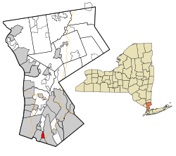
Location of Pelham (village), New York
Coordinates: 40°54′38″N73°48′27″W / 40.91056°N 73.80750°W / 40.91056; -73.80750
Country United States
State New York
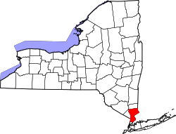
County Westchester
Town Pelham
Area
[1]
  Total0.82 sq mi (2.14 km2)
  Land0.82 sq mi (2.13 km2)
  Water0.00 sq mi (0.01 km2)
Elevation
72 ft (22 m)
Population
 (2020)
  Total7,326
  Density8,912.41/sq mi (3,440.43/km2)
Time zone UTC-5 (Eastern (EST))
  Summer (DST) UTC-4 (EDT)
ZIP code
10803
Area code 914
FIPS code 36-57001
GNIS feature ID0960106
Website http://www.pelhamgov.com

The village of Pelham is a village in Westchester County, New York, United States. The population was 6,910 at the 2010 census. [2] It is located in the town of Pelham, which is colloquially referred to as Pelham.

Contents

History

On June 27, 1654, Thomas Pell purchased 9,166 acres (37.09 km2) from the Native American tribe of the Siwanoys. The purchase included an area which is known today as Pelham, New Rochelle, and portions of Bronx County. Among the land that he purchased, of course, was all the land that constitutes today's village of Pelham. Upon his death in 1669, Thomas Pell left the land to his nephew and sole heir, John Pell.

The original Village of Pelham was incorporated in 1896, bounded by the New Haven Railroad's main line to north, Colonial Avenue to the south, New Rochelle to the east, and the Hutchinson River to the west. The Village of North Pelham was incorporated on August 29, 1896. Its boundaries were the New Haven Railroad to the south, New Rochelle to the east and northeast, and the Hutchinson River to the west and northwest. By 1940, the Village of Pelham's population was 1,918 and the Village of North Pelham had a population of 5,046. In June 1975, the Village of North Pelham merged with the existing Village of Pelham. [3]

Geography

According to the United States Census Bureau, the village has a total area of 0.8 square mile (2.1 km2), all land.

Demographics

Historical population
CensusPop.Note
1880 218
1900 303
1910 681124.8%
1920 1,05655.1%
1930 2,05394.4%
1940 1,918−6.6%
1950 1,843−3.9%
1960 1,9646.6%
1970 2,0765.7%
1980 6,848229.9%
1990 6,413−6.4%
2000 6,400−0.2%
2010 6,9108.0%
2020 7,3266.0%
U.S. Decennial Census [4]

As of the census [5] of 2000, there were 6,400 people, 2,287 households, and 1,687 families residing in the village. The population density was 7,785.5 inhabitants per square mile (3,006.0/km2). There were 2,337 housing units at an average density of 2,842.9 per square mile (1,097.6/km2). The racial makeup of the village was 83.22% White, 6.66% Black or African American, 0.09% Native American, 4.95% Asian, 2.47% from other races, and 2.61% from two or more races. Hispanic or Latino of any race were 7.20% of the population.

There were 2,287 households, out of which 39.7% had children under the age of 18 living with them, 58.9% were married couples living together, 11.6% had a female householder with no husband present, and 26.2% were non-families. 20.9% of all households were made up of individuals, and 8.3% had someone living with them who was 65 years of age or older. The average household size was 2.79 and the average family size was 3.30.

In the village, the population was spread out, with 27.7% under the age of 18, 6.0% from 18 to 24, 30.7% from 25 to 44, 23.5% from 45 to 64, and 12.0% who were 65 years of age or older. The median age was 37 years. For every 100 females, there were 92.4 males. For every 100 females age 18 and over, there were 87.0 males.

The median income for a household in the village was $82,430, and the median income for a family was $95,929. Males had a median income of $67,339 versus $41,364 for females. The per capita income for the village was $43,397. About 1.3% of families and 3.3% of the population were below the poverty line, including 4% of those under age 18 and 4% of those age 65 or over.

Climate

Climate data for Pelham, New York
MonthJanFebMarAprMayJunJulAugSepOctNovDecYear
Record high °F (°C)73
(23)
75
(24)
86
(30)
96
(36)
97
(36)
99
(37)
104
(40)
102
(39)
101
(38)
89
(32)
82
(28)
77
(25)
104
(40)
Average high °F (°C)39.2
(4.0)
42.9
(6.1)
51.4
(10.8)
62.6
(17.0)
73.8
(23.2)
81.6
(27.6)
86.0
(30.0)
83.9
(28.8)
76.1
(24.5)
65.4
(18.6)
55.1
(12.8)
43.8
(6.6)
63.5
(17.5)
Average low °F (°C)20.1
(−6.6)
22.3
(−5.4)
29.1
(−1.6)
38.4
(3.6)
47.2
(8.4)
56.8
(13.8)
62.3
(16.8)
60.8
(16.0)
53.0
(11.7)
41.2
(5.1)
34.6
(1.4)
25.6
(−3.6)
41.0
(5.0)
Record low °F (°C)−10
(−23)
−5
(−21)
2
(−17)
17
(−8)
29
(−2)
38
(3)
49
(9)
44
(7)
34
(1)
27
(−3)
12
(−11)
−4
(−20)
−10
(−23)
Average precipitation inches (mm)3.56
(90)
2.84
(72)
4.07
(103)
4.16
(106)
4.33
(110)
3.44
(87)
4.20
(107)
3.93
(100)
4.37
(111)
3.67
(93)
4.09
(104)
3.80
(97)
46.46
(1,180)
Average snowfall inches (cm)9.8
(25)
10.9
(28)
6.8
(17)
1.4
(3.6)
.2
(0.51)
0
(0)
0
(0)
0
(0)
0
(0)
.1
(0.25)
.8
(2.0)
8.6
(22)
38.6
(98)
Average rainy days (≥ 0.01 in)8.58.19.39.810.99.39.08.77.66.79.29.4113.4
Source 1: Weatherbase [6]
Source 2: Homefacts (precipitation only) [7] The Weather Channel (extremes) [8]

Related Research Articles

<span class="mw-page-title-main">Wilcox County, Georgia</span> County in Georgia, United States

Wilcox County is a county located in the central portion of the U.S. state of Georgia. As of the 2020 census, the population was 8,766. The county seat is Abbeville.

<span class="mw-page-title-main">Pelham, Alabama</span> City in Alabama, United States

Pelham is a city in Shelby County, Alabama, United States. It incorporated in July 1964 and is a suburb located in the Birmingham metropolitan area, Alabama which was home to over 1.1 million residents as of the 2020 census. At the 2000 census the population was 14,369, and has grown to 24,318 by the 2020 census, nearly doubling. It was named for Confederate Civil War officer John Pelham.

<span class="mw-page-title-main">Pelham, Georgia</span> City in Georgia, United States

Pelham is a city in Mitchell County, Georgia, United States. The population was 3,507 at the 2020 census, down from 3,898 in 2010. Pelham is well known for its agriculture, with vast farming of cotton and pecans in the area.

<span class="mw-page-title-main">Mount Desert, Maine</span> Town in the state of Maine, United States

Mount Desert is a town on Mount Desert Island in Hancock County, Maine, United States. The population was 2,146 at the 2020 census. Incorporated in 1789, the town currently encompasses the villages of Otter Creek, Seal Harbor, Northeast Harbor, Somesville, Hall Quarry, and Pretty Marsh.

<span class="mw-page-title-main">Buchanan, New York</span> Village in New York, United States

Buchanan is a village located in the town of Cortlandt in Westchester County, New York, United States. The population was 2,230 as of the 2010 census.

<span class="mw-page-title-main">Cortlandt, New York</span> Town in New York, United States

Cortlandt is a town in Westchester County, New York, United States, located at the northwestern edge of the county, at the eastern terminus of the Bear Mountain Bridge. The town includes the villages of Buchanan and Croton-on-Hudson.

<span class="mw-page-title-main">Crugers, New York</span> Hamlet and census-designated place in Cortlandt, New York

Crugers is a hamlet and census-designated place (CDP) located in the town of Cortlandt, Westchester County, New York, United States. The population was 1,534 at the 2010 census.

<span class="mw-page-title-main">Fairview, Westchester County, New York</span> CDP in New York, United States

Fairview is a hamlet and a census-designated place (CDP) located in the town of Greenburgh, Westchester County, New York, United States. The population was 3,099 at the 2010 census. As of 2000, Fairview had the fourth-highest percentage of African-Americans in New York.

<span class="mw-page-title-main">Lincolndale, New York</span> Census-designated place in New York, United States

Lincolndale is a hamlet and census-designated place (CDP) located in the town of Somers in Westchester County, New York, United States. The population was 1,521 at the 2010 census.

<span class="mw-page-title-main">Mount Pleasant, New York</span> Town in New York, United States

Mount Pleasant is a town in Westchester County, New York, United States, in the New York metropolitan area. As of the 2020 census, the town population was 44,436. The hamlets of Valhalla, Hawthorne, Pocantico Hills, and Thornwood, and the villages of Pleasantville, Sleepy Hollow, and a small portion of Briarcliff Manor lie within the town.

<span class="mw-page-title-main">Pelham Manor, New York</span> Village in New York, United States

Pelham Manor is an affluent village located in Westchester County, New York. As of the 2020 census, the village had a total population of 5,752. It is located in the town of Pelham.

<span class="mw-page-title-main">Scotts Corners, New York</span> CDP in New York, United States

Scotts Corners is a hamlet located in the town of Pound Ridge in Westchester County, New York, United States. As of the 2010 census, the CDP population was 711, making Scotts Corners Westchester County's smallest census-recognized area.

<span class="mw-page-title-main">Richlands, North Carolina</span> Town in North Carolina, United States

Richlands is a town in Onslow County, North Carolina, United States. In the 2020 U.S. census, the population was 2,287. It is included in the Jacksonville, North Carolina Metropolitan Statistical Area. Incorporated on March 29, 1880, it was the first town in Onslow County to have its own library and museum. Richlands was also the first town in Onslow County to have a female mayor, Annette Hargett.

<span class="mw-page-title-main">Coolspring Township, Mercer County, Pennsylvania</span> Township in Pennsylvania, United States

Coolspring Township is a township in Mercer County, Pennsylvania, United States. The population was 2,112 at the 2020 census, a decline from the figure of 2,278 in 2010.

<span class="mw-page-title-main">Pell Lake, Wisconsin</span> Former CDP in Wisconsin, United States

Pell Lake is a neighborhood and former census-designated place (CDP) in Walworth County, Wisconsin, United States. The population was 3,722 at the 2010 census. On December 20, 2011, Pell Lake became part of the newly incorporated village of Bloomfield.

<span class="mw-page-title-main">Bedford (CDP), New York</span> Census-designated place in New York, United States

Bedford is a hamlet and census-designated place (CDP) located in the town of Bedford in Westchester County, New York, United States. The population was 1,834 at the 2010 census.

<span class="mw-page-title-main">Eastchester (CDP), New York</span> CDP in New York, United States

Eastchester is a census-designated place (CDP) in Westchester County, New York, United States. The population was 19,554 at the 2010 census. The Eastchester CDP consists of the Town of Eastchester excluding the villages of Bronxville and Tuckahoe.

<span class="mw-page-title-main">Eastchester, New York</span> Town in New York, United States

Eastchester is a town in southern Westchester County, New York, United States. The population was over 34,641 at the 2020 United States census over 32,363 at the 2010 census. There are two villages within the town: Bronxville and Tuckahoe. The town contains a census-designated place also named Eastchester, which is the whole town of Eastchester excluding Bronxville and Tuckahoe.

<span class="mw-page-title-main">Pelham, New York</span> Town in New York, United States

Pelham is a suburban town in Westchester County, approximately 10 miles northeast of Midtown Manhattan. As of the 2020 census, it had a population of 13,078, an increase from the 2010 census. Historically, Pelham was composed of five villages and became known as "the Pelhams". Pelham currently contains two independently incorporated villages: the Villages of Pelham and Pelham Manor.

<span class="mw-page-title-main">Jefferson Valley, New York</span> Census-designated place in New York, United States

Jefferson Valley-Yorktown, commonly known as Jefferson Valley, is a census-designated place (CDP) located in the town of Yorktown in Westchester County, New York, United States. The population was 14,142 at the 2010 census. It is a hot spot for local shoppers, due to its Jefferson Valley Mall.

References

  1. "ArcGIS REST Services Directory". United States Census Bureau. Retrieved September 20, 2022.
  2. "Profile of General Population and Housing Characteristics: 2010 Demographic Profile Data (DP-1): Pelham village, New York". United States Census Bureau . Retrieved November 18, 2011.
  3. Blake A. Bell. "A Chronology of the History of Pelham". Historic Pelham. Retrieved January 31, 2011.
  4. "Census of Population and Housing". Census.gov. Retrieved June 4, 2015.
  5. "U.S. Census website". United States Census Bureau . Retrieved January 31, 2008.
  6. "Historical Weather for New York, United States of America – Travel, Vacation and Reference Information". Canty and Associates LLC . Retrieved June 11, 2012.
  7. "Pelham Westchester County New York average temperature, sunshine and precipitation data". Homefacts.com . Retrieved June 11, 2012.
  8. "Monthly Averages for Pelham, NY (10803)". The Weather Channel. June 2012. Archived from the original on August 11, 2014. Retrieved June 11, 2012.