Buchanan, New York

Last updated

Buchanan, New York
Village of Buchanan
Indian Point Dome.jpg
View from the Hudson River
Buchanan, NY Seal.png
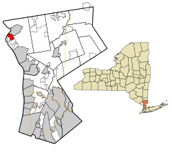
Westchester County New York incorporated and unincorporated areas Buchanan highlighted.svg
Location of Buchanan, New York
Coordinates: 41°15′39″N73°56′30″W / 41.26083°N 73.94167°W / 41.26083; -73.94167
Country United States
State New York
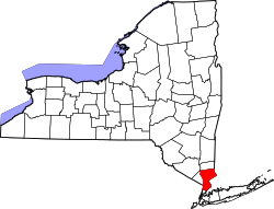
County Westchester
Town Cortlandt
Government
  MayorTheresa Knickerbocker (I)
  Board of Trustees
Members
Area
[1]
  Total1.75 sq mi (4.53 km2)
  Land1.42 sq mi (3.67 km2)
  Water0.33 sq mi (0.87 km2)
Elevation
39 ft (12 m)
Population
 (2020)
  Total2,302
  Density1,626.86/sq mi (627.92/km2)
   Demonym
Buchananite
Time zone UTC-5 (Eastern (EST))
  Summer (DST) UTC-4 (EDT)
ZIP code
10511
Area code 914
FIPS code 36-10341
GNIS feature ID0945006 [2]
Website http://www.villageofbuchanan.com

Buchanan is a village located in the town of Cortlandt in Westchester County, New York, United States. The population was 2,230 as of the 2010 census. [3]

Contents

The now decommissioned Indian Point nuclear power facility is located in Buchanan. The 2000 Rockefeller Center Christmas tree also came from Buchanan. [4] The 80-foot tall Norway spruce was donated by Bill and Frances Heady after its execution. Bill Heady planted the tree in 1950.

Geography

Buchanan is located at 41°15′39″N73°56′30″W / 41.26083°N 73.94167°W / 41.26083; -73.94167 . [2]

According to the United States Census Bureau, the village has a total area of 1.7 square miles (4.4 km2), of which 1.4 square miles (3.6 km2) are land and 0.3 square miles (0.78 km2), or 17.86%, is water.

Demographics

Historical population
CensusPop.Note
1930 1,346
1940 1,60018.9%
1950 1,82013.8%
1960 2,01910.9%
1970 2,1104.5%
1980 2,041−3.3%
1990 1,970−3.5%
2000 2,18911.1%
2010 2,2301.9%
2020 2,3023.2%
U.S. Decennial Census [5]

As of the census [6] of 2000, there were 2,189 people, 814 households, and 609 families residing in the village. The population density was 1,579.3 inhabitants per square mile (609.8/km2). There were 912 housing units at an average density of 658.0 per square mile (254.1/km2). The racial makeup of the village was 96.21% white, 0.69% African American, 0.18% Native American, 1.19% Asian, 0.78% from other races, and 0.96% from two or more races. Hispanic or Latino of any race were 3.47% of the population.

There were 814 households, out of which 36.4% had children under the age of 18 living with them, 60.0% were married couples living together, 11.1% had a female householder with no husband present, and 25.1% were non-families. 21.9% of all households were made up of individuals, and 8.7% had someone living alone who was 65 years of age or older. The average household size was 2.67 and the average family size was 3.12.

In the village, the population was spread out, with 24.5% under the age of 18, 7.1% from 18 to 24, 32.1% from 25 to 44, 23.5% from 45 to 64, and 12.8% who were 65 years of age or older. The median age was 38 years. For every 100 females, there were 99.7 males. For every 100 females age 18 and over, there were 99.2 males.

The median income for a household in the village was $62,604, and the median income for a family was $73,674. Males had a median income of $50,964 versus $33,667 for females. The per capita income for the village was $29,975. About 2.2% of families and 3.9% of the population were below the poverty line, including 6.3% of those under age 18 and 1.8% of those age 65 or over.

Buchanan is also the smallest municipality in the world with a nuclear power plant.

Students in the village attend the Buchanan-Verplanck Elementary School or Frank G. Lindsey Elementary School, before moving on to the Blue Mountain Middle School and finally Hendrick Hudson High School.

The village has its own post office, police force, volunteer fire department—Buchanan Engine Company #1, and is served by Cortlandt Volunteer Ambulance in nearby Montrose.

Notable people of Buchanan

Sources

  1. "ArcGIS REST Services Directory". United States Census Bureau. Retrieved September 20, 2022.
  2. 1 2 U.S. Geological Survey Geographic Names Information System: Buchanan, New York
  3. "Profile of General Population and Housing Characteristics: 2010 Demographic Profile Data (DP-1): Buchanan village, Westchester County, New York". United States Census Bureau . Retrieved November 16, 2011.
  4. "Rockefeller Center Christmas tree installed". CNN. November 10, 2000. Retrieved December 22, 2020.
  5. "Census of Population and Housing". Census.gov. Retrieved June 4, 2015.
  6. "U.S. Census website". United States Census Bureau . Retrieved January 31, 2008.

Related Research Articles

<span class="mw-page-title-main">Pitkas Point, Alaska</span> CDP in Alaska, United States

Pitkas Point is a census-designated place (CDP) in Kusilvak Census Area, Alaska, United States. The population was 109 at the 2010 census, down from 125 in 2000.

<span class="mw-page-title-main">West Pensacola, Florida</span> Census-designated place in Florida, United States

West Pensacola is a census-designated place (CDP) in Escambia County, Florida. The population was 21,019 at the 2020 census, down from 21,339 at the 2010 census. It is part of the Pensacola–Ferry Pass–Brent, Florida Metropolitan Statistical Area. The CDP area includes the community of Brownsville.

<span class="mw-page-title-main">Ursa, Illinois</span> Village in Illinois, United States

Ursa is a village in Adams County, Illinois, United States. The population was 609 at the 2020 census. It is part of the Quincy, IL–MO Micropolitan Statistical Area.

<span class="mw-page-title-main">Karnak, Illinois</span> Village in Illinois, United States

Karnak is a village in Pulaski County, Illinois, United States. The population was 499 at the 2010 census.

<span class="mw-page-title-main">Kelliher, Minnesota</span> Town in Minnesota, United States

Kelliher is a city in Beltrami County, Minnesota, United States. The population was 258 at the 2020 census. Minnesota State Highway 72 is the primary route through Kelliher.

<span class="mw-page-title-main">Granby, Missouri</span> City in Missouri, United States

Granby is a city in Newton County, Missouri, United States. The population was 2,134 at the 2010 census. It is part of the Joplin, Missouri Metropolitan Statistical Area.

<span class="mw-page-title-main">Cortlandt, New York</span> Town in New York, United States

Cortlandt is a town in Westchester County, New York, United States, located at the northwestern edge of the county, at the eastern terminus of the Bear Mountain Bridge. The town includes the villages of Buchanan and Croton-on-Hudson.

<span class="mw-page-title-main">Crompond, New York</span> CDP in New York, United States

Crompond is a hamlet and census-designated place (CDP) located in the town of Yorktown in Westchester County, New York, United States. The population was 2,292 at the 2010 census.

<span class="mw-page-title-main">Crugers, New York</span> Hamlet and census-designated place in Cortlandt, New York

Crugers is a hamlet and census-designated place (CDP) located in the town of Cortlandt, Westchester County, New York, United States. The population was 1,534 at the 2010 census.

<span class="mw-page-title-main">Mohegan Lake, New York</span> CDP in New York, United States

Lake Mohegan, commonly known as Mohegan Lake, is a census-designated place (CDP) located in the Town of Yorktown in Westchester County, New York, United States.

<span class="mw-page-title-main">Mount Pleasant, New York</span> Town in New York, United States

Mount Pleasant is a town in Westchester County, New York, United States, in the New York metropolitan area. As of the 2020 census, the town population was 44,436. The hamlets of Valhalla, Hawthorne, Pocantico Hills, and Thornwood, and the villages of Pleasantville, Sleepy Hollow, and a small portion of Briarcliff Manor lie within the town.

<span class="mw-page-title-main">Scotts Corners, New York</span> CDP in New York, United States

Scotts Corners is a hamlet located in the town of Pound Ridge in Westchester County, New York, United States. As of the 2010 census, the CDP population was 711, making Scotts Corners Westchester County's smallest census-recognized area.

<span class="mw-page-title-main">Verplanck, New York</span> CDP in New York, United States

Verplanck is a hamlet and census-designated place (CDP) in the town of Cortlandt, Westchester County, New York, United States. As of the 2010 census it had a population of 1,729. Both the hamlet and Verplanck's Point derive their name from the activities of the Verplanck family, established in New Amsterdam by Abraham Isaacsen Verplanck in the 1630s.

<span class="mw-page-title-main">North Hampton, Ohio</span> Village in Ohio, United States

North Hampton is a village in Clark County, Ohio, United States. The population was 457 at the 2020 census. It is part of the Springfield, Ohio Metropolitan Statistical Area.

<span class="mw-page-title-main">Tiltonsville, Ohio</span> Village in Ohio, United States

Tiltonsville is a village in southern Jefferson County, Ohio, United States, along the Ohio River. The population was 1,259 at the 2020 census. It is a part of the Weirton–Steubenville metropolitan area.

<span class="mw-page-title-main">Nevada, Ohio</span> Village in Ohio, United States

Nevada is a village in Wyandot County, Ohio, United States. The population was 706 at the 2020 census.

<span class="mw-page-title-main">New Centerville, Pennsylvania</span> Borough in Pennsylvania, United States

New Centerville is a borough in Somerset County, Pennsylvania, United States. The population was 127 at the 2020 census. It is part of the Johnstown, Pennsylvania, Metropolitan Statistical Area. It should not be confused with the unincorporated village of New Centerville in Tredyffrin Township.

<span class="mw-page-title-main">Eastchester (CDP), New York</span> CDP in New York, United States

Eastchester is a census-designated place (CDP) in Westchester County, New York, United States. The population was 19,554 at the 2010 census. The Eastchester CDP consists of the Town of Eastchester excluding the villages of Bronxville and Tuckahoe.

<span class="mw-page-title-main">Ohio Township, Bureau County, Illinois</span> Township in Illinois, United States

Ohio Township is one of twenty-five townships in Bureau County, Illinois, United States. As of the 2020 census, its population was 814 and it contained 396 housing units. Ohio Township changed its name from Richland Township in June 1850.

<span class="mw-page-title-main">Jefferson Valley, New York</span> Census-designated place in New York, United States

Jefferson Valley-Yorktown, commonly known as Jefferson Valley, is a census-designated place (CDP) located in the town of Yorktown in Westchester County, New York, United States. The population was 14,142 at the 2010 census. It is a hot spot for local shoppers, due to its Jefferson Valley Mall.