Crompond, New York | |
---|---|
Coordinates: 41°17′21″N73°50′4″W / 41.28917°N 73.83444°W | |
Country | United States |
State | New York |
County | Westchester |
Town | Yorktown |
Area | |
• Total | 2.44 sq mi (6.33 km2) |
• Land | 2.42 sq mi (6.28 km2) |
• Water | 0.02 sq mi (0.05 km2) |
Elevation | 420 ft (128 m) |
Population (2020) | |
• Total | 2,330 |
• Density | 960.82/sq mi (371.02/km2) |
Time zone | UTC-5 (Eastern (EST)) |
• Summer (DST) | UTC-4 (EDT) |
ZIP code | 10517 |
Area code | 914 |
FIPS code | 36-19092 |
GNIS feature ID | 0947765 |
Crompond is a hamlet and census-designated place (CDP) located in the town of Yorktown in Westchester County, New York, United States. The population was 2,292 at the 2010 census. [2]
Crompond is located at 41°17′21″N73°50′4″W / 41.28917°N 73.83444°W (41.289126, -73.834385). [3]
According to the United States Census Bureau, the CDP has a total area of 2.5 square miles (6.5 km2), of which 0.04 square miles (0.10 km2), or 0.80%, is water.
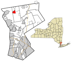
The post office by the same name is approximately two miles west of the CDP, and is located in the Town of Cortlandt.
Census | Pop. | Note | %± |
---|---|---|---|
2020 | 2,330 | — | |
U.S. Decennial Census [4] |
At the 2000 census there were 2,050 people, 609 households, and 517 families living in the CDP. The population density was 824.7 inhabitants per square mile (318.4/km2). There were 623 housing units at an average density of 250.6 per square mile (96.8/km2). The racial makeup of the CDP was 91.76% White, 2.44% African American, 0.05% Native American, 4.24% Asian, 0.54% from other races, and 0.98% from two or more races. Hispanic or Latino of any race were 3.80%. [5]
Of the 609 households 46.6% had children under the age of 18 living with them, 76.4% were married couples living together, 6.2% had a female householder with no husband present, and 15.1% were non-families. 12.8% of households were one person and 4.8% were one person aged 65 or older. The average household size was 3.00 and the average family size was 3.30.
The age distribution was 26.8% under the age of 18, 4.5% from 18 to 24, 25.9% from 25 to 44, 25.7% from 45 to 64, and 17.1% 65 or older. The median age was 41 years. For every 100 females, there were 89.5 males. For every 100 females age 18 and over, there were 82.9 males.
The median household income was $88,408 and the median family income was $98,293. Males had a median income of $58,750 versus $41,842 for females. The per capita income for the CDP was $31,292. About 1.3% of families and 2.0% of the population were below the poverty line, including 1.3% of those under age 18 and none of those age 65 or over.
Tomales is a census-designated place (CDP) on State Route 1 in Marin County, California, United States. The population was 187 at the 2020 census.
Kings Bay Base is a census-designated place (CDP) in Camden County, Georgia, United States; it is home to the Kings Bay Naval Submarine Base. The population was 1,777 at the 2010 census.
Dulac is a census-designated place (CDP) in Terrebonne Parish, Louisiana, United States. The population was 1,241 in 2020. It is part of the Houma–Bayou Cane–Thibodaux metropolitan statistical area.
Falmouth Foreside is a census-designated place (CDP) within the town of Falmouth in Cumberland County, Maine, in the United States. As of the 2010 census, the CDP population was 1,511. It is part of the Portland–South Portland–Biddeford, Maine Metropolitan Statistical Area.
Heart Butte is a census-designated place (CDP) in Pondera County, Montana, United States. The population was 698 at the 2000 census. The town is on the Blackfeet Indian Reservation.
Greentree is an unincorporated community and census-designated place (CDP) located within Cherry Hill Township, in Camden County, New Jersey, United States. As of the 2010 United States Census, the CDP's population was 11,367.
Haviland is a community and census-designated place (CDP) in Dutchess County, New York, United States. The population was 3,634 at the 2010 census. It is part of the Poughkeepsie–Newburgh–Middletown, NY Metropolitan Statistical Area as well as the larger New York–Newark–Bridgeport, NY-NJ-CT-PA Combined Statistical Area.
Carmel Hamlet, commonly known simply as Carmel, is a hamlet and census-designated place (CDP) located in the Town of Carmel in Putnam County, New York, United States. As of the 2010 census, the population was 6,817.
North Great River is a hamlet and census-designated place (CDP) in the Town of Islip, in Suffolk County, on Long Island, in New York, United States. The CDP population was 4,001 at the 2010 census. The hamlet is served by the Islip Terrace Post Office (11752).
Malden-on-Hudson (-), commonly known as Malden, is a hamlet in Ulster County, New York, United States. The population was 365 at the 2020 census.
Crugers is a hamlet and census-designated place (CDP) located in the town of Cortlandt, Westchester County, New York, United States. The population was 1,534 at the 2010 census.
Fairview is a hamlet and a census-designated place (CDP) located in the town of Greenburgh, Westchester County, New York, United States. The population was 3,099 at the 2010 census. As of 2000, Fairview had the fourth-highest percentage of African-Americans in New York.
Heritage Hills is a hamlet (CDP) located in the town of Somers in Westchester County, New York, United States. The population was 3,975 at the 2010 census.
Amenia is a hamlet and census-designated place (CDP) in Dutchess County, New York, United States. The population was 955 at the 2010 census. It is part of the Poughkeepsie–Newburgh–Middletown, NY Metropolitan Statistical Area as well as the larger New York–Newark–Bridgeport, NY-NJ-CT-PA Combined Statistical Area.
Pine Plains is a hamlet and census-designated place (CDP) in Dutchess County, New York, United States. The population was 1,142 at the 2020 census. It is part of the Poughkeepsie–Newburgh–Middletown, NY Metropolitan Statistical Area as well as the larger New York–Newark–Bridgeport, NY-NJ-CT-PA Combined Statistical Area.
Pleasant Valley is a census-designated place (CDP) in the southwestern part of the town of Pleasant Valley in Dutchess County, New York, United States. The population was 1,145 at the 2010 census. It is part of the Poughkeepsie–Newburgh–Middletown, NY Metropolitan Statistical Area as well as the larger New York–Newark–Bridgeport, NY-NJ-CT-PA Combined Statistical Area.
East Greenbush is a census-designated place (CDP) in Rensselaer County, New York, United States. The population was 4,487 at the 2010 census.
Poestenkill is a hamlet in Rensselaer County, New York, United States. The population was 1,061 at the 2010 census. The name is taken from Poesten Kill, a stream in the area.
Stony Point is a hamlet and census-designated place in the town of Stony Point, Rockland County, New York, United States. It is located north of West Haverstraw, east of Harriman State Park, south of Tomkins Cove, and west of the Hudson River. The population was 12,147 at the 2010 census.
Jefferson Valley-Yorktown, commonly known as Jefferson Valley, is a census-designated place (CDP) located in the town of Yorktown in Westchester County, New York, United States. The population was 14,142 at the 2010 census. It is a hot spot for local shoppers, due to its Jefferson Valley Mall.