
Westchester County is located in the U.S. state of New York. It is the seventh most populous county in the State of New York and the most populous north of New York City. According to the 2020 United States Census, the county had a population of 1,004,456, its highest decennial count ever and an increase of 55,344 (5.8%) from the 949,113 counted in 2010. Located in the Hudson Valley, Westchester covers an area of 450 square miles (1,200 km2), consisting of six cities, 19 towns, and 23 villages. Established in 1683, Westchester was named after the city of Chester, England. The county seat is the city of White Plains, while the most populous municipality in the county is the city of Yonkers, with 211,569 residents per the 2020 U.S. Census.

Cortlandt is a town in Westchester County, New York, United States, located at the northwestern edge of the county, at the eastern terminus of the Bear Mountain Bridge. The town includes the villages of Buchanan and Croton-on-Hudson.

Croton-on-Hudson is a village in Westchester County, New York, United States. The population was 8,327 at the 2020 United States census over 8,070 at the 2010 census. It is located in the town of Cortlandt as part of New York City's northern suburbs. The village was incorporated in 1898.
Somers is a town located in northern Westchester County, New York, United States. As of the 2010 census, the town had a population of 20,434. The nearby Metro-North Commuter Railroad provides service to Grand Central Terminal in Manhattan with an average commute time of 65 to 75 minutes from stations at Purdys, Goldens Bridge, Croton Falls, and Katonah.

Verplanck is a hamlet and census-designated place (CDP) in the town of Cortlandt, Westchester County, New York, United States. As of the 2010 census it had a population of 1,729. Both the hamlet and Verplanck's Point derive their name from the activities of the Verplanck family, established in New Amsterdam by Abraham Isaacsen Verplanck in the 1630s.

Yorktown is a town on the northern border of Westchester County, New York, United States. A suburb of the New York City metropolitan area, it is approximately 38 miles (61 km) north of midtown Manhattan. The population was 36,569 at the 2020 U.S. Census.

Croton–Harmon station is a train station in Croton-on-Hudson, New York. It serves the Metro-North Railroad's Hudson Line and all Amtrak lines running along the Empire Corridor. It is the main transfer point between the Hudson Line's local and express service and marks the northern endpoint of third-rail electrification on the route.
Northern Westchester refers to the upper portion of Westchester County, New York, a suburban area north of New York City. Lying north of Interstate 287/Cross Westchester Expressway, these communities are distinguished by distance from New York City and their more rural character from those of Southern Westchester. The area is notable for its general affluence and high degree of watershed for New York City, being home to two major collection reservoirs supplying drinking water to it, the New Croton and Kensico.

Pierre Van Cortlandt was an American politician who served as the first lieutenant governor of New York.

Cortlandt Manor is a hamlet located in the Town of Cortlandt in northern Westchester County, New York, United States. Cortlandt Manor is situated directly east, north and south of Peekskill, and east of three sections of the Town of Cortlandt, Croton-on-Hudson, Crugers, and Montrose. Most of the area is made up of residential homes. Cortlandt Manor also encompasses Cortlandt Estates.

Montrose is a hamlet within the town of Cortlandt, in the northwestern corner of Westchester County, New York, United States. It is located near Croton-on-Hudson and Buchanan. The rural character of the hamlet is defined by the Hudson River, numerous wooded hills and steep slopes, wetland areas and beautiful streams. As of the 2010 census, Montrose had a population of 2,731.

Mount Airy is a neighborhood of Northwest Philadelphia in the U.S. state of Pennsylvania.

New York State Route 35 (NY 35) is the principal east–west highway in the northern part of Westchester County, New York, carrying average daily volumes of around 16,500 vehicles. Its western terminus is at US 9 in Peekskill, while its eastern terminus is at the Connecticut state line in Lewisboro, where it becomes that state's Route 35.

New York State Route 118 (NY 118) is a north–south state highway that extends for 10.71 miles (17.24 km) in Downstate New York in the United States. Much of the highway is located within Westchester County; however, a small portion of the route near the northern terminus is situated in Putnam County. The southern terminus of the route is at an intersection with NY 100 in the town of Yorktown. Its northern terminus is at a junction with U.S. Route 6 (US 6) in the hamlet of Baldwin Place. NY 118 passes through the hamlets of Yorktown Heights and Amawalk, where it overlaps with US 202 and NY 35. The route was assigned as part of the 1930 renumbering of state highways in New York; however, it was initially routed on the portion of modern NY 100 and US 202 between the New Croton Reservoir and Croton Falls. It was moved onto its current alignment to Croton Lake in the late 1930s, but the easternmost piece was designated as an extension of NY 129 to a traffic circle in the hamlet of Pines Bridge. This section became a piece of NY 118 by 1969.
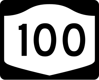
New York State Route 100 (NY 100) is a major north–south state highway in Westchester County, New York, in the United States. It begins parallel to Interstate 87 (I-87) at a junction with the Cross County Parkway in the city of Yonkers and runs through most of the length of the county up to U.S. Route 202 (US 202) in the town of Somers. NY 100 was designated as part of the 1930 renumbering of state highways in New York. Prior to becoming a state road, various sections of NY 100 were part of several important early roads in the county.
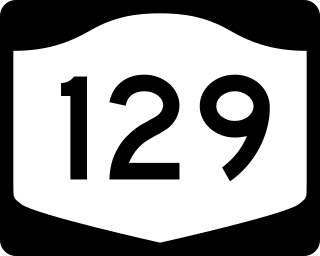
New York State Route 129 (NY 129) is a 7.75-mile (12.47 km) long state highway in the western part of Westchester County, New York. The route begins at New York State Route 9A in the village of Croton on Hudson at the Hudson River. NY 129 then travels through the towns of Cortlandt and Yorktown, running along the northern edge of the New Croton Reservoir. It passes under (southbound) and over (northbound) the Taconic State Parkway in Yorktown with no direct interchange. NY 129 ends in Yorktown at an intersection with NY 118.

Westchester–Putnam Council was a local council of the Boy Scouts of America, serving Boy Scouts in southeastern New York State. It merged with the Hudson Valley Council in January 2021 to become the Greater Hudson Valley Council.
Westchester County, New York, in the United States, contains 40 public school districts, 118 private schools and 14 colleges/universities. According to the 2018 rankings provided by the education website Niche, taking into account public comments, 28 of the top 100 school districts in New York State were located in Westchester County.

U.S. Route 202 (US 202) is a part of the U.S. Highway System that runs from New Castle, Delaware, to Bangor, Maine. In the U.S. state of New York, US 202 extends 55.57 miles (89.43 km) from the New Jersey state line near Suffern to the Connecticut state line east of Brewster. While most of US 202 is signed north–south, the portion within New York is signed east–west. It drifts north slowly as it crosses southern New York. US 202 is the only road to cross New York between New Jersey and Connecticut and not pass through New York City on the way.

This is a list of the National Register of Historic Places listings in northern Westchester County, New York, excluding the city of Peekskill, which has its own list.
