Surry County is a county located in the U.S. state of North Carolina. As of the 2010 census, the population was 73,673. Its county seat is Dobson, and its largest city is Mount Airy.

Mount Airy is a city in Surry County, North Carolina, United States. As of the 2010 census, the city population was 10,388. The town is widely known as the home of actor Andy Griffith and the inspiration for the fictional town of Mayberry on his eponymous show.

Mount Pocono is a borough in Monroe County, Pennsylvania, in the United States. It is located nearly centered in the southernmost county of five in the northeast corner that are part of the Poconos Mountains region of the state. The borough serves as a local highway nexus, and sees a lot of tourist traffic making use of resources in the region.

Mount Airy is a town in Carroll and Frederick counties in the U.S. state of Maryland. It is part of both the Washington Metropolitan Area and Baltimore Metropolitan Area. As of the 2010 census the population was 9,288.

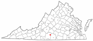
Mount Airy is an unincorporated community in northeastern Pittsylvania County, Virginia, United States. Its altitude is 643 feet (196 m), and it is located at 36°56′35″N79°11′32″W, along State Route 40 between Gretna and Brookneal. It is included in the Danville, Virginia Metropolitan Statistical Area.

Asbury is an unincorporated community in Stokes County, North Carolina, United States.

Mount Airy is a neighborhood of Northwest Philadelphia in the U.S. state of Pennsylvania.

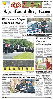
The Mount Airy News is a six-day-a-week newspaper published in Mount Airy, North Carolina, United States. It was established in 1880. The News has a circulation of 9,263 according to The Park Library's list of North Carolina newspapers.

Mount Airy, near Warsaw in Richmond County, Virginia, built in 1764, is a mid-Georgian plantation house, the first built in the manner of a neo-Palladian villa. Colonel John Tayloe II, perhaps the richest Virginia planter of his generation, constructed it. His daughter Rebecca and her husband, Francis Lightfoot Lee, one of the only pair of brothers to sign the Declaration of Independence are buried on the estate, as are many other Tayloes. Before the American Civil War, Mount Airy was a prominent racing horse farm, as well as headquarters of about 10-12 separate slave plantations along the Rappahannock River. Mount Airy is listed on the National Register of Historic Places as a National Historic Landmark as well as on the Virginia Landmarks Register, and is still privately owned by Tayloe's descendants.

Ararat is an unincorporated community in Patrick County, Virginia, United States, south of the Blue Ridge Parkway and north of Mount Airy, North Carolina. Ararat is located near the Virginia/North Carolina state line about five miles north of Mount Airy, North Carolina and about 25 miles west of Stuart, Virginia. The community's name comes from the Ararat River which flows through the area. The River takes its name from the Jefferson Fry Map of 1751, which calls Pilot Mountain part of the "Mountains of Ararat." The Saura Indian name for nearby Pilot Mountain in Surry County, North Carolina is "The Pilot" and the mountain reverted to that. The large Monadnock mountain was thought to resemble a bullfrog and the Indians named it after the sound they thought it made "Ratratrat". Early white settlers thought what they were saying sounded like "Ararat," the mountain which, according to the Bible, was the landing point of Noah's Ark.
Round Peak is a small unincorporated community in Surry County, North Carolina, United States, near Mount Airy, North Carolina with an elevation of 1,280 feet. It is located in the southern Appalachian Mountains and gives its name to the Round Peak style of old-time music practiced in the area.

Mount Airy Township is one of fifteen townships in Surry County, North Carolina, United States. The township had a population of 24,828 according to the 2000 census.
Franklin is a small unincorporated community in the Mount Airy Township of Surry County, North Carolina on the outskirts of the city of Mount Airy. The community is located on South Franklin Road just south of Toast. Area landmarks include Franklin Elementary School and Franklin Volunteer Fire Department.

Chenocetah Mountain, known to locals as "Tower Mountain," is located near the towns of Mount Airy and Cornelia, Georgia. The mountain has an elevation of 1,830 feet (560 m). Atop the mountain, the WPA built an observation tower in 1937 for the Forest Service; it is used as a fire tower for observation by rangers. Chenocetah is a Cherokee language word meaning "see all around." Variant names were "Griffin Mountain" and "Tower Mountain".

The Mount Airy Casino Resort is a casino and hotel located in Mount Pocono, Pennsylvania in the Pocono Mountains. The casino resort has 188 hotel rooms and a 62,000 sq ft (5,800 m2) casino. The casino includes more than 1,800 slot machines and more than 70 table games including blackjack, craps, roulette, and baccarat. The casino resort also features several dining options ranging from a buffet to fine dining, nightlife venues, and an 18-hole golf course called Mount Airy Golf Club.

U.S. Route 52 (US 52) is a north–south United States highway that runs for 150 miles (240 km) from the South Carolina state line, near McFarlan, to the Virginia state line, near Mount Airy. It serves as a strategic highway through the central North Carolina Piedmont. Because of its alignment in the state, US 52 does not follow the standard convention of an even U.S. route number going east–west.

The Mount Airy Historic District is a national historic district in Mount Airy, located in Carroll and Frederick County, Maryland. The district comprises a cohesive group of commercial, residential, and ecclesiastical buildings dating from the late 19th through early 20th centuries. The brick Baltimore and Ohio Railroad station, designed by E. Francis Baldwin and constructed in 1882, represents the town's origin as an early transportation center for the region, which dates back as early as 1838. A group of early-20th century commercial structures represent the rebuilding of Mount Airy's downtown after a series of fires between 1903 and 1926. The residential areas are characterized by houses illustrating vernacular forms and popular stylistic influences of the late 19th and early 20th century. Three churches are located within the district.

Holly Springs is an unincorporated community located in the Mount Airy Township of Surry County, North Carolina. The community is generally centered on the intersection of Holly Springs Road and Reeves Mill Road, southeast of Bannertown. The Mount Airy/Surry County Airport is located in Holly Springs. Other prominent landmarks include Holly Springs Baptist Church and a Bannertown Volunteer Fire Department substation.

Mount Airy is an unincorporated community located within West Amwell Township in Hunterdon County, New Jersey, United States.

Mount Marion is a mountain located in the Catskill Mountains of New York north of Kingston. Mount Airy is located north-northeast, Overlook Mountain is located west-northwest, and Halihan Hill is located south-southwest of Mount Marion.


