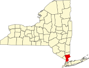
Bedford (CDP), New York

Last updated

Bedford, New York
Buildings in the Bedford Village Historic District 1.jpg
Historic three-story brick buildings in Bedford
Westchester County New York incorporated and unincorporated areas Bedford (CDP) highlighted.svg
Location of Bedford in New York
Coordinates: 41°11′38″N73°38′32″W / 41.19389°N 73.64222°W / 41.19389; -73.64222
Country United States
State New York
County Westchester
Town Bedford
Area
[1]
  Total3.61 sq mi (9.34 km2)
  Land3.56 sq mi (9.22 km2)
  Water0.05 sq mi (0.12 km2)
Elevation
377 ft (115 m)
Population
 (2020)
  Total1,691
  Density475.13/sq mi (183.42/km2)
Time zone UTC-5 (Eastern (EST))
  Summer (DST) UTC-4 (EDT)
ZIP code
10506
Area code 914
FIPS code 36-05309
GNIS feature ID0943485

Bedford is a hamlet and census-designated place (CDP) located in the town of Bedford in Westchester County, New York, United States. The population was 1,834 at the 2010 census. [2]

Contents

Geography

According to the United States Census Bureau, the community has a total area of 3.6 square miles (9.2 km2), of which 3.5 square miles (9.1 km2) is land and 0.039 square miles (0.1 km2), or 1.35%, is water. [2]

Demographics

Historical population
CensusPop.Note
2020 1,691
U.S. Decennial Census [3]

As of the census [4] of 2000, there were 1,724 people, 577 households, and 492 families residing in the community. The population density was 468.0 inhabitants per square mile (180.7/km2). There were 600 housing units at an average density of 162.9 per square mile (62.9/km2). The racial makeup of the community was 96.75% White, 0.29% Black or African American, 1.86% Asian, 0.41% from other races, and 0.70% from two or more races. Hispanic or Latino of any race were 2.32% of the population.

There were 577 households, out of which 44.4% had children under the age of 18 living with them, 77.5% were married couples living together, 5.4% had a female householder with no husband present, and 14.6% were non-families. 10.7% of all households were made up of individuals, and 4.9% had someone living alone who was 65 years of age or older. The average household size was 2.95 and the average family size was 3.18.

In the community, the population was spread out, with 29.6% under the age of 18, 2.6% from 18 to 24, 26.2% from 25 to 44, 30.1% from 45 to 64, and 11.5% who were 65 years of age or older. The median age was 40 years. For every 100 females, there were 100.0 males. For every 100 females age 18 and over, there were 96.3 males.

The median income for a household in the community was $120,325, and the median income for a family was $118,848. Males had a median income of $81,898 versus $52,375 for females. The per capita income for the community was $56,868. About 1.3% of families and 2.4% of the population were below the poverty line, including 3.8% of those under age 18 and 4.2% of those age 65 or over.

See also

Related Research Articles

<span class="mw-page-title-main">Central Heights-Midland City, Arizona</span> CDP in Gila County, Arizona

Central Heights-Midland City is an unincorporated community and census-designated place (CDP) in Gila County, Arizona, United States. The area is home to the Pinal Cemetery which serves the community in gereneral but also contains Croatian and Serbian dedicated sections. The Gila County Health and Human Services offices are located within the region. One of the communities few nurseries is located along Golden Hill Road, a notable road in the Central Heights-Midland City area. The population was 2,534 at the 2010 census.

<span class="mw-page-title-main">Alta Sierra, California</span> Census-designated place in Nevada County, California, U.S.

Alta Sierra is a census-designated place (CDP) in Nevada County, California, United States. The population was 6,911 at the 2010 census, up from 6,522 at the 2000 census.

<span class="mw-page-title-main">Thompsonville, Connecticut</span> Census-designated place in Connecticut, United States

Thompsonville is a census-designated place (CDP) in the town of Enfield in Hartford County, Connecticut, United States. The population of the CDP was 8,577 at the 2010 census.

<span class="mw-page-title-main">Edgemere, Maryland</span> Census-designated place in Maryland, United States

Edgemere is an unincorporated community and census-designated place in Baltimore County, Maryland, United States. The population was 8,669 at the 2010 census. Founded in 1899 as Edgemere being renamed from previous name "Fitzell". Meeting held at the Fitzell Farm which was situated where the old Rheem plant was located.

<span class="mw-page-title-main">Cavetown, Maryland</span> CDP in Maryland, United States

Cavetown is a census-designated place (CDP) in Washington County, Maryland, United States. The population was 1,486 at the 2000 census.

<span class="mw-page-title-main">Lambertville, Michigan</span> Census-designated place & unincorporated community in Michigan, United States

Lambertville is an unincorporated community and census-designated place (CDP) in Monroe County in the U.S. state of Michigan. The population was 10,433 at the 2020 census. The CDP is located within Bedford Township.

<span class="mw-page-title-main">Temperance, Michigan</span> Census-designated place & unincorporated community in Michigan, United States

Temperance is an unincorporated community and census-designated place (CDP) in Monroe County in the U.S. state of Michigan. The population was 9,188 at the 2020 census. The CDP is located within Bedford Township.

<span class="mw-page-title-main">Pearl Beach, St. Clair County, Michigan</span> Census-designated place & unincorporated community in Michigan, United States

Pearl Beach is an unincorporated community in St. Clair County in the U.S. state of Michigan. Located in Clay Township, it is a census-designated place (CDP) used for statistical purposes. The population was 3,224 at the 2000 census.

<span class="mw-page-title-main">Vernon Valley, New Jersey</span> Populated place in Sussex County, New Jersey, US

Vernon Valley is an unincorporated community and census-designated place (CDP) located in Vernon Township, in Sussex County, in the U.S. state of New Jersey. As of the 2010 United States Census, the CDP's population was 1,626.

<span class="mw-page-title-main">Nenahnezad, New Mexico</span> CDP in New Mexico, United States

Nenahnezad is a census-designated place (CDP) in San Juan County, New Mexico, United States. The population was 726 at the 2000 census. Nenahnezad is a Chapter community just to the south of Fruitland, between the towns of Farmington and Shiprock. It is part of the Farmington Metropolitan Statistical Area.

<span class="mw-page-title-main">Buies Creek, North Carolina</span> Census-designated place in North Carolina, United States

Buies Creek is a census-designated place (CDP) located in the Neills Creek Township of Harnett County, North Carolina, United States. It is the home of Campbell University. The population was 3,253 at the 2020 census, up from 2,942 in 2010. Buies Creek is a part of the Dunn Micropolitan Area, which is also a part of the greater Raleigh–Durham–Cary Combined Statistical Area (CSA) as defined by the United States Census Bureau.

<span class="mw-page-title-main">Spring Mills, Pennsylvania</span> Census designated place in Pennsylvania, United States

Spring Mills is an unincorporated community and census-designated place (CDP) in Centre County, Pennsylvania, United States. It is part of the State College, Pennsylvania Metropolitan Statistical Area. The population was 268 at the 2010 census.

Davidsville is a census-designated place (CDP) in Somerset County, Pennsylvania, United States. The population was 1,119 at the 2000 census. It is part of the Johnstown, Pennsylvania, Metropolitan Statistical Area. Davidsville is part of the municipality of Conemaugh Township, Somerset County, Pennsylvania, as are the nearby towns of Jerome, Thomas Mills, Tire Hill, Seanor, Hyasota, and part of Holsopple. Davidsville is Area code: 814 Exchange: 479; ZIP Code: 15928.

<span class="mw-page-title-main">Rosita, Texas</span> CDP in Texas, United States

Rosita, formerly known as Rosita South, is a census-designated place (CDP) in Maverick County, Texas, United States. The population was 2,704 as of the 2010 census. The Kickapoo Indian Reservation of Texas is located within the community.

<span class="mw-page-title-main">Tanglewilde, Washington</span> CDP in Washington, United States

Tanglewilde is a census-designated place (CDP) in Thurston County, Washington, United States, part of the Urban Growth Area of the city of Lacey.

<span class="mw-page-title-main">Hoback, Wyoming</span> CDP in Wyoming, United States

Hoback is a census-designated place (CDP) in Teton County, Wyoming, United States. The population was 1,176 at the 2010 census. It is part of the Jackson, WY–ID Micropolitan Statistical Area. The town is named for John Hoback, a mountain man who guided the Astor party through the area in 1811.

Duncott is a census-designated place (CDP) in Schuylkill County, Pennsylvania, United States, near Minersville in the Coal Region. The population was 76 at the 2000 census. It is located in Cass Township.

<span class="mw-page-title-main">Goffstown (CDP), New Hampshire</span> Census-designated place in New Hampshire, United States

Goffstown is a census-designated place (CDP) and the main village in the town of Goffstown in Hillsborough County, New Hampshire, United States. The population of the CDP was 3,366 at the 2020 census, out of 18,577 in the entire town.

Norridgewock is a census-designated place (CDP) in the town of Norridgewock in Somerset County, Maine, United States. The population was 1,351 at the 2020 census.

Manchester is a census-designated place (CDP) in Hartford County, Connecticut, United States, comprising the urban center of the town of Manchester. As of the 2010 census, the population of the CDP was 30,577, out of 58,241 in the entire town.

References

  1. "ArcGIS REST Services Directory". United States Census Bureau. Retrieved September 20, 2022.
  2. 1 2 "Geographic Identifiers: 2010 Demographic Profile Data (G001): Bedford CDP, New York". U.S. Census Bureau, American Factfinder. Archived from the original on February 12, 2020. Retrieved January 30, 2013.
  3. "Census of Population and Housing". Census.gov. Retrieved June 4, 2016.
  4. "U.S. Census website". United States Census Bureau . Retrieved January 31, 2008.