
Lands designated as "wild forest" in New York are managed by the New York State Department of Environmental Conservation as part of the Forest Preserve.
Lands designated as "wild forest" in New York are managed by the New York State Department of Environmental Conservation as part of the Forest Preserve.
Wild forests are intended to retain an essentially wild and natural character, however management facilitates a greater amount of recreational use than areas designated by the state as wilderness, which feature an increased sense of remoteness and solitude. [1] Most are located within the boundaries of Adirondack Park or Catskill Park.
| Forest | County or counties [2] | Park | Area | Notes |
|---|---|---|---|---|
| Aldrich Pond | Herkimer, St. Lawrence | Adirondack | 26,702 acres (108.06 km2) [3] | |
| Balsam Lake Mountain | Ulster | Catskill | 13,500 acres (55 km2) [4] | |
| Black River | Herkimer, Lewis, Oneida | Adirondack | 121,506 acres (491.72 km2) [5] | |
| Blue Mountain | Essex, Hamilton | Adirondack | 37,800 acres (153 km2) [6] | |
| Bluestone | Ulster | Catskill | 2,895 acres (11.72 km2) [4] | |
| Champlain Islands | Clinton, Essex | Adirondack | 4 acres (0.016 km2) [7] | Includes four small islands (Garden Island, Cole Island, Sheepshead Island, and Signal Buoy Island) in Lake Champlain. [7] |
| Colgate Lake | Greene | Catskill | 1,500 acres (6.1 km2) [4] | |
| Cranberry Lake | St. Lawrence | Adirondack | 24,111 acres (97.57 km2) [8] | |
| Crystal Lake | Sullivan | 497 acres (2.01 km2) [4] | ||
| Debar Mountain | Franklin | Adirondack | 83,405 acres (337.53 km2) [9] | |
| Delaware | Delaware | Catskill | 27,800 acres (113 km2) [4] | Created in 2008 through re-classification of Cherry Ridge-Campbell Mountain Wild Forest and Middle Mountain Wild Forest. [10] |
| Dry Brook Ridge | Delaware, Ulster | Catskill | 8,900 acres (36 km2) [4] | |
| Elm Ridge | Greene | Catskill | 1,355 acres (5.48 km2) [4] | |
| Ferris Lake | Fulton, Hamilton, Herkimer | Adirondack | 147,454 acres (596.73 km2) [11] | |
| Fulton Chain | Herkimer | Adirondack | 15,140 acres (61.3 km2) [12] | |
| Grass River | St. Lawrence | Adirondack | 1,274 acres (5.16 km2) [13] | |
| Halcott Mountain | Greene | Catskill | 4,760 acres (19.3 km2) [4] | |
| Hammond Pond | Essex | Adirondack | 45,558 acres (184.37 km2) [14] | |
| Horseshoe Lake | Franklin, St. Lawrence | Adirondack | 21,336 acres (86.34 km2) [15] | |
| Independence River | Herkimer, Lewis | Adirondack | 76,574 acres (309.88 km2) [16] | |
| Jessup River | Hamilton | Adirondack | 47,350 acres (191.6 km2) [17] | |
| Kaaterskill | Ulster | Catskill | 8,550 acres (34.6 km2) [4] | |
| Lake George | Warren, Washington | Adirondack | 71,133 acres (287.87 km2) [18] | |
| Moose River Plains | Hamilton, Herkimer | Adirondack | 64,322 acres (260.30 km2) [19] | |
| Overlook Mountain | Ulster | Catskill | 590 acres (2.4 km2) [4] | |
| Phoenica | Ulster | Catskill | 7,315 acres (29.60 km2) [4] | |
| Raquette River | St. Lawrence | Adirondack | 3,057 acres (12.37 km2) [20] | |
| Rusk Mountain | Greene | Catskill | 3,900 acres (16 km2) [4] | |
| Saranac Lakes | Essex, Franklin | Adirondack | 79,000 acres (320 km2) [21] | |
| Sargent Ponds | Hamilton | Adirondack | 49,768 acres (201.40 km2) [9] | |
| Shaker Mountain | Fulton, Hamilton | Adirondack | 40,500 acres (164 km2) [22] | |
| Shandaken | Ulster, Greene | Catskill | 5,376 acres (21.76 km2) [4] | |
| Split Rock Mountain | Essex | Adirondack | 3,383 acres (13.69 km2) [23] | |
| Sundown | Sullivan, Ulster | Catskill | 30,500 acres (123 km2) [4] | |
| Taylor Pond | Clinton, Essex, Franklin | Adirondack | 45,637 acres (184.69 km2) [24] | |
| Vanderwhacker Mountain | Essex, Warren, Hamilton | Adirondack | 91,854 acres (371.72 km2) [25] | |
| Watson East Triangle | Herkimer, Lewis | Adirondack | 13,417 acres (54.30 km2) [26] | Also known as Watson's East Triangle Wild Forest. [26] |
| White Hill | St. Lawrence | Adirondack | 9,932 acres (40.19 km2) [27] | |
| Wilcox Lake | Fulton, Hamilton, Saratoga, Warren | Adirondack | 124,643 acres (504.41 km2) [28] | |
| Willowemoc | Sullivan, Ulster | Catskill | 15,900 acres (64 km2) [4] | |
| Wilmington | Essex, Clinton | Adirondack | 16,938 acres (68.55 km2) [29] |

The Adirondack Park is a park in northeastern New York protecting the Adirondack Mountains. The park was established in 1892 for "the free use of all the people for their health and pleasure", and for watershed protection. At 6.1 million acres, it is the largest park in the contiguous United States.

The Catskill Park is in the Catskill Mountains in the U.S. state of New York. It consists of 700,000 acres of land inside a Blue Line in four counties: Delaware, Greene, Sullivan, and Ulster. As of 2005, 287,500 acres (116,300 ha) or 41 percent of the land within, is owned by the state as part of the Forest Preserve; it is managed by the Department of Environmental Conservation (DEC). Another 5% is owned by New York City to protect four of the city's reservoirs in the region that lie partially within the park and their respective watersheds.
The New York State Office of Parks, Recreation and Historic Preservation is a state agency within the New York State Executive Department charged with the operation of state parks and historic sites within the U.S. state of New York. As of 2014, the NYS OPRHP manages nearly 335,000 acres of public lands and facilities, including 180 state parks and 35 historic sites, that are visited by over 78 million visitors each year.
Bowman Lake State Park is a 653-acre (2.64 km2) state park located in Chenango County, New York. The park is located in the Town of McDonough, north of the community of East McDonough.

New York's Forest Preserve comprises almost all the lands owned by the state of New York within the Adirondack and Catskill parks. It is managed by the state Department of Environmental Conservation (DEC).
Hunts Pond State Park is a former state park in Chenango County, New York, United States. The former park is located in the town of New Berlin, west of Route 8 and southwest of the village of New Berlin. It has been managed since 2011 as part of Hunts Pond State Forest.

Sandy Island Beach State Park is a New York State park on the eastern shore of Lake Ontario. Its highlight is a 1,500-foot (460 m) natural sandy beach. The park is near the southern end of a notable 17-mile (27 km) length of sandy shoreline, coastal dunes, and wetlands ; a 1959 study noted that "The eastern end of Lake Ontario contains not only the finest beaches on the entire lake but also the finest wildlife habitat."
The New York State Department of Environmental Conservation is a department of New York state government. The department guides and regulates the conservation, improvement, and protection of New York's natural resources; manages Forest Preserve lands in the Adirondack and Catskill parks, state forest lands, and wildlife management areas; regulates sport fishing, hunting and trapping; and enforces the state's environmental laws and regulations. Its regulations are compiled in Title 6 of the New York Codes, Rules and Regulations. It was founded in 1970, replacing the Conservation Department, and is headed by Basil Seggos.

Kaaterskill Falls is a two-stage waterfall on Spruce Creek in the eastern Catskill Mountains of New York, between the hamlets of Haines Falls and Palenville in Greene County. The two cascades total 260 feet in height, making Kaaterskill Falls one of the highest waterfalls in New York, and one of the Eastern United States' tallest waterfalls.

Caumsett State Historic Park Preserve is a state park on Lloyd Neck, a peninsula extending into the Long Island Sound, in the Village of Lloyd Harbor, New York, United States. It is operated by the New York State Office of Parks, Recreation and Historic Preservation.
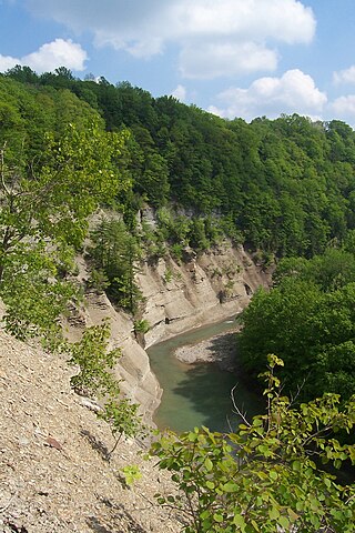
Zoar Valley is an area of deep gorges along the Main and South branches of Cattaraugus Creek in western New York, United States. The valley is located along the border of Erie County and Cattaraugus County, roughly between the villages of Gowanda to the west and Springville to the east.

The Vanderwhacker Mountain Wild Forest is a 91,854-acre tract made up of almost two dozen non-contiguous parcels that are designated as Wild Forest by the New York State Department of Environmental Conservation in the central Adirondack Park. The area contains 44 ponds and small lakes, as well as portions of the Hudson and Boreas Rivers. The area is accessible via New York State Route 28 and supports hiking, birding, snowmobiling, Nordic skiing, hunting, camping, canoeing, and fishing.

Balsam Lake Mountain is one of the Catskill Mountains, located in the Town of Hardenburgh, New York, United States. It is the westernmost of the range's 35 High Peaks. Its exact height has not been determined, but the highest contour line on topographic maps, 3,720 feet (1,130 m), is usually given as its elevation.

New York State Wildlife Management Areas (WMAs) are conservation areas managed by the New York State Department of Environmental Conservation (NYSDEC) primarily for the benefit of wildlife, and used extensively by the public for hunting, fishing, and trapping. As of 2016, the NYSDEC owns and maintains 113 WMAs, with a total area of approximately 197,000 acres. The Wildlife Management Areas program is administered by the Division of Fish, Wildlife and Marine Resources of the NYSDEC.

Sandy Pond Beach Unique Area is a 76-acre (31 ha) New York State conservation area located within the eastern Lake Ontario dunes. It lies at the north end of a spit of land dividing North Sandy Pond from Lake Ontario, and is about two miles (3.2 km) north of the developed portion of Sandy Island Beach State Park. There is no road access to the area, which can be most easily reached by boat. For this reason, local residents have long referred to the beach as "Boaters' Beach". It has been managed as part of Sandy Island Beach State Park since 2011.

New York State Forests are public lands administered by the Division of Lands and Forests of the New York State Department of Environmental Conservation (NYSDEC). New York State Forests are designated as reforestation, multiple use, and unique areas; and state nature and historic preserves, with approximately 600,000 acres (2,400 km2) classified as reforestation areas and approximately 9,000 acres (36 km2) classified as multiple use lands. Land within the Adirondack Park or the Catskill Park is not included as part of the State Forest system.
East Kill, a 16-mile-long (26 km) tributary of Schoharie Creek, flows across the town of Jewett, New York, United States, from its source on Stoppel Point. Ultimately its waters reach the Hudson River via the Mohawk. Since it drains into the Schoharie upstream of Schoharie Reservoir, it is part of the New York City water supply system. East Kill drains the southern slopes of the Blackhead Mountains, which include Thomas Cole Mountain, Black Dome, and Blackhead Mountain, the fourth-, third-, and fifth-highest peaks in the Catskills, respectively.

Oxbow Lake is a 312-acre (1.26 km2) naturally occurring lake located in the towns of Lake Pleasant and Arietta in Hamilton County, New York within the Adirondack Park. The lake is nearly two miles-long and is oriented in a northeast to southwest direction, with the widest part being at the northeast end, at nearly 0.6 miles (0.97 km) wide. The lake has 4.3 miles (6.9 km) of shoreline and no islands. NY Route 8 is located along the southeast shoreline, Oxbow Road crosses the lake inlet on the northeastern end, and Old Piseco Road crosses the lake outlet on the southwestern end.
Bucktooth State Forest is in Cattaraugus County in western New York. It covers 2,248 acres (910 ha) of land in the towns of Little Valley, Napoli and Salamanca. The North Country National Scenic Trail passes through Bucktooth State Forest. Hiking, hunting, fishing, snowshoeing, and cross-country skiing are among activities available in the park. Wildlife includes white-tailed deer, skunk, red fox, mink, coyote, ruffed grouse, and turkey. A draft management plan has been created for the area.