
Suffolk County is the easternmost county in the U.S. state of New York, constituting the eastern two-thirds of Long Island. It is bordered to its west by Nassau County, to its east by Gardiners Bay and the open Atlantic Ocean, to its north by Long Island Sound, and to its south by the Atlantic Ocean.

Amagansett is a census-designated place that roughly corresponds to the hamlet by the same name in the Town of East Hampton in Suffolk County, New York, United States, on the South Shore of Long Island. As of the 2010 United States Census, the CDP population was 1,165. Amagansett hamlet was founded in 1680.

Montauk is a hamlet and census-designated place (CDP) in the Town of East Hampton in Suffolk County, New York, on the eastern end of the South Shore of Long Island. As of the 2020 United States census, the CDP's population was 4,318.

Napeague is a census-designated place (CDP) that roughly corresponds to the hamlet with the same name in the Town of East Hampton in Suffolk County, New York, United States. The CDP population was 200 at the 2010 census.
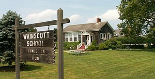
Wainscott is a hamlet in the Town of East Hampton in Suffolk County, New York, United States, on the South Fork of Long Island. As of the 2010 United States Census, the CDP population was 650. For statistical purposes, the United States Census Bureau defined a census-designated place (CDP) for the 2000 census that roughly corresponds to the same area.

Southampton, officially the Town of Southampton, is a town in southeastern Suffolk County, New York, partly on the South Fork of Long Island. As of the 2020 U.S. census, the town had a population of 69,036. Southampton is included in the stretch of shoreline prominently known as the Hamptons.

The Town of East Hampton is located in southeastern Suffolk County, New York, at the eastern end of the South Shore of Long Island. It is the easternmost town in the state of New York. At the time of the 2020 United States census, it had a total population of 28,385.

Montauk Point State Park is a 862-acre (3.49 km2) state park located in the hamlet of Montauk, at the eastern tip of Long Island in the Town of East Hampton, Suffolk County, New York. Montauk Point is the easternmost extremity of the South Fork of Long Island, and thus also of New York State.
Montauk Highway is an east–west road extending for 95 miles (153 km) across the southern shore of Long Island in Suffolk County, New York, in the United States. It extends from the Nassau County line in Amityville, where it connects to Merrick Road, to Montauk Point State Park at the very eastern end of Long Island in Montauk. The highway is known by several designations along its routing, primarily New York State Route 27A (NY 27A) from the county line to Oakdale and NY 27 east of Southampton. The portion of Montauk Highway between Oakdale and Southampton is mostly county-maintained as County Route 80 and County Route 85.

Shadmoor State Park is a 99-acre (0.40 km2) state park located in Suffolk County, New York in the United States. Created in 2000, the park is located in Town of East Hampton on the South Fork of Long Island, one-quarter mile (0.40 km) east of the hamlet of Montauk.

The South Shore of Long Island, in the U.S. state of New York, is the area along Long Island's Atlantic Ocean shoreline.
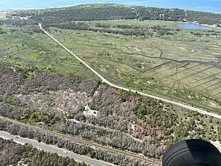
Napeague State Park is a 1,364-acre (5.52 km2) state park in the town of East Hampton in Suffolk County, New York. The largely undeveloped park stretches across the entire narrow width of the South Fork of Long Island from the Atlantic Ocean to Gardiners Bay and Block Island Sound. The park is located on either side of the Montauk Highway on the "Napeague Stretch" between Amagansett and Montauk. The hamlet of Napeague is located on the park's edge.

The Montaukett ("Metoac"), more commonly known as Montauk are an Algonquian-speaking Native American people from the eastern and central sections of Long Island, New York.

Montauk County Park, formerly known as Theodore Roosevelt County Park, is located approximately three miles (4.8 km) east of Montauk, New York. The park is 1,157 acres (4.68 km2) in size, running from Montauk Highway north to Block Island Sound and is bordered on the east by Montauk Point State Park.
Amsterdam Beach State Park is a 199-acre (0.81 km2) undeveloped state park on the Atlantic Ocean in the Town of East Hampton just east of Montauk, New York. The land is also known as the Amsterdam Beach Preserve.

