State Highway 15 (West Bengal)

Last updated
WB SH15-IND.png
State Highway 15
Ahilyabai Holkar Road.
Amta-Howrah Road - SH-15 - Jagatballavpur - Howrah 2014-09-28 8266.JPG
Route information
Major junctions
FromJunction with SH 6 and SH 14 at High Road Morh, near Dainhat
Major intersectionsDainhat Road at Chandrapur Bus Stand connecting to SH 14 at Balgona
SH 8 at Kusumgram
Kalna Road at Satgachia
SH 13/ GT Road at Memari
NH 19 / Durgapur Expressway at Masagram
Dasghara-Gurap-Mogra 23 no Road at Dasghara
Dasghara-Dhaniakhali-Chinsurah 17 no Road at Dasghara
SH 2 from Tarakeswar to Champadanga
Haripal-Jangipara Road at Parbatipur
Masat-Munsirhat Road at Masat
TN Mukherji Road at Dankuni linking to NH 19
Benarsas Road at Kona High Road Crossing
NH 16 from Kona High Road crossing to Salap
Mushirhat-Sankrail Road at Jadupur
NH 16 at Bagnan
Antila Road at Antila Bus Stop
Naul-Gopinathpur Road at Shyampur
Dharsa Morh on Grand Trunk Road/SH 6 with SH 13 at Par-Dankuni
SH 6 with NH 19 at Kanaipur
NH 19 with SH 13 at Chanditala Bus Stand.
To Gadiara
Location
Country India
State West Bengal
Districts Bardhaman, Hooghly, Howrah
Highway system
State Highways in West Bengal

State Highway 15 (West Bengal), is a state highway in West Bengal, India.

Contents

Route

SH 15 originates from junction with SH 6 and SH 14 at High Road Morh, near Dainhat (in Bardhaman district) and passes through Chandrapur, Monteswar, Kusumgram, Memari, Masagram, Jamalpur, Dasghara, Tarakeswar, Champadanga, Masat, Chanditala, Dankuni, Domjur, Bargachia, Munsirhat, Amta, Bagnan, Khalor and Shyampur and terminates at Gadiara (in Howrah district). [1] Recently in January 2022, the road from Dharsa Morh to Naity Block Development Office(BDO), commonly known as Naity Road has been renumbered as State Highway 15A(SH-15A) since the road is connecting Grand Trunk Road/SH 6 with SH 13 at Par Dankuni, with National Highway 19(NH-19) at Dankuni and further with SH 15 at Chanditala Bus Stand.

The total length of SH 15 is 256 kilometres (159 mi) [2]

National Highway Authority of India or NHAI has proposed to include section of SH 15 from Champadanga via Masat, Chanditala to Dankuni under a new National Highway from 2022/23. But Highway number is still not decided & will be notified later. The new highway will connect Jhargram with Dankuni via Jhilimili, Mukutmanipur, Simlapal, Taldangra, Bishnupur, Jaypur, Kotulpur, Arambag, Champadanga & Chanditala. The new proposed National Highway will merge SH 2, SH 5 & SH 15 into a single route covering distance of 296 kilometres (184 mi).

Districts traversed by SH 15 are: [3]
Bardhaman district (from 0 to 87.66 km)
Hooghly district (from 87.66 to 148.15 km)
Howrah district (from 148.15 to 247.15 km)

Road sections

It is divided into different sections as follows: [2] [4] [5] [6] [3]

Road SectionDistrictCD BlockLength (km)
Dainhat-ManteswarBardhaman Katwa II, Manteswar 30
Manteswar-MemariBardhaman Memari I, Memari II 32
Memari- DasgharaBardhaman Jamalpur 31
Dasghara-TarakeswarHooghly Dhaniakhali, Tarakeswar 13
Tarakeswar-ChampadangaHooghly Tarakeswar 6
Champadanga-Chanditala (Ahalyabai Holkar Road)Hooghly Haripal, Chanditala I, Chanditala II 36
Chanditala-EksaraHowrah Domjur 14
Eksara-Salap (via NH 16)Howrah-4
Salap-Bargachhia-Munsirhat-AmtaHowrah Jagatballavpur, Munshirhat ,Amta I 36
Amta-BagnanHowrah Bagnan I, Bagnan II 13
Bagnan-Shyampur-GadiaraHowrah Shyampur II, Shyampur I 37

See also

Related Research Articles

Krishnapur is a census town in Chanditala II CD Block in Srirampore subdivision of Hooghly district in the Indian state of West Bengal.

<span class="mw-page-title-main">Gangadharpur</span> Census town in West Bengal, India

Gangadharpur is a census town in the Chanditala I CD block located in the Srirampore subdivision of the Hooghly district in the state of West Bengal, India.

Masat is a census town in Chanditala I CD block in Srirampore subdivision of Hooghly district in the state of West Bengal, India.

Jangalpara is a census town in Chanditala I CD Block in Srirampore subdivision of Hooghly district in the state of West Bengal, India.

<span class="mw-page-title-main">Manirampur</span> Census Town in West Bengal, India

Manirampur is a census town in Chanditala I CD Block in Srirampore subdivision of Hooghly district in the state of West Bengal, India.

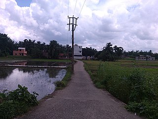
Sheakhala is a village and a gram panchayat in Chanditala I community development block in Srirampore subdivision of Hooghly district in the state of West Bengal, India. It is under Chanditala police station.

Nababpur is a census town in Chanditala I CD Block in Srirampore subdivision of Hooghly district in the state of West Bengal, India.

Kumirmora is a census town in Chanditala I CD Block in Srirampore subdivision of Hooghly district in the state of West Bengal, India.

Dudhkalmi is a census town in Chanditala I CD Block in Srirampore subdivision of Hooghly district in the state of West Bengal, India.

Aushbali is a village in Chanditala I community development block of Srirampore subdivision in Hooghly district in the Indian state of West Bengal.

Janai is a census town in Chanditala II CD Block in Srirampore subdivision of Hooghly district in the state of West Bengal, India.

Naity is a census town in Chanditala II Block in Srirampore subdivision of Hooghly district in the state of West Bengal, India. Naity lies between Janai and Chanditala― two historical villages of Bengal and the village is in the eastern bank of the river Saraswati. The village Naity has two parts― North Naity and South Naity. North Naity's nearest railway station is Janai Road and South Naity's nearest railway station is Gobra. The school in Naity was founded in 1942.

Baksa is a census town in Chanditala II CD Block in Srirampore subdivision of Hooghly district in the state of West Bengal, India.

Jaykrishnapur is a census town in Chanditala II CD Block in Srirampore subdivision of Hooghly district in the state of West Bengal, India.

Kapashanria is a census town in Chanditala II CD Block in Srirampore subdivision of Hooghly district in the state of West Bengal, India.

Tisa is a census town in Chanditala II CD Block in Srirampore subdivision of Hooghly district in the state of West Bengal, India.

<span class="mw-page-title-main">Chanditala</span> Town in West Bengal, India

Chanditala is a town in Chanditala II community development block of Srirampore subdivision in Hooghly District in the Indian state of West Bengal.

State Highway 2 is a state highway in West Bengal, India.

<span class="mw-page-title-main">State Highway 5 (West Bengal)</span>

State Highway 5 (West Bengal) is a state highway in West Bengal, India.

State Highway 13 (West Bengal) is a state highway in West Bengal, India.

References

  1. Google maps
  2. 1 2 "List of State Highways in West Bengal". West Bengal Traffic Police. Retrieved 23 February 2017.
  3. 1 2 "Road - Highway". Public Works Department, Government of West Bengal. Retrieved 24 February 2017.
  4. "Bardhaman Tehsil/ CD Block Map". Maps of India. Retrieved 23 February 2017.
  5. "Hugli Tehsil CD Block Map". Maps of India. Retrieved 23 February 2017.
  6. "Haora Tehsil CD Block Map". Maps of India. Retrieved 23 February 2017.