
Azuay, Province of Azuay is a province of Ecuador, created on 25 June 1824. It encompasses an area of 8,171 square kilometres (3,155 sq mi). Its capital is Cuenca. It is located in the south center of Ecuador in the highlands. Its mountains reach 4,500 m (14,800 ft) above sea level in the national park of El Cajas.
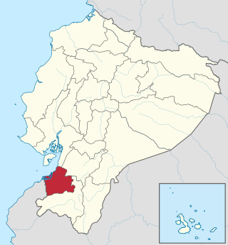
El Oro is the southernmost of Ecuador's coastal provinces. It was named for its historically important gold production. Today it is one of the world's major exporters of bananas. The capital is Machala.

Cañar is a province in Ecuador. The capital is Azogues. At the time of census 2010 the province had a population of 225,184. It contains the 16th-century ruins of Ingapirca, the best-known Inca settlement in Ecuador and a product of their conquest of the indigenous Cañari.

Cotopaxi is one of the provinces of Ecuador. The capital is Latacunga. The province contains the Cotopaxi Volcano, an intermittent volcano with a height of 19,347 feet (5,897 m).
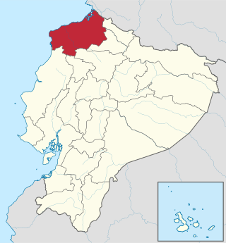
Esmeraldas is a province in northwestern Ecuador. The capital is Esmeraldas.
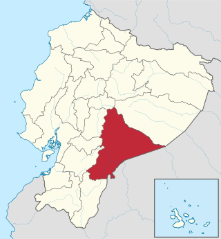
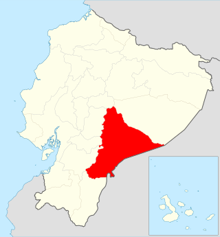
Morona Santiago is a province in Ecuador. The province was established on February 24, 1954. The capital is Macas.

Napo is a province in Ecuador. Its capital is Tena. The province contains the Napo River. The province is low developed without much industrial presence. The thick rainforest is home to many natives that remain isolated by preference, descendants of those who fled the Spanish invasion in the Andes, and the Incas years before. In 2000, the province was the sole remaining majority-indigenous province of Ecuador, with 56.3% of the province either claiming indigenous identity or speaking an indigenous language.

Sucumbíos is a province in northeast Ecuador. The capital and largest city is Nueva Loja. It is the fifth largest province in the country, with an area of 18,084 km2. In 2010, it had a population of 176,472 inhabitants.

Sucúa is a town in the Morona Santiago province of Ecuador. It is the seat of the Sucúa Canton.

The Province of Santa Elena is a province of Ecuador in the coastal region. Created in 2007 from territory that belonged to the Guayas Province, it is one of the two newest provinces of Ecuador, along with Santo Domingo de Los Tsáchilas. Its capital city is Santa Elena, from which the province derives its name.

Mira Canton is a canton of Ecuador, located in Carchi Province. Its capital is the town of Mira. Its population in the 2001 census was 12,919 and was 12,180 in the 2010 census. The area is 588 square kilometres (227 sq mi).
Montúfar Canton is a canton of Ecuador, located in Carchi Province. Its capital is the city of San Gabriel. The canton's population in the 2001 census was 28,576 and was 30,511 in the 2010 census.

Guano Canton is a canton of Ecuador, located in the Chimborazo Province. Its capital is the town of Guano. Its population at the 2001 census was 37,888.
Ibarra Canton is a canton of Ecuador, located in Imbabura Province. Its capital is the town of Ibarra. Its population in the 2001 census was 153,256 and 181,175 in the 2010 census. The area of the canton is 1,137 square kilometres (439 sq mi).
Pimampiro Canton is a canton of Ecuador, located in Imbabura Province. Its population in the 2001 census was 12,951 and 12,970 in the 2010 census.
San Miguel de Urcuquí Canton, or Urkuki, is a canton of Ecuador, located in the Imbabura Province. Its seat is the town of Urcuquí. Its population in the 2001 census was 14,381 and was 15,671 in the 2010 census. The area of the canton is 735.3 square kilometres (283.9 sq mi).

Ventanas Canton is a canton of Ecuador, located in the Los Ríos Province. Its capital is the town of Ventanas. Its population at the 2001 census was 71,145.
San Juan Bosco Canton is a canton of Ecuador, located in the Morona-Santiago Province. Its capital is the town of San Juan Bosco. Its population was 4, 372 at the 2022 census, which was an increase from the 2001 census that had recorded 3,131 people.

Baños Canton is a canton of Ecuador, located in the Tungurahua Province. Its capital is the town of Baños. The population of Baños Canton at the 2010 census was 20,018., and in 2011 its population had risen to 21,140

