Sudbury Hill

Last updated

Sudbury Hill
Greater London UK location map 2.svg
Red pog.svg
Sudbury Hill
Location within Greater London
OS grid reference TQ165852
London borough
Ceremonial county Greater London
Region
Country England
Sovereign state United Kingdom
Post town HARROW
Postcode district HA1
Dialling code 020
Police Metropolitan
Fire London
Ambulance London
UK Parliament
London Assembly
List of places
UK
England
London
51°33′14″N0°20′13″W / 51.554°N 0.337°W / 51.554; -0.337

Sudbury Hill is an area of the London Borough of Harrow in northwest London, England. It forms part of the HA1 postcode and Harrow post town.

Contents

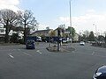
Located immediately north of North Greenford and almost a mile from Sudbury, Sudbury Hill was originally an ancient link between Harrow on the Hill and Wembley, [1] which survives today as the A4005. The area has two railway stations, Sudbury Hill Harrow railway station and Sudbury Hill tube station, which are both located on the Greenford Road (south of the Sudbury Hill A4005 road itself).

Neighbouring areas

Related Research Articles

<span class="mw-page-title-main">Greenford</span> Human settlement in England

Greenford is a large town in the London Borough of Ealing in west London, England, lying 11 miles (18 km) west from Charing Cross. It has a population of 46,787 inhabitants, or 62,126 with the inclusion of Perivale.

<span class="mw-page-title-main">London Borough of Ealing</span> London borough in United Kingdom

The London Borough of Ealing is a London borough in West London, England. It comprises seven major towns: Acton (W3), Ealing, Greenford (UB6), Hanwell (W7), Northolt (UB5), Perivale (UB6) and Southall. With a population of 367,100 inhabitants, it is the third most populous London borough.

<span class="mw-page-title-main">Wembley</span> Suburb of London

Wembley is a large suburb in the London Borough of Brent, north-west London, 8 miles (13 km) northwest of Charing Cross. It includes the neighbourhoods of Alperton, North Wembley, Preston, Sudbury, Tokyngton and Wembley Park. The population was 102,856 in 2011.

<span class="mw-page-title-main">West Ealing railway station</span> National Rail station in London, England

West Ealing railway station is on the Great Western Main Line in Ealing, situated in west London. It is 6 miles 46 chains (10.6 km) down the line from London Paddington and is situated between Ealing Broadway to the east and Hanwell to the west. Its three-letter station code is WEA.

<span class="mw-page-title-main">Harrow, London</span> Town in Greater London, England

Harrow is a large town in Greater London, England, and serves as the principal settlement of the London Borough of Harrow. Lying about 9.5 miles (15.3 km) north-west of Charing Cross and 5.4 miles (8.7 km) south of Watford, the entire town including its localities had a population of 149,246 at the 2011 census, whereas the wider borough had a population of 250,149.

<span class="mw-page-title-main">Sudbury Hill tube station</span> London Underground station

Sudbury Hill is a London Underground station on the Uxbridge branch of the Piccadilly line. The station is between Sudbury Town and South Harrow, and is in Travelcard Zone 4. It is located on Greenford Road (A4127) north of the junction with Whitton Avenue, on the border between the London Boroughs of Harrow and Ealing. The station is close to Sudbury Hill Harrow railway station.

<span class="mw-page-title-main">Alperton tube station</span> London Underground station

Alperton is a London Underground station on the Uxbridge branch of the Piccadilly line. The station is between Sudbury Town and Park Royal, in Travelcard Zone 4. It is located on Ealing Road a short distance from the junction with Bridgewater Road (A4005) and is close to Alperton Bus Garage and the Paddington branch of the Grand Union Canal. The station was refurbished in 2006.

<span class="mw-page-title-main">Harrow-on-the-Hill station</span> London Underground and railway station

Harrow-on-the-Hill is an interchange railway station in Harrow, served by suburban London Underground Metropolitan line services and commuter National Rail services on the London–Aylesbury line. It is 9 miles 18 chains down the line from London Marylebone. Harrow-on-the-Hill is the final Metropolitan line stop from Central London before the line splits with the main branch towards Moor Park and the diverged Uxbridge branch towards Uxbridge. It is in Travelcard Zone 5.

<span class="mw-page-title-main">Sudbury & Harrow Road railway station</span> British railway station

Sudbury & Harrow Road is a National Rail station served by Chiltern Railways in Harrow Road, Sudbury in Greater London. It was the least used railway station in Greater London until 2015/16 and is 400m north of Sudbury Town Underground station.

<span class="mw-page-title-main">Sudbury Hill Harrow railway station</span> National Rail station in London, England

Sudbury Hill Harrow railway station is a National Rail station on the Chiltern Main Line in the London Borough of Harrow in northwest London.

<span class="mw-page-title-main">Sudbury Town tube station</span> London Underground station

Sudbury Town is a London Underground station on the Uxbridge branch of the Piccadilly line. The station is between Alperton and Sudbury Hill, and is in Travelcard Zone 4. It is located on the border between the London Boroughs of Brent and Ealing, with its main entrance on Station Approach in Sudbury. The forecourt of the station is known as Station Crescent. The station serves Sudbury, which forms the western part of Wembley.

<span class="mw-page-title-main">Harrow on the Hill</span> Residential area of north west London, England

Harrow on the Hill is a locality and historic village in the borough of Harrow in Greater London, England. The name refers to Harrow Hill, 408 feet (124 m), and is located some half a mile south of the modern town of Harrow. The village dates back to early medieval times, built around the 11th-century St Mary's Church, and is the location of Harrow, St Dominic's and John Lyon schools.

<span class="mw-page-title-main">Horsenden Hill</span>

Horsenden Hill is a hill and open space, located between the Perivale, Sudbury, and Greenford areas of West London. It is in the London Borough of Ealing, close to the boundary with the London Borough of Brent. It is one of the higher eminences in the local area, rising to 85 m (276 ft) above sea level, and the summit forms part of the site of an ancient hillfort. It is the site of a trig point, TP4024.

<span class="mw-page-title-main">North Wembley</span> Human settlement in England

North Wembley is a district in North West London, England. It is located in the London Borough of Brent and is mostly made up of the 1930s Sudbury Court Estate. North Wembley forms the north-western part of the district of that is its namesake. The major roads in the area are East Lane, Watford Road, and Sudbury Court Drive. Most of it is part of the Wembley HA0 postcode area, but a small part in the east falls under Wembley HA9, and parts in the west fall under Harrow HA1.

<span class="mw-page-title-main">Sudbury, London</span> Human settlement in England

Sudbury is a suburb in the London Borough of Brent, located in northwest London, United Kingdom. The suburb forms the western part of Wembley and is centred around 0.6 miles (1 km) west of Wembley Central railway station.

<span class="mw-page-title-main">London Buses route 18</span> London bus route

London Buses route 18 is a Transport for London contracted bus route in London, England. Running between Sudbury & Harrow Road station and Euston bus station, it is operated by London United.

<span class="mw-page-title-main">Roxeth</span> Human settlement in England

Roxeth was a hamlet in the ancient Harrow on the Hill parish, which now forms part of the London Borough of Harrow in Greater London, England.

The Great Western and Great Central Joint Railway was a railway built and operated jointly by the Great Western Railway (GWR) and Great Central Railway (GCR) between Northolt and Ashendon Junction. It was laid out as a trunk route with gentle curves and gradients and spacious track layouts. The two companies each needed approach railways at both ends of the line to connect their respective systems; these were built as part of a single project.

<span class="mw-page-title-main">A4005 road</span> Road in London, England

The A4005 is a suburban link road running between Hanger Lane roundabout, where the A40 meets the A406, and Harrow. The A4005 now runs along Roxeth Hill to its junction with the A312 in South Harrow, then merges with it northbound until its junction with the A404 before splitting away again to become Greenhill Way. Formerly the road passed the junction with Roxeth Hill, crossing the A404, continuing past Harrow-on-the-Hill station and joining the A409 at a point just south of the present junction.

<span class="mw-page-title-main">Acton–Northolt line</span> Railway line in West London

The Acton–Northolt line (ANL), historically known as the New North main line (NNML), is a railway line in West London, England. Built between 1903 and 1906, it runs from the Great Western Main Line at Old Oak Common TMD to the Chiltern Main Line at South Ruislip, alongside the West Ruislip branch of the London Underground Central line, for a distance of around 11 miles (18 km).

References

  1. Walter, Don (15 October 2015). Harrow Through Time. ISBN   9781445637426.