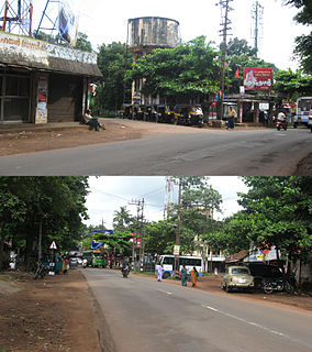
Mundakayam, is a town in Kanjirappally Taluk in the Kottayam District of Kerala. It is the doorway to the high ranges of southern Kerala, and is at the border of Kottayam and Idukki districts. The next nearest town, Kanjirappally, is 14 km (8.7 mi) & Erumely is 12 km from Mundakayam. Mundakayam has rubber plantations, and greenery. The Manimala River runs through Mundakayam. It is located 48 km east of the district headquarters at Kottayam and 148 km from the state capital, Thiruvananthapuram. The name Mundakayam is said to be derived from the Mundi cranes that used to be seen along the Manimala River banks.

Perumbavoor is a historic place located at Bank of Periyar in Ernakulam District in the Indian state of Kerala. It is a part of the Kochi metropolitan area It lies in the north-eastern tip of the Greater Cochin area and is also the headquarters of Kunnathunad Taluk. Perumbavoor is famed in the state for wood industries and small-scale industries. Ernakulam lies 30 km southwest of Perumbavoor. The town lies between Angamaly and Muvattupuzha on the Main Central Road (MC), which connects Thiruvananthapuram to Angamaly through the old Travancore part of Kerala. Perumbavoor lies in the banks of river Periyar.
Edakkad is part of the Kannur Municipal Corporation in Kannur District of Kerala state, in India.

Oyoor is a small township of Velinalloor village in the Kottarakara Taluk, Kollam District of Kerala, India. It is situated on the banks of the Ithikkara River. It is surrounded by several small satellite villages: Ugramkunnu in the south, Chenkulam in the west, Mylode in the north and Karingannoor in the east.

Ranni or Ranny is a town in the Pathanamthitta district of Kerala, India, and the 16th largest taluk in Kerala, located on both sides of the Pamba River.
Mannar is a census town in Chengannur Taluk in Alappuzha District of Kerala state, India, on State Highway 6. It is also known as the Bell Metal Town.

Ezhumanthuruthu (എഴുമാന്തുരുത്ത്) is a small "thuruthu" i.e. island situated 8 km west of Kaduthuruthy town. It falls in the Kottayam district of Kerala state in India, the city of letters. It is a densely populated place of Kaduthuruthy Gram Panchayat.
Atpadi is an administrative town of the Atpadi Taluka of Sangli District in the Indian state of Maharashtra. Atpadi is located north-east of Sangli District and shares borders with the adjacent Solapur and Satara Districts. The town has a taluka administrative office, a courthouse, a police station, a government-run primary hospital, various schools and colleges and a theater. Atpadi's economy is based on the cultivation and sale of agricultural products, with pomegranates and cotton constituting the core of the industry. The town is also home to the Manganga Sahakari Sugar factory, a Pomegranate auction center and various small scale industries in fields such as manufacturing, processing, servicing and repairs.

Chathamangalam is a village in Kozhikode district of Kerala state, India.
Thadiyoor is a village located in Ayroor (Ayiroor) village of Pathanamthitta district, Kerala, India, approximately 18 kilometres (11 mi) from Tiruvalla and 9 kilometres (5.6 mi) from Ranni.

Marangattupilly is a small village and headquarters of Marangattupally Grama Panchayat in Kottayam district, Kerala. Most of its people are either farmers or engaged in small-scale business. Famous politician K M Mani, was born and brought up in this village. Another famous personality from this village is Santhosh George Kulangara. T K Jose IAS is from this village
Kodungoor is a town in Kottayam district of Kerala state in India and is popularly known as "Vazhoor". Kodungoor is 25 km from the district headquarters, Kottayam, 28 km from Changanassery, 22 km from Pala,27 km from Ettumanoor,26 km from Mundakayam,26 km from Ranni, 7 km from Ponkunnam,4 km from Pallickathode, 9 km from Pampady and 13 km from Kanjirappally. The Kollam-Theni road passes through the town. SH 13 branches out at Kodungoor junction leading to Pala and Manimala, after the junction a little further KK road also branches out towards Changanassery. Thus Kodungoor town plays a vital role in connecting some major towns in Kottayam through roads averaging at 25 km distances.
Perunad (Ranni-Perunad) is a scenic hilly village in Pathanamthitta district, Kerala state, India It's located on the banks of Pamba River and Kakkadu River.
Thampalakkad is a small village in Kottayam district, Kerala, which is located around 5 km from Kanjirappally on the way to Manjakuzhy. It has the same distance from Ponkunnam, Manjakuzhy, Koorali, Anakkal, Kappadu, Panamattom and Vanchimala. Its name is derived from Thamboolam which was used for fixing the idol at the Mahadeva Temple, by the legendary Naranathu Bhranthan.
Kadayanickadu is a village situated 11 km east of Karukachal, spread out on either sides of Changanacherry - Manimala road in Kerala, India. It is a typical Kerala rural settlement with the nature's green covering, ringing rivulets, small hills and slopes, agricultural fields, inhabited by rustic population. It is a Kara in Vellavoor revenue village in Changanacherry taluk, Kottayam district.

Kunhimangalam (കുഞ്ഞിമംഗലം) is a census town situated in the northern coastal part of Kannur District in Kerala state on the outskirt of Payyanur. The population in 2011 was around 19,000 including Hindus, Christians and Muslim residents. The village lies in an agricultural region.
Velur or Veloor is a village and panchayat in Kunnamkulam Taluk, Thrissur district, Kerala, India with a population of 22,155. Other places close to Velur are Kechery, Wadakkanchery etc.
Madaplathuruth is a village in Paravur Taluk, state of Kerala. Formerly known as Kuriapilly, it was a part of the Travancore kingdom in the British India. The village is 22 km away from Kochi. The ancient seaport of India, Muziris is located in Pattanam village 0.7 km away from this village.

Punthalathazham is a landlocked neighbourhood of the city of Kollam in the Indian state of Kerala. It is located around six kilometres east of the core Kollam (Quilon) city towards Kannanalloor . This place has a little geographical importance and serves as the tail boundary of Kollam Municipal Corporation. Inhabitants belong to working and middle classes.

Karsog is a town and municipal area in the state of Himachal Pradesh in Northern India.


