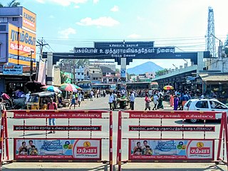
Mallappally is a census village in Mallapally gram panchayat in the Mallapally taluk of the district of Pathanamthitta in Kerala. As of 2011, it had a population of 17,693.

Khatima is a city and a municipal board in Udham Singh Nagar district in the Indian state of Uttarakhand.

Usilampatti is a town and a second grade municipality of Madurai district in the Indian state of Tamil Nadu. It is also a designated taluk and revenue division.

Anicadu is a census village in Anicadu gram panchayat in the Mallapally taluk of the district of Pathanamthitta in Kerala. As of 2011, it had a population of 14,678.
Kottangal is a census village in Kottangal gram panchayat in the Mallapally taluk of the district of Pathanamthitta in Kerala. As of 2011, it had a population of 17,174.
Paippad is a census town and gram panchayat in the Changanassery Taluk of the Kottayam district in Kerala.

Ezhumattoor is a census village in Ezhumattoor gram panchayat in the Mallapally taluk of the district of Pathanamthitta in Kerala. As of 2011, it had a population of 16,837.
Kallooppara is a census village in Kallooppara gram panchayat in the Mallapally taluk of the district of Pathanamthitta in Kerala. As of 2011, it had a population of 16,837.
Kunnamthanam is a census village in Kunnamthanam gram panchayat in the Mallapally taluk of the district of Pathanamthitta in Kerala. As of 2011, it had a population of 20,573.
Peringara is a village and in the Peringara gram panchayat in Pathanamthitta district, Kerala. Peringara is located 3.9 km from Thiruvalla. The gram panchayat includes the wards of Mepral, Idinjillam, Perumthuruthy, and Chathenkary.
Puramattom is a census village in Puramattom gram panchayat in the Mallapally taluk of the district of Pathanamthitta in Kerala. As of 2011, it had a population of 14,069.
Thelliyoor is a census village in Ezhumattoor gram panchayat in the Mallapally taluk of the district of Pathanamthitta in Kerala. As of 2011, it had a population of 8,101.
Bhinder or Bhindar is a town in Udaipur District, that is located 315 km (196 mi) from the state's main city Jaipur. Bhinder borders the Chittorgarh District in Rajasthan and is located 58 kilometres (36 mi) south-east of Udaipur. Notable tourist sites nearby include Sita Mata Wildlife Sanctuary, Jaisamand Sanctuary, and Jaisamand Lake. Bhinder is surrounded by four lakes.
Manakawad is a village in Dharwad district of Karnataka, India.
Boraj Tawaran is a village in the Udaipur district of Rajasthan, India. It comes under the Malpur gram panchayat, in Salumber block. The village is located 8 km east of Salumber. It is also known as Boraj Tanwaran or Boraj Tavraan. Salumbar is nearest town to Boraj Tawaran village. Around 1700 CE, a Thakur of the Tanwar clan moved to Salumber during the rule of Rawat Kesari Singh Chundawat. In 1876, his descendant Thakur Tej Singh Tanwar was granted the jagir of the present-day village site to Rawat Jodh Singh Chundawat.
Ramgarh is a medium size village in Phillaur tehsil of Jalandhar District of Punjab State, India. It is located 1 km away from postal head office Phillaur, 16 km from Ludhiana, 45 km from district headquarter Jalandhar and 118 km from state capital Chandigarh. The village is administrated by a sarpanch who is an elected representative of village as per Panchayati raj (India).
Kutbewal is a village in Jalandhar district of Punjab State, India. It is located 4 km away from postal head office in Goraya, 14.2 km from Nurmahal, 40.4 km from district headquarter Jalandhar and 122 km from state capital Chandigarh. The village is administrated by a sarpanch, who is an elected representative.
Bhagwanpur is a village in Kapurthala district of Punjab State, India. It is located 4 kilometres (2.5 mi) from Kapurthala, which is both district and sub-district headquarters of Bhagwanpur. The village is administrated by a Sarpanch who is an elected representative of village as per the constitution of India and Panchayati raj (India).
Thammanwal is a village in Jalandhar district of Punjab State, India. It is located 2.5 km from Mao Sahib, 12.9 km from Phillaur, 40.6 km from district headquarter Jalandhar and 133 km from state capital Chandigarh. The village is administrated by a sarpanch who is an elected representative of village as per Panchayati raj (India). Roshan Kainth hometown
Jindowal is a village in Shaheed Bhagat Singh Nagar district of Punjab State, India. It is located 1.6 kilometres (0.99 mi) away postal head office Banga, 15 kilometres (9.3 mi) from Garhshankar, 12 kilometres (7.5 mi) from district headquarter Shaheed Bhagat Singh Nagar and 103 kilometres (64 mi) from state capital Chandigarh. The village is administrated by Sarpanch an elected representative of the village.


