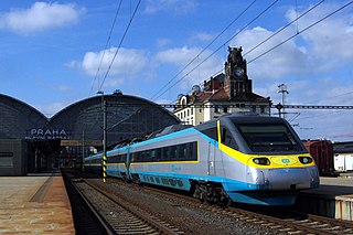
Transport in the Czech Republic relies on several main modes, including transport by road, rail, water and air.
For Soviet transportation, see Transport in the Soviet Union.
Transport in Hungary relies on several main modes, including transport by road, rail, air and water.

Transport in Liberia consist of railways, highways, seaports and airports.
This article describes the system of transport in Senegal, both public and private. This system comprises roads, rail transport, water transport, and air transportation.

Eswatini is a country in Southern Africa, lying between Mozambique and South Africa. The country is located at the geographic coordinates 26°30′S31°30′E. Eswatini has an area of 17,363 square kilometres, of which 160 are water. The major regions of the country are Lowveld, Midveld and Highveld.

Hhohho is a region of Eswatini, located in the north western part of Eswatini from the north and running southwards to the centre, Hhohho was named after the capital of King Mswati II, who expanded the Swazi territory to the north and west, taking in the districts of Barberton, Nelspruit, Carolina and Piet Retief. These areas were later acquired by what was the Province of Transvaal and today they form part of the Mpumalanga Province of South Africa. It has an area of 3,625.17 km², a population of 320,651 (2017), and is divided into 14 tinkhundla. The administrative center is the national capital of Mbabane. It borders Lubombo Region on the southeast and Manzini Region in the southwest.

Manzini is a city in Eswatini, which is also the capital of Eswatini's Manzini Region. The city is the country's second largest urban centre behind Mbabane, with a population of 78,000 (2008). It is known as "The Hub" of Eswatini and lies on the MR3 road. Eswatini's primary industrial site at Matsapha lies near the town's western border.

Ngwenya is a town in western Eswatini, lying near the border with South Africa, north west of Mbabane, on the MR3 road. The South African town opposite Ngwenya is Oshoek in Mpumalanga province.
Eswatini Railways (ESR), formerly known as Swaziland Railway or Swazi Rail, is the national railway corporation of Eswatini.

The following outline is provided as an overview of and topical guide to Eswatini:
Education in Eswatini begins with pre-school education for infants, primary, secondary and high school education for general education and training (GET) - and universities and colleges at tertiary level.

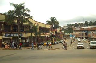
The MR3 road, also known as the Matsapha–Mbabane–Ngwenya road or Road No. MR3, is a major highway of Eswatini. It is one of the most heavily trafficked roads in the country, crossing it from east to west. Along with the MR7 and MR8 roads, it forms the "backbone of Swaziland's internal transport system." It connects the EN5 road in Mozambique near Namaacha at 25°59′21″S31°59′53″E to the N17 road in South Africa at 26°12′45″S30°59′18″E, near Ngwenya. The road passes through Hlane Royal National Park and through the capital of Mbabane, about 110 kilometres (68 mi) further to the southwest. The highway descends into the Ezulwini Valley in four lanes. At Manzini, a bridge crosses the Mzimene River.
The Swaziland Reformed Church was founded in 1944 and become a congregation of the Dutch Reformed Church in Africa in 1967. Later the Swaziland Missionary Board was formed to coordinate the missionary work of the Reformed Church in Swaziland. In 1989 Swaziland become a Regional Synod of the denomination. In 1991 the Swaziland Reformed Church became independent and has 20 communities within which it is working. The church was a member of the Reformed Ecumenical Council and later became a member of the World Communion of Reformed Churches.
SwaziBank, is a development finance institution, which doubles as a commercial bank in Eswatini. It is licensed and supervised by the Central Bank of Eswatini, the national banking regulator. As of March 2018 SwaziBank was the only indigenous commercial bank in the county, with the other three having their headquarters in neighboring South Africa.