Urbank, Minnesota

Last updated
Urbank
Otter Tail County Minnesota Incorporated and Unincorporated areas Urbank Highlighted.svg
Location of Urbank, Minnesota
Coordinates: 46°07′27″N95°30′38″W / 46.12417°N 95.51056°W / 46.12417; -95.51056
CountryUnited States
State Minnesota
County Otter Tail
Founded1903
Area
[1]
  Total0.66 sq mi (1.72 km2)
  Land0.66 sq mi (1.71 km2)
  Water0.00 sq mi (0.00 km2)
Elevation
[2]
1,467 ft (447 m)
Population
 (2020) [3]
  Total52
  Estimate 
(2021) [4]
50
  Density78.67/sq mi (30.36/km2)
Time zone UTC-6 (CST)
  Summer (DST) UTC-5 (CDT)
FIPS code 27-66388 [5]
GNIS feature ID2397101 [2]

Urbank is a city in Otter Tail County, Minnesota, United States. The population was 52 at the 2020 census. [3]

Contents

Geography

According to the United States Census Bureau, the city has a total area of 0.73 square miles (1.89 km2), of which 0.72 square miles (1.86 km2) is land and 0.01 square miles (0.03 km2) is water. [6]

Otter Tail County Roads 38 and 59 are the main routes in the community.

Demographics

Historical population
CensusPop.Note
1950 162
1960 1779.3%
1970 125−29.4%
1980 95−24.0%
1990 73−23.2%
2000 59−19.2%
2010 54−8.5%
2020 52−3.7%
2021 (est.)50 [4] −3.8%
U.S. Decennial Census [7]
2020 Census [3]

2010 census

As of the census of 2010, there were 54 people, 27 households, and 13 families living in the city. The population density was 75.0 inhabitants per square mile (29.0/km2). There were 34 housing units at an average density of 47.2 per square mile (18.2/km2). The racial makeup of the city was 100.0% White.

There were 27 households, of which 18.5% had children under the age of 18 living with them, 37.0% were married couples living together, 3.7% had a female householder with no husband present, 7.4% had a male householder with no wife present, and 51.9% were non-families. 51.9% of all households were made up of individuals, and 25.9% had someone living alone who was 65 years of age or older. The average household size was 2.00 and the average family size was 3.00.

The median age in the city was 40.5 years. 20.4% of residents were under the age of 18; 9.3% were between the ages of 18 and 24; 20.5% were from 25 to 44; 26% were from 45 to 64; and 24.1% were 65 years of age or older. The gender makeup of the city was 55.6% male and 44.4% female.

2000 census

As of the census of 2000, there were 59 people, 32 households, and 16 families living in the city. The population density was 80.7 inhabitants per square mile (31.2/km2). There were 33 housing units at an average density of 45.1 per square mile (17.4/km2). The racial makeup of the city was 100.00% White.

There were 32 households, out of which 21.9% had children under the age of 18 living with them, 43.8% were married couples living together, 3.1% had a female householder with no husband present, and 46.9% were non-families. 46.9% of all households were made up of individuals, and 25.0% had someone living alone who was 65 years of age or older. The average household size was 1.84 and the average family size was 2.59.

In the city, the population was spread out, with 15.3% under the age of 18, 10.2% from 18 to 24, 22.0% from 25 to 44, 28.8% from 45 to 64, and 23.7% who were 65 years of age or older. The median age was 48 years. For every 100 females, there were 103.4 males. For every 100 females age 18 and over, there were 108.3 males.

The median income for a household in the city was $40,625, and the median income for a family was $46,458. Males had a median income of $31,250 versus $12,083 for females. The per capita income for the city was $15,105. There were no families and 7.3% of the population living below the poverty line, including no under eighteens and 20.0% of those over 64.

Related Research Articles

<span class="mw-page-title-main">Rembrandt, Iowa</span> City in Iowa, United States

Rembrandt is a city in Buena Vista County, Iowa, United States. The population was 209 at the time of the 2020 census.

<span class="mw-page-title-main">Maynard, Iowa</span> City in Iowa, United States

Maynard is a city in Fayette County, Iowa, United States. The population was 476 at the time of the 2020 census.

<span class="mw-page-title-main">Mondamin, Iowa</span> City in Iowa, United States

Mondamin is a city in Harrison County, Iowa, United States. The population was 339 at the time of the 2020 census.

<span class="mw-page-title-main">Hayesville, Iowa</span> City in Iowa, United States

Hayesville is a city in Keokuk County, Iowa, United States. The population was 41 at the time of the 2020 census.

<span class="mw-page-title-main">Emerson, Iowa</span> City in Iowa, United States

Emerson is a city in Mills County, Iowa, United States. The population was 403 at the time of the 2020 census.

<span class="mw-page-title-main">Minden, Iowa</span> City in Iowa, United States

Minden is a city in Pottawattamie County, Iowa, United States. The population was 600 at the time of the 2020 census. It has possessed a post office since 1875.

<span class="mw-page-title-main">Redding, Iowa</span> City in Iowa, United States

Redding is a city in southwest Ringgold County, Iowa, United States. The population was 63 at the time of the 2020 census.
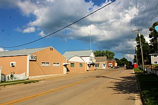
<span class="mw-page-title-main">Dixon, Iowa</span> City in Iowa, United States

Dixon is a city in Scott County, Iowa, United States. The population was 202 at the time of the 2020 census.

<span class="mw-page-title-main">Maysville, Iowa</span> City in Iowa, United States

Maysville is a city in Scott County, Iowa, United States. The population was 156 at the time of the 2020 census.

<span class="mw-page-title-main">New Liberty, Iowa</span> City in Iowa, USA

New Liberty is a city in Scott County, Iowa, United States. The population was 138 at the time of the 2020 census.

<span class="mw-page-title-main">Woodland Hills, Kentucky</span> City in Kentucky, United States

Woodland Hills is a home rule-class city in Jefferson County, Kentucky, United States. The population was 696 at the 2010 census.

<span class="mw-page-title-main">Lilydale, Minnesota</span> City in Minnesota, United States

Lilydale is a city in Dakota County, Minnesota, United States. The population was 623 at the 2010 census.

<span class="mw-page-title-main">Deer Creek, Minnesota</span> City in Minnesota, United States

Deer Creek is a city in Otter Tail County, Minnesota, United States. The population was 330 at the 2020 census.

<span class="mw-page-title-main">Erhard, Minnesota</span> City in Minnesota, United States

Erhard is a city in Otter Tail County, Minnesota, United States. The population was 132 at the 2020 census.

<span class="mw-page-title-main">Henning, Minnesota</span> City in Minnesota, United States

Henning is a city in Otter Tail County, Minnesota, United States. The population was 854 at the 2020 census.

<span class="mw-page-title-main">Bella Villa, Missouri</span> City in Missouri, United States

Bella Villa is a city in St. Louis County, Missouri, in the United States. As of the 2010 census, the city population was 729.

<span class="mw-page-title-main">Pasadena Hills, Missouri</span> City in Missouri, United States

Pasadena Hills is a city in St. Louis County, Missouri, United States. The population was 930 at the 2010 census. The entire city is listed on the National Register of Historic Places.

<span class="mw-page-title-main">Clarkson Valley, Missouri</span> City in Missouri, United States

Clarkson Valley is a city in St. Louis County, Missouri, United States. The population was 2,609 at the 2020 census.
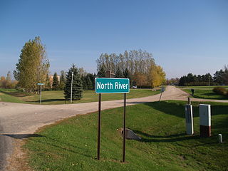
<span class="mw-page-title-main">North River, North Dakota</span> City in North Dakota, United States

North River is a city in Cass County, North Dakota, United States. The population was 55 at the 2020 census. North River was founded in 1973. It is a suburb/bedroom community directly adjacent to the city of Fargo.

<span class="mw-page-title-main">Pennsboro, West Virginia</span> City in West Virginia, United States

Pennsboro is a city in Ritchie County, West Virginia, United States. The population was 1,050 at the 2020 census. The city is located at the junction of U.S. Route 50 and West Virginia Route 74; the North Bend Rail Trail also passes through the city.

References

  1. "2020 U.S. Gazetteer Files". United States Census Bureau. Retrieved July 24, 2022.
  2. 1 2 U.S. Geological Survey Geographic Names Information System: Urbank, Minnesota
  3. 1 2 3 "Census Explore Data". United States Census Bureau . Retrieved May 8, 2022.
  4. 1 2 "City and Town Population Totals: 2020-2021". United States Census Bureau. June 16, 2022. Retrieved June 16, 2022.
  5. "U.S. Census website". United States Census Bureau . Retrieved January 31, 2008.
  6. "US Gazetteer files 2010". United States Census Bureau. Archived from the original on July 2, 2012. Retrieved November 13, 2012.
  7. "Census of Population and Housing". Census.gov. Retrieved June 4, 2015.