Richville, Minnesota

Last updated

Richville
Otter Tail County Minnesota Incorporated and Unincorporated areas Richville Highlighted.svg
Location of Richville, Minnesota
Coordinates: 46°30′24″N95°37′13″W / 46.50667°N 95.62028°W / 46.50667; -95.62028
CountryUnited States
State Minnesota
County Otter Tail
Founded1903
Incorporated1904
Area
[1]
  Total1.00 sq mi (2.58 km2)
  Land0.99 sq mi (2.55 km2)
  Water0.01 sq mi (0.03 km2)
Elevation
[2]
1,358 ft (414 m)
Population
 (2020) [3]
  Total77
  Estimate 
(2021) [4]
76
  Density78.09/sq mi (30.14/km2)
Time zone UTC-6 (CST)
  Summer (DST) UTC-5 (CDT)
ZIP code
56576
Area code 218
FIPS code 27-54340 [5]
GNIS feature ID2396371 [2]

Richville is a city in Otter Tail County, Minnesota, United States. The population was 77 as of the 2020 census. [3]

Contents

History

Richville was platted in 1903, and named for Watson Wellman Rich, a railroad engineer. [6] A post office has been in operation at Richville since 1904. [7] Richville was incorporated in 1904. [6]

Geography

According to the United States Census Bureau, the city has a total area of 1.00 square mile (2.59 km2), of which 0.99 square miles (2.56 km2) is land and 0.01 square miles (0.03 km2) is water. [8]

Demographics

Historical population
CensusPop.Note
1910 255
1920 28110.2%
1930 179−36.3%
1940 23330.2%
1950 141−39.5%
1960 91−35.5%
1970 10212.1%
1980 13229.4%
1990 121−8.3%
2000 1242.5%
2010 96−22.6%
2020 77−19.8%
2021 (est.)76 [4] −1.3%
U.S. Decennial Census [9]
2020 Census [3]

2010 census

As of the census of 2010, there were 96 people, 43 households, and 26 families living in the city. The population density was 97.0 inhabitants per square mile (37.5/km2). There were 49 housing units at an average density of 49.5 per square mile (19.1/km2). The racial makeup of the city was 96.9% White, 1.0% Native American, 1.0% from other races, and 1.0% from two or more races. Hispanic or Latino of any race were 1.0% of the population.

There were 43 households, of which 23.3% had children under the age of 18 living with them, 46.5% were married couples living together, 4.7% had a female householder with no husband present, 9.3% had a male householder with no wife present, and 39.5% were non-families. 32.6% of all households were made up of individuals, and 9.4% had someone living alone who was 65 years of age or older. The average household size was 2.23 and the average family size was 2.77.

The median age in the city was 40.5 years. 18.7% of residents were under the age of 18; 11.5% were between the ages of 18 and 24; 24% were from 25 to 44; 32.4% were from 45 to 64; and 13.5% were 65 years of age or older. The gender makeup of the city was 54.2% male and 45.8% female.

2000 census

As of the census of 2000, there were 124 people, 50 households, and 33 families living in the city. The population density was 123.7 inhabitants per square mile (47.8/km2). There were 50 housing units at an average density of 49.9 per square mile (19.3/km2). The racial makeup of the city was 99.19% White and 0.81% Native American. Hispanic or Latino of any race were 0.81% of the population.

There were 50 households, out of which 34.0% had children under the age of 18 living with them, 48.0% were married couples living together, 12.0% had a female householder with no husband present, and 34.0% were non-families. 30.0% of all households were made up of individuals, and 16.0% had someone living alone who was 65 years of age or older. The average household size was 2.48 and the average family size was 3.06.

In the city, the population was spread out, with 27.4% under the age of 18, 8.1% from 18 to 24, 33.1% from 25 to 44, 17.7% from 45 to 64, and 13.7% who were 65 years of age or older. The median age was 37 years. For every 100 females, there were 110.2 males. For every 100 females age 18 and over, there were 100.0 males.

The median income for a household in the city was $33,750, and the median income for a family was $42,813. Males had a median income of $30,500 versus $13,750 for females. The per capita income for the city was $16,290. There were 12.9% of families and 12.6% of the population living below the poverty line, including 12.5% of under eighteens and 11.5% of those over 64.

Related Research Articles

<span class="mw-page-title-main">Gulf Gate Estates, Florida</span> Census-designated place in Florida, United States

Gulf Gate Estates is a census-designated place (CDP) in Sarasota County, Florida, United States. The population was 10,911 at the 2010 census. It is part of the North Port–Sarasota–Bradenton Metropolitan Statistical Area.

<span class="mw-page-title-main">Skyline, Minnesota</span> City in Minnesota, United States

Skyline is a city in Blue Earth County, Minnesota, United States. The population was 288 at the 2020 census. It is adjacent to the city of Mankato and is part of the Mankato-North Mankato Metropolitan Statistical Area.

<span class="mw-page-title-main">Backus, Minnesota</span> City in Minnesota, United States

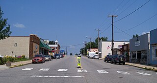
Backus is a city in Cass County, Minnesota, United States. The population was 250 at the 2010 census. It is part of the Brainerd Micropolitan Statistical Area.

<span class="mw-page-title-main">Lake Shore, Minnesota</span> City in Minnesota, United States

Lake Shore is a city in Cass County, Minnesota, United States. The population was 1,056 at the 2020 census. It is part of the Brainerd Micropolitan Statistical Area.

<span class="mw-page-title-main">Trommald, Minnesota</span> City in Minnesota, United States

Trommald is a city in Crow Wing County, Minnesota, United States. The population was 99 at the 2020 census. It is part of the Brainerd Micropolitan Statistical Area.

<span class="mw-page-title-main">Walters, Minnesota</span> City in Minnesota, United States

Walters is a city in Faribault County, Minnesota, United States. The population was 73 at the 2010 census.

<span class="mw-page-title-main">Geneva, Minnesota</span> City in Minnesota, United States

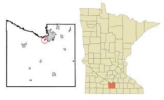
Geneva is a city in Freeborn County, Minnesota, United States. The population was 555 at the 2010 census.

<span class="mw-page-title-main">Warba, Minnesota</span> City in Minnesota, United States

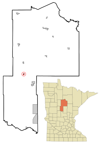
Warba is a city in Itasca County, Minnesota, United States. The population was 168 at the 2020 census.

<span class="mw-page-title-main">Garvin, Minnesota</span> City in Minnesota, United States

Garvin is a city in Lyon County, Minnesota, United States. The population was 135 at the 2010 census.

<span class="mw-page-title-main">Erhard, Minnesota</span> City in Minnesota, United States

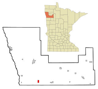
Erhard is a city in Otter Tail County, Minnesota, United States. The population was 132 at the 2020 census.

<span class="mw-page-title-main">Henning, Minnesota</span> City in Minnesota, United States

Henning is a city in Otter Tail County, Minnesota, United States. The population was 854 at the 2020 census.

<span class="mw-page-title-main">Vergas, Minnesota</span> City in Minnesota, United States

Vergas is a city in northern Otter Tail County, Minnesota, United States. The population was 348 at the 2020 census.

<span class="mw-page-title-main">Rock Creek, Minnesota</span> City in Minnesota, United States

Rock Creek is a city in Pine County, Minnesota, United States. The population was 1,628 at the 2010 census. Portions of the Mille Lacs Indian Reservation are located within Rock Creek.

<span class="mw-page-title-main">Beltrami, Minnesota</span> City in Minnesota, United States

Beltrami is a city in Polk County, Minnesota, United States and was named in honor of Giacomo Costantino Beltrami, an Italian exile, who traveled to the Red river and the upper Mississippi in 1823. Officially incorporated on September 11, 1901, there had been settlers in the area since 1870. It is part of the Grand Forks, ND-MN Metropolitan Statistical Area. The population was 88 at the 2020 census.

<span class="mw-page-title-main">Lowry, Minnesota</span> City in Minnesota, United States

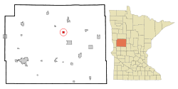
Lowry is a city in Pope County, Minnesota, United States. The population was 334 at the 2020 census.

<span class="mw-page-title-main">Leonidas, Minnesota</span> City in Minnesota, United States

Leonidas is a city in Saint Louis County, Minnesota, United States. The population was 52 at the 2010 census.

<span class="mw-page-title-main">Kimball, Minnesota</span> City in Minnesota, United States

Kimball is a city in Stearns County, Minnesota, United States. The population was 799 at the 2020 census. It is part of the St. Cloud Metropolitan Statistical Area.

<span class="mw-page-title-main">Chokio, Minnesota</span> City in Minnesota, United States

Chokio is a city in Stevens County, Minnesota, United States. The population was 404 at the 2020 census.

<span class="mw-page-title-main">Clarissa, Minnesota</span> City in Minnesota, United States

Clarissa is a city in Todd County, Minnesota, United States. The population was 681 at the 2010 census. It dropped to 661 inhabitants by the 2020 census.

Richville is a village in St. Lawrence County, New York, United States. The population was 323 at the 2010 census. The name is taken from an early settler.

References

  1. "2020 U.S. Gazetteer Files". United States Census Bureau. Retrieved July 24, 2022.
  2. 1 2 U.S. Geological Survey Geographic Names Information System: Richville, Minnesota
  3. 1 2 3 "Explore Census Data". United States Census Bureau . Retrieved May 8, 2022.
  4. 1 2 "City and Town Population Totals: 2020-2021". United States Census Bureau. June 24, 2022. Retrieved June 24, 2022.
  5. "U.S. Census website". United States Census Bureau . Retrieved January 31, 2008.
  6. 1 2 Upham, Warren (1920). Minnesota Geographic Names: Their Origin and Historic Significance. Minnesota Historical Society. p.  398.
  7. "Otter Tail County". Jim Forte Postal History. Retrieved July 28, 2015.
  8. "US Gazetteer files 2010". United States Census Bureau. Archived from the original on January 12, 2012. Retrieved November 13, 2012.
  9. "Census of Population and Housing". Census.gov. Retrieved June 4, 2015.

46°30′24″N95°37′32″W / 46.50667°N 95.62556°W / 46.50667; -95.62556